philip s rgs world atlas philip s maps
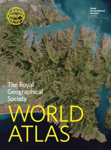
Philip's RGS World Atlas - Philip's Maps
"An excellent world atlas. Very illuminating, good colours, clear texts...good glossary and, last but not least, up-to-date". Amazon customer review· The perfect world atlas for work, study or leisure· Great value for money· 96 pages of authoritative world maps, physical and political· 70 city maps in the fascinating World Cities section, with full-page satellite images for 10 great cities· Over 35,000 place name indexAll this and a special 32-page introductory section - ''The World in Focus'' - covers key geographical themes such as the Earth''s position in the Solar System, the structure of the Earth, climate and weather, the environment, population, resources, economics and international organizations. Vital information on topics covered in geography, humanities and economics courses.The information-packed World Atlas from Philip''s, published in association with the Royal Geographical Society has been fully updated for this new, 2021 edition
Objev podobné jako Philip's RGS World Atlas - Philip's Maps
Philip's RGS World Atlas (A4) - Philip's Maps
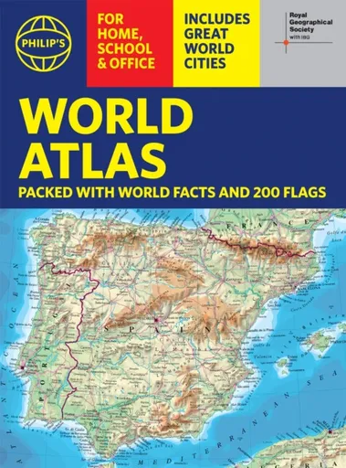
Thousands of global facts at your fingertips with the best value quick-reference World Atlas on the market. Both physical and political geography is clearly illustrated alongside the great cities of our planet.The highest peak? The deepest ocean trench? The wettest, driest, longest, largest - we list the world''s fascinating extremes. Crammed with practical information like a Distance Chart for World Cities, World Time Zones, over 200 State Flags and the top 100 most populous countries, we include around 15,000 places indexed for easy checking. Whether for the pub quiz, travel planning or school reference, this great value handy world atlas is crammed with everything you need to know.Alongside the topography and physical attributes of the earth we also show political boundaries and the great global cities, including transport hubs and places of interest from mosques to temples, palaces to zoos and shopping centres to tourist information centres.Features include: * 200 Flags of the world''s major states and territories* 21 City centre maps: transport (road, rail, trams, light railways, bus and railway stations) and places of interest including religious buildings (churches, abbeys, cathedrals, synagogues, shrines, temples, mosques), museums, galleries, theatres, palaces, castles, parks, gardens, zoos, shopping centres, hospitals, Tourist Centres.* World ... Unknown localization key: "more"
Objev podobné jako Philip's RGS World Atlas (A4) - Philip's Maps
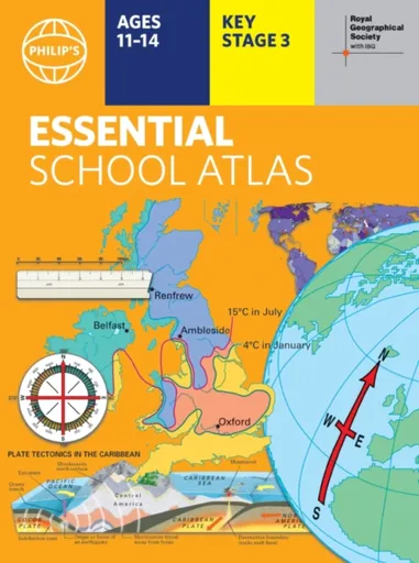
Philip's RGS Essential School Atlas - Philip's Maps
"An excellent world atlas. Very illuminating, good colours, clear texts...good glossary and, last but not least, up-to-date." - customer review- The ideal school atlas for Key Stage 3 pupils and Scotland''s National Qualifications, 11-14 years old- All updated for 2024 specifically to meet curriculum needs- Specially focused 16-page UK and Ireland section- Comprehensive 62-page world section includes thematic maps on the environment, climate change, people, quality of life, and energy- Published in association with the Royal Geographical SocietyPhilip''s RGS Essential School Atlas has been specially created for lower-secondary geography students (11-14 year olds). The maps have been carefully designed to be uncluttered and easy to read, containing specially selected place names and detail. A clear set of symbols and scale information accompanies every map, with a useful introductory section covering basic atlas skills, including aerial photographs and satellite images to further explain particular features on the maps. Latitude and longitude co-ordinates are included in the index, alongside figure-letter references. Fully up-to-date, the atlas includes detailed regional maps, charts and satellite images of Europe, Italy, the Middle East, China, Japan, Kenya, USA, Brazil, and the Arctic and Antarctica. It also focuses on areas of special interest for students of geography, such ... Unknown localization key: "more"
Objev podobné jako Philip's RGS Essential School Atlas - Philip's Maps
Podívejte se také
povlečení atlas grádl zelené 140x200 cm
luxusní bavlněné povlečení atlas grádl
povlak na přikrývku 140x200 z atlas grádlu
povlečení z 100% bavlny atlas grádl
povlečení atlas grádl starorůžová
povlečení atlas grádl světle šedá
povlečení atlas grádl pro dospělé
tmavě šedé atlas grádl povlečení
povlečení atlas grádl 140x200 cm
100% bavlna povlečení atlas grádl
péče o povlečení atlas grádl
povlečení atlas grádl smetanová
povlak na polštář 70x90 atlas
povlak na přikrývku atlas grádl
povlečení atlas grádl béžová 140x200 cm
povlak na polštář 70x90 atlas grádl

Philip's RGS Essential School Atlas - Philip's Maps
"An excellent world atlas. Very illuminating, good colours, clear texts...good glossary and, last but not least, up-to-date." - customer review- The ideal school atlas for Key Stage 3 pupils and Scotland''s National Qualifications, 11-14 years old- All updated for 2024 specifically to meet curriculum needs- Specially focused 16-page UK and Ireland section- Comprehensive 62-page world section includes thematic maps on the environment, climate change, people, quality of life, and energy- Published in association with the Royal Geographical SocietyPhilip''s RGS Essential School Atlas has been specially created for lower-secondary geography students (11-14 year olds). The maps have been carefully designed to be uncluttered and easy to read, containing specially selected place names and detail. A clear set of symbols and scale information accompanies every map, with a useful introductory section covering basic atlas skills, including aerial photographs and satellite images to further explain particular features on the maps. Latitude and longitude co-ordinates are included in the index, alongside figure-letter references. Fully up-to-date, the atlas includes detailed regional maps, charts and satellite images of Europe, Italy, the Middle East, China, Japan, Kenya, USA, Brazil, and the Arctic and Antarctica. It also focuses on areas of special interest for students of geography, such ... Unknown localization key: "more"
Objev podobné jako Philip's RGS Essential School Atlas - Philip's Maps
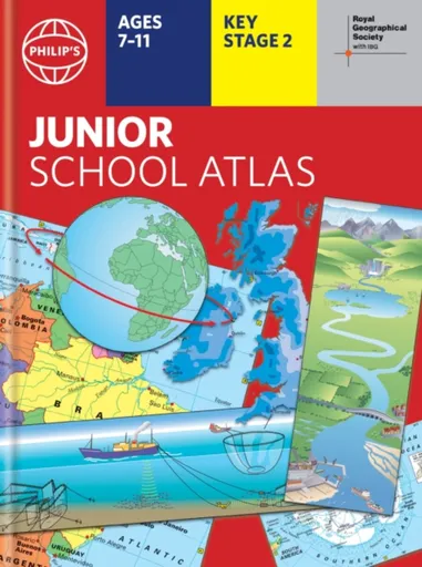
Philip's RGS Junior School Atlas - Philip's Maps
The 12th edition of the market-leading atlas for primary school pupils, Philip''s RGS Junior School Atlas has been fully revised and updated with all the latest facts and curriculum requirements.- The essential atlas for primary schools with clear and easy-to-follow maps and diagrams - updated for 2024/2025- Published in association with the Royal Geographical Society- Recommended for Key Stage 2 of the National Curriculum - and all 7-11 year olds - An excellent introduction to mapping concepts such as scale, direction, symbols, longitude and latitude- 22-page Britain and Ireland section with clear thematic charts, diagrams and large-scale regional maps- 22-page section on The World, with political maps - and thematic treatment of key themes, from volcanoes and earthquakes to transport and tourism- Continents section with physical and political maps- Easy-to-follow map references and 1,000-place indexThe introductory section describes the meaning of scale, how to measure distances using the maps, and explains the symbols on the maps.The following section is devoted to the United Kingdom and Ireland. Thematic maps cover topics such as mountains and rivers, climate and weather, population and cities, farming and fishing, industry and energy, transport, tourism and conservation. The rest of the atlas is made up of ... Unknown localization key: "more"
Objev podobné jako Philip's RGS Junior School Atlas - Philip's Maps
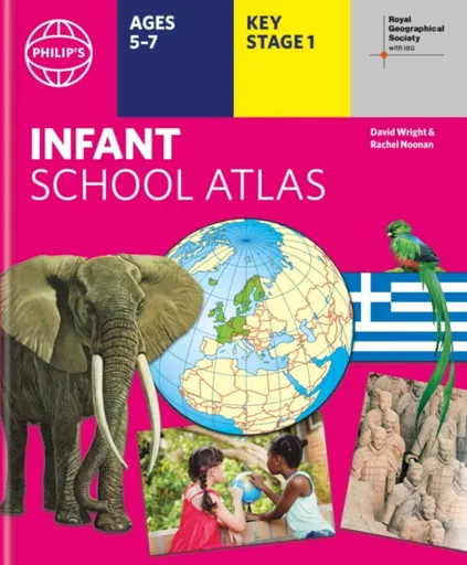
Philip's RGS Infant School Atlas - David Wright, Philip's Maps, Rachel Noonan
Written for 5 to 7 year-old this atlas is ideal for teaching Key Stage 1, helping to cover geography, history, science, citizenship and literacy requirements- Written by experts Professor David Wright and Rachel Noonan- Published in association with the Royal Geographical Society- 50 pages of clear, child-friendly maps showing our world today- Countries of the world brought to life with flags, illustrations and photos- Bold text, simple words and short sentences to encourage reading skills- Starts with the Earth as a Planet then zooms into each of the world''s regions with maps and illustrations- Numbered balloons on each map link to photos of a real placeFully revised and updated, the atlas is for children aged 5-7 in the early stages of reading, with simple text to explain what is happening on the maps and illustrations - all compatible with National Curriculum Key Stage 1.Clear, child-friendly maps are combined with vibrant photographs and facts about the world. Guidance is given at the beginning of the atlas on how to use the maps, encouraging the early development of map skills. Each colourful spread is illustrated with photographs and packed with fact boxes, curiosities, flags, stamps and simple quiz questions. Philip''s RGS Infant ... Unknown localization key: "more"
Objev podobné jako Philip's RGS Infant School Atlas - David Wright, Philip's Maps, Rachel Noonan
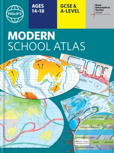
Philip's RGS Modern School Atlas - Philip's Maps
- Britain''s best-selling school atlas - now in its 101st edition- Recommended for Key Stage 4, GCSE and A-Level in England and Wales (Scottish National Qualifications/Highers) and international schools- Fully updated to reflect the latest changes in the curriculum- Published in association with the Royal Geographical Society- Combines superb digital maps of Britain and the world with up-to-date thematic maps - Country-by-country statistics on population, land use, trade, tourism, energy, wealth and much more - World Themes Section - from volcanoes and earthquakes to population trends, languages and religions, all the key aspects and statistics of geography are explored and explained- Plus a special section on how satellite imagery is used to interpret global, environmental and urban patterns of change Britain''s best-selling secondary school atlas, now in its 101st Edition. The contents are divided into colour-coded sections for rapid reference. The physical maps of the United Kingdom and Ireland are accompanied by thematic maps on numerous key social and economic themes. World topographical maps, with thematic maps on topics such as climate, population and economics, are followed by 30 pages of World thematic maps.Completing the atlas is a section of World social and economic statistics, and an index with letter-figure ... Unknown localization key: "more"
Objev podobné jako Philip's RGS Modern School Atlas - Philip's Maps
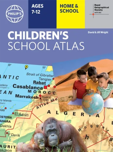
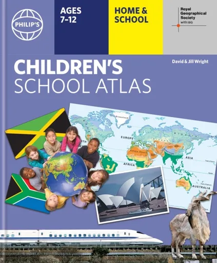
Philip's RGS Children's School Atlas - David Wright, Jill Wright
"This is such a great book for primary school age children and a little beyond for finding out about the world, its countries and people" Amazon customer review- Philip''s atlas, designed specially to use at home and at school with guidance for parents and teachers- Clear maps and fascinating facts bring geography to life for readers aged 7-12- Published by Philip''s the UK''s leading school atlas publisher, in association with the Royal Geographical Society- Quizzes, activity ideas and puzzles to make learning fun- Past winner of the Geographical Association''s award for making a significant contribution to geographyThe atlas is organized spread by spread in the classic sequence: first Europe, then its land neighbour Asia, followed by Africa, Australia and Oceania, North America and South America.Illustrated with captivating full-colour photographs and packed with fact boxes, curiosities, flags, stamps and quiz questions, Philip''s RGS Children''s Atlas is both fun to use and easy to understand.Now in its 16th edition, Philip''s RGS Children''s Atlas is a past winner of the Geographical Association''s award for making a significant contribution to geography. The atlas was judged "an excellent ''all round'' children''s atlas with simple yet well-designed maps, well-illustrated with colour photographs. It links places to ... Unknown localization key: "more"
Objev podobné jako Philip's RGS Children's School Atlas - David Wright, Jill Wright
Philip's RGS Children's School Atlas - David Wright, Jill Wright
"This is such a great book for primary school age children and a little beyond for finding out about the world, its countries and people" customer review- Philip''s atlas, designed specially to use at home and at school with guidance for parents and teachers- Clear maps and fascinating facts bring geography to life for readers aged 7-12- Published by Philip''s in association with the Royal Geographical Society- Quizzes, activity ideas and puzzles to make learning fun- Past winner of the Geographical Association''s award for making a significant contribution to geographyThe atlas is organized spread by spread in the classic sequence: first Europe, then its land neighbour Asia, followed by Africa, Australia and Oceania, North America and South America. Illustrated with captivating full-colour photographs and packed with fact boxes, curiosities, flags, stamps and quiz questions, Philip''s RGS Children''s Atlas is both fun to use and easy to understand.Now in its 17th edition, Philip''s RGS Children''s Atlas is a past winner of the Geographical Association''s award for making a significant contribution to geography. The atlas was judged "an excellent ''all round'' children''s atlas with simple yet well-designed maps, well-illustrated with colour photographs. It links places to issues, events and real people, giving ... Unknown localization key: "more"
Objev podobné jako Philip's RGS Children's School Atlas - David Wright, Jill Wright

Philip's RGS Children's School Atlas - David Wright, Jill Wright
"This is such a great book for primary school age children and a little beyond for finding out about the world, its countries and people" customer review- Philip''s atlas, designed to use at home and at school with guidance for parents and teachers- Clear maps and fascinating facts bring geography to life for readers aged 7-12- Published by Philip''s in association with the Royal Geographical Society- Quizzes, activity ideas and puzzles to make learning fun- Past winner of the Geographical Association''s award for making a significant contribution to geographyThe atlas is organized spread by spread in the classic sequence: first Europe, then its land neighbour Asia, followed by Africa, Australia and Oceania, North America and South America. Illustrated with captivating full-colour photographs and packed with fact boxes, curiosities, flags, stamps and quiz questions, Philip''s RGS Children''s Atlas is both fun to use and easy to understand.Now in its 17th edition, Philip''s RGS Children''s Atlas is a past winner of the Geographical Association''s award for making a significant contribution to geography. The atlas was judged "an excellent ''all round'' children''s atlas with simple yet well-designed maps, well-illustrated with colour photographs. It links places to issues, events and real people, giving a ... Unknown localization key: "more"
Objev podobné jako Philip's RGS Children's School Atlas - David Wright, Jill Wright

Philip's Caribbean Atlas for Secondary Schools - Philip's Maps
A new edition of the market-leading atlas for CXC Geography students, Philip''s Caribbean Atlas for Secondary Schools provides extensive coverage of the Caribbean area, together with a comprehensive selection of world and regional maps. The atlas is arranged in three sections for ease of use, with each page colour-coded for rapid reference. The first section is devoted to a detailed coverage of the Caribbean region in 48 pages, and includes maps of every island plus Belize and Guyana, as well as topographical, land use, tourism and mining maps.The second section is made up of 72 pages of World topographical maps, incorporating continental thematic maps on topics such as population, climate and biomes, followed by 32 pages of World thematic maps. This new 8th edition features updated mapping of all Caribbean islands, as well as the latest statistics. The World map section contains additional coverage of Brazil, the Americas and Asia, while the World thematic section includes maps on volcanoes, El Niño, tourism, energy, minerals, industry, trade and international organizations.Completing the atlas is a section of CXC study maps covering topics such as farming, soil conservation, economics, tourism and urban land use. Features regional studies of Mauritius, UK, Canada, USA and ... Unknown localization key: "more"
Objev podobné jako Philip's Caribbean Atlas for Secondary Schools - Philip's Maps
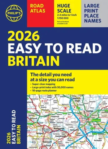
2026 Philip's Easy to Read Road Atlas of Britain - Philip's Maps
"The detail you need at a size you can read". The latest 2026 Philip''s Easy to Read Road Atlas of Britain from the best-selling Road Atlas range has over 350 pages packed with exceptionally clear mapping and everything you need for exploring Britain. Now available as a practical paperback, it will enhance any trip.· Clear maps packed with extra details for a better journey· Huge 1:150,000 scale (approx 2.4 miles to 1 inch)· Large print place names· Large print index· Super-clear 10-page route planner to create the best journeys· Thousands of attractions clearly mapped, including castles, theme parks, gardens, zoos and more.· London''s expanded ULEZ clearly shown on approach mapping· Over 100,000 copies of the Philip''s Easy Read Road Atlases of Britain sold since launch in 2020.At last, a road atlas that everyone can read easily, in or out of the car, no matter what the conditions. With up-to-date mapping technology, your travels have never been easier to plan. This edition contains a wealth of useful information, including tourist attractions, to ensure the best possible journey. Whether it''s dark, or if you just can''t find your glasses, the 2026 Philip''s Easy to Read Road Atlas of Britain is the ultimate ... Unknown localization key: "more"
Objev podobné jako 2026 Philip's Easy to Read Road Atlas of Britain - Philip's Maps

Philip's RGS Modern School Atlas
Britain's best-selling school atlas - now in its 101st edition Recommended for Key Stage 4, GCSE and A-Level in England and Wales (Scottish National Qualifications/Highers) and international schools Fully updated to reflect the latest changes in the curriculum Published in association with the Royal Geographical Society Combines superb digital maps of Britain and the world with up-to-date thematic maps Country-by-country statistics on population, land use, trade, tourism, energy, wealth and much more - World Themes Section - from volcanoes and earthquakes to population trends, languages and religions, all the key aspects and statistics of geography are explored and explained- Plus a special section on how satellite imagery is used to interpret global, environmental and urban patterns of change Britain's best-selling secondary school atlas, now in its 101st Edition. The contents are divided into colour-coded sections for rapid reference. The physical maps of the United Kingdom and Ireland are accompanied by thematic maps on numerous key social and economic themes. World topographical maps, with thematic maps on topics such as climate, population and economics, are followed by 30 pages of World thematic maps.Completing the atlas is a section of World social and economic statistics, and an index with letter-figure grid references ... Unknown localization key: "more"
Objev podobné jako Philip's RGS Modern School Atlas
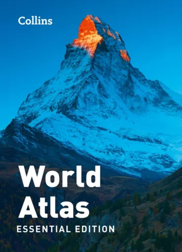
Collins World Atlas: Essential Edition - Collins Maps
A new fully updated reference atlas in the exciting Collins world atlas range. Great value and contains all the world maps you need in a budget atlas, for family, study and business use.
Objev podobné jako Collins World Atlas: Essential Edition - Collins Maps
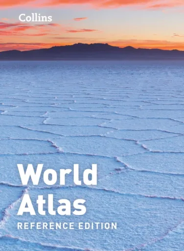
Collins World Atlas: Reference Edition - Collins Maps
A new, fully updated edition of this popular atlas in the Collins world atlas range. Designed in the distinctive Collins style, it is the ideal reference atlas for school, home and business use.
Objev podobné jako Collins World Atlas: Reference Edition - Collins Maps
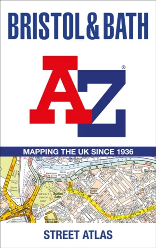
Bristol and Bath A-Z Street Atlas - A-Z Maps
Navigate your way around Bristol and Bath with this detailed and easy-to-use A-Z Street Atlas.Printed in full-colour, paperback format, this atlas contains 104 pages of continuous street mapping. More than 12,800 streets indexed. Large scale 6.25 inches to 1 mile map.Areas covered include: Avonmouth, Bradley Stoke, Filton, Keynsham, Kingswood, Mangotsfield, Portishead, Yate, Frampton Cotterell, Chipping Sodbury, Oldland, Swainswick, Batheaston, University of Bath, Combe Down, Bath Spa University, Saltford, Whitchurch, Bedminster, Long Ashton, Easton-in-Gordano, Cribbs Causeway.Also included are large scale city centre maps of both Bristol and Bath and a postcode map of the atlas area.Postcode districts, one-way streets and safety camera locations with their maximum speed are featured on the street mapping.A comprehensive index lists streets, selected flats, walkways and places of interest, place, area and station names. Additional healthcare (hospitals, walk-in centres and hospices) and transport connections are indexed as well.
Objev podobné jako Bristol and Bath A-Z Street Atlas - A-Z Maps
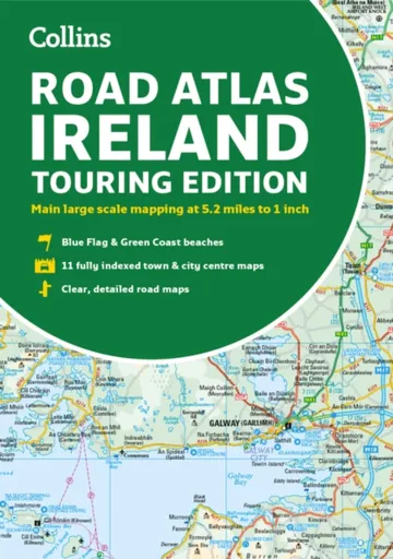
Road Atlas Ireland - Collins Maps
Explore Ireland with this accurate and fully updated road atlas.This road atlas is at A4 size, covering the whole of Ireland and features clear and detailed Collins colour mapping at a scale of 5.2 miles to 1 inch. Perfect for both residents and visitorstouring Ireland.This revised edition includes:Places of tourist interestContact information for Tourist Information Centres with grid references to the mappingFully indexed street maps of 11 cities and towns – Dublin, Belfast, Cork, Limerick, Waterford,Londonderry (Derry), Galway, Bangor, Dun Laoghaire, Drogheda and KillarneyBlue Flag & Green Coast beachesFerry and airport information; Distance chart; Distances marked on the roads in miles and kilometresRoute planning map of the whole of Ireland at 15.8 miles to 1 inchAdministrative map of Irish counties and districts.
Objev podobné jako Road Atlas Ireland - Collins Maps
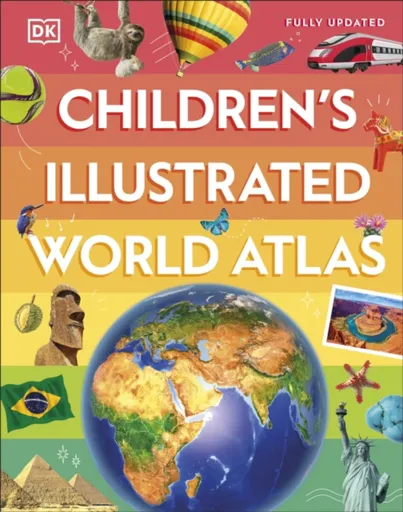
Children's Illustrated World Atlas - DK
Take young readers on the ultimate round-the-world trip with this impressive atlas - packed full of beautiful illustrations and photographs.Discover the world map-by-map with this exciting world atlas book for children, featuring more than 50 maps! Each page is filled with fascinating information, facts and colourful illustrations of our world. Children aged 9-12 will love to learn all about the many countries, cultures and people of the world through vibrant maps. Fascinating facts, local stories, vivid pictures, and clear, satellite-based maps together make this atlas a global yet personal experience for young readers.This illustrated atlas book for children offers: - Bite-sized information giving the profiles, facts, stats and flags of every country.- Pictures and stories explaining the society, culture and history of each region.- Maps created using satellite imagery providing a clear view of the world map-by-map.- A variety of topics covered, including population density, wealth, and internet access shown through graphics.From Bangkok''s floating markets to the carnival in Venice, the Children''s Illustrated World Atlas brings together views from windows all over the world. This illustrated atlas not only portrays regions, such as the Siberian wastes, with beautifully detailed maps but also describes the peoples who live there.
Objev podobné jako Children's Illustrated World Atlas - DK
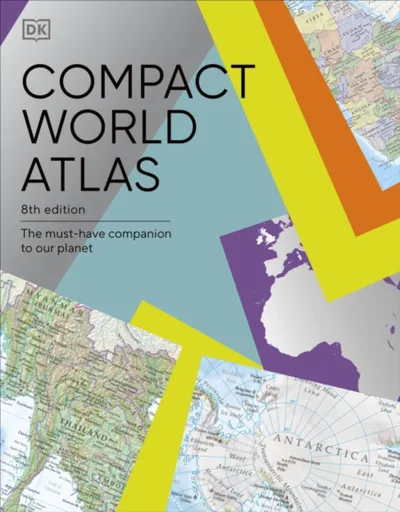
Compact World Atlas - DK
Colourful maps, flags and fascinating insights make this pocket sized atlas an ideal source of information about our ever changing world.Arranged in two main sections - a world atlas and country factfile - the Pocket A-Z World Atlas provides an invaluable source of accurate, informative and interesting geographical information, all in one compact and affordable volume. The atlas section, arranged by continent, presents over 70 colourful, clearly labelled, easy-to-read regional maps showing all the world''s nations, combining digital landscape modelling with the most important roads, railways, rivers, and settlements. Each map is annotated with fascinating ''insight'' facts that reveal a wealth of amazing information from around the world. The second section comprises a comprehensive series of country profiles, arranged alphabetically, covering all the essential facts and figures, including details of geography, climate, society, and economics. This section also contains reference factfile data for every nation, including the national flag, total area, population, languages, religions, and currency.Dive straight in to discover: - This new fully revised 8th Edition incorporating hundreds of updates to maps and statistics.- 71 regional maps, 196 country profile maps, flags, and statistics.- In-depth country profiles. - Fully cross-referenced index/gazetteer.Finding places is quick and convenient with a clearly-styled ... Unknown localization key: "more"
Objev podobné jako Compact World Atlas - DK
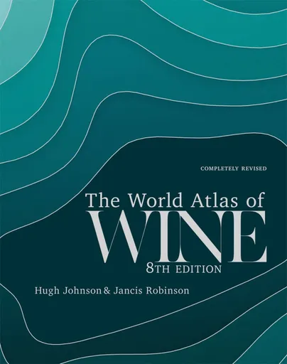
World Atlas of Wine 8th Edition - Hugh Johnson, Jancis Robinson
Winner of the André Simon Drinks Book of the Year 2019Shortlisted for the Louis Roederer Wine Book of the Year 2020"One book deserves a place on every wine drinker''s shelf, and that is The World Atlas of Wine" - Victoria Moore in the Telegraph"magisterial" - Fiona Beckett, Guardian "a key reference material for any sommelier, wine professional or any amateur serious about their passion" - Imbibe "The most useful single volume on wine ever published... If I owned only one wine book, it would be this one." - Andrew Jefford, Decanter*** Few wine books can be called classic, but the first edition of The World Atlas of Wine made publishing history when it appeared in 1971. It is recognized by critics as the essential and most authoritative wine reference work available. This eighth edition will bring readers, both old and new, up to date with the world of wine. To reflect all the changes in the global wine scene over the past six years, the Atlas has grown in size to 416 pages and 22 new maps have been added to the wealth of superb cartography in the book. The text has been given a complete overhaul to address the ... Unknown localization key: "more"
Objev podobné jako World Atlas of Wine 8th Edition - Hugh Johnson, Jancis Robinson
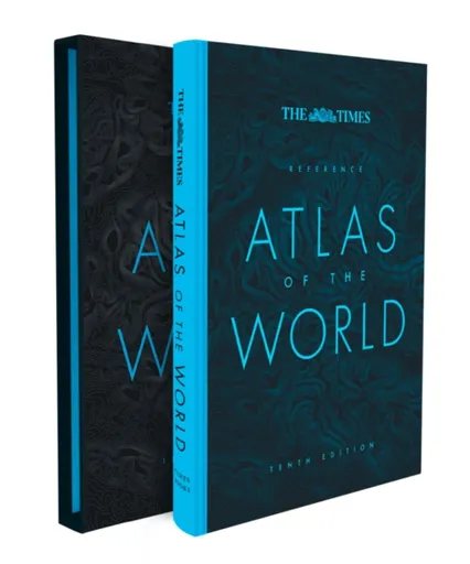
The Times Reference Atlas of the World - Times Atlases
Discover new places with authoritative atlases, beautifully designed and packaged.Tenth edition of this popular atlas from the prestigious and authoritative Times Atlas range. This world atlas contains the breadth, scale and detail to make it an ideal reference resource for school, home and business.The atlas has been brought fully up-to-date to provide a detailed and attractive picture of the world today. The beautifully illustrated introductory section gives a detailed profile of today’s world and covers major contemporary geographical and global issues – such as migration and population growth – through maps and graphics.The reference maps give exceptional detail and provide accurate, accessible and attractive coverage, helping you explore the world.A comprehensive guide to the world’s states and territories including flags, capitals and key statistics is included. Making this an ideal reference atlas for home, school or office.Main features include:• Authoritative mapping of the whole world• Plans of 46 of the world’s major cities• Geographical reference section with flags and statistics for the world’s states and territories• Maps and illustrations on major geographical themes, including earthquakes, population, cities, climate and migration• Historical mapping of the world from 1858 to the present day• More than 45,000 index entries
Objev podobné jako The Times Reference Atlas of the World - Times Atlases
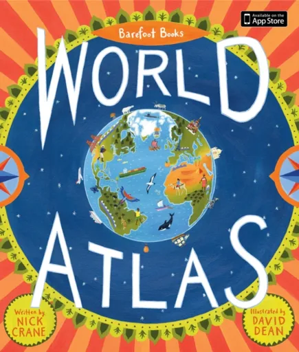
Barefoot Books World Atlas - Nick Crane
"With its emphasis on sustainability, interconnectedness, and diversity, [Barefoot Books World Atlas] offers young armchair travelers and globe-trotters much to discover" – Publishers Weekly Explore the world at your fingertips in this comprehensive, kid-friendly guide to geography and cultures around the world. Laid out by geographic region, zoom in and out our World Atlas celebrates cultural diversity and highlights the ways different people care for this planet we call home Further learning with he Barefoot Books World Atlas app and Barefoot Books World Atlas Sticker Book Table of contents helps guide kids in their exploration Includes a map poster Large hardcover format makes the perfect gift for young globetrotters!
Objev podobné jako Barefoot Books World Atlas - Nick Crane
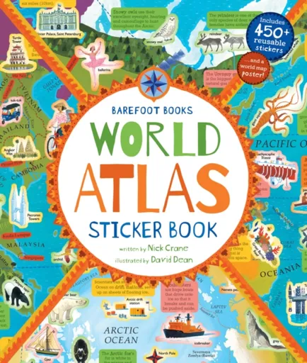
World Atlas Sticker Book
"This is a very hands-on, interactive book so it would be great for children that learn in this manner" - Youth Services Book Review Guide children on a fact-packed journey around the world, teaching them about each region’s people, plants, animals and landmarks -- through stickers! With 450+ resuable stickers, this interactive companion to Barefoot Books World Atlas includes 32 pages of maps and information about our world. Further learnign with the Barefoot Books World Atlas app and Barefoot Books World Atlas Includes a map poster The perfect gift for young globetrotters!
Objev podobné jako World Atlas Sticker Book
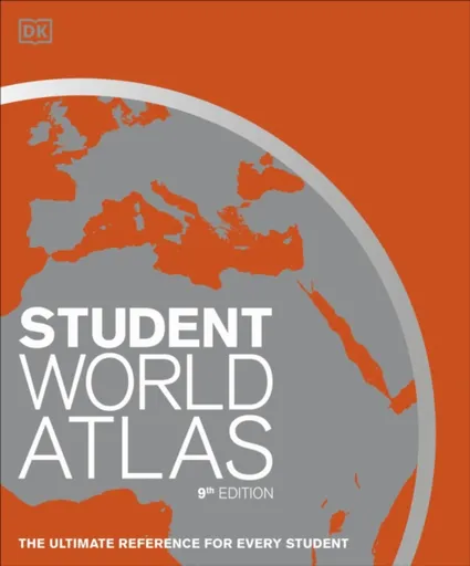
Student World Atlas - DK
Packed with beautifully designed and detailed maps, this world atlas is the perfect companion for young geography students.First published in 1988 and now in its 9th edition, Student World Atlas has been fully revised and updated. With 290 maps in total, it combines larger, traditional reference maps with smaller topic maps. These topics include industry, farming, climate, population, and the environment. Each theme will engage students, expanding their understanding of Earth and also making possible comparisons between different regions. For example, this student atlas not only displays an impressive map of the Caribbean, but highlights the hurricanes that continually threaten these islands and the people that live there. Then move to New Zealand map and learn about its diverse population of Polynesians, European settlers, and many other immigrants that make up this multicultural nation. On every page, you will discover more and more fascinating facts about each country''s landscape and its inhabitants. In addition to maps, this clear and accessible atlas also includes up-to-date statistics and flags for every country. It distills the huge mass of information available about our world down to the essential facts needed for the effective and successful study of our ever-changing planet.
Objev podobné jako Student World Atlas - DK
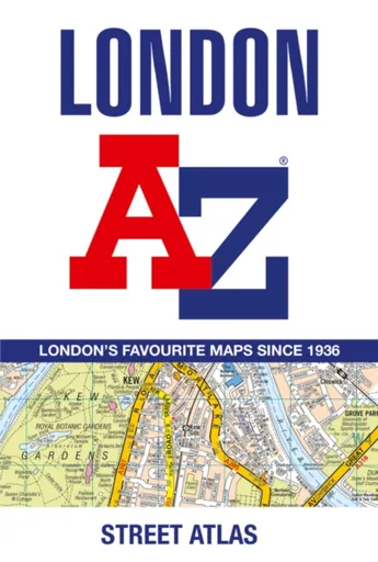
London A-Z Street Atlas - A-Z Maps
Navigate your way around London with this detailed, easy-to-use and up-to-date A-Z Street Atlas.First published in 1936, this iconic atlas is a trusted means of finding your way around the capital city.The main mapping extends beyond Central London from Heathrow Airport to Chingford at a scale of 2.88 inches to 1 mile (4.55 cm to 1 km), featuring postcode districts, one-way streets, the Congestion Charging Zone and Low Emission Zone.The large-scale street map of Central London – at a scale of 5.75 inches to 1 mile – cover Regent’s Park and Shoreditch, Chelsea and Vauxhall, Hyde Park and Bermondsey.A comprehensive index lists streets, selected flats, walkways and places of interest, place, area and junction names. Additional healthcare (hospitals, walk-in centres and hospices) and transport connections (National Rail, London Tramlink, Docklands Light Railway, London Underground and Overground stations, and River Bus pier) are indexed as well.Also included are:• Overview map of the Congestion Charging Zone, Ultra Low Emission and Low Emission Zones• West End Theatre map• London Connections rail services map
Objev podobné jako London A-Z Street Atlas - A-Z Maps
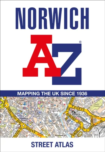
Norwich A-Z Street Atlas - A-Z Maps
Navigate your way around Norwich with this detailed and easy-to-use A-Z Street Atlas.Printed in full-colour, paperback format, this atlas contains 42 pages of continuous street mapping. More than 4,500 streets indexed. Large scale 4 inches to 1 mile map.Areas covered include :Blofield, Blofield Heath, Brundall, Cringleford, Hethersett, Norwich Airport,Poringland, Spixworth, Sprowston, Taverham, Wroxham, Wymondham.In addition, there is an inset map of Horsford and a large scale city centre map of Norwich.Postcode districts, one-way streets and safety camera locations with their maximum speed are featured on the street mapping.A comprehensive index lists streets, selected flats, walkways and places of interest, place, area and station names. Additional healthcare (hospitals, walk-in centres and hospices) and transport connections are indexed as well.
Objev podobné jako Norwich A-Z Street Atlas - A-Z Maps
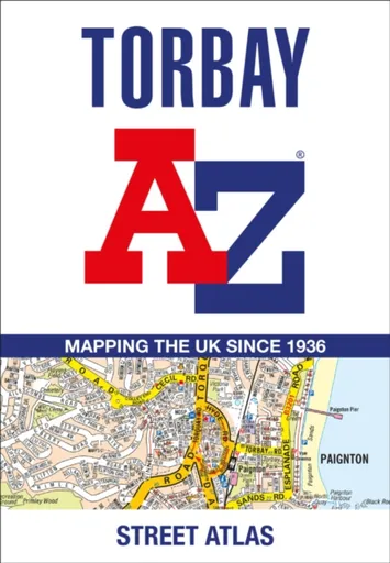
Torbay A-Z Street Atlas - A-Z Maps
Navigate your way around Torbay with this detailed and easy-to-use A-Z Street Atlas.Printed in full-colour, paperback format, this atlas contains 38 pages of continuous street mapping. More than 5,100 streets indexed. Large scale 4 inches to 1 mile map.Areas covered include: Brixham, Paignton, Torquay, Kingskerswell, Newton Abbot, Bovey Tracey, Teignmouth, Dawlish, Ashburton, Buckfastleigh, Totnes, Kingsbridge, Salcombe, Dartmouth.In addition, there are insets of: Bishopsteignton, Ipplepen, Stoke Gabriel and a large scale town centre map of Dartmouth.Postcode districts, one-way streets, Park and Ride sites, safety camera locations with their maximum speed and Dartmoor National Park boundary are featured on the mapping.The Places of Interest Guide is both informative and helpful with information about:Tourist Information CentresBoat tripsSelected places of interestThe English RivieraA comprehensive index lists streets, selected flats, walkways and places of interest, place, area and station names. Additional healthcare (hospitals, walk-in centres and hospices) and transport connections are indexed as well.
Objev podobné jako Torbay A-Z Street Atlas - A-Z Maps
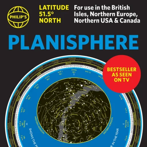
Philip's Planisphere (Latitude 51.5 North) - Philip's Maps
The first thing that every stargazer needs - an hour-by-hour and night-by-night moveable map of the stars ''A really useful bit of kit...a map of the night sky for any time of the year'' Mark Thompson, TV Astronomer on BBC Stargazing Live- Just turn the disc and ''dial up'' tonight''s night sky- Bestselling and accurate sky map for every hour of every night 24/7/365- Simple and fun to use for beginners - and an essential tool for experienced astronomers- All the stars and constellations down to magnitude 5 (visible with the naked eye)- Planet Tracker for the major visible planets - Full instructions and hints on exploring the skies by season - Suitable for UK, Ireland, Northern Europe, Canada and Northern USA (51.5N plus or minus 10 degrees)Philip''s have created a bestselling, practical, hour-by-hour tracker of the stars and constellations. Turn the oval panel to tonight''s date and time - and reveal the whole sky star by star visible from where you are. The map shows stars down to magnitude 5, plus several important deep-sky objects such as the Pleiades, the Andromeda Galaxy (M31) and the Orion Nebula (M42) The Planisphere is based at 51.5 degrees North. So it''s perfect ... Unknown localization key: "more"
Objev podobné jako Philip's Planisphere (Latitude 51.5 North) - Philip's Maps
The World Atlas of Rivers, Estuaries, and Deltas - Carol Wilson, Stephen Darby, Luciana Esteves, Jim Best
A stunningly illustrated atlas of the world’s rivers, estuaries, and deltas, and their ecosystemsFrom the Congo and the Mekong to the Seine and the Mississippi, Earth’s rivers carve through landscapes before coursing into the world’s oceans through estuaries and deltas. Their inexorable flow carries sediment and more, acting as lifeblood for a variety of ecosystems and communities. More than any other surface feature of Earth, rivers, estuaries, and deltas are vitally important to our economic and social well-being, and our management of them often sits at the sharp edge of today’s most pressing environmental challenges. The World Atlas of Rivers, Estuaries, and Deltas takes readers on an unforgettable tour of these dynamic bodies of water, explaining how they function at each stage of their flow. Combining maps and graphics with informative essays and beautiful photos, this invaluable reference book will give you a new appreciation for the power that rivers, estuaries, and deltas wield.Features a wealth of color photos, maps, and infographicsBrings together invaluable perspectives from leading expertsDescribes the rich biodiversity associated with the world’s rivers, estuaries, and deltasExplains how rivers, estuaries, and deltas work, from river networks to deltaic floodplains, and sheds light on the erosion, movement, and deposition ... Unknown localization key: "more"
Objev podobné jako The World Atlas of Rivers, Estuaries, and Deltas - Carol Wilson, Stephen Darby, Luciana Esteves, Jim Best
World Atlas of Beer - Tim Webb, Stephen Beaumont
Praise for the second edition of World Atlas of Beer:''Written with authority and wit... the perfect guide to the rapidly changing beer scene'' Guardian***As craft brewing continues to go from strength to strength across the world, World Atlas of Beer is the definitive and essential guide to beer. Understand the rich, multi-faceted traditions of Belgium, the Nordic legend that is Finnish Sahti, the relatively new phenomenon of the New England hazy IPA, and why Australia''s lower-strength beers are one of its great successes. With thousands of breweries now operating around the globe, and more opening every day, this is the expert guide to what is really worth drinking.Country by country the book considers a vast range of brewing techniques, beer styles and traditions. Detailed maps describe crucial trends in major territories and features such as matching beer with food and how to pour different kinds of beer complete the picture. Now in a fully updated third edition, this book is the perfect companion to help you explore the best beers the world has to offer.
Objev podobné jako World Atlas of Beer - Tim Webb, Stephen Beaumont

The World Atlas of Tattoo - Anna Felicity Friedman
Showcases the work of the top 100 tattoo artists around the globe Lively and informative, The World Atlas of Tattoo is a superbly illustrated and compelling reference book that, through examining the meeting point between tattoo artists and their personal understanding of their environment, presents a well-informed and nuanced account of what has become a widespread art practice. Organized geographically, each section is introduced by a short historical overview of the types of tattooing traditionally practised in that area of the world, enabling the reader to trace historical threads in the careers of some of the profiled tattooers, as well as marvel at how other artists have managed to create novel forms of tattooing that transcend any previous context. The book also tracks the movement of styles from their indigenous settings to diasporic communities, where they have often been transformed into creative, multicultural, hybrid designs. Written by an international team of scholars, historians and journalists, this comprehensive atlas will enlighten and excite anyone who is passionate about tattoo art in its many forms worldwide. Contents List Introduction • Europe • North America • Central and South America • East, South, Central and Southeast Asia • Pacific Islands and Australia • ... Unknown localization key: "more"
Objev podobné jako The World Atlas of Tattoo - Anna Felicity Friedman
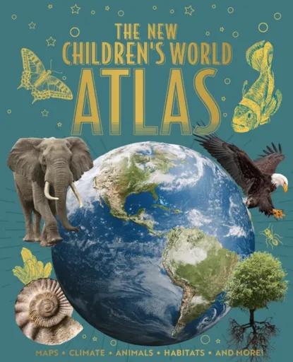
The New Children's World Atlas - Claudia Martin, Clare Hibbert, Honor Head, Donna Gregory
Celebrate our extraordinary, interconnected planet with this beautifully illustrated hardback atlas with gold cover accents.From Afghanistan to Zimbabwe, children can explore all corners of the world through perfectly rendered, clearly annotated maps. In-depth information pages explain more about Planet Earth, from oceans and icebergs to hurricanes and volcanoes. This hardback atlas gives children a fascinating insight into the world around them. Ideal for readers aged 8+.
Objev podobné jako The New Children's World Atlas - Claudia Martin, Clare Hibbert, Honor Head, Donna Gregory
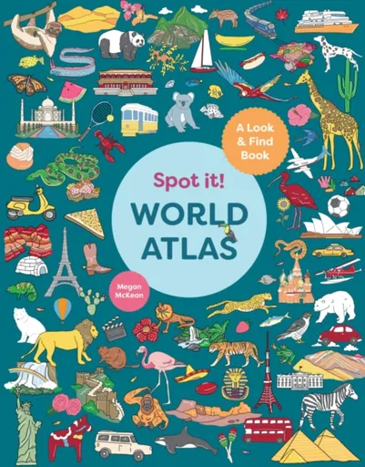
Spot It! World Atlas - Megan McKean
Spot it! World Atlas is a gorgeous and vibrant look-and-find children's atlas for kids aged 3+. Travel around each continent and discover the icons that are special to each country. Explore Europe and spot the Eiffel Tower in France or a scrumptious pizza in Italy. Trek to Africa and spot the pyramids in Egypt. Journey to Asia and spot a bamboo-eating panda in China or the gleaming Taj Mahal in India. Cruise to Oceania and spot colorful fish swimming in Australia's Great Barrier Reef. Roam the wildernesses of Canada in North America and spot a moose, then navigate to South America and spot a soccer ball in Brazil. Written and illustrated by the talented Megan McKean, children will be happily occupied, at home or on the go, searching for iconic animals, buildings, food and more, while learning interesting facts about countries around the world.
Objev podobné jako Spot It! World Atlas - Megan McKean
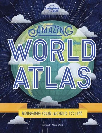
Lonely Planet Kids Amazing World Atlas - Lonely Planet Kids, Alexa Ward
Bringing planet earth to life, this colourful and fun addition to Lonely Planet Kids takes you on a trip around the world that you’ll never forget. Filled with continental and regional maps, lively text, an entry for every country on the planet, plus mind-blowing facts, and an emphasis on the species that live on our planet, this is an essential resource for young readers wanting to learn about the world.With 240 pages of illustrated maps, engaging infographics, mind-blowing photography and a large dose of humour, this fun and informative world guide, written by children’s author and wildlife enthusiast Alexa Ward, is the definitive guide to what our planet is really like. From exploration of indigenous peoples all over the globe, to illustrations of festivals in Brazil and each country’s individual history, young readers will be enticed to go on a journey to some of the furthest corners of the globe, learning intriguing facts as they go. Take a trip around the world that you’ll never forget with the Amazing World Atlas!About Lonely Planet Kids: Lonely Planet Kids – an imprint of the world’s leading travel authority Lonely Planet – published its first book in 2011. Over the past 45 years, ... Unknown localization key: "more"
Objev podobné jako Lonely Planet Kids Amazing World Atlas - Lonely Planet Kids, Alexa Ward
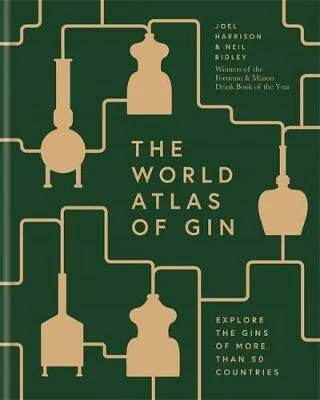
The World Atlas of Gin - Joel Harrison, Neil Ridley
''Excellent'' - Susy Atkins, the TelegraphFor everyone and anyone who wants to understand more about gin, this is the definitive guide - covering the best gins the world has to offer, history and production methods, and the countries that have helped make gin a global success story.Never has there been a more striking revolution in the world of distilled spirits than the current renaissance of gin. With small craft distilleries popping up all over the world, from Texas to Tasmania, more varieties and techniques being used than ever before, and a tapestry of tastes from light and citrusy to big bold savoury notes, gin''s appeal is extraordinarily wide and varied.From gin made in small batches from local botanicals, through to large facilities which make some of the world''s most recognized gin brands, World Atlas of Gin looks at everything from the botanical to the bottle: how and where botanicals are grown and harvested and their role within the flavour of gin; producers and the stories behind their brands; exactly where, and how, gins are made; and, country by country, the best examples to try. Global cocktails are covered too, including the history and country of origin of some of the ... Unknown localization key: "more"
Objev podobné jako The World Atlas of Gin - Joel Harrison, Neil Ridley
World Music - Philip V. Bohlman
The term ''world music'' encompasses both folk and popular music across the globe, as well as the sounds of cultural encounter and diversity, sacred voices raised in worship, local sounds, and universal values. It emerged as an invention of the West from encounters with other cultures, and holds the power to evoke the exotic and give voice to the voiceless. Today, in both sound and material it has a greater presence in human societies than ever before. The politics of which world music are a part - globalization, cosmopolitanism, and nationalism - play an increasingly direct role in societies throughout the world, but are at the same time also becoming increasingly controversial. In this new edition of his Very Short Introduction, Philip Bohlman considers questions of meaning and technology in world music, and responds to the dramatically changing political world in which people produce and listen to world music. He also addresses the different ways in which world music is created, disseminated, and consumed, as the full reach of the internet and technologies that store and spread music through the exchange of data files spark a revolution in the production and availability of world music. Finally, Bohlman revises the way ... Unknown localization key: "more"
Objev podobné jako World Music - Philip V. Bohlman
Kniha: The World Atlas of Coffee - James Hoffmann - 2nd Edition (EN)
V druhém vydání knihy The World Atlas of Coffee od autora Jamese Hoffmanna, spolumajitele pražírny Square Mile Coffee Roasters Jamese Hoffmanna, naleznete aktualizované statistiky pěstitelských zemí. Kniha vás provází od původu kávového zrna přes vaření a vychutnávání kávy. Celá kniha je rozdělena do tří hlavních sekcí: je zaměřena na odrůdy kávy, sklizeň, zpracování až pražení. zkoumá, jak dosáhnou t nejlepší chuti z kávy, kterou si pořídíte domů. Představuje různé metody přípravy, včetně espress, mlýnku na kávu a také detaily o kvalitě vody. je hlavní část knihy soustředící se na země, které kávu produkují. Kniha je v anglickém jazyce. Autor: James Hoffmann Rok vydání: 2018 Vazba: pevná Počet stran: 272 ISBN: 1784724297 Rozměr: 20 x 2.4 x 25.8 cm
Objev podobné jako Kniha: The World Atlas of Coffee - James Hoffmann - 2nd Edition (EN)
The World Atlas of Trees and Forests - White Peter, Herman and Research Professor) Shugart, Sassan, Adjunct Professor (UCLA)) Saatchi, Jerome Chave
A marvelously illustrated look at the world’s diverse forests and their ecosystemsThe earth’s forests are havens of nature supporting a diversity of life. Shaped by climate and geography, these vast and dynamic wooded spaces offer unique ecosystems that shelter complex and interdependent webs of flora, fungi, and animals. The World Atlas of Trees and Forests offers a beautiful introduction to what forests are, how they work, how they grow, and how we map, assess, and conserve them. Provides the most wide-ranging coverage of the world’s forests availableTakes readers beneath the breathtaking variety of wooded canopies that span the globeProfiles a wealth of tree species, with enlightening and entertaining natural-history highlights along the wayFeatures stunning color photos, maps, and graphicsDraws on the latest cutting-edge research and technology, including satellite imagery
Objev podobné jako The World Atlas of Trees and Forests - White Peter, Herman and Research Professor) Shugart, Sassan, Adjunct Professor (UCLA)) Saatchi, Jerome Chave
A History of the Second World War in 100 Maps - Jeremy Black
In this highly original work Jeremy Black, one of world's leading military and cartographic historians, shows how fundamental maps were to the conflict as he charts its historical sweep across each of the major theatres.
Objev podobné jako A History of the Second World War in 100 Maps - Jeremy Black

Stanex Povlečení atlas grádl tmavě šedá, 140 x 200 cm, 70 x 90 cm
Povlečení z atlas grádlu je vyrobeno ze 100% bavlny a nabízí pohodlí a hebkost. Tmavě šedý odstín a struktura proužků dodávají elegantní vzhled. Souprava obsahuje povlak na polštář 70x90 cm a povlak na přikrývku 140x200 cm.
- Vyrobeno ze 100% kvalitní bavlny pro mimořádnou hebkost
- Elegantní tmavě šedý odstín a struktura 2,5 cm proužků
- Snadná údržba – perte naruby bez bělidel
Objev podobné jako Stanex Povlečení atlas grádl tmavě šedá, 140 x 200 cm, 70 x 90 cm
The Devil's Atlas - Edward Brooke-Hitching
'Very beautiful and illuminating' Mariella Frostrup Edward Brooke-Hitching, author of the international bestseller The Phantom Atlas delivers an atlas unlike any other. The Devil’s Atlas is an illustrated guide to the heavens, hells and lands of the dead as imagined throughout history by cultures and religions around the world. Packed with colourful maps, paintings and captivating stories, the reader is taken on a compelling tour of the geography, history and supernatural populations of the afterworlds of cultures around the globe. Whether it’s the thirteen heavens of the Aztecs, the Chinese Taoist netherworld of ‘hungry ghosts’, or the ‘Hell of the Flaming Rooster’ of Japanese Buddhist mythology (in which sinners are tormented by an enormous fire-breathing cockerel), The Devil’s Atlas gathers together a wonderful variety of beliefs and representations of life after death. These afterworlds are illustrated with an unprecedented collection of images, ranging from the marvellous ‘infernal cartography’ of the European Renaissance artists attempting to map the structured Hell described by Dante and the decorative Islamic depictions of Paradise to the various efforts to map the Garden of Eden and the spiritual vision paintings of nineteenth-century mediums.The Devil’s Atlas accompanies beautiful images with a highly readable trove of surprising facts ... Unknown localization key: "more"
Objev podobné jako The Devil's Atlas - Edward Brooke-Hitching

Stanex Povlečení atlas grádl béžová, 140 x 200 cm, 70 x 90 cm
Povlečení z atlas grádlu je vyrobeno z 100% bavlny a nabízí pohodlí a hebkost. Béžový odstín a struktura proužků dodávají elegantní vzhled. Souprava obsahuje povlak na přikrývku 140x200 cm a povlak na polštář 70x90 cm.
- Vyrobeno ze 100% kvalitní bavlny pro mimořádnou hebkost.
- Elegantní design s 2,5 cm proužky a noblesním béžovým odstínem.
- Snadná údržba – perte naruby bez bělidel a chemických čistidel.
- Kompletní souprava obsahuje povlak na přikrývku i polštář.
Objev podobné jako Stanex Povlečení atlas grádl béžová, 140 x 200 cm, 70 x 90 cm
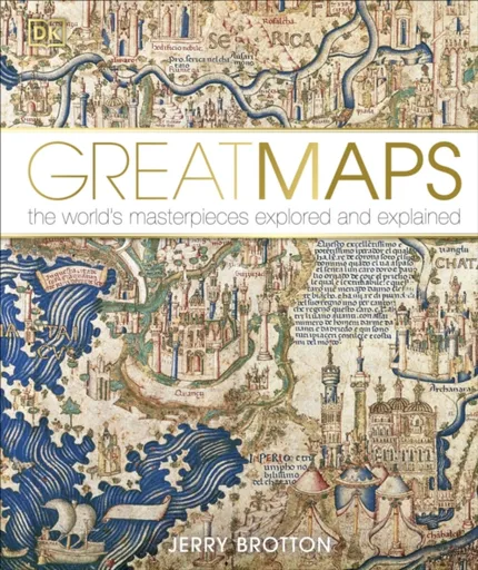
Great Maps - Jerry Brotton
A superbly illustrated guide to 64 maps from all around the world! From examples of medieval Mappa Mundi and the first atlas to Google Earth and maps of the moon, this captivating maps book is a must-have for all history and geography enthusiasts and explorers! Embark on a visual tour of the world''s finest maps! This fascinating world atlas book: - Analyses each map visually, with the help of pull-outs and graphic close-up details- Traces the history of maps chronologically, providing a fascinating overview of cartography through the ages- Tells the story behind each map - why it was created, who it was for, and how it was achieved- Profiles key cartographers, explorers, and artists- Draws together navigation, propaganda, power, art, and politics through the world''s greatest mapsMaps are much more than just geographical data. They are an accurate reflection of the culture and context of different time frames in history. This remarkable geography book puts cartography on the map! It tells the stories behind great maps through stunning pull-out details and reveals how they have helped people make sense of the world. Embark on a global adventure of a lifetime with this world map book and see our planet ... Unknown localization key: "more"
Objev podobné jako Great Maps - Jerry Brotton

Stanex Povlečení atlas grádl světle šedá, 140 x 200 cm, 70 x 90 cm
Povlečení z atlas grádlu je vyrobeno z 100% bavlny a nabízí pohodlí a hebkost. Světle šedý odstín a struktura proužků dodávají elegantní vzhled. Souprava obsahuje povlak na přikrývku 140x200 cm a povlak na polštář 70x90 cm.
- Vyrobeno ze 100% kvalitní bavlny pro mimořádnou hebkost.
- Elegantní design s 2,5 cm proužky a světle šedým odstínem.
- Snadná údržba – doporučeno prát naruby bez agresivní chemie.
- Kompletní souprava obsahuje povlak na přikrývku i polštář.
Objev podobné jako Stanex Povlečení atlas grádl světle šedá, 140 x 200 cm, 70 x 90 cm

Stanex Povlečení atlas grádl smetanová, 140 x 220 cm, 70 x 90 cm
Povlečení z materiálu atlas grádl nabízí hebkost a pohodlí. Sada obsahuje povlak na přikrývku 140x220 cm a povlak na polštář 70x90 cm v smetanovém odstínu. Je vyrobeno z kvalitní bavlny a vyznačuje se elegantním designem s proužky.
- Vyrobeno ze 100% kvalitní bavlny pro maximální pohodlí
- Elegantní design s 2,5 cm proužky a noblesním smetanovým odstínem
- Snadná údržba - doporučeno prát naruby bez agresivní chemie
Objev podobné jako Stanex Povlečení atlas grádl smetanová, 140 x 220 cm, 70 x 90 cm

Stanex Povlečení atlas grádl starorůžová, 140 x 220 cm, 70 x 90 cm
Povlečení z materiálu atlas grádl nabízí hebkost a pohodlí díky 100% bavlně. Design s 2,5 cm proužky a starorůžovým odstínem přináší do ložnice noblesní vzhled. Souprava obsahuje povlak na přikrývku 140x220 cm a povlak na polštář 70x90 cm.
- Vyrobeno ze 100% kvalitní bavlny pro maximální pohodlí
- Elegantní starorůžový odstín a struktura proužků
- Snadná údržba - doporučeno prát naruby bez agresivní chemie
- Kompletní souprava obsahuje povlak na přikrývku i polštář
Objev podobné jako Stanex Povlečení atlas grádl starorůžová, 140 x 220 cm, 70 x 90 cm
Atlas Obscura - Joshua Foer, kolektiv autorů
Atlas Obscura je průvodce představující přes 700 nejpodivuhodnějších a nejméně známých míst na planetě. Zahrnuje přírodní zázraky, bizarní lidské výtvory a tajemné lokality. Kniha slouží jako inspirace pro cestovatele hledající neobvyklé zážitky.
- Obsahuje více než 700 unikátních a kuriózních míst z celého světa.
- Inspiruje k objevování neznámých a nevyšlapaných cest.
- Bohatě ilustrovaný průvodce pro milovníky dobrodružství a záhad.
Objev podobné jako Atlas Obscura - Joshua Foer, kolektiv autorů

The Collected Stories of Philip K. Dick Volume 2 - Philip K. Dick
The definitive editions of Philip K. Dick's short stories, containing some of the most defining works in the Science Fiction genre. This stunning new edition of Philip K Dick's work includes the influential 'Adjustment Team' and 'The Father Thing', as well as a litany of mind-expanding other works.Work your way through some of the most influential stories from the 20th century, which have had a massive impact on popular culture. 'I am bowled over. I am so impressed by the variety in stories, and how interesting the individual story ideas are' Goodreads reviewer, 'Philip K.Dick is a master of messing with your head in a story' Goodreads reviewer, 'Enter the Mind of a Genius . . .This collection of short stories by Philip K. Dick are great, thought provoking, funny, and some really frightening' Goodreads reviewer, 'This blew my mind, and then some. The ideas and concepts alone need five stars.What an amazing man' Goodreads reviewer,
Objev podobné jako The Collected Stories of Philip K. Dick Volume 2 - Philip K. Dick
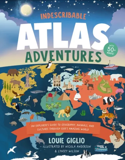
Indescribable Atlas Adventures - Louie Giglio
With more than 50 infographic maps, this illustrated world atlas for kids from bestselling author Louie Giglio will stretch your children''s understanding of the world as they discover more about God, science, and His amazing world!Indescribable Atlas Adventures offers a self-guided tour for your favorite explorer throughout the seven continents and over 50 countries. Easy-to-read maps, more than 1,500 facts, and a world map that helps kids identify each continent and country will help your child to think globally and discover new insights into God''s incredible creation. Each map includesan overview of each country''s population, languages, and prominent features;key facts about the country''s capital cities; neighboring countries; and the national bird, tree, and dish;notable people and their amazing achievements;the country''s terrain, climate, wildlife, contributions to space exploration, cultural hallmarks, and Christian faith traditions; andbiblical and inspirational pieces, like devotional thoughts, prayers, and Bible verses that highlight how amazing God and His world are.Indescribable Atlas Adventures is for ages 6 to 10 and spotlights several fascinating ecosystems, like the Sahara, Amazon, and Great Barrier Reef. This book has a large trim size to help kids explore fun details on each page and is a perfect "my first atlas of the world" ... Unknown localization key: "more"
Objev podobné jako Indescribable Atlas Adventures - Louie Giglio
Philip and Alexander - Adrian Goldsworthy
''A thrilling read'' Tom Holland''History-writing at its best'' Barry StraussBy the end of his short life, Alexander the Great had redrawn the map of the ancient world to create an empire that stretched from the Adriatic Sea to the Indian subcontinent. But his success was not just the product of his own genius and restless energy, it was built on decades of effort by his father.History has portrayed Philip II of Macedon as a one-eyed old man whose assassination allowed Alexander to accede to power. But there was far more to him than this. Through decades of hard fighting and clever diplomacy, Philip unified his country and conquered Greece. His son inherited all of this at the perfect moment for him to win yet greater glory.The work of a master historian, Philip and Alexander describes how Philip and Alexander of Macedon transformed a weak kingdom in northern Greece into a globe-spanning empire and – in so doing – changed the course of history.
Objev podobné jako Philip and Alexander - Adrian Goldsworthy