road atlas ireland collins maps
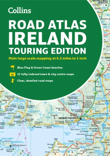
Road Atlas Ireland - Collins Maps
Explore Ireland with this accurate and fully updated road atlas.This road atlas is at A4 size, covering the whole of Ireland and features clear and detailed Collins colour mapping at a scale of 5.2 miles to 1 inch. Perfect for both residents and visitorstouring Ireland.This revised edition includes:Places of tourist interestContact information for Tourist Information Centres with grid references to the mappingFully indexed street maps of 11 cities and towns – Dublin, Belfast, Cork, Limerick, Waterford,Londonderry (Derry), Galway, Bangor, Dun Laoghaire, Drogheda and KillarneyBlue Flag & Green Coast beachesFerry and airport information; Distance chart; Distances marked on the roads in miles and kilometresRoute planning map of the whole of Ireland at 15.8 miles to 1 inchAdministrative map of Irish counties and districts.
Objev podobné jako Road Atlas Ireland - Collins Maps
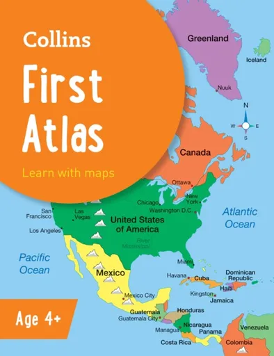
Collins First Atlas - Collins Maps
The must-have atlas for children aged 4-7Collins First Atlas is a fun, vibrant and clear starter atlas for children aged 4-7 years, providing the perfect foundation to basic geography skills.The atlas begins by introducing pupils to photographs and mapping of a local area, then gradually leads them through maps of regional, national, continental and global areas.Short, informative sentences introduce pupils to basic geographical and atlas vocabularyMaps are clearly labelled to highlight certain countries and featuresMapping concepts are presented in a way that supports learning development, as concepts become more complexIdeal for classroom use or home learningFully up-to-dateSuitable for EYFS and KS1This atlas is also available in a Kindle format. The next atlas in this series is the Collins Primary Atlas, suitable for ages 7+ and KS2.
Objev podobné jako Collins First Atlas - Collins Maps
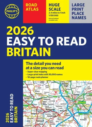
2026 Philip's Easy to Read Road Atlas of Britain - Philip's Maps
"The detail you need at a size you can read". The latest 2026 Philip''s Easy to Read Road Atlas of Britain from the best-selling Road Atlas range has over 350 pages packed with exceptionally clear mapping and everything you need for exploring Britain. Now available as a practical paperback, it will enhance any trip.· Clear maps packed with extra details for a better journey· Huge 1:150,000 scale (approx 2.4 miles to 1 inch)· Large print place names· Large print index· Super-clear 10-page route planner to create the best journeys· Thousands of attractions clearly mapped, including castles, theme parks, gardens, zoos and more.· London''s expanded ULEZ clearly shown on approach mapping· Over 100,000 copies of the Philip''s Easy Read Road Atlases of Britain sold since launch in 2020.At last, a road atlas that everyone can read easily, in or out of the car, no matter what the conditions. With up-to-date mapping technology, your travels have never been easier to plan. This edition contains a wealth of useful information, including tourist attractions, to ensure the best possible journey. Whether it''s dark, or if you just can''t find your glasses, the 2026 Philip''s Easy to Read Road Atlas of Britain is the ultimate ... Unknown localization key: "more"
Objev podobné jako 2026 Philip's Easy to Read Road Atlas of Britain - Philip's Maps
Podívejte se také
Sebring Road Performance 88 V
Hexbug Hexmods Pro Series žlutý off-road truck
RC auto off road modré
off road auto s dosahem 40 metrů
jungle off-road vozidlo pro děti
motopneu Michelin Road Classic 130/70/17
Michelin Road Classic suchý i mokrý povrch
Kormoran Road Performance letní pneu
psychologický román road movie
psychedelický road trip Austrálií
road enduro bunda s ventilací
červený traktor s off-road nápravou pro děti
řiditelná off-road náprava Bruder
off-road model auta do vitríny
věšák na boty Wenko Atlas
povlečení atlas grádl zelené
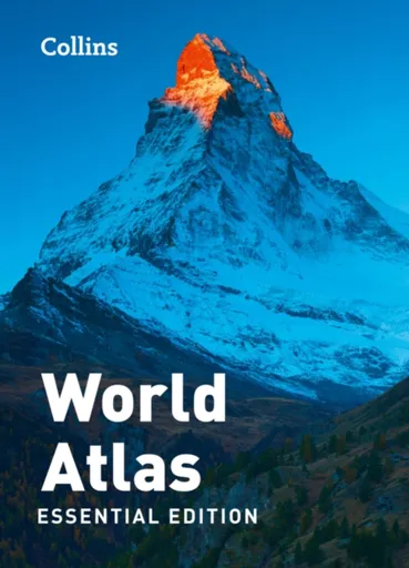
Collins World Atlas: Essential Edition - Collins Maps
A new fully updated reference atlas in the exciting Collins world atlas range. Great value and contains all the world maps you need in a budget atlas, for family, study and business use.
Objev podobné jako Collins World Atlas: Essential Edition - Collins Maps
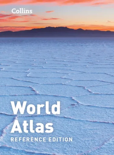
Collins World Atlas: Reference Edition - Collins Maps
A new, fully updated edition of this popular atlas in the Collins world atlas range. Designed in the distinctive Collins style, it is the ideal reference atlas for school, home and business use.
Objev podobné jako Collins World Atlas: Reference Edition - Collins Maps
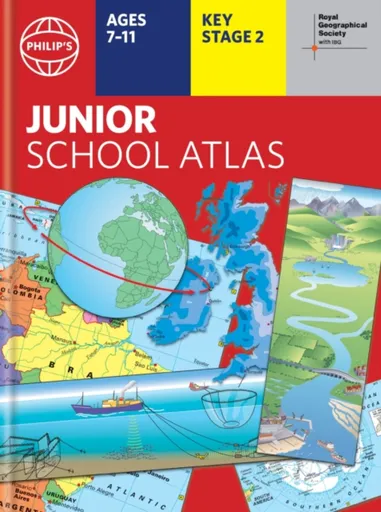
Philip's RGS Junior School Atlas - Philip's Maps
The 12th edition of the market-leading atlas for primary school pupils, Philip''s RGS Junior School Atlas has been fully revised and updated with all the latest facts and curriculum requirements.- The essential atlas for primary schools with clear and easy-to-follow maps and diagrams - updated for 2024/2025- Published in association with the Royal Geographical Society- Recommended for Key Stage 2 of the National Curriculum - and all 7-11 year olds - An excellent introduction to mapping concepts such as scale, direction, symbols, longitude and latitude- 22-page Britain and Ireland section with clear thematic charts, diagrams and large-scale regional maps- 22-page section on The World, with political maps - and thematic treatment of key themes, from volcanoes and earthquakes to transport and tourism- Continents section with physical and political maps- Easy-to-follow map references and 1,000-place indexThe introductory section describes the meaning of scale, how to measure distances using the maps, and explains the symbols on the maps.The following section is devoted to the United Kingdom and Ireland. Thematic maps cover topics such as mountains and rivers, climate and weather, population and cities, farming and fishing, industry and energy, transport, tourism and conservation. The rest of the atlas is made up of ... Unknown localization key: "more"
Objev podobné jako Philip's RGS Junior School Atlas - Philip's Maps
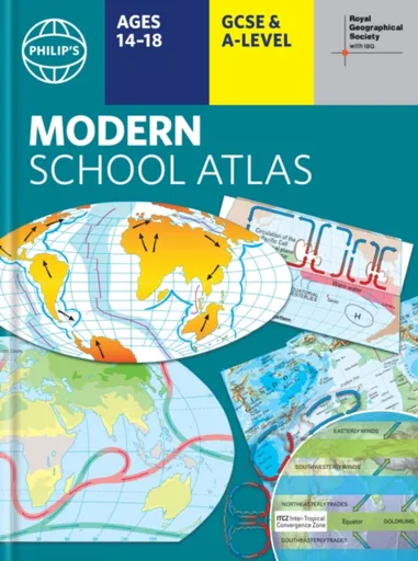
Philip's RGS Modern School Atlas - Philip's Maps
- Britain''s best-selling school atlas - now in its 101st edition- Recommended for Key Stage 4, GCSE and A-Level in England and Wales (Scottish National Qualifications/Highers) and international schools- Fully updated to reflect the latest changes in the curriculum- Published in association with the Royal Geographical Society- Combines superb digital maps of Britain and the world with up-to-date thematic maps - Country-by-country statistics on population, land use, trade, tourism, energy, wealth and much more - World Themes Section - from volcanoes and earthquakes to population trends, languages and religions, all the key aspects and statistics of geography are explored and explained- Plus a special section on how satellite imagery is used to interpret global, environmental and urban patterns of change Britain''s best-selling secondary school atlas, now in its 101st Edition. The contents are divided into colour-coded sections for rapid reference. The physical maps of the United Kingdom and Ireland are accompanied by thematic maps on numerous key social and economic themes. World topographical maps, with thematic maps on topics such as climate, population and economics, are followed by 30 pages of World thematic maps.Completing the atlas is a section of World social and economic statistics, and an index with letter-figure ... Unknown localization key: "more"
Objev podobné jako Philip's RGS Modern School Atlas - Philip's Maps
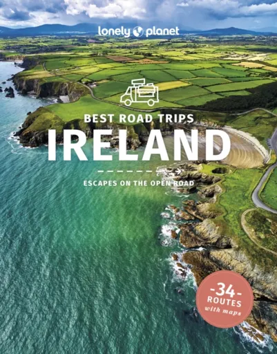
Lonely Planet Best Road Trips Ireland - Wilson Neil, Le Nevez Catherine, Albiston Isabel, Lonely Planet, Davenport Fionn, Belinda Dixon
Lonely Planet''s Best Road Trips Ireland reveals 34incredible escapes -with maps - so you can experience the freedom of the open road.Get ready for a road trip like no other and discover unforgettable drives across Ireland that range from 2-day escapes to 2-week adventures, from feasting on gastronomic delights along the Wild Atlantic Way, to finding dreamlike views around the Ring of Kerry, and scuba diving and surfing in the Dingle Peninsula.InsideLonely Planet''s Best Road Trips Ireland:Discover 34open road escapes that range from 2 days to 2 weeksEach route featured includes easy-to-use maps, detailed directions and tips about when to go, duration, distance, and how to link your trip to other drivesFind the top stops and experiences as well as fun photo opportunities along the way''Our Picks'' section highlights the best: scenic drives, hidden treasures, good food, ancient monuments, adrenaline rushesLocal travel experts share why they love each trip Essential ''Toolkit'' on arriving, hiring the right car for your trip, getting around, local driving laws, accommodation, health and safety, and moreCovers: Dublin & Eastern Ireland, Cork & Southwest Ireland, Galway & the West of Ireland, Belfast & the North of IrelandHit the road with Lonely Planet''s Best Road Trips Ireland ... Unknown localization key: "more"
Objev podobné jako Lonely Planet Best Road Trips Ireland - Wilson Neil, Le Nevez Catherine, Albiston Isabel, Lonely Planet, Davenport Fionn, Belinda Dixon
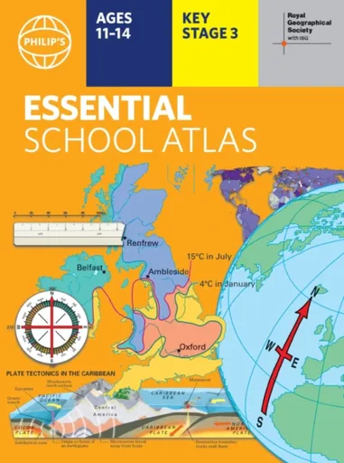
Philip's RGS Essential School Atlas - Philip's Maps
"An excellent world atlas. Very illuminating, good colours, clear texts...good glossary and, last but not least, up-to-date." - customer review- The ideal school atlas for Key Stage 3 pupils and Scotland''s National Qualifications, 11-14 years old- All updated for 2024 specifically to meet curriculum needs- Specially focused 16-page UK and Ireland section- Comprehensive 62-page world section includes thematic maps on the environment, climate change, people, quality of life, and energy- Published in association with the Royal Geographical SocietyPhilip''s RGS Essential School Atlas has been specially created for lower-secondary geography students (11-14 year olds). The maps have been carefully designed to be uncluttered and easy to read, containing specially selected place names and detail. A clear set of symbols and scale information accompanies every map, with a useful introductory section covering basic atlas skills, including aerial photographs and satellite images to further explain particular features on the maps. Latitude and longitude co-ordinates are included in the index, alongside figure-letter references. Fully up-to-date, the atlas includes detailed regional maps, charts and satellite images of Europe, Italy, the Middle East, China, Japan, Kenya, USA, Brazil, and the Arctic and Antarctica. It also focuses on areas of special interest for students of geography, such ... Unknown localization key: "more"
Objev podobné jako Philip's RGS Essential School Atlas - Philip's Maps
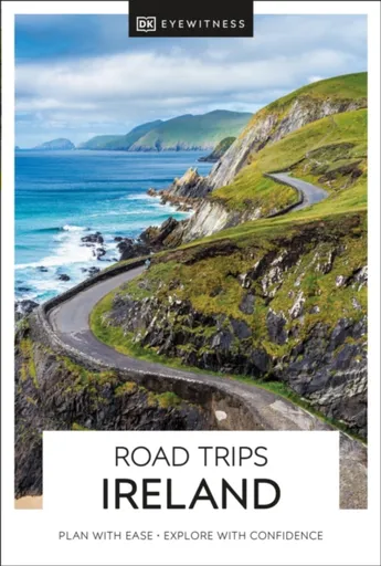
DK Road Trips Ireland - DK Travel
Winding rural roads, lush verdant valleys, endless miles of untamed coastline: Ireland is the perfect destination for a road trip to remember. With Road Trips Ireland, it''s yours to explore.Featuring 25 wonderful drives across the country and packed with detailed driving instructions and practical information, this easy-to-use guide helps you discover Ireland at its best.Inside, you''ll find:25 easy-to-follow scenic driving tours, each lasting two to five daysOur pick of the best places to stay, eat and shopWays to see more of each area en route, including great viewpoints, delightful detours, walks through historic towns and villages, outdoor activities, and various tours and trips.Rules of the road, addresses for satnavs, detailed directions for easy navigation, road conditions and parking tips, and useful travel, visa and health informationA laminated pull-out road map of Ireland, which helps you navigate with easeDK is the world''s leading illustrated reference publisher, producing beautifully designed books for adults and children in over 120 countries. Looking for more on Ireland''s culture, history and attractions? Try our DK Eyewitness Ireland.
Objev podobné jako DK Road Trips Ireland - DK Travel
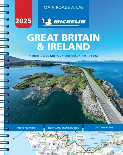
Great Britain & Ireland 2025 - Mains Roads Atlas (A4-Spiral) - Michelin
Updated annually - Full of practical features, the Michelin Road Atlas Great Britain & Ireland is the perfect companion for your everyday journey and holiday planning. Updated every year, it gives you clear and accurate information for a safe and enjoyable journey thanks to a detailed mapping scale of 1/300 000. The route planner as well as the time and distance charts will help you plan and optimise your journey. Michelins safety alerts warn you about dangerous driving areas, such as steep hills, level crossing as well as risk zone subject to tighter speed check. The Michelin Great Britain and Ireland road atlas also shows tourist sights, leisure facilities, as well as scenic routes so that you can make the most of your journey. Michelin Great Britain & Ireland Atlas (A4 Spiral) features: * Detailed mapping with a scale 1/300 000 (4.75 miles to 1 inch) * Mileage chart and journey times to help you plan your journey *Key to Map Pages to quickly access your region of interest *Practical street plan section for an easy navigation in urban areas: 52 town plans embedded in the mapping of their surrounding area. * Easier navigation thanks to the location map featured ... Unknown localization key: "more"
Objev podobné jako Great Britain & Ireland 2025 - Mains Roads Atlas (A4-Spiral) - Michelin
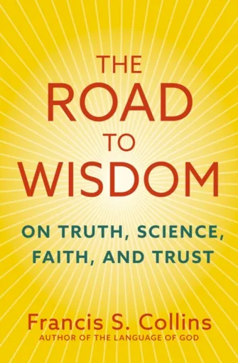
The Road to Wisdom - Collins Francis S.
''Inspirational''- YO YO MA''When Dr Collins speaks, I listen - and his message is more important now than ever''- PRESIDENT BILL CLINTON''Collins''s personal journey of reflection and discovery will speak to many struggling to make sense of life, cope with uncertainty, and find their place in a greater scheme of things''- ALISTER MCGRATH''Francis is a careful, friendly and generous thinker. This book will help anyone who wishes to see integrity, civility and truth prevail in the public square.''- JUSTIN BRIERLEY''Dr Francis Collins is a bridge person in a polarized time. Amid the shrillness of our era, Collins offers a calming voice of hope''- PHILIP YANCEY''I would recommend this book to anyone.''- NICKY GUMBEL''This practical, refreshingly humble book offers guidance for all those worried about the state of wisdom in our world''- ELIZABETH OLDFIELDFrom world-leading scientist and New York Times bestselling author of The Language of God, a deeply thoughtful guidebook to discerning what and who we can trust to move us from societal discord to civic harmony.As the COVID-19 pandemic revealed, western society has become not just hyper-partisan, but also deeply cynical; distrustful of traditional sources of knowledge and wisdom such as science and faith. Scepticism about vaccines led to ... Unknown localization key: "more"
Objev podobné jako The Road to Wisdom - Collins Francis S.
Philip's RGS World Atlas - Philip's Maps
"An excellent world atlas. Very illuminating, good colours, clear texts...good glossary and, last but not least, up-to-date". Amazon customer review· The perfect world atlas for work, study or leisure· Great value for money· 96 pages of authoritative world maps, physical and political· 70 city maps in the fascinating World Cities section, with full-page satellite images for 10 great cities· Over 35,000 place name indexAll this and a special 32-page introductory section - ''The World in Focus'' - covers key geographical themes such as the Earth''s position in the Solar System, the structure of the Earth, climate and weather, the environment, population, resources, economics and international organizations. Vital information on topics covered in geography, humanities and economics courses.The information-packed World Atlas from Philip''s, published in association with the Royal Geographical Society has been fully updated for this new, 2021 edition
Objev podobné jako Philip's RGS World Atlas - Philip's Maps
Bristol and Bath A-Z Street Atlas - A-Z Maps
Navigate your way around Bristol and Bath with this detailed and easy-to-use A-Z Street Atlas.Printed in full-colour, paperback format, this atlas contains 104 pages of continuous street mapping. More than 12,800 streets indexed. Large scale 6.25 inches to 1 mile map.Areas covered include: Avonmouth, Bradley Stoke, Filton, Keynsham, Kingswood, Mangotsfield, Portishead, Yate, Frampton Cotterell, Chipping Sodbury, Oldland, Swainswick, Batheaston, University of Bath, Combe Down, Bath Spa University, Saltford, Whitchurch, Bedminster, Long Ashton, Easton-in-Gordano, Cribbs Causeway.Also included are large scale city centre maps of both Bristol and Bath and a postcode map of the atlas area.Postcode districts, one-way streets and safety camera locations with their maximum speed are featured on the street mapping.A comprehensive index lists streets, selected flats, walkways and places of interest, place, area and station names. Additional healthcare (hospitals, walk-in centres and hospices) and transport connections are indexed as well.
Objev podobné jako Bristol and Bath A-Z Street Atlas - A-Z Maps
The Road to Wisdom - Collins Francis S.
From world-leading scientist and New York Times bestselling author of The Language of God, a deeply thoughtful guidebook to discerning what and who we can trust to move us from societal discord to civic harmony.As the COVID-19 pandemic revealed, western society has become not just hyper-partisan, but also deeply cynical; distrustful of traditional sources of knowledge and wisdom such as science and faith. Scepticism about vaccines led to the needless deaths of at least 230,000 Americans, and "Do your own research" is now a rallying cry in many online rabbit holes. Yes, experts can make mistakes, and institutions can lose their moral compass, but there are reliable ways and means to weigh information and navigate truth, and The Road to Wisdom is here to help us rediscover them.Francis Collins reminds us of the four core sources of judgement and clear thinking: truth, science, faith, and trust. Drawing on his scientific work at the forefront of the Human Genome Project and the US National Institutes of Health, as well as on ethics, philosophy, and theology, Collins makes a robust, thoughtful case for each of these sources - their reliability, and their limits. Ultimately, he shows how they work together, not separately ... Unknown localization key: "more"
Objev podobné jako The Road to Wisdom - Collins Francis S.
London A-Z Street Atlas - A-Z Maps
Navigate your way around London with this detailed, easy-to-use and up-to-date A-Z Street Atlas.First published in 1936, this iconic atlas is a trusted means of finding your way around the capital city.The main mapping extends beyond Central London from Heathrow Airport to Chingford at a scale of 2.88 inches to 1 mile (4.55 cm to 1 km), featuring postcode districts, one-way streets, the Congestion Charging Zone and Low Emission Zone.The large-scale street map of Central London – at a scale of 5.75 inches to 1 mile – cover Regent’s Park and Shoreditch, Chelsea and Vauxhall, Hyde Park and Bermondsey.A comprehensive index lists streets, selected flats, walkways and places of interest, place, area and junction names. Additional healthcare (hospitals, walk-in centres and hospices) and transport connections (National Rail, London Tramlink, Docklands Light Railway, London Underground and Overground stations, and River Bus pier) are indexed as well.Also included are:• Overview map of the Congestion Charging Zone, Ultra Low Emission and Low Emission Zones• West End Theatre map• London Connections rail services map
Objev podobné jako London A-Z Street Atlas - A-Z Maps
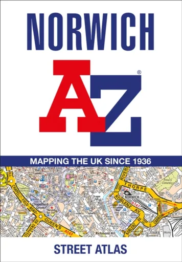
Norwich A-Z Street Atlas - A-Z Maps
Navigate your way around Norwich with this detailed and easy-to-use A-Z Street Atlas.Printed in full-colour, paperback format, this atlas contains 42 pages of continuous street mapping. More than 4,500 streets indexed. Large scale 4 inches to 1 mile map.Areas covered include :Blofield, Blofield Heath, Brundall, Cringleford, Hethersett, Norwich Airport,Poringland, Spixworth, Sprowston, Taverham, Wroxham, Wymondham.In addition, there is an inset map of Horsford and a large scale city centre map of Norwich.Postcode districts, one-way streets and safety camera locations with their maximum speed are featured on the street mapping.A comprehensive index lists streets, selected flats, walkways and places of interest, place, area and station names. Additional healthcare (hospitals, walk-in centres and hospices) and transport connections are indexed as well.
Objev podobné jako Norwich A-Z Street Atlas - A-Z Maps
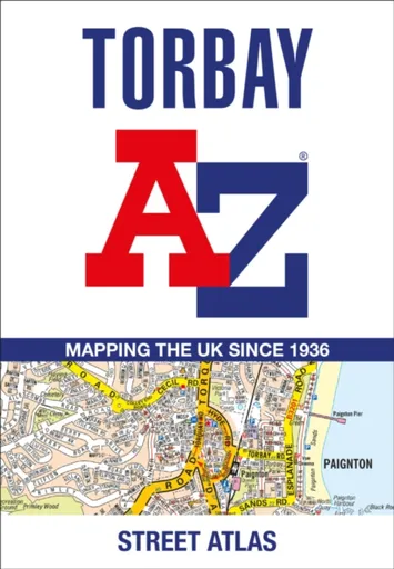
Torbay A-Z Street Atlas - A-Z Maps
Navigate your way around Torbay with this detailed and easy-to-use A-Z Street Atlas.Printed in full-colour, paperback format, this atlas contains 38 pages of continuous street mapping. More than 5,100 streets indexed. Large scale 4 inches to 1 mile map.Areas covered include: Brixham, Paignton, Torquay, Kingskerswell, Newton Abbot, Bovey Tracey, Teignmouth, Dawlish, Ashburton, Buckfastleigh, Totnes, Kingsbridge, Salcombe, Dartmouth.In addition, there are insets of: Bishopsteignton, Ipplepen, Stoke Gabriel and a large scale town centre map of Dartmouth.Postcode districts, one-way streets, Park and Ride sites, safety camera locations with their maximum speed and Dartmoor National Park boundary are featured on the mapping.The Places of Interest Guide is both informative and helpful with information about:Tourist Information CentresBoat tripsSelected places of interestThe English RivieraA comprehensive index lists streets, selected flats, walkways and places of interest, place, area and station names. Additional healthcare (hospitals, walk-in centres and hospices) and transport connections are indexed as well.
Objev podobné jako Torbay A-Z Street Atlas - A-Z Maps
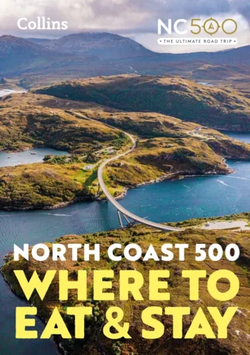
North Coast 500 - Collins Maps
A guide to the best places to enjoy the local Scottish cuisine and where to rest for the night along the famous North Coast 500. Elemental, enchanting and inspiring, the NC500 is Scotland’s most popular touring route, a stunning 500 mile loop around Northern Scotland.This unique guide makes sure that at every stage and stop of the way, you will find the most creative chefs, the best hotels, the cosiest pubs, the best local foods and the most acclaimed destinations.In this guide you’ll find:• Overview maps of the NC500 route, broken down into six regions• Beautiful full-colour photos taken along the route• what3words geocode system used to specify exact locations of places to eat and stay• A guide to pricing at each of the venues• Information on dietary options, wheelchair access, pet friendly spots, electric vehicle charing points, WiFi, and places with NC500 member perksResearched and written by travel bloggers, Campbell Kerr and Gemma Spence. The ultimate guide to where to eat and stay along Scotland’s ultimate touring route.
Objev podobné jako North Coast 500 - Collins Maps

Stanex Povlečení atlas grádl tmavě šedá, 140 x 200 cm, 70 x 90 cm
Povlečení z atlas grádlu je vyrobeno ze 100% bavlny a nabízí pohodlí a hebkost. Tmavě šedý odstín a struktura proužků dodávají elegantní vzhled. Souprava obsahuje povlak na polštář 70x90 cm a povlak na přikrývku 140x200 cm.
- Vyrobeno ze 100% kvalitní bavlny pro mimořádnou hebkost
- Elegantní tmavě šedý odstín a struktura 2,5 cm proužků
- Snadná údržba – perte naruby bez bělidel
Objev podobné jako Stanex Povlečení atlas grádl tmavě šedá, 140 x 200 cm, 70 x 90 cm

Stanex Povlečení atlas grádl béžová, 140 x 200 cm, 70 x 90 cm
Povlečení z atlas grádlu je vyrobeno z 100% bavlny a nabízí pohodlí a hebkost. Béžový odstín a struktura proužků dodávají elegantní vzhled. Souprava obsahuje povlak na přikrývku 140x200 cm a povlak na polštář 70x90 cm.
- Vyrobeno ze 100% kvalitní bavlny pro mimořádnou hebkost.
- Elegantní design s 2,5 cm proužky a noblesním béžovým odstínem.
- Snadná údržba – perte naruby bez bělidel a chemických čistidel.
- Kompletní souprava obsahuje povlak na přikrývku i polštář.
Objev podobné jako Stanex Povlečení atlas grádl béžová, 140 x 200 cm, 70 x 90 cm

Stanex Povlečení atlas grádl světle šedá, 140 x 200 cm, 70 x 90 cm
Povlečení z atlas grádlu je vyrobeno z 100% bavlny a nabízí pohodlí a hebkost. Světle šedý odstín a struktura proužků dodávají elegantní vzhled. Souprava obsahuje povlak na přikrývku 140x200 cm a povlak na polštář 70x90 cm.
- Vyrobeno ze 100% kvalitní bavlny pro mimořádnou hebkost.
- Elegantní design s 2,5 cm proužky a světle šedým odstínem.
- Snadná údržba – doporučeno prát naruby bez agresivní chemie.
- Kompletní souprava obsahuje povlak na přikrývku i polštář.
Objev podobné jako Stanex Povlečení atlas grádl světle šedá, 140 x 200 cm, 70 x 90 cm

Stanex Povlečení atlas grádl smetanová, 140 x 220 cm, 70 x 90 cm
Povlečení z materiálu atlas grádl nabízí hebkost a pohodlí. Sada obsahuje povlak na přikrývku 140x220 cm a povlak na polštář 70x90 cm v smetanovém odstínu. Je vyrobeno z kvalitní bavlny a vyznačuje se elegantním designem s proužky.
- Vyrobeno ze 100% kvalitní bavlny pro maximální pohodlí
- Elegantní design s 2,5 cm proužky a noblesním smetanovým odstínem
- Snadná údržba - doporučeno prát naruby bez agresivní chemie
Objev podobné jako Stanex Povlečení atlas grádl smetanová, 140 x 220 cm, 70 x 90 cm

Stanex Povlečení atlas grádl starorůžová, 140 x 220 cm, 70 x 90 cm
Povlečení z materiálu atlas grádl nabízí hebkost a pohodlí díky 100% bavlně. Design s 2,5 cm proužky a starorůžovým odstínem přináší do ložnice noblesní vzhled. Souprava obsahuje povlak na přikrývku 140x220 cm a povlak na polštář 70x90 cm.
- Vyrobeno ze 100% kvalitní bavlny pro maximální pohodlí
- Elegantní starorůžový odstín a struktura proužků
- Snadná údržba - doporučeno prát naruby bez agresivní chemie
- Kompletní souprava obsahuje povlak na přikrývku i polštář
Objev podobné jako Stanex Povlečení atlas grádl starorůžová, 140 x 220 cm, 70 x 90 cm
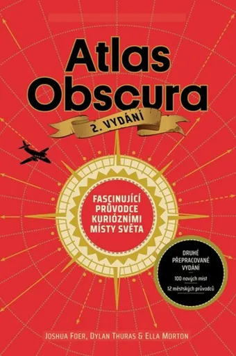
Atlas Obscura - Joshua Foer, kolektiv autorů
Atlas Obscura je průvodce představující přes 700 nejpodivuhodnějších a nejméně známých míst na planetě. Zahrnuje přírodní zázraky, bizarní lidské výtvory a tajemné lokality. Kniha slouží jako inspirace pro cestovatele hledající neobvyklé zážitky.
- Obsahuje více než 700 unikátních a kuriózních míst z celého světa.
- Inspiruje k objevování neznámých a nevyšlapaných cest.
- Bohatě ilustrovaný průvodce pro milovníky dobrodružství a záhad.
Objev podobné jako Atlas Obscura - Joshua Foer, kolektiv autorů
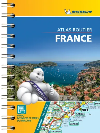
France - Mini Atlas - Michelin
Small and practical, France mini-road atlas is a must have in your car''s glove compartment. This pocket sized atlas will give you an overall view of your journey thanks to its scale 1/1000 000. This compact atlas is very convenient to use thanks to its pocket sized format, a complete index of localities and a very clever distance and time chartSmall and practical. France mini-road atlas features:* Scale: 1/1,000,000* Key to map page* Distance table* Exhaustive town index* Primary and secondary road network* Indication of tourist sights and scenic routes
Objev podobné jako France - Mini Atlas - Michelin
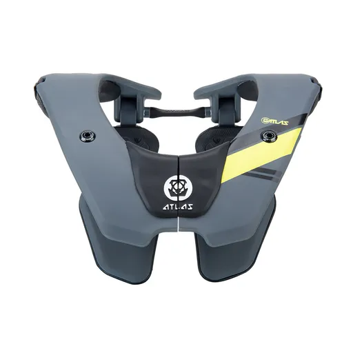
Dětský chránič krční páteře ATLAS Tyke Grey
Dětský chránič krční páteře ATLAS Tyke Grey je určen pro motokros, BMX, čtyřkolky a horská kola. Konstrukce Split-Flex Frame a systém ERS zajišťují pohyblivost a možnost rychlého odložení. Chránič zabraňuje hyperflexi, hyperextenzi a axiálnímu zatížení páteře.
- Patentovaná flexibilní konstrukce Split-Flex Frame pro maximální pohyblivost
- Systém ERS umožňující rychlé odložení chrániče při nehodě
- Široká kontaktní zóna a odpružení hrudní části pro vyšší bezpečnost
- Minimalistický design s nízkou hmotností (460 g) pro pohodlí dítěte
Objev podobné jako Dětský chránič krční páteře ATLAS Tyke Grey

Stanex Povlečení atlas grádl smetanová, 140 x 200 cm, 70 x 90 cm
Povlečení z atlas grádlu je vyrobeno ze 100% bavlny a nabízí pohodlí s hebkou strukturou. Smetanový odstín a proužkový design přináší do ložnice eleganci. Souprava obsahuje povlak na polštář 70x90 cm a povlak na přikrývku 140x200 cm.
- Vyrobeno z 100% kvalitní bavlny pro mimořádnou hebkost
- Elegantní struktura 2,5 cm proužků podtrhne design
- Smetanový odstín dodá ložnici noblesní vzhled
- Snadná údržba - doporučeno prát naruby bez bělidel
Objev podobné jako Stanex Povlečení atlas grádl smetanová, 140 x 200 cm, 70 x 90 cm

Stanex Povlečení atlas grádl světle šedá, 140 x 220 cm, 70 x 90 cm
Povlečení Stanex z atlas grádlu je vyrobeno z 100% bavlny a nabízí pohodlí s elegantním designem proužků. Světle šedý odstín dodá ložnici noblesní vzhled. Sada obsahuje povlak na přikrývku 140 x 220 cm a povlak na polštář 70 x 90 cm.
- Vyrobeno ze 100% kvalitní bavlny pro mimořádnou hebkost.
- Elegantní design s 2,5 cm proužky a světle šedým odstínem.
- Snadná údržba – perte naruby bez agresivní chemie.
- Kompletní sada obsahuje povlak na přikrývku i polštář.
Objev podobné jako Stanex Povlečení atlas grádl světle šedá, 140 x 220 cm, 70 x 90 cm
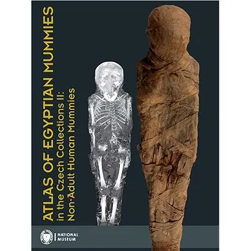
Atlas of Egyptian Mummies in the Czech Collections II: Non-Adult Human Mummies (978-80-7036-750-6)
Druhý díl série Atlas egyptských mumií v českých sbírkách se specializuje na mumie a pohřební vybavení dětí a dospívajících do 15 let. Obsahuje podrobný katalog dvou kompletních mumií, dvanácti izolovaných částí a šesti pohřebních schránek. Publikace přináší informace o zdravotním stavu, nemocech a pohřebních praktikách dětí ve starověkém Egyptě.
- Druhý díl odborné série o egyptských mumiích
- Zaměření na mumie dětí a dospívajících do 15 let
- Podrobný katalog s proveniencí a zdravotními analýzami
- Vědecky hodnotný materiál z Národního muzea v Praze
Objev podobné jako Atlas of Egyptian Mummies in the Czech Collections II: Non-Adult Human Mummies (978-80-7036-750-6)
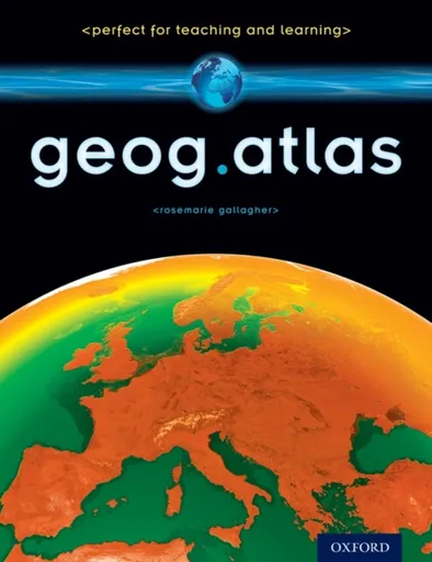
geog.atlas - Gallagher RoseMarie
geog.atlas is an engaging atlas of accessible maps and supporting information. It features unique coverage of places likely to appear in the news, such as the Middle East, Afghanistan, and the Falklands. Special maps look at themes like global warming, desertification, and how people spread around the world. Stunning satellite images are placed alongside physical geography maps to aid understanding. ''Did you know?'' and ''What if?'' circles provide interesting extra information and engaging facts.Full of clearly-labelled maps, straightforward explanations, and advice on how to ''read'' maps and understand what they show, it will help improve students'' basic locational knowledge, enhance their understanding, and build their confidence.geog.atlas supports teachers whether they''re using geog.123 or an alternative course at KS3.
Objev podobné jako geog.atlas - Gallagher RoseMarie

Stanex Povlečení atlas grádl starorůžová, 140 x 200 cm, 70 x 90 cm
Povlečení z atlas grádlu je vyrobeno ze 100% bavlny a nabízí pohodlí a hebkost. Souprava obsahuje povlak na přikrývku 140 x 200 cm a povlak na polštář 70 x 90 cm. Elegantní design s proužkovou strukturou a starorůžovým odstínem dodává ložnici noblesní vzhled.
- Vyrobeno ze 100% kvalitní bavlny pro mimořádnou hebkost.
- Elegantní design s 2,5 cm proužkovou strukturou.
- Starorůžový odstín dodává ložnici noblesní vzhled.
- Snadná údržba - doporučeno prát naruby bez bělidel.
Objev podobné jako Stanex Povlečení atlas grádl starorůžová, 140 x 200 cm, 70 x 90 cm

The Atlas Maneuver - Steve Berry
Román představuje nové dobrodružství Cottona Malonea, který se zaplete do pátrání po legendárním japonském válečném pokladu zvaném Yamashitovo zlato. Příběh propojuje historické události z konce druhé světové války se současnou hrozbou zneužití kryptoměn k narušení globálního finančního systému. Děj zavede čtenáře do Švýcarska, Lucemburska a marockých hor v honbě za odhalením konspirace známé jako Atlasovo manévr.
- Nejnovější díl oblíbené série Cotton Malone
- Napínavý příběh kombinující historická fakta a fikci
- Rychlý spád děje s mezinárodním přesahem
- Aktuální téma kryptoměn v thrillerovém kontextu
Objev podobné jako The Atlas Maneuver - Steve Berry
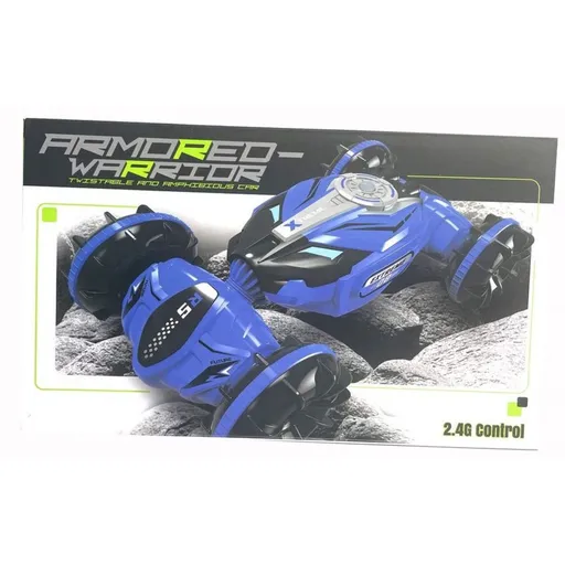
Alltoys RC Auto off-road
RC auto off road v modré barvě je určeno pro děti od 8 let. Ovládá se dálkovým ovladačem s dosahem 40 metrů a umožňuje transformaci mezi dvěma režimy jízdy. Maximální rychlost činí 8 km/h a auto je vybaveno dobíjecí baterií s USB kabelem.
- Transformace mezi režimy jízdy na vodě a na zemi jedním tlačítkem
- Dosah dálkového ovládání až 40 metrů pro volný pohyb
- USB dobíjecí baterie pro pohodlné nabíjení
- Automatické demo funkce pro snadné ovládání
Objev podobné jako Alltoys RC Auto off-road
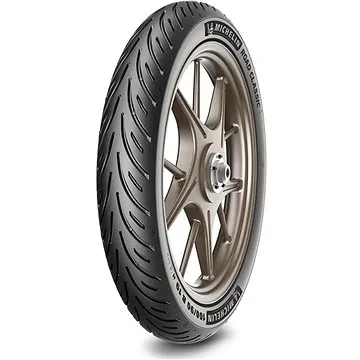
Michelin Road Classic 130/70/17 TL,R 62 H (396007)
Přední motocyklová pneumatika Michelin Road Classic 130/70/17 TL,R 62 H kombinuje sportovní výkon s každodenní užitnou hodnotou. Pneumatika nabízí rychlostní index H (až 210 km/h) a nosnostní index 62 (až 265 kg). Je určena pro montáž na přední kolo a vyznačuje se sofistikovanou směsí a dezénem pro dobrou odezvu.
- Vynikající přilnavost na suchém i mokrém povrchu
- Rychlostní index H pro jízdu až do 210 km/h
- Nosnostní index 62 (až 265 kg) pro spolehlivé zatížení
- DOT maximálně 2 roky stará s 95% zásob do 1 roku stáří
Objev podobné jako Michelin Road Classic 130/70/17 TL,R 62 H (396007)
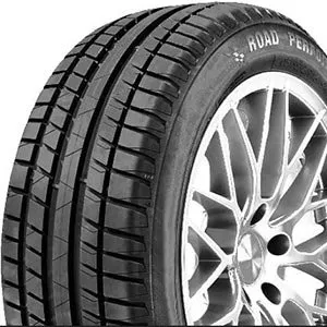
Sebring Road Performance 195/60 R15 88 V (489729)
Letní pneumatika Sebring Road Performance 195/60 R15 88 V je určena pro osobní automobily. Nabízí rychlostní index V (až 240 km/h) a nosnostní index 88 (až 560 kg na pneumatiku). Pneumatika splňuje parametry hlučnosti 71 dB a je dodávána s maximální stářím 2 roky.
- Rychlostní index V pro bezpečnou jízdu až do 240 km/h
- Nosnostní index 88 zajišťující zatížení až 560 kg na pneumatiku
- Nízká hlučnost 71 dB pro komfortní jízdu
- Čerstvá pneumatika s DOT maximálně 2 roky stará
Objev podobné jako Sebring Road Performance 195/60 R15 88 V (489729)
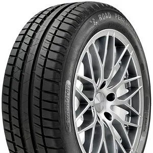
Kormoran Road Performance 205/65 R15 94 V (316622)
Letní pneumatika Kormoran Road Performance ve velikosti 205/65 R15 s rychlostním indexem V (až 240 km/h) a nosnostním indexem 94 (až 670 kg). Pneumatika má hlučnost 71 dB, přilnavost na mokru třídy C a úsporu paliva třídy C. Je určena pro provoz při teplotách nad +7 °C.
- Rychlostní index V pro jízdu až do 240 km/h
- Nosnostní index 94 (až 670 kg na pneumatiku)
- Nízká hlučnost 71 dB (třída 2)
- Čerstvá pneumatika s DOT maximálně 2 roky stará
Objev podobné jako Kormoran Road Performance 205/65 R15 94 V (316622)
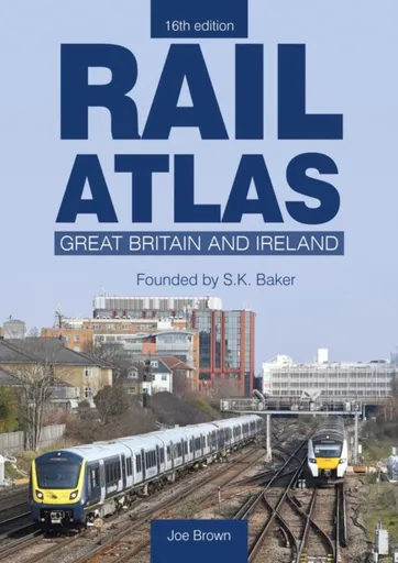
Rail Atlas: Great Britain & Ireland 16th Edition - Joe Brown
Following the sad death of Stuart Baker, the creator of Rail Atlas Great Britain and Ireland, in 2020, we were fortunate that another fine railway cartographer, Joe Brown, agreed to complete the work that Stuart had begun, to revise what became the 15th edition. However, the railway network of Great Britain and Ireland is always changing and never static and revised editions of this atlas are required on a regular basis; the rebuilding of the line from Oxford towards Cambridge and the reinstatement of the Foynes branch in Ireland being examples of some of the additions to this new edition. Fortunately, Joe Brown has agreed to take on this work and this 16th edition will be the first one to be fully edited and revised by him. As with all the previous editions, the Atlas has been fully revised and updated whilst retaining the convenient format of mapping where each page overlaps with that on adjoining pages to make it easier to follow a long-distance route. Where appropriate, additional detailed inset maps have been drawn to show the complex railway developments in metropolitan areas such as Nottingham and Manchester. While some minor changes to the layout have been made, Rail ... Unknown localization key: "more"
Objev podobné jako Rail Atlas: Great Britain & Ireland 16th Edition - Joe Brown
Philip's Caribbean Atlas for Secondary Schools - Philip's Maps
A new edition of the market-leading atlas for CXC Geography students, Philip''s Caribbean Atlas for Secondary Schools provides extensive coverage of the Caribbean area, together with a comprehensive selection of world and regional maps. The atlas is arranged in three sections for ease of use, with each page colour-coded for rapid reference. The first section is devoted to a detailed coverage of the Caribbean region in 48 pages, and includes maps of every island plus Belize and Guyana, as well as topographical, land use, tourism and mining maps.The second section is made up of 72 pages of World topographical maps, incorporating continental thematic maps on topics such as population, climate and biomes, followed by 32 pages of World thematic maps. This new 8th edition features updated mapping of all Caribbean islands, as well as the latest statistics. The World map section contains additional coverage of Brazil, the Americas and Asia, while the World thematic section includes maps on volcanoes, El Niño, tourism, energy, minerals, industry, trade and international organizations.Completing the atlas is a section of CXC study maps covering topics such as farming, soil conservation, economics, tourism and urban land use. Features regional studies of Mauritius, UK, Canada, USA and ... Unknown localization key: "more"
Objev podobné jako Philip's Caribbean Atlas for Secondary Schools - Philip's Maps
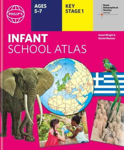
Philip's RGS Infant School Atlas - David Wright, Philip's Maps, Rachel Noonan
Written for 5 to 7 year-old this atlas is ideal for teaching Key Stage 1, helping to cover geography, history, science, citizenship and literacy requirements- Written by experts Professor David Wright and Rachel Noonan- Published in association with the Royal Geographical Society- 50 pages of clear, child-friendly maps showing our world today- Countries of the world brought to life with flags, illustrations and photos- Bold text, simple words and short sentences to encourage reading skills- Starts with the Earth as a Planet then zooms into each of the world''s regions with maps and illustrations- Numbered balloons on each map link to photos of a real placeFully revised and updated, the atlas is for children aged 5-7 in the early stages of reading, with simple text to explain what is happening on the maps and illustrations - all compatible with National Curriculum Key Stage 1.Clear, child-friendly maps are combined with vibrant photographs and facts about the world. Guidance is given at the beginning of the atlas on how to use the maps, encouraging the early development of map skills. Each colourful spread is illustrated with photographs and packed with fact boxes, curiosities, flags, stamps and simple quiz questions. Philip''s RGS Infant ... Unknown localization key: "more"
Objev podobné jako Philip's RGS Infant School Atlas - David Wright, Philip's Maps, Rachel Noonan
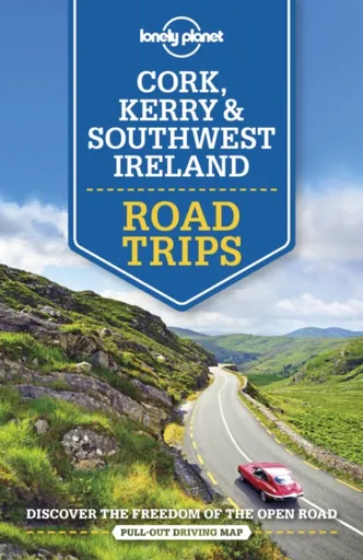
Lonely Planet Cork, Kerry & Southwest Ireland Road Trips - Wilson Neil, Lonely Planet, Clifton Wilkinson
Lonely Planet: The world''s number one travel guide publisherWhether exploring your own backyard or somewhere new, discover the freedom of the open road with Lonely Planet''s Cork, Kerry & Southwest Ireland''s BestTrips. Featuring amazing road trips, plus up-to-date advice on the destinations you''ll visit along the way, you can explore the Ring of Kerry, the castles of Killarney and West Cork villages - all with your trusted travel companion. Jump in the car, turn up the tunes, and hit the road!Inside Lonely Planet''s Cork, Kerry & Southwest Ireland''s Best Trips:Lavish colour and gorgeous photography throughoutItineraries and planning advice to pick the right tailored routes for your needs and interestsGet around easily - easy-to-read, full-colour route maps and detailed directionsInsider tips to get around like a local, avoid trouble spots and be safe on the road - local driving rules, parking, toll roadsEssential infoat your fingertips - hours of operation, phone numbers, websites, pricesHonest reviews for all budgets - eating, sleeping, sight-seeing, hidden gems that most guidebooks missUseful features - including Stretch Your Legs, Detours, Link Your Trip Covers Cork, Kerry, Killarney and moreThe Perfect Choice: Lonely Planet''s Cork, Kerry & Southwest Ireland''s BestTrips is perfect for exploring southwest Ireland by ... Unknown localization key: "more"
Objev podobné jako Lonely Planet Cork, Kerry & Southwest Ireland Road Trips - Wilson Neil, Lonely Planet, Clifton Wilkinson
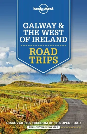
Lonely Planet Galway & the West of Ireland Road Trips - Lonely Planet, Belinda Dixon, Clifton Wilkinson
Lonely Planet: The world''s number one travel guide publisherWhether exploring your own backyard or somewhere new, discover the freedom of the open road with Lonely Planet''s Galway & the West of Ireland''s BestTrips. Featuring seven amazing road trips, plus up-to-date advice on the destinations you''ll visit along the way, you can find traditional folk music, Connemara''s wilderness and cute villages - all with your trusted travel companion. Jump in the car, turn up the tunes, and hit the road!Inside Lonely Planet''s Galway & the West of Ireland''sBest Trips:Lavish colour and gorgeous photography throughoutItineraries and planning advice to pick the right tailored routes for your needs and interestsGet around easily - easy-to-read, full-colour route maps and detailed directionsInsider tips to get around like a local, avoid trouble spots and be safe on the road - local driving rules, parking, toll roadsEssential infoat your fingertips - hours of operation, phone numbers, websites, pricesHonest reviews for all budgets - eating, sleeping, sight-seeing, hidden gems that most guidebooks missUseful features - including Stretch Your Legs,Detours, Link Your Trip Covers Galway, Connemara, County Clare, County Galway, County Mayo, Sligo, and moreThe Perfect Choice: Lonely Planet''s Galway & the West of Ireland''s Best Trips is perfect ... Unknown localization key: "more"
Objev podobné jako Lonely Planet Galway & the West of Ireland Road Trips - Lonely Planet, Belinda Dixon, Clifton Wilkinson
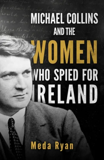
Michael Collins and the Women Who Spied For Ireland - Meda Ryan
Michael Collins and the Women Who Spied for Ireland is the first book to concentrate on the crucial role played by women in Collins''s personal and working life. From his boyhood in an overwhelmingly female household in West Cork, women brought out the best in him and he brought out the best in them. Susan Killeen, his first girlfriend, remained a steadfast ally throughout his life. From 1917, his girlfriend, Madeline (Dilly) Dicker, helped to ease the burden of his huge workload as well as acting as a secret agent. Society ladies Moya Llewelyn Davies and Lady Hazel Lavery were conduits between Collins and the British Establishment and active participants in his work of espionage. In the final years of his life the true romantic passion between him and Kitty Kiernan is testified to by their frequent correspondence.These women, and many others who participated in the national struggle, women such as Kathleen Clarke, Leslie Price, Peg Barrett, Nancy O''Brien, Madge Hales and Collins'' sister Mary Collins Powell, are woven into this fascinating narrative of Collins'' life.
Objev podobné jako Michael Collins and the Women Who Spied For Ireland - Meda Ryan
Philip's RGS World Atlas (A4) - Philip's Maps
Thousands of global facts at your fingertips with the best value quick-reference World Atlas on the market. Both physical and political geography is clearly illustrated alongside the great cities of our planet.The highest peak? The deepest ocean trench? The wettest, driest, longest, largest - we list the world''s fascinating extremes. Crammed with practical information like a Distance Chart for World Cities, World Time Zones, over 200 State Flags and the top 100 most populous countries, we include around 15,000 places indexed for easy checking. Whether for the pub quiz, travel planning or school reference, this great value handy world atlas is crammed with everything you need to know.Alongside the topography and physical attributes of the earth we also show political boundaries and the great global cities, including transport hubs and places of interest from mosques to temples, palaces to zoos and shopping centres to tourist information centres.Features include: * 200 Flags of the world''s major states and territories* 21 City centre maps: transport (road, rail, trams, light railways, bus and railway stations) and places of interest including religious buildings (churches, abbeys, cathedrals, synagogues, shrines, temples, mosques), museums, galleries, theatres, palaces, castles, parks, gardens, zoos, shopping centres, hospitals, Tourist Centres.* World ... Unknown localization key: "more"
Objev podobné jako Philip's RGS World Atlas (A4) - Philip's Maps
Lonely Planet The Tree Atlas - Lonely Planet, Matthew Collins
“Perfect†- The Independent“this beautiful atlas will be the perfect addition to any coffee table†- Better Homes & GardensIntroducing 50 of the world''s most magnificent trees for travellers and nature lovers to enjoy from the comfort of an armchair or to seek and behold in the wild.Whether taking in the beautiful cherry blossoms of Japan or a beech forest''s seasonal hues in France, The Tree Atlas is the ultimate guide to discovering our planet''s most amazing species of tree, as well as better understanding their role in our ever changing ecosystem, and appreciating the restorative effects of visiting these natural wonders in the flesh.Inside The Tree Atlas:50 amazing trees from around the world presented alongside exquisite photography and handy locator mapsKnowledgeable sidebar provides key vitals for each tree including its lifespan, environmental status, and height, plus tips to help you identify each speciesPractical advice on how to see each tree in the wild including where and when to goExpert authors including Matt Collins: head gardener of London''s Garden Museum; and Thomas Rutter: horticulturalist and garden writer, offer fascinating insight into each tree''s story and what makes it so unique and specialBeautiful bespoke illustrations throughout by Holly Exley Featured trees ... Unknown localization key: "more"
Objev podobné jako Lonely Planet The Tree Atlas - Lonely Planet, Matthew Collins
Collins Children’s Picture Atlas - Collins Kids
Beautifully illustrated atlases for inquisitive kidsA beautifully illustrated picture atlas designed to take children on an exciting journey around the world.This newly updated atlas opens with the continents, then presents a world view of countries showing fun facts and exciting places to visit within each.The maps are clear, colourful and perfect for children to explore the world and let their imaginations run riot.This book is ideal for home or school and finding out more about the world whilst also helping to develop essential reading skills.Clear, colourful, highly informative, illustrated mapping designed for young readers.Arranged by continent for easy reference.Facts about the world we live in are included on each spread.
Objev podobné jako Collins Children’s Picture Atlas - Collins Kids
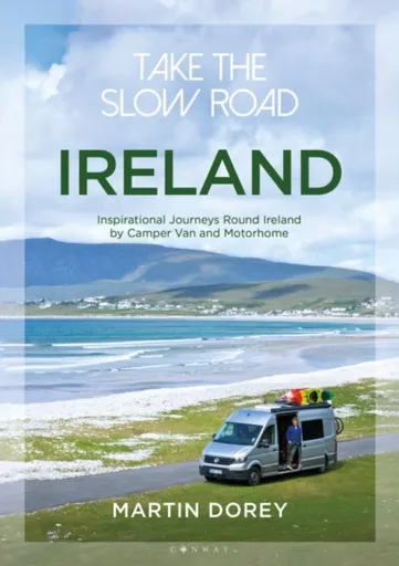
Take the Slow Road: Ireland - Martin Dorey
Forget hurrying. Forget putting your foot down and racing through sweeping bends. Forget the understeer (whatever that is). Forget the blur of a life lived too fast. This is a look at taking life slowly. It’s about taking the time to enjoy journeys and places for their own sake. It’s about stopping and putting the kettle on. Stopping to take a picture. Stopping to enjoy stopping. How are you going to do it? In a camper van or a motorhome, of course. In this book we define the best driving routes around Ireland for camper vans and motorhomes. We show you the coolest places to stay, what to see, what to do and explain why it’s special. We meander around Ireland on the most breathtaking roads, chugging up mountain passes and pootling along the coast. We show you stuff that’s fun; often free. We include the best drives for different kinds of drivers; for surfers, wildlife watchers, climbers and walkers. We include the steepest, the bendiest, the scariest and most interesting. And you don’t even have to own a camper van or motorhome – we’ll tell you the many places you can rent one to take you on the journey. ... Unknown localization key: "more"
Objev podobné jako Take the Slow Road: Ireland - Martin Dorey
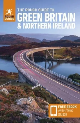
The Rough Guide to Green Britain & Northern Ireland: Compact Guide with eBook - Guide to travelling by electric vehicle (EV) - Rough Guides
Practical travel guide to Green Britain & Northern Ireland with a free eBook featuring points-of-interest structured lists of all sights and off-the-beaten-track treasures, with detailed colour-coded maps, practical details about what to see and to do in Green Britain & Northern Ireland. The Rough Guide to Green Britain & Northern Ireland also includes details on how to get there and around, pre-departure information, as well as top time-saving tips, like a visual list of things not to miss in Green Britain & Northern Ireland, expert author picks and itineraries to help you plan your trip. This guide book has been fully updated post-COVID-19.The Rough Guide to Green Britain & Northern Ireland covers: London & the Southeast, the Southwest, Central England, Northern England, Wales, Scotland and Northern Ireland.Inside this travel guide you''ll find:RECOMMENDATIONS FOR EVERY TYPE OF TRAVELLERExperiences selected for every kind of trip to Green Britain & Northern Ireland, from off-the-beaten-track adventures in The White Cliffs of Dover to family activities in child-friendly places, like Northumberland National Park or chilled-out breaks in popular tourist areas, like The Eden Project in Cornwall.PRACTICAL TRAVEL TIPSEssential pre-departure information including Green Britain & Northern Ireland entry requirements, getting around, health information, travelling with children, ... Unknown localization key: "more"
Objev podobné jako The Rough Guide to Green Britain & Northern Ireland: Compact Guide with eBook - Guide to travelling by electric vehicle (EV) - Rough Guides
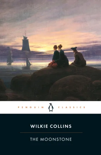
The Moonstone - Wilkie Collins
The Moonstone is one of the first true works of detective fiction, in which Wilkie Collins established the groundwork for the genre itself. This Penguin Classics edition is edited with an introduction by Sandra Kemp.The Moonstone, a priceless yellow diamond, is looted from an Indian temple and maliciously bequeathed to Rachel Verinder. On her eighteenth birthday, her friend and suitor Franklin Blake brings the gift to her. That very night, it is stolen again. No one is above suspicion, as the idiosyncratic Sergeant Cuff and the Franklin piece together a puzzling series of events as mystifying as an opium dream and as deceptive as the nearby Shivering Sand. The intricate plot and modern technique of multiple narrators made Wilkie Collins''s 1868 work a huge success in the Victorian sensation genre. With a reconstruction of the crime, red herrings and a ''locked-room'' puzzle, The Moonstone was also a major precursor of the modern mystery novel.In her introduction Sandra Kemp explores The Moonstone''s the detective elements of Collins''s writing, and reveals how Collins''s sensibilities were untypical of his era.Wilkie Collins (1824-1889) was born in London in 1824, the eldest son of the landscape painter William Collins. In 1846 he was entered to ... Unknown localization key: "more"
Objev podobné jako The Moonstone - Wilkie Collins