london a z street atlas a z maps
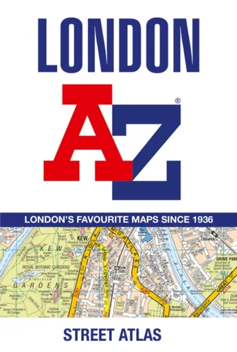
London A-Z Street Atlas - A-Z Maps
Navigate your way around London with this detailed, easy-to-use and up-to-date A-Z Street Atlas.First published in 1936, this iconic atlas is a trusted means of finding your way around the capital city.The main mapping extends beyond Central London from Heathrow Airport to Chingford at a scale of 2.88 inches to 1 mile (4.55 cm to 1 km), featuring postcode districts, one-way streets, the Congestion Charging Zone and Low Emission Zone.The large-scale street map of Central London – at a scale of 5.75 inches to 1 mile – cover Regent’s Park and Shoreditch, Chelsea and Vauxhall, Hyde Park and Bermondsey.A comprehensive index lists streets, selected flats, walkways and places of interest, place, area and junction names. Additional healthcare (hospitals, walk-in centres and hospices) and transport connections (National Rail, London Tramlink, Docklands Light Railway, London Underground and Overground stations, and River Bus pier) are indexed as well.Also included are:• Overview map of the Congestion Charging Zone, Ultra Low Emission and Low Emission Zones• West End Theatre map• London Connections rail services map
Objev podobné jako London A-Z Street Atlas - A-Z Maps
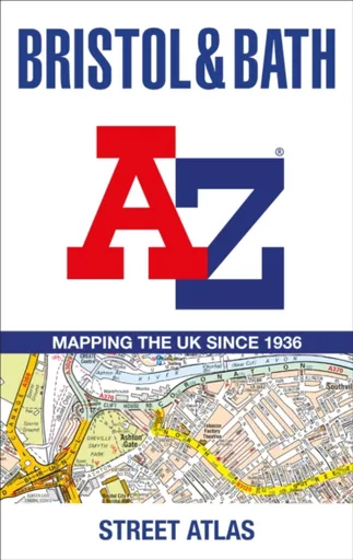
Bristol and Bath A-Z Street Atlas - A-Z Maps
Navigate your way around Bristol and Bath with this detailed and easy-to-use A-Z Street Atlas.Printed in full-colour, paperback format, this atlas contains 104 pages of continuous street mapping. More than 12,800 streets indexed. Large scale 6.25 inches to 1 mile map.Areas covered include: Avonmouth, Bradley Stoke, Filton, Keynsham, Kingswood, Mangotsfield, Portishead, Yate, Frampton Cotterell, Chipping Sodbury, Oldland, Swainswick, Batheaston, University of Bath, Combe Down, Bath Spa University, Saltford, Whitchurch, Bedminster, Long Ashton, Easton-in-Gordano, Cribbs Causeway.Also included are large scale city centre maps of both Bristol and Bath and a postcode map of the atlas area.Postcode districts, one-way streets and safety camera locations with their maximum speed are featured on the street mapping.A comprehensive index lists streets, selected flats, walkways and places of interest, place, area and station names. Additional healthcare (hospitals, walk-in centres and hospices) and transport connections are indexed as well.
Objev podobné jako Bristol and Bath A-Z Street Atlas - A-Z Maps
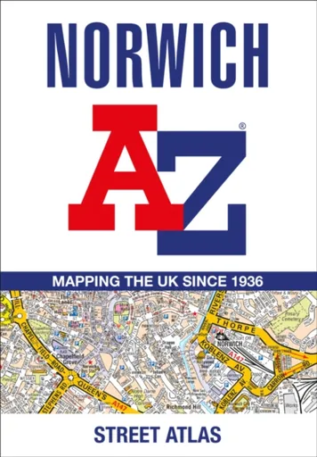
Norwich A-Z Street Atlas - A-Z Maps
Navigate your way around Norwich with this detailed and easy-to-use A-Z Street Atlas.Printed in full-colour, paperback format, this atlas contains 42 pages of continuous street mapping. More than 4,500 streets indexed. Large scale 4 inches to 1 mile map.Areas covered include :Blofield, Blofield Heath, Brundall, Cringleford, Hethersett, Norwich Airport,Poringland, Spixworth, Sprowston, Taverham, Wroxham, Wymondham.In addition, there is an inset map of Horsford and a large scale city centre map of Norwich.Postcode districts, one-way streets and safety camera locations with their maximum speed are featured on the street mapping.A comprehensive index lists streets, selected flats, walkways and places of interest, place, area and station names. Additional healthcare (hospitals, walk-in centres and hospices) and transport connections are indexed as well.
Objev podobné jako Norwich A-Z Street Atlas - A-Z Maps
Podívejte se také
kožený organizér na hodinky London 26120-2
freestyle koloběžka Street Surfing BANDIT Blast Olive Cr-Mo
Hirsch London Alligator styl Rembordé Look
Ashleigh & Burwood London Lamp Fragrance
šedo-oranžové odrážedlo Street Champion
dámské tenisky Puma CARINA STREET SD
CARINA STREET SD boty
DIESEL Only The Brave Street EdT 50 ml
DIESEL Only The Brave Street parfém
DIESEL Only The Brave Street EdT
řemínek Hirsch London Alligator
Hirsch London kolekce
luxusní kožený řemínek London
Hirsch London Alligator bílý lesk
autentické recepty z East London
Hirsch London Alligator lesklý
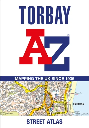
Torbay A-Z Street Atlas - A-Z Maps
Navigate your way around Torbay with this detailed and easy-to-use A-Z Street Atlas.Printed in full-colour, paperback format, this atlas contains 38 pages of continuous street mapping. More than 5,100 streets indexed. Large scale 4 inches to 1 mile map.Areas covered include: Brixham, Paignton, Torquay, Kingskerswell, Newton Abbot, Bovey Tracey, Teignmouth, Dawlish, Ashburton, Buckfastleigh, Totnes, Kingsbridge, Salcombe, Dartmouth.In addition, there are insets of: Bishopsteignton, Ipplepen, Stoke Gabriel and a large scale town centre map of Dartmouth.Postcode districts, one-way streets, Park and Ride sites, safety camera locations with their maximum speed and Dartmoor National Park boundary are featured on the mapping.The Places of Interest Guide is both informative and helpful with information about:Tourist Information CentresBoat tripsSelected places of interestThe English RivieraA comprehensive index lists streets, selected flats, walkways and places of interest, place, area and station names. Additional healthcare (hospitals, walk-in centres and hospices) and transport connections are indexed as well.
Objev podobné jako Torbay A-Z Street Atlas - A-Z Maps
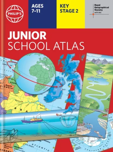
Philip's RGS Junior School Atlas - Philip's Maps
The 12th edition of the market-leading atlas for primary school pupils, Philip''s RGS Junior School Atlas has been fully revised and updated with all the latest facts and curriculum requirements.- The essential atlas for primary schools with clear and easy-to-follow maps and diagrams - updated for 2024/2025- Published in association with the Royal Geographical Society- Recommended for Key Stage 2 of the National Curriculum - and all 7-11 year olds - An excellent introduction to mapping concepts such as scale, direction, symbols, longitude and latitude- 22-page Britain and Ireland section with clear thematic charts, diagrams and large-scale regional maps- 22-page section on The World, with political maps - and thematic treatment of key themes, from volcanoes and earthquakes to transport and tourism- Continents section with physical and political maps- Easy-to-follow map references and 1,000-place indexThe introductory section describes the meaning of scale, how to measure distances using the maps, and explains the symbols on the maps.The following section is devoted to the United Kingdom and Ireland. Thematic maps cover topics such as mountains and rivers, climate and weather, population and cities, farming and fishing, industry and energy, transport, tourism and conservation. The rest of the atlas is made up of ... Unknown localization key: "more"
Objev podobné jako Philip's RGS Junior School Atlas - Philip's Maps
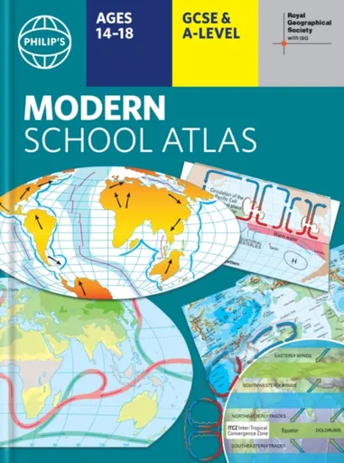
Philip's RGS Modern School Atlas - Philip's Maps
- Britain''s best-selling school atlas - now in its 101st edition- Recommended for Key Stage 4, GCSE and A-Level in England and Wales (Scottish National Qualifications/Highers) and international schools- Fully updated to reflect the latest changes in the curriculum- Published in association with the Royal Geographical Society- Combines superb digital maps of Britain and the world with up-to-date thematic maps - Country-by-country statistics on population, land use, trade, tourism, energy, wealth and much more - World Themes Section - from volcanoes and earthquakes to population trends, languages and religions, all the key aspects and statistics of geography are explored and explained- Plus a special section on how satellite imagery is used to interpret global, environmental and urban patterns of change Britain''s best-selling secondary school atlas, now in its 101st Edition. The contents are divided into colour-coded sections for rapid reference. The physical maps of the United Kingdom and Ireland are accompanied by thematic maps on numerous key social and economic themes. World topographical maps, with thematic maps on topics such as climate, population and economics, are followed by 30 pages of World thematic maps.Completing the atlas is a section of World social and economic statistics, and an index with letter-figure ... Unknown localization key: "more"
Objev podobné jako Philip's RGS Modern School Atlas - Philip's Maps
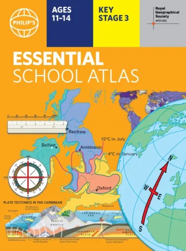
Philip's RGS Essential School Atlas - Philip's Maps
"An excellent world atlas. Very illuminating, good colours, clear texts...good glossary and, last but not least, up-to-date." - customer review- The ideal school atlas for Key Stage 3 pupils and Scotland''s National Qualifications, 11-14 years old- All updated for 2024 specifically to meet curriculum needs- Specially focused 16-page UK and Ireland section- Comprehensive 62-page world section includes thematic maps on the environment, climate change, people, quality of life, and energy- Published in association with the Royal Geographical SocietyPhilip''s RGS Essential School Atlas has been specially created for lower-secondary geography students (11-14 year olds). The maps have been carefully designed to be uncluttered and easy to read, containing specially selected place names and detail. A clear set of symbols and scale information accompanies every map, with a useful introductory section covering basic atlas skills, including aerial photographs and satellite images to further explain particular features on the maps. Latitude and longitude co-ordinates are included in the index, alongside figure-letter references. Fully up-to-date, the atlas includes detailed regional maps, charts and satellite images of Europe, Italy, the Middle East, China, Japan, Kenya, USA, Brazil, and the Arctic and Antarctica. It also focuses on areas of special interest for students of geography, such ... Unknown localization key: "more"
Objev podobné jako Philip's RGS Essential School Atlas - Philip's Maps

D-Street - Cruiser Atlas Blue 28" (5059415068513)
Longboard s cruiser tvarem desky, rozměry 71,2 × 18,4 cm, tvrdost koleček 78 A, průměr koleček 59 mm Pokud hledáte cruiser vhodný na jízdu po městě i delší projížďky, D-Street Atlas je skvělou volbou. Osloví vás nejen jeho výjimečný design, ale rovněž vysoce kvalitní komponenty. Cruiser je tvořený deskou ze 7 vrstev kanadského javoru, což zajistí jeho maximální pevnost. Pohodlnou jízdu umožní rychlá kolečka o průměru 60 mm a tvrdosti 78A, která jsou osazená ložisky ABEC-7. Trucky jsou přitom vyrobené z hliníku. S cruisem D-Street Atlas si užijete jízdu po městě i perfektní triky v parku. Klíčové vlastnosti longboardu D-Street Atlas Blue 28"Longboard vhodný na jízdu po městě i delší projížďkyTvořený deskou ze 7 vrstev kanadského javoruPohodlnou jízdu zajistí rychlá kolečka o průměru 60 mm a tvrdosti 78ATrucky vyrobené z hliníkuNechybí ložiska ABEC-7Cruiser D-Street Atlas umožní i provádění trikůBarevné provedení: žluto-černo-modré...
Objev podobné jako D-Street - Cruiser Atlas Blue 28" (5059415068513)
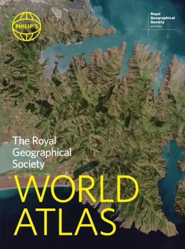
Philip's RGS World Atlas - Philip's Maps
"An excellent world atlas. Very illuminating, good colours, clear texts...good glossary and, last but not least, up-to-date". Amazon customer review· The perfect world atlas for work, study or leisure· Great value for money· 96 pages of authoritative world maps, physical and political· 70 city maps in the fascinating World Cities section, with full-page satellite images for 10 great cities· Over 35,000 place name indexAll this and a special 32-page introductory section - ''The World in Focus'' - covers key geographical themes such as the Earth''s position in the Solar System, the structure of the Earth, climate and weather, the environment, population, resources, economics and international organizations. Vital information on topics covered in geography, humanities and economics courses.The information-packed World Atlas from Philip''s, published in association with the Royal Geographical Society has been fully updated for this new, 2021 edition
Objev podobné jako Philip's RGS World Atlas - Philip's Maps
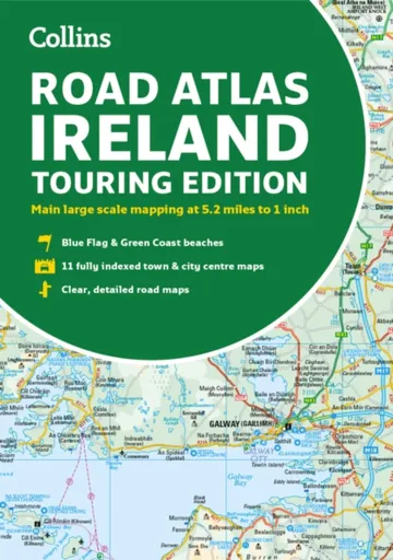
Road Atlas Ireland - Collins Maps
Explore Ireland with this accurate and fully updated road atlas.This road atlas is at A4 size, covering the whole of Ireland and features clear and detailed Collins colour mapping at a scale of 5.2 miles to 1 inch. Perfect for both residents and visitorstouring Ireland.This revised edition includes:Places of tourist interestContact information for Tourist Information Centres with grid references to the mappingFully indexed street maps of 11 cities and towns – Dublin, Belfast, Cork, Limerick, Waterford,Londonderry (Derry), Galway, Bangor, Dun Laoghaire, Drogheda and KillarneyBlue Flag & Green Coast beachesFerry and airport information; Distance chart; Distances marked on the roads in miles and kilometresRoute planning map of the whole of Ireland at 15.8 miles to 1 inchAdministrative map of Irish counties and districts.
Objev podobné jako Road Atlas Ireland - Collins Maps

London - The Secret Atlas - Rachel Howard
London – a secret atlas is a glorious celebration of all that is unusual and undiscovered in this magnificent city.Welcome to this richly detailed and beautifully illustrated compendium of interesting, unexpected and downright bizarre places to be discovered in London; a treasure trove for those who love to dig beneath the surface and explore the secret and unusual locations.Guaranteed to delight and inspire, here you can:Find monsters in Trafalgar SquareDiscover the trick of instant weight lossFind out what happened to BedlamUnderstand what''s quietly growing under your feetPeer inside Richard Burton''s tentPraise god, buy meatballs and have a sauna all at onceLondon is full of iconic sites. But if you’re more interested in the unusual and unfamiliar, turn to the Secret Atlas of London to uncover your new favourite location through this sumptuously illustrated guide. An ideal gift for the London afficionado in your life.Â
Objev podobné jako London - The Secret Atlas - Rachel Howard

Nicolson Street Atlas Ayrshire - Nicolson Digital Ltd, Val Fry
Based on OS data and fully revised for 2017 the Ayrshire Street Atlas is your essential guide to the towns and villages throughout Ayrshire. Exceptionally clear mapping and full index to street names. Don''t leave home without it!Exceptionally clear street mappingIndex to street namesTourist attractions highlightedShows schools, post offices, parking, petrol stations, hospitals religious buildings, recreation areas, cemeteries and more
Objev podobné jako Nicolson Street Atlas Ayrshire - Nicolson Digital Ltd, Val Fry
Nicolson Street Atlas Fife
Street atlas of all the towns and villages in Fife.Featuring the great clear Nicolson Digital Mapping
Objev podobné jako Nicolson Street Atlas Fife

Stanex Povlečení atlas grádl tmavě šedá, 140 x 200 cm, 70 x 90 cm
Povlečení z atlas grádlu je vyrobeno ze 100% bavlny a nabízí pohodlí a hebkost. Tmavě šedý odstín a struktura proužků dodávají elegantní vzhled. Souprava obsahuje povlak na polštář 70x90 cm a povlak na přikrývku 140x200 cm.
- Vyrobeno ze 100% kvalitní bavlny pro mimořádnou hebkost
- Elegantní tmavě šedý odstín a struktura 2,5 cm proužků
- Snadná údržba – perte naruby bez bělidel
Objev podobné jako Stanex Povlečení atlas grádl tmavě šedá, 140 x 200 cm, 70 x 90 cm

Stanex Povlečení atlas grádl béžová, 140 x 200 cm, 70 x 90 cm
Povlečení z atlas grádlu je vyrobeno z 100% bavlny a nabízí pohodlí a hebkost. Béžový odstín a struktura proužků dodávají elegantní vzhled. Souprava obsahuje povlak na přikrývku 140x200 cm a povlak na polštář 70x90 cm.
- Vyrobeno ze 100% kvalitní bavlny pro mimořádnou hebkost.
- Elegantní design s 2,5 cm proužky a noblesním béžovým odstínem.
- Snadná údržba – perte naruby bez bělidel a chemických čistidel.
- Kompletní souprava obsahuje povlak na přikrývku i polštář.
Objev podobné jako Stanex Povlečení atlas grádl béžová, 140 x 200 cm, 70 x 90 cm

Stanex Povlečení atlas grádl světle šedá, 140 x 200 cm, 70 x 90 cm
Povlečení z atlas grádlu je vyrobeno z 100% bavlny a nabízí pohodlí a hebkost. Světle šedý odstín a struktura proužků dodávají elegantní vzhled. Souprava obsahuje povlak na přikrývku 140x200 cm a povlak na polštář 70x90 cm.
- Vyrobeno ze 100% kvalitní bavlny pro mimořádnou hebkost.
- Elegantní design s 2,5 cm proužky a světle šedým odstínem.
- Snadná údržba – doporučeno prát naruby bez agresivní chemie.
- Kompletní souprava obsahuje povlak na přikrývku i polštář.
Objev podobné jako Stanex Povlečení atlas grádl světle šedá, 140 x 200 cm, 70 x 90 cm

Stanex Povlečení atlas grádl smetanová, 140 x 220 cm, 70 x 90 cm
Povlečení z materiálu atlas grádl nabízí hebkost a pohodlí. Sada obsahuje povlak na přikrývku 140x220 cm a povlak na polštář 70x90 cm v smetanovém odstínu. Je vyrobeno z kvalitní bavlny a vyznačuje se elegantním designem s proužky.
- Vyrobeno ze 100% kvalitní bavlny pro maximální pohodlí
- Elegantní design s 2,5 cm proužky a noblesním smetanovým odstínem
- Snadná údržba - doporučeno prát naruby bez agresivní chemie
Objev podobné jako Stanex Povlečení atlas grádl smetanová, 140 x 220 cm, 70 x 90 cm

Stanex Povlečení atlas grádl starorůžová, 140 x 220 cm, 70 x 90 cm
Povlečení z materiálu atlas grádl nabízí hebkost a pohodlí díky 100% bavlně. Design s 2,5 cm proužky a starorůžovým odstínem přináší do ložnice noblesní vzhled. Souprava obsahuje povlak na přikrývku 140x220 cm a povlak na polštář 70x90 cm.
- Vyrobeno ze 100% kvalitní bavlny pro maximální pohodlí
- Elegantní starorůžový odstín a struktura proužků
- Snadná údržba - doporučeno prát naruby bez agresivní chemie
- Kompletní souprava obsahuje povlak na přikrývku i polštář
Objev podobné jako Stanex Povlečení atlas grádl starorůžová, 140 x 220 cm, 70 x 90 cm
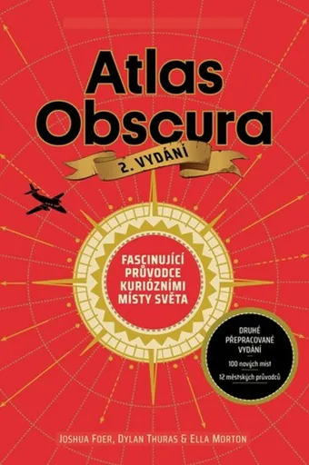
Atlas Obscura - Joshua Foer, kolektiv autorů
Atlas Obscura je průvodce představující přes 700 nejpodivuhodnějších a nejméně známých míst na planetě. Zahrnuje přírodní zázraky, bizarní lidské výtvory a tajemné lokality. Kniha slouží jako inspirace pro cestovatele hledající neobvyklé zážitky.
- Obsahuje více než 700 unikátních a kuriózních míst z celého světa.
- Inspiruje k objevování neznámých a nevyšlapaných cest.
- Bohatě ilustrovaný průvodce pro milovníky dobrodružství a záhad.
Objev podobné jako Atlas Obscura - Joshua Foer, kolektiv autorů
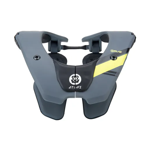
Dětský chránič krční páteře ATLAS Tyke Grey
Dětský chránič krční páteře ATLAS Tyke Grey je určen pro motokros, BMX, čtyřkolky a horská kola. Konstrukce Split-Flex Frame a systém ERS zajišťují pohyblivost a možnost rychlého odložení. Chránič zabraňuje hyperflexi, hyperextenzi a axiálnímu zatížení páteře.
- Patentovaná flexibilní konstrukce Split-Flex Frame pro maximální pohyblivost
- Systém ERS umožňující rychlé odložení chrániče při nehodě
- Široká kontaktní zóna a odpružení hrudní části pro vyšší bezpečnost
- Minimalistický design s nízkou hmotností (460 g) pro pohodlí dítěte
Objev podobné jako Dětský chránič krční páteře ATLAS Tyke Grey

Stanex Povlečení atlas grádl smetanová, 140 x 200 cm, 70 x 90 cm
Povlečení z atlas grádlu je vyrobeno ze 100% bavlny a nabízí pohodlí s hebkou strukturou. Smetanový odstín a proužkový design přináší do ložnice eleganci. Souprava obsahuje povlak na polštář 70x90 cm a povlak na přikrývku 140x200 cm.
- Vyrobeno z 100% kvalitní bavlny pro mimořádnou hebkost
- Elegantní struktura 2,5 cm proužků podtrhne design
- Smetanový odstín dodá ložnici noblesní vzhled
- Snadná údržba - doporučeno prát naruby bez bělidel
Objev podobné jako Stanex Povlečení atlas grádl smetanová, 140 x 200 cm, 70 x 90 cm

Stanex Povlečení atlas grádl světle šedá, 140 x 220 cm, 70 x 90 cm
Povlečení Stanex z atlas grádlu je vyrobeno z 100% bavlny a nabízí pohodlí s elegantním designem proužků. Světle šedý odstín dodá ložnici noblesní vzhled. Sada obsahuje povlak na přikrývku 140 x 220 cm a povlak na polštář 70 x 90 cm.
- Vyrobeno ze 100% kvalitní bavlny pro mimořádnou hebkost.
- Elegantní design s 2,5 cm proužky a světle šedým odstínem.
- Snadná údržba – perte naruby bez agresivní chemie.
- Kompletní sada obsahuje povlak na přikrývku i polštář.
Objev podobné jako Stanex Povlečení atlas grádl světle šedá, 140 x 220 cm, 70 x 90 cm
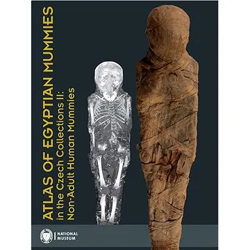
Atlas of Egyptian Mummies in the Czech Collections II: Non-Adult Human Mummies (978-80-7036-750-6)
Druhý díl série Atlas egyptských mumií v českých sbírkách se specializuje na mumie a pohřební vybavení dětí a dospívajících do 15 let. Obsahuje podrobný katalog dvou kompletních mumií, dvanácti izolovaných částí a šesti pohřebních schránek. Publikace přináší informace o zdravotním stavu, nemocech a pohřebních praktikách dětí ve starověkém Egyptě.
- Druhý díl odborné série o egyptských mumiích
- Zaměření na mumie dětí a dospívajících do 15 let
- Podrobný katalog s proveniencí a zdravotními analýzami
- Vědecky hodnotný materiál z Národního muzea v Praze
Objev podobné jako Atlas of Egyptian Mummies in the Czech Collections II: Non-Adult Human Mummies (978-80-7036-750-6)
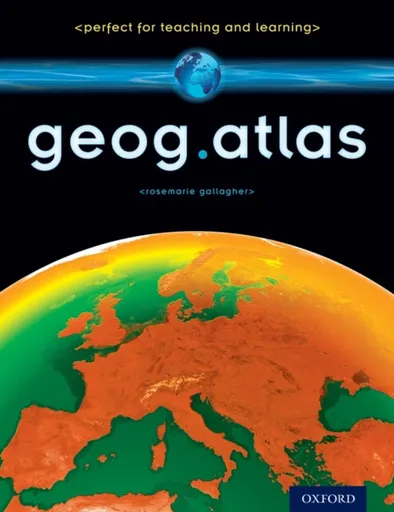
geog.atlas - Gallagher RoseMarie
geog.atlas is an engaging atlas of accessible maps and supporting information. It features unique coverage of places likely to appear in the news, such as the Middle East, Afghanistan, and the Falklands. Special maps look at themes like global warming, desertification, and how people spread around the world. Stunning satellite images are placed alongside physical geography maps to aid understanding. ''Did you know?'' and ''What if?'' circles provide interesting extra information and engaging facts.Full of clearly-labelled maps, straightforward explanations, and advice on how to ''read'' maps and understand what they show, it will help improve students'' basic locational knowledge, enhance their understanding, and build their confidence.geog.atlas supports teachers whether they''re using geog.123 or an alternative course at KS3.
Objev podobné jako geog.atlas - Gallagher RoseMarie

Stanex Povlečení atlas grádl starorůžová, 140 x 200 cm, 70 x 90 cm
Povlečení z atlas grádlu je vyrobeno ze 100% bavlny a nabízí pohodlí a hebkost. Souprava obsahuje povlak na přikrývku 140 x 200 cm a povlak na polštář 70 x 90 cm. Elegantní design s proužkovou strukturou a starorůžovým odstínem dodává ložnici noblesní vzhled.
- Vyrobeno ze 100% kvalitní bavlny pro mimořádnou hebkost.
- Elegantní design s 2,5 cm proužkovou strukturou.
- Starorůžový odstín dodává ložnici noblesní vzhled.
- Snadná údržba - doporučeno prát naruby bez bělidel.
Objev podobné jako Stanex Povlečení atlas grádl starorůžová, 140 x 200 cm, 70 x 90 cm
The Atlas Maneuver - Steve Berry
Román představuje nové dobrodružství Cottona Malonea, který se zaplete do pátrání po legendárním japonském válečném pokladu zvaném Yamashitovo zlato. Příběh propojuje historické události z konce druhé světové války se současnou hrozbou zneužití kryptoměn k narušení globálního finančního systému. Děj zavede čtenáře do Švýcarska, Lucemburska a marockých hor v honbě za odhalením konspirace známé jako Atlasovo manévr.
- Nejnovější díl oblíbené série Cotton Malone
- Napínavý příběh kombinující historická fakta a fikci
- Rychlý spád děje s mezinárodním přesahem
- Aktuální téma kryptoměn v thrillerovém kontextu
Objev podobné jako The Atlas Maneuver - Steve Berry
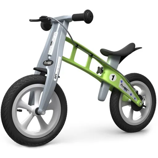
First Bike Odrážedlo Street green
First Bike Street je odrážedlo určené dětem od 2 do 5 let pro nácvik rovnováhy před přechodem na šlapací kolo. Disponuje nastavitelným sedlem, jemnými nafukovacími pneumatikami pro městské použití a bezpečnostními prvky jako omezený rozsah řídítek. Hmotnost 3,9 kg zajišťuje snadnou ovladatelnost pro malé děti.
- Lehká konstrukce (3,9 kg) pro snadné ovládání dětmi
- Plynule nastavitelné sedlo (34,5–44,5 cm) s možností snížení adaptérem
- Dvojité brzdění: citlivá ruční přední a bubnová zadní brzda
- Časově neomezená záruka na rám a vidlici, 5 let na ostatní díly
Objev podobné jako First Bike Odrážedlo Street green
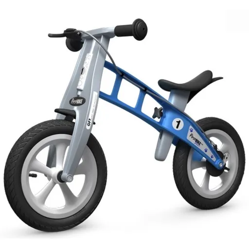
First BIKE Odrážedlo Street light blue s brzdou
Odrážedlo First Bike Street je lehké dětské odrážedlo určené pro věk 2–5 let, které pomáhá trénovat rovnováhu před přechodem na šlapací kolo. Disponuje nastavitelným sedlem, bezpečnostní brzdou a je optimalizováno pro použití ve městě. Výrobek nabízí rozšířené záruční podmínky.
- Lehká konstrukce (3,9 kg) pro snadné ovládání dětmi
- Plynule nastavitelné sedlo (34,5–44,5 cm) s možností snížení adaptérem
- Bezpečnostní prvky: citlivá ruční brzda, bubnová zadní brzda a omezený rozsah otáčení řídítek
- Dlouhá záruka: časově neomezená na rám a vidlici, 5 let na ostatní části
Objev podobné jako First BIKE Odrážedlo Street light blue s brzdou

DIESEL Only The Brave Street EdT 50 ml (3614272320819)
DIESEL Only The Brave Street EdT je pánská toaletní voda italské výroby s objemem 50 ml. Hlavní charakteristikou je dřevitá vůně kombinující silné a jemné tóny. Vůně je navržena tak, aby působila svěže a dynamicky.
- Dřevitá hlavní vůně s jedinečnou kombinací tónů
- Italská výroba zajišťující kvalitu
- Objem 50 ml pro dlouhodobé používání
- Silná, ale jemná vůně vhodná pro každodenní nošení
Objev podobné jako DIESEL Only The Brave Street EdT 50 ml (3614272320819)

First Bike Odrážedlo Street red
Odrážedlo First Bike Street je lehké sportovní odrážedlo určené dětem od 2 do 5 let pro trénink rovnováhy před přechodem na šlapací kolo. Vybaveno je nastavitelným sedlem, ruční a zadní brzdou a kvalitními nafukovacími pneumatikami vhodnými pro městské použití. Rám a vidlice mají časově neomezenou záruku.
- Lehounká konstrukce (3,9 kg) pro snadné ovládání dětmi
- Plynule nastavitelné sedlo (34,5–44,5 cm) a volitelný snižovací adaptér pro menší děti
- Dvojité brzdění: citlivá ruční brzda a zadní bubnová brzda
- Dlouhá záruka: časově neomezená na rám a vidlici, 5 let na ostatní části
Objev podobné jako First Bike Odrážedlo Street red

Puma COURT CLASSIC STREET Pánské boty na volný čas, bílá, velikost 42.5
Pánské tenisky Puma COURT CLASSIC STREET kombinují retro tenisový design s moderní všestranností pro denní nošení. Boty jsou vybaveny technologií SOFTFOAM+ pro optimální odpružení a pohodlí. Jedná se o ikonický základní kousek vhodný pro volnočasové aktivity.
- Stylový retro design inspirovaný tenisem
- Vložka SOFTFOAM+ pro vynikající odpružení a pohodlí
- Všestranný základní kousek vhodný pro každodenní nošení
- Kvalitní materiály a ikonická značka Puma
Objev podobné jako Puma COURT CLASSIC STREET Pánské boty na volný čas, bílá, velikost 42.5

Puma CARINA STREET SD Dámské tenisky, béžová, velikost 41
Dámské tenisky Puma CARINA STREET SD s platformou jsou určeny pro každodenní nošení. Béžová barva umožňuje snadnou kombinaci s různými outfity. Model je dostupný ve velikosti 41.
- Zvýšená platforma pro pohodlí
- Vhodné pro každodenní nošení
- Stylový design od značky Puma
- Béžová barva snadno kombinovatelná
Objev podobné jako Puma CARINA STREET SD Dámské tenisky, béžová, velikost 41
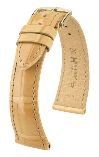
Řemínek Hirsch London Alligator - béžový, lesk - 21 mm - L – Standardní délka (doporučujeme) - 18 mm - Zlatá
Řemínek Hirsch London Alligator je luxusní kožený doplněk z kolekce London. Vyznačuje se sudově barvenou kůží s perleťovým povrchem a ručně lakovanými okraji. Design doplňuje prošívání tón v tónu a ručně šitý bartack steh na sponě.
- Luxusní materiál ze sudově barvené kůže s perleťovým povrchem
- Ručně lakované okraje ve stylu Rembordé Look Coupé Franc
- Precizní ruční šití a prošívání tón v tónu
- Nadčasový elegantní design promyšlený do detailů
Objev podobné jako Řemínek Hirsch London Alligator - béžový, lesk - 21 mm - L – Standardní délka (doporučujeme) - 18 mm - Zlatá
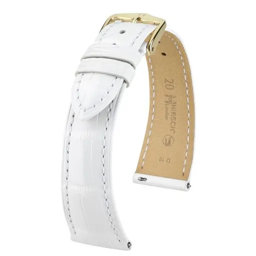
Řemínek Hirsch London Alligator - bílý, lesk - 18 mm - L – Standardní délka (doporučujeme) - 14 mm - Stříbrná
Řemínek Hirsch London Alligator je luxusní kožený doplněk z kolekce London. Vyrábí se ze sudově barvené kůže s perleťovým povrchem a ručně lakovanými okraji. Disponuje stříbrnou sponou o šířce 14 mm a standardní délkou.
- Luxusní sudově barvená kůže s perleťovým povrchem
- Ručně lakované okraje ve stylu Rembordé Look Coupé Franc
- Precizní prošívání tón v tónu a ručně šitý bartack steh
- Nadčasový elegantní design v módní bílé barvě
Objev podobné jako Řemínek Hirsch London Alligator - bílý, lesk - 18 mm - L – Standardní délka (doporučujeme) - 14 mm - Stříbrná
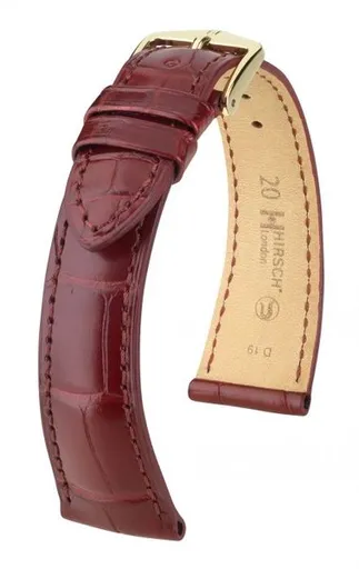
Řemínek Hirsch London Alligator - vínový, mat - 22 mm - L – Standardní délka (doporučujeme) - 20 mm - Stříbrná
Řemínek Hirsch London Alligator je vyroben ze sudově barvené kůže s perleťovým povrchem. Disponuje ručně lakovanými okraji ve stylu Rembordé Look Coupé Franc a prošíváním tón v tónu. Jedná se o elegantní a nadčasový doplněk s precizním zpracováním.
- Luxusní sudově barvená kůže s perleťovým povrchem
- Ručně lakované okraje ve stylu Rembordé Look Coupé Franc
- Precizní prošívání tón v tónu a bartack steh
- Elegantní a nadčasový design promyšlený do detailů
Objev podobné jako Řemínek Hirsch London Alligator - vínový, mat - 22 mm - L – Standardní délka (doporučujeme) - 20 mm - Stříbrná
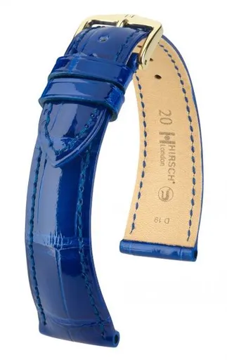
Řemínek Hirsch London Alligator - královská modrá, lesk - 22 mm - L – Standardní délka (doporučujeme) - 18 mm - Rose Gold
Řemínek Hirsch London Alligator v královské modré barvě s lesklým perleťovým povrchem představuje elegantní a nadčasový doplněk. Je vyroben ze sudově barvené kůže s ručně lakovanými okraji ve stylu Rembordé Look Coupé Franc. Design doplňuje prošívání tón v tónu a ručně šitý bartack steh na sponě.
- Luxusní design s módní královskou modrou barvou a perleťovým leskem
- Ručně lakované okraje ve stylu Rembordé Look Coupé Franc pro exkluzivní vzhled
- Precizní ruční šití a prošívání tón v tónu zajišťující dlouhou životnost
- Vyrobeno ze sudově barvené kůže pro autentický a kvalitní dojem
Objev podobné jako Řemínek Hirsch London Alligator - královská modrá, lesk - 22 mm - L – Standardní délka (doporučujeme) - 18 mm - Rose Gold
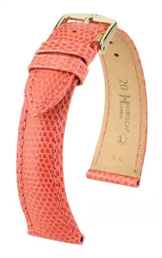
Řemínek Hirsch London Lizard - tmavě růžový, lesk - 19 mm - L – Standardní délka (doporučujeme) - 14 mm - Rose Gold
Řemínek Hirsch London Lizard je vyroben z prvotřídní ještěrčí kůže s charakteristickou strukturou šupin. Disponuje módní tmavě růžovou barvou, lesklým povrchem a kontrastním ručně lakovaným okrajem. Standardní délka 14 mm je vhodná pro většinu uživatelů.
- Prvotřídní ještěrčí kůže s hustými šupinami
- Precizní prošívání a ručně lakovaný kontrastní okraj
- Módní tmavě růžová barva s lesklým finish
- Nadčasový elegantní design z kolekce London
Objev podobné jako Řemínek Hirsch London Lizard - tmavě růžový, lesk - 19 mm - L – Standardní délka (doporučujeme) - 14 mm - Rose Gold

Falk Odrážedlo Street Chamipion šedo-oranžové
Odrážedlo Street Champion v šedo-oranžovém provedení je určeno pro děti od 2 let. Disponuje robustní konstrukcí s nosností do 30 kg a tichými kolečky. Výrobek je vyroben z části z recyklovaného plastu ve Francii a splňuje evropské bezpečnostní normy.
- Vhodné pro děti již od 2 let pro rozvoj rovnováhy a koordinace.
- Robustní konstrukce s nosností až 30 kg a tichými kolečky pro hladkou jízdu.
- Vyrobeno z kvalitního materiálu s 50% podílem recyklovaného plastu ve Francii.
- Kompaktní rozměry (75 × 40 × 51 cm) a testováno podle evropských bezpečnostních norem.
Objev podobné jako Falk Odrážedlo Street Chamipion šedo-oranžové
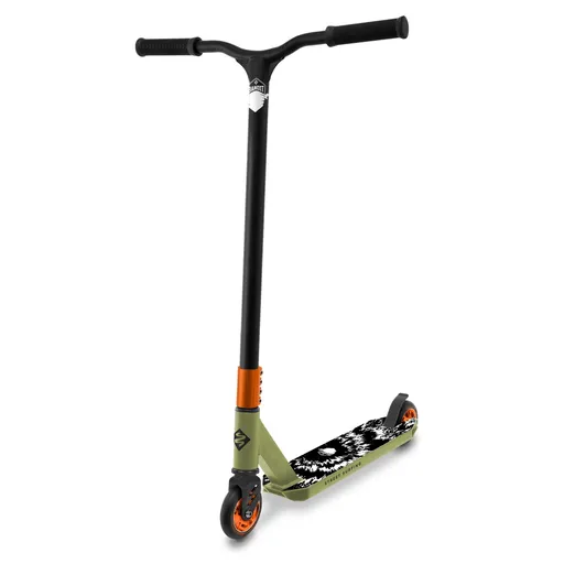
Freestyle koloběžka Street Surfing BANDIT Blast Olive Cr-Mo
Freestyle koloběžka Street Surfing BANDIT Blast je navržena pro triky s pevným hlavovým složením HIC a zpevněnými řídítky z oceli Cr-Mo. Disponuje širokým hliníkovým nášlapem, výkonnou brzdou a kolečky 100 mm. Je vhodná pro jezdce od 8 let s nosností 100 kg a hmotností 3,4 kg.
- Zpevněná ocelová řídítka Cr-Mo 4130 s otáčením 360° pro ovládání triků
- HIC kompresní systém v hlavovém složení pro stabilitu a snadné manévrování
- Široký protiskluzový nášlap ze slitiny hliníku 6061 o šířce 110 mm
- Výkonná zadní brzda a kvalitní komponenty (ABEC 9, PU kolečka) pro bezpečný výkon
Objev podobné jako Freestyle koloběžka Street Surfing BANDIT Blast Olive Cr-Mo
Řemínek Hirsch London Alligator - bílý, lesk - 14 mm - M – Střední délka - 12 mm - Rose Gold
Řemínek Hirsch London Alligator v bílé lesklé barvě s perleťovým povrchem a růžovým zlatem. Vyrábí se ze sudově barvené kůže s ručně lakovanými okraji ve stylu Rembordé Look Coupé Franc. Součástí jsou designové detaily jako prošívání tón v tónu a ručně šitý bartack steh.
- Luxusní design s perleťovým povrchem a ručně lakovanými okraji
- Vysoká kvalita sudově barvené kůže
- Elegantní detaily jako prošívání tón v tónu a ručně šitý bartack steh
Objev podobné jako Řemínek Hirsch London Alligator - bílý, lesk - 14 mm - M – Střední délka - 12 mm - Rose Gold
Řemínek Hirsch London Alligator - pastelový modrý, mat - 14 mm - M – Střední délka - 10 mm - Zlatá
Řemínek Hirsch London Alligator je vyroben ze sudově barvené kůže s perleťovým povrchem a ručně lakovanými okraji. Disponuje prošíváním tón v tónu a ručně šitým bartack stehem na sponě. Model má šířku 14 mm, střední délku a zlatou sponu o šířce 10 mm.
- Luxusní sudově barvená kůže s perleťovým povrchem
- Ručně lakované okraje ve stylu Rembordé Look Coupé Franc
- Precizní prošívání tón v tónu a ručně šitý bartack steh
- Nadčasový design s módní pastelovou modrou barvou
Objev podobné jako Řemínek Hirsch London Alligator - pastelový modrý, mat - 14 mm - M – Střední délka - 10 mm - Zlatá
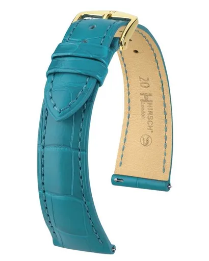
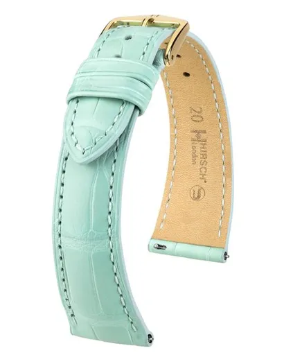
Řemínek Hirsch London Alligator - tyrkysový, mat - 21 mm - L – Standardní délka (doporučujeme) - 18 mm - Stříbrná
Řemínek Hirsch London Alligator je luxusní kožený doplněk s tyrkysovou matnou barvou a perleťovým povrchem. Vyznačuje se ručně lakovanými okraji ve stylu Rembordé Look Coupé Franc a prošíváním tón v tónu. Řemínek je vyroben ze sudově barvené kůže a disponuje stříbrnou sponou s ručně šitým bartack stehem.
- Elegantní nadčasový design s módní tyrkysovou barvou
- Ručně lakované okraje ve stylu Rembordé Look Coupé Franc
- Jemná struktura s perleťovým povrchem a prošíváním tón v tónu
- Precizní zpracování ze sudově barvené kůže
Objev podobné jako Řemínek Hirsch London Alligator - tyrkysový, mat - 21 mm - L – Standardní délka (doporučujeme) - 18 mm - Stříbrná

Puma CARINA STREET LUX CRAFTED FLOWERS Dámská vycházková obuv, bílá, velikost 38
Dámské tenisky Puma Carina Street Lux Crafted Flowers kombinují streetwearový design s platformovým profilem a basketbalovými detaily. Bílé boty s květinovým potiskem jsou vhodné pro volnočasové nošení. Model nabízí stylové doplnění každodenního outfitu.
- Stylový streetwear design s květinovým potiskem
- Platformový podpatek pro pohodlí a výšku
- Všestrannost pro každodenní nošení
- Kvalitní zpracování značky Puma
Objev podobné jako Puma CARINA STREET LUX CRAFTED FLOWERS Dámská vycházková obuv, bílá, velikost 38
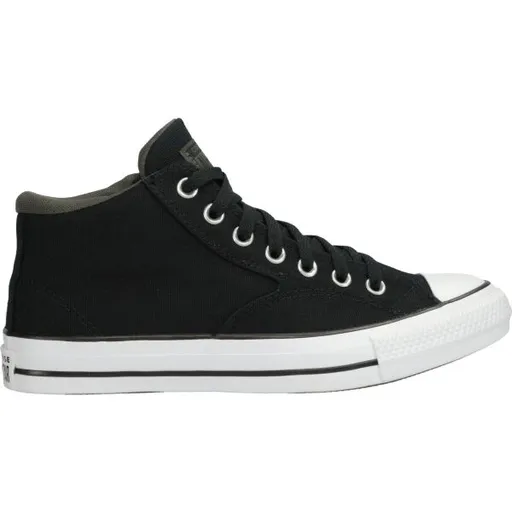
Converse CHUCK TAYLOR ALL STAR MALDEN STREET Pánské kotníkové tenisky, černá, velikost
Pánské kotníkové tenisky Converse CHUCK TAYLOR ALL STAR MALDEN STREET v černé barvě nabízejí pohodlné nošení díky polstrování okolo kotníku. Mají klasické šněrování, hřejivou podšívku a protiskluzovou podrážku. Logo značky je umístěno na vnitřní straně.
- Pohodlné silnější polstrování okolo kotníku
- Klasické šněrování s textilními tkaničkami
- Hřejivá podšívka a protiskluzová podrážka
- Univerzální design vhodný pro volnočasové outfity
Objev podobné jako Converse CHUCK TAYLOR ALL STAR MALDEN STREET Pánské kotníkové tenisky, černá, velikost
Náušnice Kurt Geiger London
Náušnice z kolekce Kurt Geiger London s křišťálovou ozdobou. Výrobek je vyroben z mosazi. Představují elegantní doplněk do šatníku.
- Křišťálová ozdoba pro elegantní vzhled
- Vyrobeno z kvalitní mosazi
- Design z exkluzivní kolekce London
- Univerzální styl pro různé příležitosti
Objev podobné jako Náušnice Kurt Geiger London
My First Book of London - Charlotte Guillain
London is one of the most exciting cities in the world! But if you are a young visitor where should you go and what should you look out for?Go for a ride on the London Eye, watch street performer spectacles at Covent Garden and stand under a life-sized model of a blue whale at the Natural History Museum. In this revised and updated edition of the much-loved My First Book of London, a fun question-and-answer format introduces young readers to the famous sights of this fascinating city. Stunning illustrations bring each feature to life and provide an ideal way for your child to learn about London and the fun of exploring it!
Objev podobné jako My First Book of London - Charlotte Guillain

Ashleigh & Burwood London Lamp Fragrance Jasmine & Damson náplň do katalytické lampy 500 ml
Náhradní náplň do katalytické lampy Ashleigh & Burwood s vůní jasmínu a damsonu. Prostřednictvím katalytického procesu účinně eliminuje nepříjemné pachy v interiéru. Obsahuje 500 ml vonné esence pro dlouhodobé použití.
- Ničí nepříjemné pachy včetně cigaretového kouře a pachů z vaření
- Lze bezpečně nechat bez dozoru během provozu
- Květinová vůně s orientálními tóny jasmínu a damsonu
- Dlouhotrvající náplň o objemu 500 ml
Objev podobné jako Ashleigh & Burwood London Lamp Fragrance Jasmine & Damson náplň do katalytické lampy 500 ml
Ashleigh & Burwood London Romance náplň do katalytické lampy 500 ml
Náhradní náplň do katalytické lampy Ashleigh & Burwood London Romance o objemu 500 ml s květinově-dřevitou vůní. Určeno k provonění interiéru podle aktuální nálady. Používá se podle přiloženého návodu.
- Květinově-dřevitá vůně pro příjemnou atmosféru
- Objem 500 ml pro dlouhodobé použití
- Vhodné pro většinu katalytických lamp
- Snadné použití podle přiloženého návodu
Objev podobné jako Ashleigh & Burwood London Romance náplň do katalytické lampy 500 ml
Cycling London - Tom Bogdanowicz
Written by the author of London’s most popular cycling blog and using years of experience and contributions from readers, it offers more than 30 leisurely routes covering both inner and outer London. Each itinerary is described in detail with a series of points of interest also pinpointed on an accompanying route map. Boxed information with each route shows at-a-glance the start point, likely duration, and some suggestions for where to eat and drink along the way. The book also covers important practical information on cycling, such as choosing the right bike for your style of cycling; tips on urban cycling, social cycling, and cycling with children; and guidance on security and insurance as well as information on accessories and clothing. This best selling guide to cycling in London is completely updated with new routes, maps, and colour photographs. It also includes full details of Santander Cycles, London''s public bike sharing scheme.Â
Objev podobné jako Cycling London - Tom Bogdanowicz