bristol and bath a z street atlas a z maps
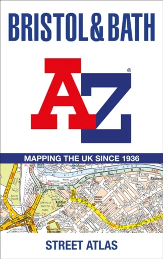
Bristol and Bath A-Z Street Atlas - A-Z Maps
Navigate your way around Bristol and Bath with this detailed and easy-to-use A-Z Street Atlas.Printed in full-colour, paperback format, this atlas contains 104 pages of continuous street mapping. More than 12,800 streets indexed. Large scale 6.25 inches to 1 mile map.Areas covered include: Avonmouth, Bradley Stoke, Filton, Keynsham, Kingswood, Mangotsfield, Portishead, Yate, Frampton Cotterell, Chipping Sodbury, Oldland, Swainswick, Batheaston, University of Bath, Combe Down, Bath Spa University, Saltford, Whitchurch, Bedminster, Long Ashton, Easton-in-Gordano, Cribbs Causeway.Also included are large scale city centre maps of both Bristol and Bath and a postcode map of the atlas area.Postcode districts, one-way streets and safety camera locations with their maximum speed are featured on the street mapping.A comprehensive index lists streets, selected flats, walkways and places of interest, place, area and station names. Additional healthcare (hospitals, walk-in centres and hospices) and transport connections are indexed as well.
Objev podobné jako Bristol and Bath A-Z Street Atlas - A-Z Maps
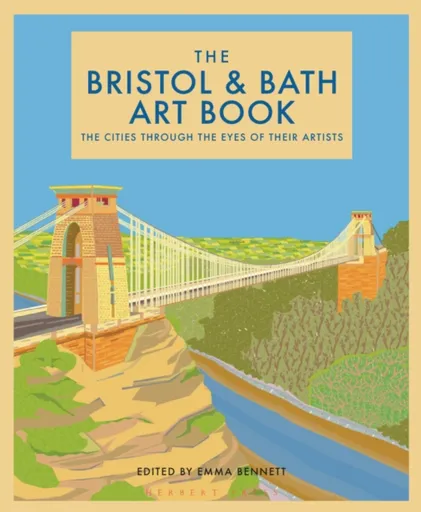
The Bristol and Bath Art Book
Bristol and Bath are two beautiful, closely connected cities. They are portrayed through the eyes of their artists in a delightful variety of styles in this stunning book.The Bristol and Bath Art Book portrays two very different cities. The beautiful images in the book capture the breath-taking landscape of rivers, hills and gorges which they share, but also the cities’ sights that are so unique. Bristol is painted as busy, quirky and vibrant, where Bath glows in more tranquil hues. These important cities in the history of the world are intimately connected.The river Avon that flows through both cities, gouges the spectacular Avon Gorge at Bristol, which is where its international maritime connections begin.The regenerated old docks (the ’floating harbour’), Wapping Wharf and the quayside are lovingly depicted by various artists. Now that the main docks are outside the city, the harbour-side now bustles with shops, bars and offices, but there are still cranes to be seen at the M shed. Underfall boatyard remains a home to maritime businesses and is also pictured in this lovely book, along with pleasure craft and houseboats in the harbour.John Cabot’s The Matthew is the ship that put America on the map. The reconstruction ... Unknown localization key: "more"
Objev podobné jako The Bristol and Bath Art Book
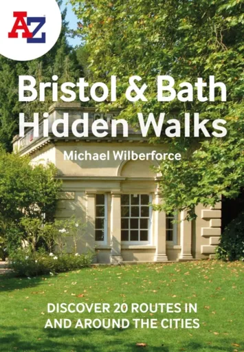
A -Z Bristol & Bath Hidden Walks - Michael Wilberforce
Discover hidden gems around Bristol and Bath with 20 walking routes.Featuring 20 walks, including lesser-known circuits and details on popular walks. Accompanied by guided walking instructions and written by a local expert, A-Z Bristol & Bath Hidden Walks is the perfect way to explore the city in a new light.Small enough to fit in a bag or pocket, this handy guidebook is ideal for tourists or locals looking to discover more about the city. Each route varies in length from 1 to 6 miles (1.6 to 9.6 km), and is clearly outlined on detailed A-Z street mapping.• 20 walking routes with instructions and maps• Full-colour photographs of hidden gems and city attractions• Key sights and locations clearly marked on map• Information such as start/finish points, nearest postcodes, distance and terrain includedMore from the A-Z Hidden Walks series:A-Z Birmingham Hidden WalksA-Z Bristol & Bath Hidden WalksA-Z Edinburgh Hidden WalksA-Z London Hidden WalksA-Z Oxford Hidden WalksA-Z York Hidden WalksA-Z Brighton Hidden WalksA-Z Cambridge Hidden WalksA-Z Manchester Hidden WalksA-Z Liverpool Hidden Walks
Objev podobné jako A -Z Bristol & Bath Hidden Walks - Michael Wilberforce
Podívejte se také
kvalitní osuška z řady COLOR BATH
ručníky řady COLOR BATH
žínky Tom Tailor řada COLOR BATH
ručník z řady COLOR BATH
žínky Tom Tailor COLOR BATH
freestyle koloběžka Street Surfing BANDIT Blast Olive Cr-Mo
šedo-oranžové odrážedlo Street Champion
dámské tenisky Puma CARINA STREET SD
CARINA STREET SD boty
DIESEL Only The Brave Street EdT 50 ml
DIESEL Only The Brave Street parfém
DIESEL Only The Brave Street EdT
kniha podobná Tomorrow and Tomorrow and Tomorrow
koncert 7th Street Entry 1981
Puma COURT CLASSIC STREET boty
platformové boty Carina Street Lux
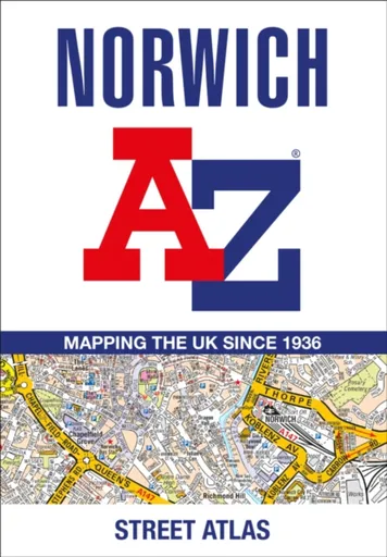
Norwich A-Z Street Atlas - A-Z Maps
Navigate your way around Norwich with this detailed and easy-to-use A-Z Street Atlas.Printed in full-colour, paperback format, this atlas contains 42 pages of continuous street mapping. More than 4,500 streets indexed. Large scale 4 inches to 1 mile map.Areas covered include :Blofield, Blofield Heath, Brundall, Cringleford, Hethersett, Norwich Airport,Poringland, Spixworth, Sprowston, Taverham, Wroxham, Wymondham.In addition, there is an inset map of Horsford and a large scale city centre map of Norwich.Postcode districts, one-way streets and safety camera locations with their maximum speed are featured on the street mapping.A comprehensive index lists streets, selected flats, walkways and places of interest, place, area and station names. Additional healthcare (hospitals, walk-in centres and hospices) and transport connections are indexed as well.
Objev podobné jako Norwich A-Z Street Atlas - A-Z Maps
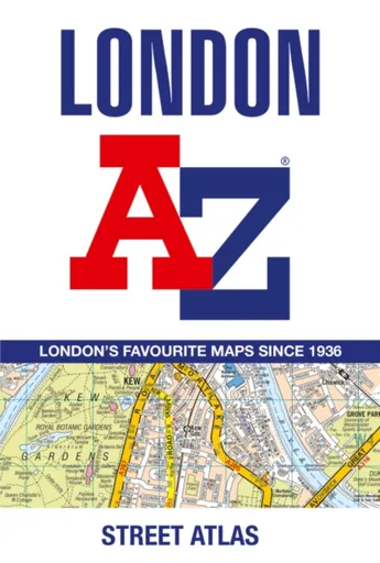
London A-Z Street Atlas - A-Z Maps
Navigate your way around London with this detailed, easy-to-use and up-to-date A-Z Street Atlas.First published in 1936, this iconic atlas is a trusted means of finding your way around the capital city.The main mapping extends beyond Central London from Heathrow Airport to Chingford at a scale of 2.88 inches to 1 mile (4.55 cm to 1 km), featuring postcode districts, one-way streets, the Congestion Charging Zone and Low Emission Zone.The large-scale street map of Central London – at a scale of 5.75 inches to 1 mile – cover Regent’s Park and Shoreditch, Chelsea and Vauxhall, Hyde Park and Bermondsey.A comprehensive index lists streets, selected flats, walkways and places of interest, place, area and junction names. Additional healthcare (hospitals, walk-in centres and hospices) and transport connections (National Rail, London Tramlink, Docklands Light Railway, London Underground and Overground stations, and River Bus pier) are indexed as well.Also included are:• Overview map of the Congestion Charging Zone, Ultra Low Emission and Low Emission Zones• West End Theatre map• London Connections rail services map
Objev podobné jako London A-Z Street Atlas - A-Z Maps
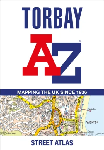
Torbay A-Z Street Atlas - A-Z Maps
Navigate your way around Torbay with this detailed and easy-to-use A-Z Street Atlas.Printed in full-colour, paperback format, this atlas contains 38 pages of continuous street mapping. More than 5,100 streets indexed. Large scale 4 inches to 1 mile map.Areas covered include: Brixham, Paignton, Torquay, Kingskerswell, Newton Abbot, Bovey Tracey, Teignmouth, Dawlish, Ashburton, Buckfastleigh, Totnes, Kingsbridge, Salcombe, Dartmouth.In addition, there are insets of: Bishopsteignton, Ipplepen, Stoke Gabriel and a large scale town centre map of Dartmouth.Postcode districts, one-way streets, Park and Ride sites, safety camera locations with their maximum speed and Dartmoor National Park boundary are featured on the mapping.The Places of Interest Guide is both informative and helpful with information about:Tourist Information CentresBoat tripsSelected places of interestThe English RivieraA comprehensive index lists streets, selected flats, walkways and places of interest, place, area and station names. Additional healthcare (hospitals, walk-in centres and hospices) and transport connections are indexed as well.
Objev podobné jako Torbay A-Z Street Atlas - A-Z Maps
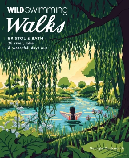
Wild Swimming Walks Bristol & Bath - Georgie Duckworth
Escape the everyday with these 28 invigorating wild swimming adventures around Bristol and Bath. Discover secret beaches, plunge into hidden pools and explore the rich history and nature of the region. With detailed directions, maps and local insights, this guide is your key to unforgettable outdoor experiences.
Objev podobné jako Wild Swimming Walks Bristol & Bath - Georgie Duckworth
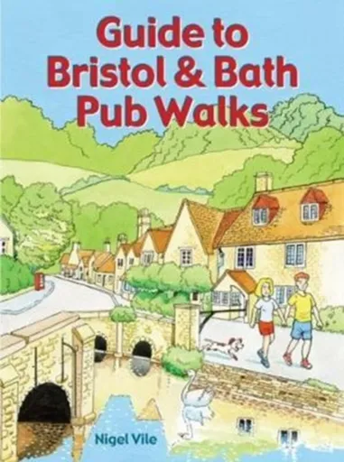
Guide to Bristol & Bath Pub Walks - Nigel Vile
Discover the beauty of the countryside around Bristol and Bath with this guide to some of the finest walking in the area. The 20 circular routes vary in length from 4 to 8 miles and are each centred on a broad variety of welcoming pubs recommended for their good food.
Objev podobné jako Guide to Bristol & Bath Pub Walks - Nigel Vile
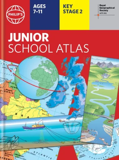
Philip's RGS Junior School Atlas - Philip's Maps
The 12th edition of the market-leading atlas for primary school pupils, Philip''s RGS Junior School Atlas has been fully revised and updated with all the latest facts and curriculum requirements.- The essential atlas for primary schools with clear and easy-to-follow maps and diagrams - updated for 2024/2025- Published in association with the Royal Geographical Society- Recommended for Key Stage 2 of the National Curriculum - and all 7-11 year olds - An excellent introduction to mapping concepts such as scale, direction, symbols, longitude and latitude- 22-page Britain and Ireland section with clear thematic charts, diagrams and large-scale regional maps- 22-page section on The World, with political maps - and thematic treatment of key themes, from volcanoes and earthquakes to transport and tourism- Continents section with physical and political maps- Easy-to-follow map references and 1,000-place indexThe introductory section describes the meaning of scale, how to measure distances using the maps, and explains the symbols on the maps.The following section is devoted to the United Kingdom and Ireland. Thematic maps cover topics such as mountains and rivers, climate and weather, population and cities, farming and fishing, industry and energy, transport, tourism and conservation. The rest of the atlas is made up of ... Unknown localization key: "more"
Objev podobné jako Philip's RGS Junior School Atlas - Philip's Maps
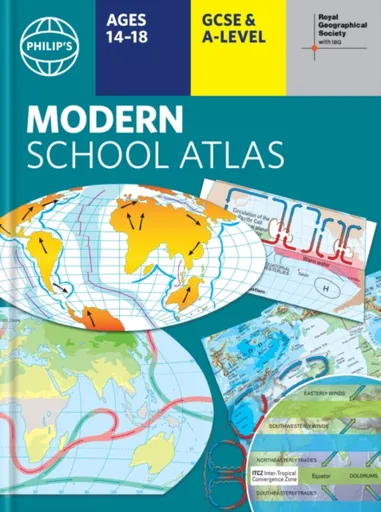
Philip's RGS Modern School Atlas - Philip's Maps
- Britain''s best-selling school atlas - now in its 101st edition- Recommended for Key Stage 4, GCSE and A-Level in England and Wales (Scottish National Qualifications/Highers) and international schools- Fully updated to reflect the latest changes in the curriculum- Published in association with the Royal Geographical Society- Combines superb digital maps of Britain and the world with up-to-date thematic maps - Country-by-country statistics on population, land use, trade, tourism, energy, wealth and much more - World Themes Section - from volcanoes and earthquakes to population trends, languages and religions, all the key aspects and statistics of geography are explored and explained- Plus a special section on how satellite imagery is used to interpret global, environmental and urban patterns of change Britain''s best-selling secondary school atlas, now in its 101st Edition. The contents are divided into colour-coded sections for rapid reference. The physical maps of the United Kingdom and Ireland are accompanied by thematic maps on numerous key social and economic themes. World topographical maps, with thematic maps on topics such as climate, population and economics, are followed by 30 pages of World thematic maps.Completing the atlas is a section of World social and economic statistics, and an index with letter-figure ... Unknown localization key: "more"
Objev podobné jako Philip's RGS Modern School Atlas - Philip's Maps

Philip's Caribbean Atlas for Secondary Schools - Philip's Maps
A new edition of the market-leading atlas for CXC Geography students, Philip''s Caribbean Atlas for Secondary Schools provides extensive coverage of the Caribbean area, together with a comprehensive selection of world and regional maps. The atlas is arranged in three sections for ease of use, with each page colour-coded for rapid reference. The first section is devoted to a detailed coverage of the Caribbean region in 48 pages, and includes maps of every island plus Belize and Guyana, as well as topographical, land use, tourism and mining maps.The second section is made up of 72 pages of World topographical maps, incorporating continental thematic maps on topics such as population, climate and biomes, followed by 32 pages of World thematic maps. This new 8th edition features updated mapping of all Caribbean islands, as well as the latest statistics. The World map section contains additional coverage of Brazil, the Americas and Asia, while the World thematic section includes maps on volcanoes, El Niño, tourism, energy, minerals, industry, trade and international organizations.Completing the atlas is a section of CXC study maps covering topics such as farming, soil conservation, economics, tourism and urban land use. Features regional studies of Mauritius, UK, Canada, USA and ... Unknown localization key: "more"
Objev podobné jako Philip's Caribbean Atlas for Secondary Schools - Philip's Maps
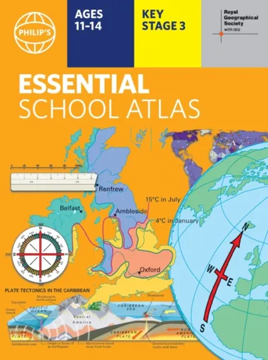
Philip's RGS Essential School Atlas - Philip's Maps
"An excellent world atlas. Very illuminating, good colours, clear texts...good glossary and, last but not least, up-to-date." - customer review- The ideal school atlas for Key Stage 3 pupils and Scotland''s National Qualifications, 11-14 years old- All updated for 2024 specifically to meet curriculum needs- Specially focused 16-page UK and Ireland section- Comprehensive 62-page world section includes thematic maps on the environment, climate change, people, quality of life, and energy- Published in association with the Royal Geographical SocietyPhilip''s RGS Essential School Atlas has been specially created for lower-secondary geography students (11-14 year olds). The maps have been carefully designed to be uncluttered and easy to read, containing specially selected place names and detail. A clear set of symbols and scale information accompanies every map, with a useful introductory section covering basic atlas skills, including aerial photographs and satellite images to further explain particular features on the maps. Latitude and longitude co-ordinates are included in the index, alongside figure-letter references. Fully up-to-date, the atlas includes detailed regional maps, charts and satellite images of Europe, Italy, the Middle East, China, Japan, Kenya, USA, Brazil, and the Arctic and Antarctica. It also focuses on areas of special interest for students of geography, such ... Unknown localization key: "more"
Objev podobné jako Philip's RGS Essential School Atlas - Philip's Maps
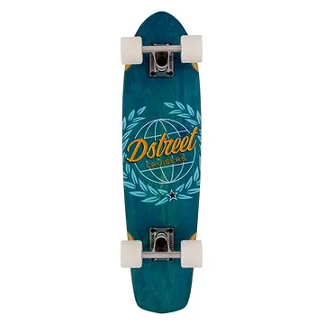
D-Street - Cruiser Atlas Blue 28" (5059415068513)
Longboard s cruiser tvarem desky, rozměry 71,2 × 18,4 cm, tvrdost koleček 78 A, průměr koleček 59 mm Pokud hledáte cruiser vhodný na jízdu po městě i delší projížďky, D-Street Atlas je skvělou volbou. Osloví vás nejen jeho výjimečný design, ale rovněž vysoce kvalitní komponenty. Cruiser je tvořený deskou ze 7 vrstev kanadského javoru, což zajistí jeho maximální pevnost. Pohodlnou jízdu umožní rychlá kolečka o průměru 60 mm a tvrdosti 78A, která jsou osazená ložisky ABEC-7. Trucky jsou přitom vyrobené z hliníku. S cruisem D-Street Atlas si užijete jízdu po městě i perfektní triky v parku. Klíčové vlastnosti longboardu D-Street Atlas Blue 28"Longboard vhodný na jízdu po městě i delší projížďkyTvořený deskou ze 7 vrstev kanadského javoruPohodlnou jízdu zajistí rychlá kolečka o průměru 60 mm a tvrdosti 78ATrucky vyrobené z hliníkuNechybí ložiska ABEC-7Cruiser D-Street Atlas umožní i provádění trikůBarevné provedení: žluto-černo-modré...
Objev podobné jako D-Street - Cruiser Atlas Blue 28" (5059415068513)
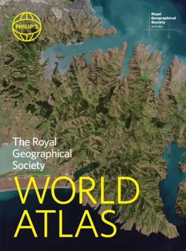
Philip's RGS World Atlas - Philip's Maps
"An excellent world atlas. Very illuminating, good colours, clear texts...good glossary and, last but not least, up-to-date". Amazon customer review· The perfect world atlas for work, study or leisure· Great value for money· 96 pages of authoritative world maps, physical and political· 70 city maps in the fascinating World Cities section, with full-page satellite images for 10 great cities· Over 35,000 place name indexAll this and a special 32-page introductory section - ''The World in Focus'' - covers key geographical themes such as the Earth''s position in the Solar System, the structure of the Earth, climate and weather, the environment, population, resources, economics and international organizations. Vital information on topics covered in geography, humanities and economics courses.The information-packed World Atlas from Philip''s, published in association with the Royal Geographical Society has been fully updated for this new, 2021 edition
Objev podobné jako Philip's RGS World Atlas - Philip's Maps
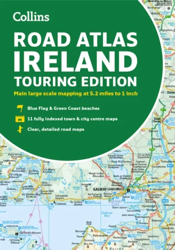
Road Atlas Ireland - Collins Maps
Explore Ireland with this accurate and fully updated road atlas.This road atlas is at A4 size, covering the whole of Ireland and features clear and detailed Collins colour mapping at a scale of 5.2 miles to 1 inch. Perfect for both residents and visitorstouring Ireland.This revised edition includes:Places of tourist interestContact information for Tourist Information Centres with grid references to the mappingFully indexed street maps of 11 cities and towns – Dublin, Belfast, Cork, Limerick, Waterford,Londonderry (Derry), Galway, Bangor, Dun Laoghaire, Drogheda and KillarneyBlue Flag & Green Coast beachesFerry and airport information; Distance chart; Distances marked on the roads in miles and kilometresRoute planning map of the whole of Ireland at 15.8 miles to 1 inchAdministrative map of Irish counties and districts.
Objev podobné jako Road Atlas Ireland - Collins Maps
Nicolson Street Atlas Ayrshire - Nicolson Digital Ltd, Val Fry
Based on OS data and fully revised for 2017 the Ayrshire Street Atlas is your essential guide to the towns and villages throughout Ayrshire. Exceptionally clear mapping and full index to street names. Don''t leave home without it!Exceptionally clear street mappingIndex to street namesTourist attractions highlightedShows schools, post offices, parking, petrol stations, hospitals religious buildings, recreation areas, cemeteries and more
Objev podobné jako Nicolson Street Atlas Ayrshire - Nicolson Digital Ltd, Val Fry
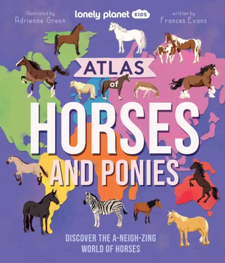
Lonely Planet Kids Atlas of Horses and Ponies - Frances Evans, Lonely Planet Kids
Take a wild ride into the world of horses and ponies with this awesome atlas of more than 100 incredible breeds from across the continents!Packed with gorgeous illustrations, marvellous maps and fascinating facts, discover a huge selection of horses and ponies from South America''s Peruvian Paso to Asia''s Orlov Trotter and Europe''s Swedish Warmblood. Learn about each horse’s country of origin, physical characteristics and personality traits, and saddle-up for the ultimate horse and pony adventure.Inside Atlas of Horses and Ponies:Over 100 awesome breeds from North and South America, Europe, Africa, Asia, Australia and New ZealandLarge maps of each continent show where each horse and pony originates fromAtlas of a horse provides readers with a basic geography of their body from their coat to their tailLearn about a horse''s amazing super senses plus discover how to talk horseFun-packed profiles give details on each horse''s personality traits, characteristics and unique skillsSpecial themed features on: Super Senses, Caring for Horses, Foals, Donkeys and Mules, Working Horses, Mythical Horses, Horse Sports, Wild Horses, War Horses, and Record-Breaking HorsesFrom the author of Lonely Planet Kids’ bestselling Atlas of Dogs and Atlas of Cats: Frances EvansFeaturing beautiful and lively illustrations throughout by Adrienne Green Hot on ... Unknown localization key: "more"
Objev podobné jako Lonely Planet Kids Atlas of Horses and Ponies - Frances Evans, Lonely Planet Kids
Nicolson Street Atlas Fife
Street atlas of all the towns and villages in Fife.Featuring the great clear Nicolson Digital Mapping
Objev podobné jako Nicolson Street Atlas Fife
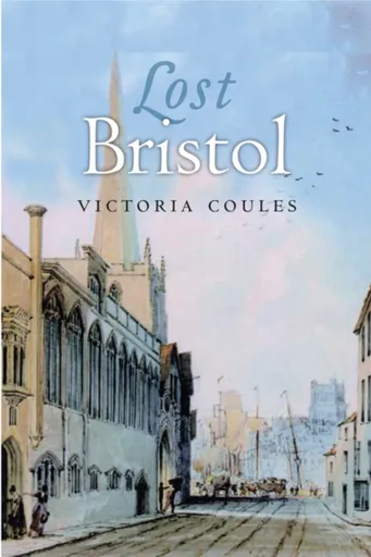
Lost Bristol - Victoria Coules
Bristol has a rich historical heritage dating back to the city''s beginnings in Anglo-Saxon times. For centuries, it was England''s second city and, as a thriving port, its past is steeped in its involvement in trade, whether of cloth, wine, pottery, glass - or slaves. As there is no commercial shipping now, much of Bristol''s past is hidden within the modern city, just out of sight, but waiting to be discovered. Lost Bristol is an exploration of Bristol''s hidden past, its ways of life, legends, relationship with the sea and its role in English history.The book includes some of the more famous aspects of the city''s past, as well as stories and information unknown even to most locals. In an informed and entertaining style, Victoria Coules uncovers events and episodes such as the 1793 bridge toll riots, the jurisdiction of the Knights Templar over certain areas in Bristol and the creation of the Floating Harbour. Lost Bristol also reveals how a 13th century quay became a traffic roundabout, what happened to Bristol''s own hot water spa and why Bristol cod merchants were also intrepid explorers.Many more surprising and remarkable stories about Bristol''s past, accompanied by maps, engravings and photographs, make ... Unknown localization key: "more"
Objev podobné jako Lost Bristol - Victoria Coules
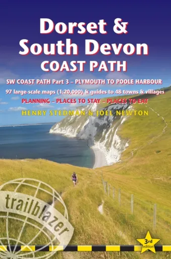
Dorset and South Devon Coast Path - guide and maps to 48 towns and villages with large-scale walking maps (1:20 000) - Henry Stedman, Joel Newton
Trailblazer British Walking Guide: Dorset & South Devon Coast Path, South-West Coast Path Part 3, Plymouth to Poole HarbourComprehensive, all-in-one guide to walking the Dorset & South Devon Coast Path, the third and last section of the South West Coast Path National Trail. The walking guide includes:88 large-scale walking maps at just under 1:20,000 - showing route times, places to stay, places to eat, points of interest and much more.29 town plans, 14 colour stage maps showing hills and descents, and 2 colour overview maps.Places to stay with reviews - pubs, hotels, B&Bs, hostels, bunkhouses, campsites.Places to eat with reviews - teashops, cafes, takeaways, pubs, restaurants.What to see along the way - historical, cultural and geographical background information.Itineraries for all walkers - whether walking the route in its entirety over a week to 10 days or sampling the highlights on day walks and short breaks.Comprehensive public transport information - for all access points on the path.Flora and fauna - four page full colour flower guide, plus an illustrated section on local wildlife.Green hiking - understanding the local environment and minimizing our impact on it.Downloadable GPS waypoints.The information is written onto the maps, so walking directions, tricky junctions, places to stay ... Unknown localization key: "more"
Objev podobné jako Dorset and South Devon Coast Path - guide and maps to 48 towns and villages with large-scale walking maps (1:20 000) - Henry Stedman, Joel Newton
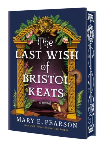
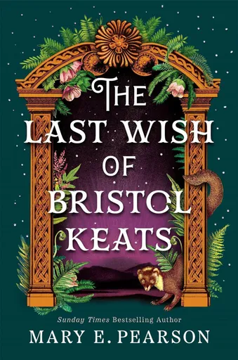
The Last Wish of Bristol Keats - Mary E. Pearsonová
INSTANT NATIONAL BESTSELLER!From NEW YORK TIMES bestselling author Mary E. Pearson comes the thrilling conclusion of the Courting of Bristol Keats romantic fantasy duology--LIMITED EDITION printing with stenciled edges!"Impossible to put down...A perfect read for fans of Heather Fawcett's Emily Wilde series and Rebecca Yarros's Fourth Wing." -Library Journal (starred review)Be wary of the legends you hear. Who knows, one day you may be a legend yourself. After Bristol Keats nearly loses her beloved King Tyghan to the monsters her mother had unleashed, their love deepens to a whole new level. Together, Bristol and Tyghan work to understand and reconcile their differences, moving forward with their common goal of saving Elphame. But when a daring rescue attempt turns into a disaster, and a beloved knight dies, Bristol is forced to confront the fact that her mother is more powerful than she could have ever imagined-and more dangerous. Meanwhile, Tyghan's heart is laid bare when he encounters his former best friend and betrayer again, Bristol's own father, and must wrestle with a new secret that throws everything he thought he knew about his past into question.Bristol is Elphame's last chance for survival, but where do her loyalties truly lie? If she ... Unknown localization key: "more"
Objev podobné jako The Last Wish of Bristol Keats - Mary E. Pearsonová

Johnson's® Wash and Bath jemný dětský šampon 500 ml
Johnson's® Wash and Bath, 500 ml, Dětské šampony pro děti, Dětské vlásky jsou velmi jemné a stejně tak jemná by měla být i péče o ně. Dětský šampon Johnson's® Wash and Bath zajistí všem drobečkům to nejšetrnější mytí bez zbytečných slziček, protože vůbec neštípe v očích, i když se do nich omylem dostane. Vlásky i pokožku hlavy s největší pečlivostí vyčistí a dodá jim lesk, aby pěkně zářily. Každé koupání tak proběhne s úsměvem na tváři. Vlastnosti: šetrně čistí jemné dětské vlásky a pokožku hlavy zanechává vlásky jemné, lesklé a dobře upravitelné nezpůsobuje nepříjemné štípání v očích výborně pění a snadno se oplachuje má vyvážené pH vhodný pro děti i dospělé Složení: formule NO MORE TEARS® – zamezuje štípání v očích dermatologicky a pediatricky testováno hypoalergenní složení bez barviv, ftalátů, sulfátů, alkoholu a mýdla Jak aplikovat: Naneste si malé množství šamponu Johnson's® Wash and Bath do dlaní a jemně vmasírujte do mokrých vlásků vašeho dítěte. Vyvarujte se přímému kontaktu s očima. Důkladně opláchněte.
Objev podobné jako Johnson's® Wash and Bath jemný dětský šampon 500 ml
Johnson's® Wash and Bath extra jemný šampon pro děti od narození 200 ml
Johnson's® Wash and Bath, 200 ml, Dětské šampony pro děti, Vlas miminka je až 5× tenčí než vlas dospělého člověka, proto je důležité vybírat pro něj speciální péči. Šampon pro děti Johnson’s® Wash and Bath je díky technologii No More Tears® tak šetrný, že i pokud se náhodou dostane do očí, je to stejné, jako by to byla pouhá voda. Už žádné dětské slzičky a křik při koupání, jen spokojený úsměv a lesklé vlásky vašeho nejmenšího. Vlastnosti: zanechává vlasy dítěte jemné, lesklé a čisté je velmi šetrný – vůbec nedráždí oči rychle pění a snadno se oplachuje má vyvážené pH je hypoalergenní vhodný již od narození Složení: technologie No More Tears® – zajišťuje, že šampon v očích vůbec neštípe bez obsahu ftalátů, sulfátů, barviv a mýdla testováno dětskými lékaři, dermatology a oftalmology 97 % složek přírodního původu veganské složení Jak aplikovat: Nejprve navlhčete vlasy dítěte teplou vodou, poté naneste dětský šampon Johnson’s® Wash and Bath, jemně napěňte a opláchněte.
Objev podobné jako Johnson's® Wash and Bath extra jemný šampon pro děti od narození 200 ml
Johnson's® Wash and Bath jemný šampon pro děti od narození s heřmánkem 500 ml
Johnson's® Wash and Bath, 500 ml, Dětské šampony pro děti, Tu nejšetrnější péči spolu s líbeznou vůní heřmánku nabízí šampon Johnson's® Wash and Bath. Rychle pění, jemně čistí dětské vlásky a zanechává je hebké a plné zdraví. Hypoalergenní šampon, který mohou využít kromě dětí i dospělí, se jednoduše oplachuje a nezpůsobuje podráždění očí. Vlastnosti: šetrně zbavuje vlasy nečistot respektuje citlivou dětskou pokožku zjemňuje vlasy a dodává jim hebkost pečuje o zdraví dětských vlásků příjemná heřmánková vůně dermatologicky a pediatricky testováno Složení: technologie NO MORE TEARS® – šampon je šetrný k dětským očím hypoalergenní vyvážené pH bez alkoholu, barviv, ftalátů, sulfátů Jak aplikovat: Naneste na dlaň malé množství šamponu Johnson's® Wash and Bath a jemně vetřete do navlhčených dětských vlasů. Nechte napěnit a důkladně opláchněte.
Objev podobné jako Johnson's® Wash and Bath jemný šampon pro děti od narození s heřmánkem 500 ml
The Last Wish of Bristol Keats - Mary E. Pearsonová
Everyone clings to something, even a deception.After Bristol’s near loss of Tyghan to her mother’s unleashed horrors, their love blossoms anew. United, Bristol and Tyghan strive to bridge their divides, pursuing their shared mission to safeguard Elphame. Yet, a valiant rescue spirals into tragedy, claiming the life of a cherished knight. Bristol confronts a chilling truth: her mother’s power eclipses her wildest fears, and her malevolence knows no bounds.As Tyghan confronts Kierus, his betrayer, a buried secret surfaces, shattering his perception of the past. Bristol stands as Elphame’s final hope, but her allegiances waver. Should she embrace her inherent magic, she risks succumbing to the monstrous nature of her mother, jeopardizing the very people she seeks to protect.
Objev podobné jako The Last Wish of Bristol Keats - Mary E. Pearsonová
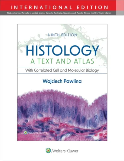
Histology: A Text and Atlas - Wojciech Pawlina
Combining a reader-friendly textbook and a rich, full-color atlas, Histology: A Text and Atlas: With Correlated Cell and Molecular Biology, 9th Edition, equips medical, dental, health professions, and undergraduate biology and cell biology students with a comprehensive grasp of the clinical and functional correlates of histology and a vivid understanding of the structural and functional details of cells, tissues, and organs. The 9th Edition of this bestselling resource reflects the latest advances in cellular and molecular biology and relevant imaging techniques, accompanied by large, high-resolution illustrations and full-color photomicrographs that clarify microanatomy in vibrant detail. System chapters align conveniently with curricula units and emphasize a clinical context, making this proven approach ideal for integrated curricula as well as standalone histology courses.   To accommodate reviewers’ suggestions, the ninth edition integrates new information in cell biology with clinical correlates, which readers will see as new clinical information items highlighted in blue text and in clinical boxes (called “Foldersâ€). For example, the last few years of the COVID-19 pandemic has sparked interest about the changes in normal tissue when infected by the severe acute respiratory syndrome coronavirus 2 (SARS-CoV-2) virus. Several chapters contain descriptions of these changes with underlying explanations of ... Unknown localization key: "more"
Objev podobné jako Histology: A Text and Atlas - Wojciech Pawlina
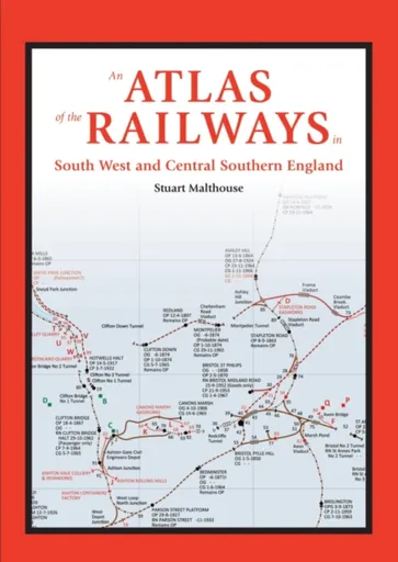
An Atlas of the Railways in South West and Central Southern England - Stuart Malthouse
This railway atlas presents a much wider range of railway types and their features than those shown on most existing maps. Its coverage begins with the earliest railways and carries through to the present day. The area covered in this volume extends from Cornwall in the South West to Hampshire in Central Southern England and as far north as Bristol and Swindon. Industrial railways are shown as well as passenger carrying lines. Each map is accompanied by a detailed key to the public and private railway systems shown. This includes dates of operation, gauges and significant topographical features. Information on stations includes the opening and closing dates and any name changes which occurred. A chronology of the public railway routes also accompanies each map, which includes independent public railways and any independent private railways with public rail involvement. Approximately 76 pages of detailed information about the railway system in the areas covered and a chronology preface the railway atlas section providing a wealth of detailed reference material.
Objev podobné jako An Atlas of the Railways in South West and Central Southern England - Stuart Malthouse
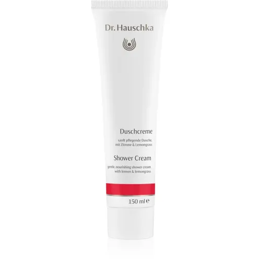
Dr. Hauschka Shower And Bath povzbuzující sprchový krém 150 ml
Dr. Hauschka Shower And Bath, 150 ml, Sprchové krémy pro ženy, Prožijte harmonii a osvěžení s povzbuzujícím sprchovým krémem. Povzbuzující sprchový krém Dr. Hauschka Shower And Bath přemění každodenní sprchování na rituál péče o tělo i mysl. Jeho jemné složení umyje pokožku šetrně a zároveň ji hýčká vyživujícími přírodními složkami. Tento sprchový krém okouzlí všechny, kdo milují čistě přírodní kosmetiku. Vůně plná osvěžujících tónů vás nabudí energií a zklidní smysly. Tento produkt je vhodný pro všechny typy pokožky a díky svému složení potěší i ty s citlivější pletí. Dopřejte si tento luxusní kousek péče, který navíc podpoří vaši vnitřní rovnováhu. Vlastnosti: hloubkově čistí pokožku a zároveň ji šetrně ošetřuje zanechává pokožku hebkou a vyživenou okouzluje osvěžující vůní vhodný pro všechny typy pokožky, včetně citlivé obsahuje přírodní ingredience v bio kvalitě povzbuzuje tělo i mysl ideální pro sprchování i relaxační koupele Složení: esenciální oleje – přináší osvěžující vůni rakytníkový olej – hydratuje a regeneruje pokožku výtažek z kdoule – posiluje přirozenou ochrannou bariéru kůže mandlový olej – vyživuje a zvláčňuje pleť éterické oleje – navozují harmonii těla a mysli Jak používat: Naneste malé množství sprchového krému na vlhkou pokožku a jemně rozetřete krouživými pohyby. Poté opláchněte vlažnou vodou. Produkt je možné ... Unknown localization key: "more"
Objev podobné jako Dr. Hauschka Shower And Bath povzbuzující sprchový krém 150 ml
Johnson's® Wash and Bath bublinková koupel a mycí gel 2 v 1 500 ml
Johnson's® Wash and Bath, 500 ml, Dětské sprchové gely pro děti, Koupání nemusí být pro vás a pro děti obávanou povinností, ale příjemným zážitkem, při kterém se dostane dětské pokožce té nejjemnější péče. Přípravek Johnson's® Wash and Bath pomáhá umýt a zbavit nečistot citlivou dětskou pokožku tak, aniž by došlo k jejímu vysušení či podráždění. Jemně o ni při koupeli pečuje, zklidňuje ji a dodává dítěti pocit komfortu. Vlastnosti: smývá nečistoty hydratuje a zvláčňuje příjemně voní nedráždí v očích Jak používat: Naneste přípravek na pokožku celého těla a jemně vmasírujte. Poté důkladně opláchněte vodou. Nanášejte na vlhkou žínku a napěňte, pěnou očistěte tělo nebo vlásky dítěte a důkladně opláchněte vodou.
Objev podobné jako Johnson's® Wash and Bath bublinková koupel a mycí gel 2 v 1 500 ml
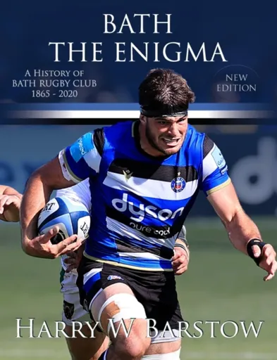
Bath The Enigma - New Edition - Harry Barstow
Bath, founded in 1865, rank among the oldest established rugby clubs in England, yet not for decades could they shake off their poor-relation status in the shadows of West Country rivals Bristol and Gloucester. Indeed, to do so required something approaching a miracle. But miracles do not ''just'' happen, they happen for a reason, or as in Bath''s case for a number of reasons. Hurdles for Bath to jump? Oh yes, plenty. Indeed, how does one even begin to define a club that by 1900 had already produced three England internationals and yet by season 1905-6 with a meagre 7 wins from 33 matches played came near to being folded-up. And who, in that same season of near despair, would ever have contemplated the transformation that would later lead Bath in season 1995-6 to be chosen to carry the Union colours against Rugby League giants Wigan (first under League rules, then Union rules) to end a century of divide between the two codes. Yet chosen Bath were!Of course, it did not happen overnight, but as the decades passed, so too did the pieces of the jigsaw slowly come together, culminating with a team (nay teams) that rose to the forefront ... Unknown localization key: "more"
Objev podobné jako Bath The Enigma - New Edition - Harry Barstow
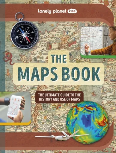
Lonely Planet Kids The Maps Book - Lonely Planet Kids, Joanne Bourne
Explore the amazing world of maps from the first sketches on cave walls to real time maps on phones. Discover their incredible history and marvel at ancient maps, war maps, weather maps and even interactive maps from computer games. Packed with awesome facts, kids will soon grasp how to read maps and symbols - plus learn how to make their own!Wow-factor maps, astounding historic photographs and lively text make this incredible map book the ultimate gift for kids - and grown ups too. Insightful case studies including Winston Churchill’s Map Room and John Snow’s groundbreaking 1854 cholera map will fascinate readers and aid learning; while unusual maps of the night sky, wildlife, populations, time-zones and even famous maps from literature and video games show the full breadth of the many mind-blowing maps in existence.Inside The Maps Book:- An exciting journey through the history of maps including ancient maps, the first ever world map, the mapping of the world wars and beyond- Vibrant artwork, unusual maps, historic photos and engaging text bring the world of maps to life- Fascinating case studies aid learning and comprehension- Revolutionary modern maps explained in detail covering GPS, online maps, streetview, 3D mapping, magnetic-field maps, map ... Unknown localization key: "more"
Objev podobné jako Lonely Planet Kids The Maps Book - Lonely Planet Kids, Joanne Bourne
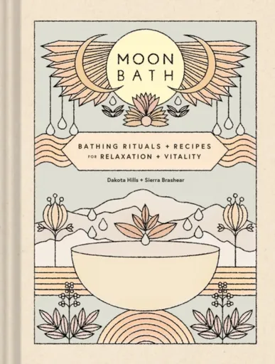
Moon Bath - Dakota Hills, Sierra Brashear
Moon Bath is a luxurious guide that invites readers to immerse themselves in the healing powers of nature.This transformative book features 16 bath and shower rituals aligned with the lunar cycles and the natural rhythms of the cosmos.Organized by moon cycle—New Moon, Waxing Moon, Full Moon, and Waning Moon—each ritual includes a bath recipe featuring healing natural ingredients.• Includes affirmations and meditations• Journaling prompts promote reflection and self-discovery.• Filled with lush, nature-inspired photographyBrimming with Ayurvedic wisdom and plant-based medicine, Moon Bath is a lovely companion for modern mystics, wellness enthusiasts, and anyone who wants to wash away the stresses of daily life.Bath recipes include ginger and baking soda for detoxification, cacao and rose to cultivate love, eucalyptus and bentonite clay to release negativity, and chamomile and lavender to connect to deep wisdom.• This beautiful guide to bathing rituals and bath recipes makes it easy to incorporate calming and enriching self-care practices into everyday life.• Presented in an enchanting package, making it a great gift• Perfect for women who love self-care, meditation, yoga, crystals, and those interested in Ayurveda• Add it to the shelf with books like Crystal Muse: Everyday Rituals to Tune In to the Real You by Heather Askinosie ... Unknown localization key: "more"
Objev podobné jako Moon Bath - Dakota Hills, Sierra Brashear
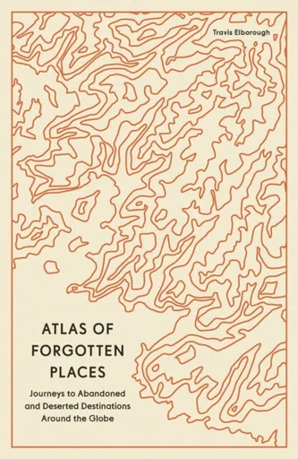
Atlas of Forgotten Places - Travis Elborough
Explore the places that time forgot. These abandoned, mysterious, sleeping monuments around the world have been relegated to the margins of history. From ancient ruins and crumbling castles to more recent relics – an art deco New York subway station, a Soviet ghost town in the Arctic Circle, a flooded Thai mall teeming with aquatic life – Travis Elborough takes you on a journey into these strange, overlooked, and disappearing worlds and immortalizes them in this book of original maps, accompanied by moving historic and geographic accounts of each site. The featured locations are a stark reminder of what was, and the accounts in this investigative book help to bring their stories back to life, telling us what happened, when and why, and to whom. The book features 40 sites, including: Santa Claus, Arizona, USA: A festive tourist resort-turned-ghost town deep in the desert where you could once meet Santa Claus any day of the year; Crystal Palace Subway, London, UK: One of the city’s best-kept secrets is an underground, cathedral-like relic that many Victorian commuters bustled through; Montserrat, West Indies: The small Caribbean island with a population of 5,000 that was evacuated when its volcano erupted in 1995. The ... Unknown localization key: "more"
Objev podobné jako Atlas of Forgotten Places - Travis Elborough
Lonely Planet Kids Deadly Animal Atlas - Lonely Planet, Lonely Planet Kids
Beware! The world''s deadliest creatures reside in the pages of this epic kid''s animal atlas… do you dare to meet them all?Discover the world''s scariest beasts in this ultimate compendium of our planet''s most fearsome predators. From snakes, sharks, and spiders to tigers, eagles, and jellyfish, curious kids will learn how these deadly animals spend their lives, defend their territories, and maintain the health of our ecosystem. Inside Deadly Animal Atlas:Thrilling photography, amazing illustrations, and original artwork make this a vibrant and engaging book for adventurous readersInsightful maps, diagrams, and fact-packed content guide children through the stealthiest predators on Earth, continent-by-continentFun interactive elements like lift-the-flaps, fold-out maps, and open-the-gatefolds keep children entertained and bring this awesome book to lifeCovers important topics including the problems animals are facing through habitat loss and climate change and highlights the measures being used to alleviate themCovers regions: North America, South America, Europe, Africa, Asia, Australasia and OceansWritten by Camilla de la Bedoyere, author of over 250 books including Lonely Planet Kids'' Bird AtlasIllustrated by Dusan Lakicevic and Alek Sotirovski Deadly Animal Atlas is the latest in Lonely Planet Kids'' awesome animal atlas series, which includes Dinosaur Atlas, Animal Atlas, Ocean Animal Atlas, and Bird ... Unknown localization key: "more"
Objev podobné jako Lonely Planet Kids Deadly Animal Atlas - Lonely Planet, Lonely Planet Kids
Leifheit Pegasus Bath 110 sušák na prádlo 81540
Leifheit Pegasus Bath 110 je dvouramenný teleskopický sušák na prádlo určený pro použití v menších prostorech, jako je vana. Je vyroben z odolné kombinace kovu a plastu, nabízí sušící plochu 11 metrů a snadno se skládá pro kompaktní skladování. Sušák je nastavitelný do 12 poloh s možností fixace a ramena lze rozložit až na 180°.
- Teleskopický systém s nastavitelnými rameny až na 180° pro přizpůsobení prostoru.
- Nastavitelný do 12 různých poloh s možností fixace pro stabilní sušení.
- Kompaktní rozměry a snadné skládání pro úsporné skladování.
- Celková sušící plocha 11 m² poskytuje dostatek prostoru i v omezených prostorech.
Objev podobné jako Leifheit Pegasus Bath 110 sušák na prádlo 81540

Stanex Povlečení atlas grádl tmavě šedá, 140 x 200 cm, 70 x 90 cm
Povlečení z atlas grádlu je vyrobeno ze 100% bavlny a nabízí pohodlí a hebkost. Tmavě šedý odstín a struktura proužků dodávají elegantní vzhled. Souprava obsahuje povlak na polštář 70x90 cm a povlak na přikrývku 140x200 cm.
- Vyrobeno ze 100% kvalitní bavlny pro mimořádnou hebkost
- Elegantní tmavě šedý odstín a struktura 2,5 cm proužků
- Snadná údržba – perte naruby bez bělidel
Objev podobné jako Stanex Povlečení atlas grádl tmavě šedá, 140 x 200 cm, 70 x 90 cm
The Devil's Atlas - Edward Brooke-Hitching
'Very beautiful and illuminating' Mariella Frostrup Edward Brooke-Hitching, author of the international bestseller The Phantom Atlas delivers an atlas unlike any other. The Devil’s Atlas is an illustrated guide to the heavens, hells and lands of the dead as imagined throughout history by cultures and religions around the world. Packed with colourful maps, paintings and captivating stories, the reader is taken on a compelling tour of the geography, history and supernatural populations of the afterworlds of cultures around the globe. Whether it’s the thirteen heavens of the Aztecs, the Chinese Taoist netherworld of ‘hungry ghosts’, or the ‘Hell of the Flaming Rooster’ of Japanese Buddhist mythology (in which sinners are tormented by an enormous fire-breathing cockerel), The Devil’s Atlas gathers together a wonderful variety of beliefs and representations of life after death. These afterworlds are illustrated with an unprecedented collection of images, ranging from the marvellous ‘infernal cartography’ of the European Renaissance artists attempting to map the structured Hell described by Dante and the decorative Islamic depictions of Paradise to the various efforts to map the Garden of Eden and the spiritual vision paintings of nineteenth-century mediums.The Devil’s Atlas accompanies beautiful images with a highly readable trove of surprising facts ... Unknown localization key: "more"
Objev podobné jako The Devil's Atlas - Edward Brooke-Hitching

Stanex Povlečení atlas grádl béžová, 140 x 200 cm, 70 x 90 cm
Povlečení z atlas grádlu je vyrobeno z 100% bavlny a nabízí pohodlí a hebkost. Béžový odstín a struktura proužků dodávají elegantní vzhled. Souprava obsahuje povlak na přikrývku 140x200 cm a povlak na polštář 70x90 cm.
- Vyrobeno ze 100% kvalitní bavlny pro mimořádnou hebkost.
- Elegantní design s 2,5 cm proužky a noblesním béžovým odstínem.
- Snadná údržba – perte naruby bez bělidel a chemických čistidel.
- Kompletní souprava obsahuje povlak na přikrývku i polštář.
Objev podobné jako Stanex Povlečení atlas grádl béžová, 140 x 200 cm, 70 x 90 cm
World Atlas of Wine 8th Edition - Hugh Johnson, Jancis Robinson
Winner of the André Simon Drinks Book of the Year 2019Shortlisted for the Louis Roederer Wine Book of the Year 2020"One book deserves a place on every wine drinker''s shelf, and that is The World Atlas of Wine" - Victoria Moore in the Telegraph"magisterial" - Fiona Beckett, Guardian "a key reference material for any sommelier, wine professional or any amateur serious about their passion" - Imbibe "The most useful single volume on wine ever published... If I owned only one wine book, it would be this one." - Andrew Jefford, Decanter*** Few wine books can be called classic, but the first edition of The World Atlas of Wine made publishing history when it appeared in 1971. It is recognized by critics as the essential and most authoritative wine reference work available. This eighth edition will bring readers, both old and new, up to date with the world of wine. To reflect all the changes in the global wine scene over the past six years, the Atlas has grown in size to 416 pages and 22 new maps have been added to the wealth of superb cartography in the book. The text has been given a complete overhaul to address the ... Unknown localization key: "more"
Objev podobné jako World Atlas of Wine 8th Edition - Hugh Johnson, Jancis Robinson
Lonely Planet Kids Bug Atlas - Joe Fullman, Lonely Planet Kids
The third in our award-winning Atlas series, following Dinosaur Atlas and Animal Atlas, Lonely Planet Kids’ Bug Atlas focuses on the magical miniature world of creepy crawlies. Continent by continent, we take a tour around the globe to uncover fascinating bugs, insects, scorpions, spiders and other icky things that live around, alongside - and often even on - us.Maps show where the critters live, while gatefolds and flaps open to reveal their wonderful, and sometimes very weird, mini lives. From spiders the size of dinner plates, stick insects as long as golf clubs and mega-ant colonies that stretch across countries to cannibal mantises, zombie ants, giant millipedes, beautiful butterflies, shiny iridescent beetles and more, this is a fascinating, in-depth exploration of the world of bugs.As with previous titles in this series, Bug Atlas features a mixture of art and photography, densely packed with information and illustrated with incredible images.Features include: Detailed maps of every continent showing where all the fascinating bugs live. Data boxes for each amazing species, listing its name, size, habitat, diet and more. Life-size elements, both big and small, showing you just how enormous a goliath-bird eating spider is (you don’t want to know) to tiny bugs ... Unknown localization key: "more"
Objev podobné jako Lonely Planet Kids Bug Atlas - Joe Fullman, Lonely Planet Kids
Rail Atlas: Great Britain & Ireland 16th Edition - Joe Brown
Following the sad death of Stuart Baker, the creator of Rail Atlas Great Britain and Ireland, in 2020, we were fortunate that another fine railway cartographer, Joe Brown, agreed to complete the work that Stuart had begun, to revise what became the 15th edition. However, the railway network of Great Britain and Ireland is always changing and never static and revised editions of this atlas are required on a regular basis; the rebuilding of the line from Oxford towards Cambridge and the reinstatement of the Foynes branch in Ireland being examples of some of the additions to this new edition. Fortunately, Joe Brown has agreed to take on this work and this 16th edition will be the first one to be fully edited and revised by him. As with all the previous editions, the Atlas has been fully revised and updated whilst retaining the convenient format of mapping where each page overlaps with that on adjoining pages to make it easier to follow a long-distance route. Where appropriate, additional detailed inset maps have been drawn to show the complex railway developments in metropolitan areas such as Nottingham and Manchester. While some minor changes to the layout have been made, Rail ... Unknown localization key: "more"
Objev podobné jako Rail Atlas: Great Britain & Ireland 16th Edition - Joe Brown
The Essential Atlas of the Bible - Carl G. Rasmussen
Embark on a fascinating journey through the lands where key biblical events unfolded. Visit the places where Jesus preached, Moses journeyed, and Paul spread the word of God - all from the comfort of your home with The Essential Atlas of the Bible.With nearly 200 visually captivating, multidimensional maps and full-color images, this comprehensive atlas will deepen your understanding of biblical lands, history, and spirituality. Leveraging highly accurate mapping technologies, it provides an up-to-date geographical perspective that makes Scripture study both engaging and impactful.Discover multifaceted insights through innovative chronological charts covering historical backgrounds, regions, weather, and roads of the Bible''s world. This full-color atlas is concise yet comprehensive - perfect for Bible scholars, future pilgrims to the Holy Land, or curious readers seeking greater insight into places frequently mentioned in the Old and New Testaments.The Essential Atlas of the Bible goes beyond just providing information; it takes you on a pilgrimage across time, enriching every step of your Bible study journey where you will discover a visual experience of the biblical world.Enhance your understanding and deepen your faith - don''t wait, grab your copy of The Essential Atlas of the Bible today.
Objev podobné jako The Essential Atlas of the Bible - Carl G. Rasmussen
Maps: Their Untold Stories 2nd edition - Andrew Janes, Rose Mitchell
A new edition of this fascinating and unusual journey through the world of maps and mapmakers, drawing on 700 years'' worth of maps from the National Archives.A map is a snapshot of a place, a city, a nation or even the world at a given point in time - fascinating for what they tell us about the way our ancestors saw themselves, their neighbours and their place in the world. This magnificent collection, drawn from seven centuries of maps held in the National Archives at Kew, looks at a variety of maps, from those found in 14th-century manuscripts, through to early estate maps, to maps used in 20th-century military campaigns.Great images are accompanied by compelling stories. Featured is a woodcut map of 16th Century London, a map of where the bombs fell during the Second World War, and a map the first American settlers drew when they were attempting to establish a new empire on Roanoke Island, off the coast of what is now North Carolina. This new edition has been revised throughout, with many new maps added, including newly discovered and digitised maps from North America. A whole new chapter, Mapping Buildings, has also been added.
Objev podobné jako Maps: Their Untold Stories 2nd edition - Andrew Janes, Rose Mitchell

Stanex Povlečení atlas grádl světle šedá, 140 x 200 cm, 70 x 90 cm
Povlečení z atlas grádlu je vyrobeno z 100% bavlny a nabízí pohodlí a hebkost. Světle šedý odstín a struktura proužků dodávají elegantní vzhled. Souprava obsahuje povlak na přikrývku 140x200 cm a povlak na polštář 70x90 cm.
- Vyrobeno ze 100% kvalitní bavlny pro mimořádnou hebkost.
- Elegantní design s 2,5 cm proužky a světle šedým odstínem.
- Snadná údržba – doporučeno prát naruby bez agresivní chemie.
- Kompletní souprava obsahuje povlak na přikrývku i polštář.
Objev podobné jako Stanex Povlečení atlas grádl světle šedá, 140 x 200 cm, 70 x 90 cm

Stanex Povlečení atlas grádl smetanová, 140 x 220 cm, 70 x 90 cm
Povlečení z materiálu atlas grádl nabízí hebkost a pohodlí. Sada obsahuje povlak na přikrývku 140x220 cm a povlak na polštář 70x90 cm v smetanovém odstínu. Je vyrobeno z kvalitní bavlny a vyznačuje se elegantním designem s proužky.
- Vyrobeno ze 100% kvalitní bavlny pro maximální pohodlí
- Elegantní design s 2,5 cm proužky a noblesním smetanovým odstínem
- Snadná údržba - doporučeno prát naruby bez agresivní chemie
Objev podobné jako Stanex Povlečení atlas grádl smetanová, 140 x 220 cm, 70 x 90 cm

Stanex Povlečení atlas grádl starorůžová, 140 x 220 cm, 70 x 90 cm
Povlečení z materiálu atlas grádl nabízí hebkost a pohodlí díky 100% bavlně. Design s 2,5 cm proužky a starorůžovým odstínem přináší do ložnice noblesní vzhled. Souprava obsahuje povlak na přikrývku 140x220 cm a povlak na polštář 70x90 cm.
- Vyrobeno ze 100% kvalitní bavlny pro maximální pohodlí
- Elegantní starorůžový odstín a struktura proužků
- Snadná údržba - doporučeno prát naruby bez agresivní chemie
- Kompletní souprava obsahuje povlak na přikrývku i polštář
Objev podobné jako Stanex Povlečení atlas grádl starorůžová, 140 x 220 cm, 70 x 90 cm
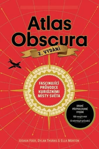
Atlas Obscura - Joshua Foer, kolektiv autorů
Atlas Obscura je průvodce představující přes 700 nejpodivuhodnějších a nejméně známých míst na planetě. Zahrnuje přírodní zázraky, bizarní lidské výtvory a tajemné lokality. Kniha slouží jako inspirace pro cestovatele hledající neobvyklé zážitky.
- Obsahuje více než 700 unikátních a kuriózních míst z celého světa.
- Inspiruje k objevování neznámých a nevyšlapaných cest.
- Bohatě ilustrovaný průvodce pro milovníky dobrodružství a záhad.
Objev podobné jako Atlas Obscura - Joshua Foer, kolektiv autorů

Philip's RGS Modern School Atlas
Britain's best-selling school atlas - now in its 101st edition Recommended for Key Stage 4, GCSE and A-Level in England and Wales (Scottish National Qualifications/Highers) and international schools Fully updated to reflect the latest changes in the curriculum Published in association with the Royal Geographical Society Combines superb digital maps of Britain and the world with up-to-date thematic maps Country-by-country statistics on population, land use, trade, tourism, energy, wealth and much more - World Themes Section - from volcanoes and earthquakes to population trends, languages and religions, all the key aspects and statistics of geography are explored and explained- Plus a special section on how satellite imagery is used to interpret global, environmental and urban patterns of change Britain's best-selling secondary school atlas, now in its 101st Edition. The contents are divided into colour-coded sections for rapid reference. The physical maps of the United Kingdom and Ireland are accompanied by thematic maps on numerous key social and economic themes. World topographical maps, with thematic maps on topics such as climate, population and economics, are followed by 30 pages of World thematic maps.Completing the atlas is a section of World social and economic statistics, and an index with letter-figure grid references ... Unknown localization key: "more"
Objev podobné jako Philip's RGS Modern School Atlas
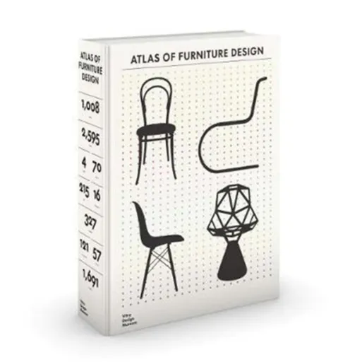
The Atlas of Furniture Design - Deyan Sudjic, Fulvio Ferrari, Mateo Kries, Wolf Tegethoff, Jochen Eisenbrand, Arthur Ruegg, Otakar Macel, Jane Pavitt,
In 2019, the Vitra Design Museum will publish the Atlas of Furniture Design, the definitive, encyclopedic overview of the history of modern furniture design. Featuring over 1700 objects by more than 500 designers and 121 manufacturers, it includes approximately 2800 images ranging from detailed object photographs to historical images documenting interiors, patents, brochures, and related works of art and architecture. The basis for the Atlas of Furniture Design is the collection held by the Vitra Design Museum, one of the largest of its kind with more than 7000 works. The book presents selected pieces by the most important designers of the last 230 years and documents key periods in design history, including early nineteenth-century industrial furniture in bentwood and metal, Art Nouveau and Secessionist pieces and works by protagonists of classical modernism and postwar design, as well as postmodern and contemporary pieces. The Atlas of Furniture Design employed a team of more than 70 experts and features over 550 detailed texts about key objects. In-depth essays provide sociocultural and design-historical context to four historical epochs of furniture design and the pieces highlighted here, enriched by a detailed annex containing designer biographies, glossaries, and elaborate information graphics. The Atlas of Furniture ... Unknown localization key: "more"
Objev podobné jako The Atlas of Furniture Design - Deyan Sudjic, Fulvio Ferrari, Mateo Kries, Wolf Tegethoff, Jochen Eisenbrand, Arthur Ruegg, Otakar Macel, Jane Pavitt,