philip s rgs infant school atlas david wright philip s maps rachel noonan
Philip's RGS Infant School Atlas - David Wright, Philip's Maps, Rachel Noonan
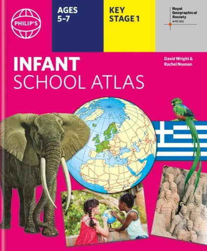
Written for 5 to 7 year-old this atlas is ideal for teaching Key Stage 1, helping to cover geography, history, science, citizenship and literacy requirements- Written by experts Professor David Wright and Rachel Noonan- Published in association with the Royal Geographical Society- 50 pages of clear, child-friendly maps showing our world today- Countries of the world brought to life with flags, illustrations and photos- Bold text, simple words and short sentences to encourage reading skills- Starts with the Earth as a Planet then zooms into each of the world''s regions with maps and illustrations- Numbered balloons on each map link to photos of a real placeFully revised and updated, the atlas is for children aged 5-7 in the early stages of reading, with simple text to explain what is happening on the maps and illustrations - all compatible with National Curriculum Key Stage 1.Clear, child-friendly maps are combined with vibrant photographs and facts about the world. Guidance is given at the beginning of the atlas on how to use the maps, encouraging the early development of map skills. Each colourful spread is illustrated with photographs and packed with fact boxes, curiosities, flags, stamps and simple quiz questions. Philip''s RGS Infant ... Unknown localization key: "more"
Objev podobné jako Philip's RGS Infant School Atlas - David Wright, Philip's Maps, Rachel Noonan
Philip's RGS Essential School Atlas - Philip's Maps
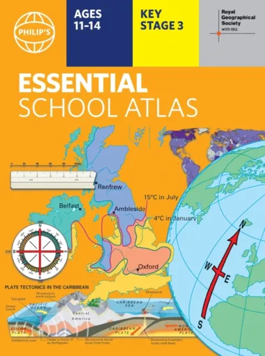
"An excellent world atlas. Very illuminating, good colours, clear texts...good glossary and, last but not least, up-to-date." - customer review- The ideal school atlas for Key Stage 3 pupils and Scotland''s National Qualifications, 11-14 years old- All updated for 2024 specifically to meet curriculum needs- Specially focused 16-page UK and Ireland section- Comprehensive 62-page world section includes thematic maps on the environment, climate change, people, quality of life, and energy- Published in association with the Royal Geographical SocietyPhilip''s RGS Essential School Atlas has been specially created for lower-secondary geography students (11-14 year olds). The maps have been carefully designed to be uncluttered and easy to read, containing specially selected place names and detail. A clear set of symbols and scale information accompanies every map, with a useful introductory section covering basic atlas skills, including aerial photographs and satellite images to further explain particular features on the maps. Latitude and longitude co-ordinates are included in the index, alongside figure-letter references. Fully up-to-date, the atlas includes detailed regional maps, charts and satellite images of Europe, Italy, the Middle East, China, Japan, Kenya, USA, Brazil, and the Arctic and Antarctica. It also focuses on areas of special interest for students of geography, such ... Unknown localization key: "more"
Objev podobné jako Philip's RGS Essential School Atlas - Philip's Maps

Philip's RGS Essential School Atlas - Philip's Maps
"An excellent world atlas. Very illuminating, good colours, clear texts...good glossary and, last but not least, up-to-date." - customer review- The ideal school atlas for Key Stage 3 pupils and Scotland''s National Qualifications, 11-14 years old- All updated for 2024 specifically to meet curriculum needs- Specially focused 16-page UK and Ireland section- Comprehensive 62-page world section includes thematic maps on the environment, climate change, people, quality of life, and energy- Published in association with the Royal Geographical SocietyPhilip''s RGS Essential School Atlas has been specially created for lower-secondary geography students (11-14 year olds). The maps have been carefully designed to be uncluttered and easy to read, containing specially selected place names and detail. A clear set of symbols and scale information accompanies every map, with a useful introductory section covering basic atlas skills, including aerial photographs and satellite images to further explain particular features on the maps. Latitude and longitude co-ordinates are included in the index, alongside figure-letter references. Fully up-to-date, the atlas includes detailed regional maps, charts and satellite images of Europe, Italy, the Middle East, China, Japan, Kenya, USA, Brazil, and the Arctic and Antarctica. It also focuses on areas of special interest for students of geography, such ... Unknown localization key: "more"
Objev podobné jako Philip's RGS Essential School Atlas - Philip's Maps
Podívejte se také
šipky s designem Peter Wright Snakebite
Summer Infant zavinovačky velikost S
Butter Kings deka Forest school
didaktická hra Cool School Naturo Mondo
Cool School Vegeto Mondo flóra planety
kadeřnické nůžky KIEPE School 5.5 palce
první díl série Bailey School Kids
věšák na boty Wenko Atlas
povlečení atlas grádl zelené
povlak na polštář 70x90 cm atlas grádl
povlečení atlas grádl pro ložnici
povlečení atlas grádl zelené 140x200 cm
luxusní bavlněné povlečení atlas grádl
povlak na přikrývku 140x200 z atlas grádlu
povlečení z 100% bavlny atlas grádl
povlečení atlas grádl starorůžová
Philip's RGS Junior School Atlas - Philip's Maps
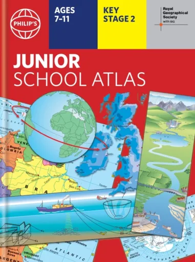
The 12th edition of the market-leading atlas for primary school pupils, Philip''s RGS Junior School Atlas has been fully revised and updated with all the latest facts and curriculum requirements.- The essential atlas for primary schools with clear and easy-to-follow maps and diagrams - updated for 2024/2025- Published in association with the Royal Geographical Society- Recommended for Key Stage 2 of the National Curriculum - and all 7-11 year olds - An excellent introduction to mapping concepts such as scale, direction, symbols, longitude and latitude- 22-page Britain and Ireland section with clear thematic charts, diagrams and large-scale regional maps- 22-page section on The World, with political maps - and thematic treatment of key themes, from volcanoes and earthquakes to transport and tourism- Continents section with physical and political maps- Easy-to-follow map references and 1,000-place indexThe introductory section describes the meaning of scale, how to measure distances using the maps, and explains the symbols on the maps.The following section is devoted to the United Kingdom and Ireland. Thematic maps cover topics such as mountains and rivers, climate and weather, population and cities, farming and fishing, industry and energy, transport, tourism and conservation. The rest of the atlas is made up of ... Unknown localization key: "more"
Objev podobné jako Philip's RGS Junior School Atlas - Philip's Maps
Philip's RGS Modern School Atlas - Philip's Maps
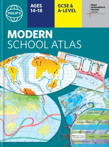
- Britain''s best-selling school atlas - now in its 101st edition- Recommended for Key Stage 4, GCSE and A-Level in England and Wales (Scottish National Qualifications/Highers) and international schools- Fully updated to reflect the latest changes in the curriculum- Published in association with the Royal Geographical Society- Combines superb digital maps of Britain and the world with up-to-date thematic maps - Country-by-country statistics on population, land use, trade, tourism, energy, wealth and much more - World Themes Section - from volcanoes and earthquakes to population trends, languages and religions, all the key aspects and statistics of geography are explored and explained- Plus a special section on how satellite imagery is used to interpret global, environmental and urban patterns of change Britain''s best-selling secondary school atlas, now in its 101st Edition. The contents are divided into colour-coded sections for rapid reference. The physical maps of the United Kingdom and Ireland are accompanied by thematic maps on numerous key social and economic themes. World topographical maps, with thematic maps on topics such as climate, population and economics, are followed by 30 pages of World thematic maps.Completing the atlas is a section of World social and economic statistics, and an index with letter-figure ... Unknown localization key: "more"
Objev podobné jako Philip's RGS Modern School Atlas - Philip's Maps

Philip's RGS Modern School Atlas
Britain's best-selling school atlas - now in its 101st edition Recommended for Key Stage 4, GCSE and A-Level in England and Wales (Scottish National Qualifications/Highers) and international schools Fully updated to reflect the latest changes in the curriculum Published in association with the Royal Geographical Society Combines superb digital maps of Britain and the world with up-to-date thematic maps Country-by-country statistics on population, land use, trade, tourism, energy, wealth and much more - World Themes Section - from volcanoes and earthquakes to population trends, languages and religions, all the key aspects and statistics of geography are explored and explained- Plus a special section on how satellite imagery is used to interpret global, environmental and urban patterns of change Britain's best-selling secondary school atlas, now in its 101st Edition. The contents are divided into colour-coded sections for rapid reference. The physical maps of the United Kingdom and Ireland are accompanied by thematic maps on numerous key social and economic themes. World topographical maps, with thematic maps on topics such as climate, population and economics, are followed by 30 pages of World thematic maps.Completing the atlas is a section of World social and economic statistics, and an index with letter-figure grid references ... Unknown localization key: "more"
Objev podobné jako Philip's RGS Modern School Atlas
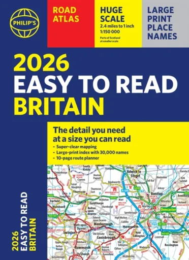
2026 Philip's Easy to Read Road Atlas of Britain - Philip's Maps
"The detail you need at a size you can read". The latest 2026 Philip''s Easy to Read Road Atlas of Britain from the best-selling Road Atlas range has over 350 pages packed with exceptionally clear mapping and everything you need for exploring Britain. Now available as a practical paperback, it will enhance any trip.· Clear maps packed with extra details for a better journey· Huge 1:150,000 scale (approx 2.4 miles to 1 inch)· Large print place names· Large print index· Super-clear 10-page route planner to create the best journeys· Thousands of attractions clearly mapped, including castles, theme parks, gardens, zoos and more.· London''s expanded ULEZ clearly shown on approach mapping· Over 100,000 copies of the Philip''s Easy Read Road Atlases of Britain sold since launch in 2020.At last, a road atlas that everyone can read easily, in or out of the car, no matter what the conditions. With up-to-date mapping technology, your travels have never been easier to plan. This edition contains a wealth of useful information, including tourist attractions, to ensure the best possible journey. Whether it''s dark, or if you just can''t find your glasses, the 2026 Philip''s Easy to Read Road Atlas of Britain is the ultimate ... Unknown localization key: "more"
Objev podobné jako 2026 Philip's Easy to Read Road Atlas of Britain - Philip's Maps
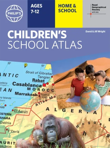
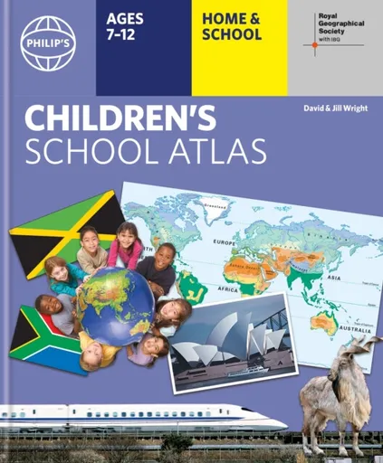
Philip's RGS Children's School Atlas - David Wright, Jill Wright
"This is such a great book for primary school age children and a little beyond for finding out about the world, its countries and people" Amazon customer review- Philip''s atlas, designed specially to use at home and at school with guidance for parents and teachers- Clear maps and fascinating facts bring geography to life for readers aged 7-12- Published by Philip''s the UK''s leading school atlas publisher, in association with the Royal Geographical Society- Quizzes, activity ideas and puzzles to make learning fun- Past winner of the Geographical Association''s award for making a significant contribution to geographyThe atlas is organized spread by spread in the classic sequence: first Europe, then its land neighbour Asia, followed by Africa, Australia and Oceania, North America and South America.Illustrated with captivating full-colour photographs and packed with fact boxes, curiosities, flags, stamps and quiz questions, Philip''s RGS Children''s Atlas is both fun to use and easy to understand.Now in its 16th edition, Philip''s RGS Children''s Atlas is a past winner of the Geographical Association''s award for making a significant contribution to geography. The atlas was judged "an excellent ''all round'' children''s atlas with simple yet well-designed maps, well-illustrated with colour photographs. It links places to ... Unknown localization key: "more"
Objev podobné jako Philip's RGS Children's School Atlas - David Wright, Jill Wright
Philip's RGS Children's School Atlas - David Wright, Jill Wright
"This is such a great book for primary school age children and a little beyond for finding out about the world, its countries and people" customer review- Philip''s atlas, designed specially to use at home and at school with guidance for parents and teachers- Clear maps and fascinating facts bring geography to life for readers aged 7-12- Published by Philip''s in association with the Royal Geographical Society- Quizzes, activity ideas and puzzles to make learning fun- Past winner of the Geographical Association''s award for making a significant contribution to geographyThe atlas is organized spread by spread in the classic sequence: first Europe, then its land neighbour Asia, followed by Africa, Australia and Oceania, North America and South America. Illustrated with captivating full-colour photographs and packed with fact boxes, curiosities, flags, stamps and quiz questions, Philip''s RGS Children''s Atlas is both fun to use and easy to understand.Now in its 17th edition, Philip''s RGS Children''s Atlas is a past winner of the Geographical Association''s award for making a significant contribution to geography. The atlas was judged "an excellent ''all round'' children''s atlas with simple yet well-designed maps, well-illustrated with colour photographs. It links places to issues, events and real people, giving ... Unknown localization key: "more"
Objev podobné jako Philip's RGS Children's School Atlas - David Wright, Jill Wright

Philip's RGS Children's School Atlas - David Wright, Jill Wright
"This is such a great book for primary school age children and a little beyond for finding out about the world, its countries and people" customer review- Philip''s atlas, designed to use at home and at school with guidance for parents and teachers- Clear maps and fascinating facts bring geography to life for readers aged 7-12- Published by Philip''s in association with the Royal Geographical Society- Quizzes, activity ideas and puzzles to make learning fun- Past winner of the Geographical Association''s award for making a significant contribution to geographyThe atlas is organized spread by spread in the classic sequence: first Europe, then its land neighbour Asia, followed by Africa, Australia and Oceania, North America and South America. Illustrated with captivating full-colour photographs and packed with fact boxes, curiosities, flags, stamps and quiz questions, Philip''s RGS Children''s Atlas is both fun to use and easy to understand.Now in its 17th edition, Philip''s RGS Children''s Atlas is a past winner of the Geographical Association''s award for making a significant contribution to geography. The atlas was judged "an excellent ''all round'' children''s atlas with simple yet well-designed maps, well-illustrated with colour photographs. It links places to issues, events and real people, giving a ... Unknown localization key: "more"
Objev podobné jako Philip's RGS Children's School Atlas - David Wright, Jill Wright
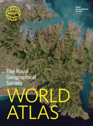
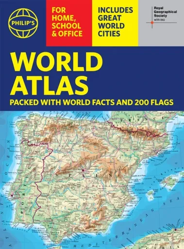
Philip's RGS World Atlas - Philip's Maps
"An excellent world atlas. Very illuminating, good colours, clear texts...good glossary and, last but not least, up-to-date". Amazon customer review· The perfect world atlas for work, study or leisure· Great value for money· 96 pages of authoritative world maps, physical and political· 70 city maps in the fascinating World Cities section, with full-page satellite images for 10 great cities· Over 35,000 place name indexAll this and a special 32-page introductory section - ''The World in Focus'' - covers key geographical themes such as the Earth''s position in the Solar System, the structure of the Earth, climate and weather, the environment, population, resources, economics and international organizations. Vital information on topics covered in geography, humanities and economics courses.The information-packed World Atlas from Philip''s, published in association with the Royal Geographical Society has been fully updated for this new, 2021 edition
Objev podobné jako Philip's RGS World Atlas - Philip's Maps
Philip's RGS World Atlas (A4) - Philip's Maps
Thousands of global facts at your fingertips with the best value quick-reference World Atlas on the market. Both physical and political geography is clearly illustrated alongside the great cities of our planet.The highest peak? The deepest ocean trench? The wettest, driest, longest, largest - we list the world''s fascinating extremes. Crammed with practical information like a Distance Chart for World Cities, World Time Zones, over 200 State Flags and the top 100 most populous countries, we include around 15,000 places indexed for easy checking. Whether for the pub quiz, travel planning or school reference, this great value handy world atlas is crammed with everything you need to know.Alongside the topography and physical attributes of the earth we also show political boundaries and the great global cities, including transport hubs and places of interest from mosques to temples, palaces to zoos and shopping centres to tourist information centres.Features include: * 200 Flags of the world''s major states and territories* 21 City centre maps: transport (road, rail, trams, light railways, bus and railway stations) and places of interest including religious buildings (churches, abbeys, cathedrals, synagogues, shrines, temples, mosques), museums, galleries, theatres, palaces, castles, parks, gardens, zoos, shopping centres, hospitals, Tourist Centres.* World ... Unknown localization key: "more"
Objev podobné jako Philip's RGS World Atlas (A4) - Philip's Maps

Philip's Caribbean Atlas for Secondary Schools - Philip's Maps
A new edition of the market-leading atlas for CXC Geography students, Philip''s Caribbean Atlas for Secondary Schools provides extensive coverage of the Caribbean area, together with a comprehensive selection of world and regional maps. The atlas is arranged in three sections for ease of use, with each page colour-coded for rapid reference. The first section is devoted to a detailed coverage of the Caribbean region in 48 pages, and includes maps of every island plus Belize and Guyana, as well as topographical, land use, tourism and mining maps.The second section is made up of 72 pages of World topographical maps, incorporating continental thematic maps on topics such as population, climate and biomes, followed by 32 pages of World thematic maps. This new 8th edition features updated mapping of all Caribbean islands, as well as the latest statistics. The World map section contains additional coverage of Brazil, the Americas and Asia, while the World thematic section includes maps on volcanoes, El Niño, tourism, energy, minerals, industry, trade and international organizations.Completing the atlas is a section of CXC study maps covering topics such as farming, soil conservation, economics, tourism and urban land use. Features regional studies of Mauritius, UK, Canada, USA and ... Unknown localization key: "more"
Objev podobné jako Philip's Caribbean Atlas for Secondary Schools - Philip's Maps
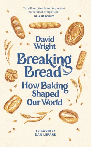
Breaking Bread - David Wright
‘An amazing book.’ Dan Lepard‘The rich and fascinating story of bread.’ Lily Vanilli‘A brilliant, timely and important book full of compassion.’ Olia Hercules‘A fascinating exploration of our universal love of bread. David traces the past, present and future of bread through his personal lens as a third generation baker.’ Edd KimberIn Breaking Bread, third generation baker, food writer and presenter David Wright examines the universal questions about bread and baking. About the people who make and shape the bread we buy and the difficulties that social and cultural change, food fads and health directives have had, and are having, on the baking industry. After his family bakery sadly closed its doors after seventy-five years, Wright asks if the the closure of the bakery underlines the very idea that bread is a dying foodstuff. Is bread good or bad? And what does the future hold for bread?Bread is an essential part of our story, our health, our very being. Every civilisation has a form of bread, and how we create, make and bake it, how we sell it and buy it, our food security, our access to it, affects everything: our physical and mental well-being, the ingredients, the seeds, the very ... Unknown localization key: "more"
Objev podobné jako Breaking Bread - David Wright
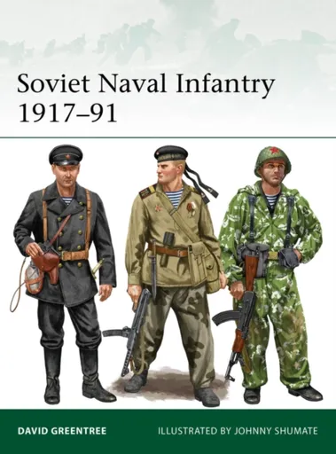
Soviet Naval Infantry 1917–91 - David Greentree
Drawing upon Soviet sources, this book assesses the evolving organization, uniforms, insignia, weaponry and personal equipment of Soviet naval infantry units from 1917 to 1991. Featuring eight plates of specially commissioned artwork alongside carefully chosen archive photographs, this study charts the history and appearance of the Soviet Union’s naval infantry, from the October Revolution to the end of the Soviet era. Although Russian naval infantry achieved fame during the October Revolution they were quickly disbanded, only being re-established in 1939. Following the Axis invasion of 1941 some 500,000 Soviet Navy personnel served on land, fighting in the defence of Leningrad, Odessa and Sevastopol and the recapture of the Crimea in 1943–44; Soviet naval troops also participated in the invasion of Manchuria in 1945. During the Cold War era the Soviet Union developed an amphibious assault capability that had a vital strategic role – to capture an aggressor’s geographical exits to the oceans and thereby forestall threats to Soviet submarine bases. Naval infantry forces could deploy a wealth of firepower assets, while the use of amphibious ships, hovercraft and helicopters aided their rapid deployment, even amid ice-bound terrain in the Arctic. All of these developments are described and illustrated in absorbing ... Unknown localization key: "more"
Objev podobné jako Soviet Naval Infantry 1917–91 - David Greentree
English Romantic Verse - David Wright
English Romantic poetry from its beginnings and its flowering to the first signs of its decadence. Nearly all the famous piéces de résistance will be found here - ''Intimations of Immortality'', ''The Ancient Mariner'', ''The Tyger'', excerpts from ''Don Juan'' - as well as some less familiar poems. As far as possible the poets are arranged in chronological order, and their poems in order of composition, beginning with eighteenth-century precursors such as Gray, Cowper, Burns and Chatterton. Naturally most space has been given over to the major Romantics - Blake, Wordsworth, Coleridge, Byron, Shelley, Clare and Keats - although their successors, poets such as Beddoes and Poe, are included too, as well as early poems by Tennyson and Browning. In an excellent introduction David Wright discusses the Romantics as a historical phenomenon, and points out their central ideals and themes.
Objev podobné jako English Romantic Verse - David Wright
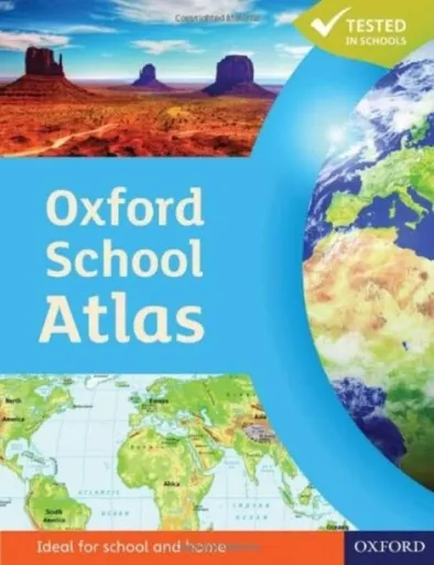
Oxford School Atlas - Wiegand Patrick
The Oxford School Atlas includes country data and easy-to-read colourful mapping, presented in an accessible visual layout based on research into how students use maps. The atlas covers key curriculum themes such as earthquakes and volcanoes, climate, economic activity, and development. It includes comprehensive coverage of the British Isles, and case studies of Italy, Kenya, Brazil, Japan, China, California, the Indian Ocean tsunami, Hurricane Katrina, and Antarctica.
Objev podobné jako Oxford School Atlas - Wiegand Patrick
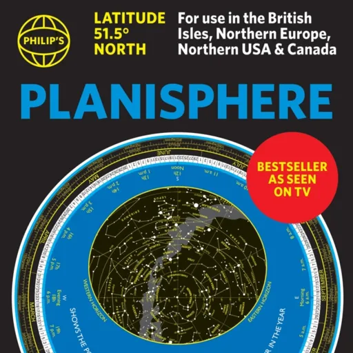
Philip's Planisphere (Latitude 51.5 North) - Philip's Maps
The first thing that every stargazer needs - an hour-by-hour and night-by-night moveable map of the stars ''A really useful bit of kit...a map of the night sky for any time of the year'' Mark Thompson, TV Astronomer on BBC Stargazing Live- Just turn the disc and ''dial up'' tonight''s night sky- Bestselling and accurate sky map for every hour of every night 24/7/365- Simple and fun to use for beginners - and an essential tool for experienced astronomers- All the stars and constellations down to magnitude 5 (visible with the naked eye)- Planet Tracker for the major visible planets - Full instructions and hints on exploring the skies by season - Suitable for UK, Ireland, Northern Europe, Canada and Northern USA (51.5N plus or minus 10 degrees)Philip''s have created a bestselling, practical, hour-by-hour tracker of the stars and constellations. Turn the oval panel to tonight''s date and time - and reveal the whole sky star by star visible from where you are. The map shows stars down to magnitude 5, plus several important deep-sky objects such as the Pleiades, the Andromeda Galaxy (M31) and the Orion Nebula (M42) The Planisphere is based at 51.5 degrees North. So it''s perfect ... Unknown localization key: "more"
Objev podobné jako Philip's Planisphere (Latitude 51.5 North) - Philip's Maps
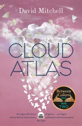
Cloud Atlas - David Mitchell
''ONE OF THE MOST BRILLIANTLY INVENTIVE WRITERS OF THIS, OR ANY, COUNTRY'' INDEPENDENTShortlisted for the Booker Prize, the James Tait Black Memorial Prize and the Arthur C. Clarke Award, winner of Richard & Judy Best Read of the Year and a BBC Two Between the Covers Book Club pick''Miraculous''SUNDAY TIMES''A masterful feast''EVENING STANDARD''Shamelessly exciting''SPECTATOR''Remarkable''GUARDIAN''Stunning''DAILY MAILA novel of mind-bending imagination and scope from the author of Ghostwritten and Utopia AvenueSouls cross ages like clouds cross skies . . .Six interlocking lives - one amazing adventure. In a narrative that circles the globe and reaches from the 19th century to a post-apocalyptic future, Cloud Atlas erases the boundaries of time, genre and language to offer an enthralling vision of humanity''s will to power, and where it will lead us.*Please note that the end of p. 39 and p. 40 are intentionally blank*PRAISE FOR DAVID MITCHELL''A thrilling and gifted writer''FINANCIAL TIMES''Dizzyingly, dazzlingly good''DAILY MAIL''Mitchell is, clearly, a genius''NEW YORK TIMES BOOK REVIEW''An author of extraordinary ambition and skill''INDEPENDENT ON SUNDAY''A superb storyteller''THE NEW YORKER
Objev podobné jako Cloud Atlas - David Mitchell
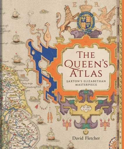
The Queen's Atlas - David Fletcher
Nowadays, we take for granted the ready availability of maps of all kinds. In mid-Tudor England, they were rare. All this was to change in 1579 when Christopher Saxton, a farmer from the West Riding of Yorkshire, became the first cartographer to make a published atlas of all the counties of England and Wales. This book traces the story of Saxton’s life and legacy by reconstructing his extraordinary mapmaking project alongside the crucial nature of the support and encouragement he received from Queen Elizabeth I and her court. Saxton’s atlas became the template for most detailed maps of the country for almost two centuries: it is hard to exaggerate its importance. For many, his atlas provided the first detailed image of England and Wales they had ever seen, showing the Elizabethan kingdom as a whole and in its constituent parts. This lavishly illustrated book reproduces all Saxton’s county maps together with many other illustrations revealing the forebears and successors to this groundbreaking work. Today, Saxton’s maps give us an invaluable cartographic snapshot of late Tudor England.
Objev podobné jako The Queen's Atlas - David Fletcher
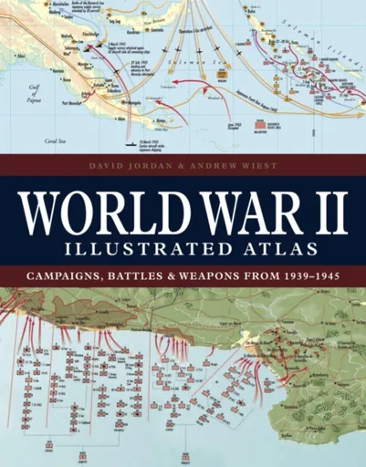
World War II Illustrated Atlas - David Jordan, Professor Andrew Wiest
This new edition of World War II Illustrated Atlas provides another 25 maps showing the key raids and battles of the war, ranging from the St Nazaire raid in 1942 to the battle for Corregidor in February 1945. World War II Illustrated Atlas is a comprehensive visual guide to this complex conflict. It plots the exact course of the land, sea, and air campaigns in fine detail, enabling the reader to trace the ebb and flow of the fortunes of both sides. With the aid of more than 180 full-color maps, every theater of war is covered. Contents include the land campaigns in Northwest Europe, Italy, North Africa, Russia, Southeast Asia and the Pacific; the naval war in the Atlantic and Mediterranean; the great carrier battles of the Pacific war; and the strategic bombing campaigns of Europe and the Pacific, culminating in the destruction of Hiroshima and Nagasaki. The isometric map views give a new perspective on the war, and are accompanied by detailed descriptions of the battles and raids along with photographs from the event.
Objev podobné jako World War II Illustrated Atlas - David Jordan, Professor Andrew Wiest
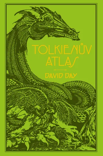
Tolkienův atlas - David Day
Tolkien? Pán Prstenů? Máme k němu mapu! Fiktivní svět J.R.R. Tolkiena je tak velký, jako lidská představivost, takže atlas poslouží jako užitečný průvodce. Berte tuto knihu jako vaši navigaci ke Středozemi a Zemím neumírajících. Najděte své Prsteny moci! Celobarevné mapy, obrázky a názorné popisy vytvářejí okouzlující odkaz ke všem fantastickým místům a bytostem, které vzešly z Tolkienova pera. Luxusní, tepelně leštěný obal z této knihy činí nádherný dodatek k vaší Tolkienovské sbírce. Tato kniha není oficiální a není autorizována společností Tolkien Estate ani HarperCollins Publishers.
Objev podobné jako Tolkienův atlas - David Day
Šipky RedDragon steel Peter Wright Snakebite Euro11, 24g, 85% wolfram (17436)
Šipky RedDragon steel Peter Wright Snakebite Euro11 jsou vyrobeny z 85% wolframu s ocelovým hrotem určeným pro sisalové terče. Každá šipka má hmotnost 24 gramů a balení obsahuje 3 kusy. Produkt je vhodný pro začínající i pokročilé hráče.
- Vyrobeno z 85% wolframu pro vyšší hustotu a přesnost
- Ocelový hrot (steeltip) vhodný pro klasické sisalové terče
- Univerzální váha 24 g vhodná pro různé styly hry
- Elegantní design zvyšující sebedůvěru hráče
Objev podobné jako Šipky RedDragon steel Peter Wright Snakebite Euro11, 24g, 85% wolfram (17436)

Stanex Povlečení atlas grádl tmavě šedá, 140 x 200 cm, 70 x 90 cm
Povlečení z atlas grádlu je vyrobeno ze 100% bavlny a nabízí pohodlí a hebkost. Tmavě šedý odstín a struktura proužků dodávají elegantní vzhled. Souprava obsahuje povlak na polštář 70x90 cm a povlak na přikrývku 140x200 cm.
- Vyrobeno ze 100% kvalitní bavlny pro mimořádnou hebkost
- Elegantní tmavě šedý odstín a struktura 2,5 cm proužků
- Snadná údržba – perte naruby bez bělidel
Objev podobné jako Stanex Povlečení atlas grádl tmavě šedá, 140 x 200 cm, 70 x 90 cm

Stanex Povlečení atlas grádl béžová, 140 x 200 cm, 70 x 90 cm
Povlečení z atlas grádlu je vyrobeno z 100% bavlny a nabízí pohodlí a hebkost. Béžový odstín a struktura proužků dodávají elegantní vzhled. Souprava obsahuje povlak na přikrývku 140x200 cm a povlak na polštář 70x90 cm.
- Vyrobeno ze 100% kvalitní bavlny pro mimořádnou hebkost.
- Elegantní design s 2,5 cm proužky a noblesním béžovým odstínem.
- Snadná údržba – perte naruby bez bělidel a chemických čistidel.
- Kompletní souprava obsahuje povlak na přikrývku i polštář.
Objev podobné jako Stanex Povlečení atlas grádl béžová, 140 x 200 cm, 70 x 90 cm

Stanex Povlečení atlas grádl světle šedá, 140 x 200 cm, 70 x 90 cm
Povlečení z atlas grádlu je vyrobeno z 100% bavlny a nabízí pohodlí a hebkost. Světle šedý odstín a struktura proužků dodávají elegantní vzhled. Souprava obsahuje povlak na přikrývku 140x200 cm a povlak na polštář 70x90 cm.
- Vyrobeno ze 100% kvalitní bavlny pro mimořádnou hebkost.
- Elegantní design s 2,5 cm proužky a světle šedým odstínem.
- Snadná údržba – doporučeno prát naruby bez agresivní chemie.
- Kompletní souprava obsahuje povlak na přikrývku i polštář.
Objev podobné jako Stanex Povlečení atlas grádl světle šedá, 140 x 200 cm, 70 x 90 cm

Stanex Povlečení atlas grádl smetanová, 140 x 220 cm, 70 x 90 cm
Povlečení z materiálu atlas grádl nabízí hebkost a pohodlí. Sada obsahuje povlak na přikrývku 140x220 cm a povlak na polštář 70x90 cm v smetanovém odstínu. Je vyrobeno z kvalitní bavlny a vyznačuje se elegantním designem s proužky.
- Vyrobeno ze 100% kvalitní bavlny pro maximální pohodlí
- Elegantní design s 2,5 cm proužky a noblesním smetanovým odstínem
- Snadná údržba - doporučeno prát naruby bez agresivní chemie
Objev podobné jako Stanex Povlečení atlas grádl smetanová, 140 x 220 cm, 70 x 90 cm

Stanex Povlečení atlas grádl starorůžová, 140 x 220 cm, 70 x 90 cm
Povlečení z materiálu atlas grádl nabízí hebkost a pohodlí díky 100% bavlně. Design s 2,5 cm proužky a starorůžovým odstínem přináší do ložnice noblesní vzhled. Souprava obsahuje povlak na přikrývku 140x220 cm a povlak na polštář 70x90 cm.
- Vyrobeno ze 100% kvalitní bavlny pro maximální pohodlí
- Elegantní starorůžový odstín a struktura proužků
- Snadná údržba - doporučeno prát naruby bez agresivní chemie
- Kompletní souprava obsahuje povlak na přikrývku i polštář
Objev podobné jako Stanex Povlečení atlas grádl starorůžová, 140 x 220 cm, 70 x 90 cm
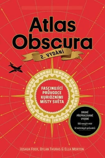
Atlas Obscura - Joshua Foer, kolektiv autorů
Atlas Obscura je průvodce představující přes 700 nejpodivuhodnějších a nejméně známých míst na planetě. Zahrnuje přírodní zázraky, bizarní lidské výtvory a tajemné lokality. Kniha slouží jako inspirace pro cestovatele hledající neobvyklé zážitky.
- Obsahuje více než 700 unikátních a kuriózních míst z celého světa.
- Inspiruje k objevování neznámých a nevyšlapaných cest.
- Bohatě ilustrovaný průvodce pro milovníky dobrodružství a záhad.
Objev podobné jako Atlas Obscura - Joshua Foer, kolektiv autorů
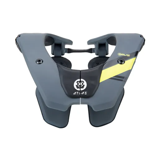
Dětský chránič krční páteře ATLAS Tyke Grey
Dětský chránič krční páteře ATLAS Tyke Grey je určen pro motokros, BMX, čtyřkolky a horská kola. Konstrukce Split-Flex Frame a systém ERS zajišťují pohyblivost a možnost rychlého odložení. Chránič zabraňuje hyperflexi, hyperextenzi a axiálnímu zatížení páteře.
- Patentovaná flexibilní konstrukce Split-Flex Frame pro maximální pohyblivost
- Systém ERS umožňující rychlé odložení chrániče při nehodě
- Široká kontaktní zóna a odpružení hrudní části pro vyšší bezpečnost
- Minimalistický design s nízkou hmotností (460 g) pro pohodlí dítěte
Objev podobné jako Dětský chránič krční páteře ATLAS Tyke Grey

Stanex Povlečení atlas grádl smetanová, 140 x 200 cm, 70 x 90 cm
Povlečení z atlas grádlu je vyrobeno ze 100% bavlny a nabízí pohodlí s hebkou strukturou. Smetanový odstín a proužkový design přináší do ložnice eleganci. Souprava obsahuje povlak na polštář 70x90 cm a povlak na přikrývku 140x200 cm.
- Vyrobeno z 100% kvalitní bavlny pro mimořádnou hebkost
- Elegantní struktura 2,5 cm proužků podtrhne design
- Smetanový odstín dodá ložnici noblesní vzhled
- Snadná údržba - doporučeno prát naruby bez bělidel
Objev podobné jako Stanex Povlečení atlas grádl smetanová, 140 x 200 cm, 70 x 90 cm

Stanex Povlečení atlas grádl světle šedá, 140 x 220 cm, 70 x 90 cm
Povlečení Stanex z atlas grádlu je vyrobeno z 100% bavlny a nabízí pohodlí s elegantním designem proužků. Světle šedý odstín dodá ložnici noblesní vzhled. Sada obsahuje povlak na přikrývku 140 x 220 cm a povlak na polštář 70 x 90 cm.
- Vyrobeno ze 100% kvalitní bavlny pro mimořádnou hebkost.
- Elegantní design s 2,5 cm proužky a světle šedým odstínem.
- Snadná údržba – perte naruby bez agresivní chemie.
- Kompletní sada obsahuje povlak na přikrývku i polštář.
Objev podobné jako Stanex Povlečení atlas grádl světle šedá, 140 x 220 cm, 70 x 90 cm
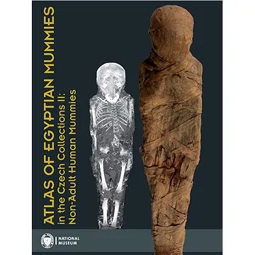
Atlas of Egyptian Mummies in the Czech Collections II: Non-Adult Human Mummies (978-80-7036-750-6)
Druhý díl série Atlas egyptských mumií v českých sbírkách se specializuje na mumie a pohřební vybavení dětí a dospívajících do 15 let. Obsahuje podrobný katalog dvou kompletních mumií, dvanácti izolovaných částí a šesti pohřebních schránek. Publikace přináší informace o zdravotním stavu, nemocech a pohřebních praktikách dětí ve starověkém Egyptě.
- Druhý díl odborné série o egyptských mumiích
- Zaměření na mumie dětí a dospívajících do 15 let
- Podrobný katalog s proveniencí a zdravotními analýzami
- Vědecky hodnotný materiál z Národního muzea v Praze
Objev podobné jako Atlas of Egyptian Mummies in the Czech Collections II: Non-Adult Human Mummies (978-80-7036-750-6)

Stanex Povlečení atlas grádl starorůžová, 140 x 200 cm, 70 x 90 cm
Povlečení z atlas grádlu je vyrobeno ze 100% bavlny a nabízí pohodlí a hebkost. Souprava obsahuje povlak na přikrývku 140 x 200 cm a povlak na polštář 70 x 90 cm. Elegantní design s proužkovou strukturou a starorůžovým odstínem dodává ložnici noblesní vzhled.
- Vyrobeno ze 100% kvalitní bavlny pro mimořádnou hebkost.
- Elegantní design s 2,5 cm proužkovou strukturou.
- Starorůžový odstín dodává ložnici noblesní vzhled.
- Snadná údržba - doporučeno prát naruby bez bělidel.
Objev podobné jako Stanex Povlečení atlas grádl starorůžová, 140 x 200 cm, 70 x 90 cm
The Atlas Maneuver - Steve Berry
Román představuje nové dobrodružství Cottona Malonea, který se zaplete do pátrání po legendárním japonském válečném pokladu zvaném Yamashitovo zlato. Příběh propojuje historické události z konce druhé světové války se současnou hrozbou zneužití kryptoměn k narušení globálního finančního systému. Děj zavede čtenáře do Švýcarska, Lucemburska a marockých hor v honbě za odhalením konspirace známé jako Atlasovo manévr.
- Nejnovější díl oblíbené série Cotton Malone
- Napínavý příběh kombinující historická fakta a fikci
- Rychlý spád děje s mezinárodním přesahem
- Aktuální téma kryptoměn v thrillerovém kontextu
Objev podobné jako The Atlas Maneuver - Steve Berry
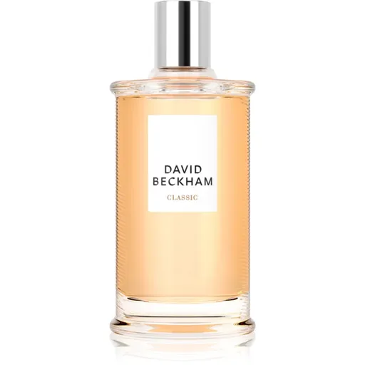
David Beckham Classic toaletní voda pro muže 100 ml
David Beckham Classic je mužská toaletní voda uvedená na trh v roce 2013. Vůni vytvořil parfumér Aurélio Guichard a kombinuje ovocné tóny gin-limetka s kořeněnými a dřevitými akcenty. Produkt je dodáván v elegantním flakonu odpovídajícím image značky.
- Charismatická vůně inspirovaná osobností Davida Beckhama
- Moderní elegantní flakon odpovídající prémiovému image
- Univerzální ovocně-kořeněná kompozice vhodná pro různé příležitosti
- Dlouhodobě oblíbená vůně na trhu od roku 2013
Objev podobné jako David Beckham Classic toaletní voda pro muže 100 ml
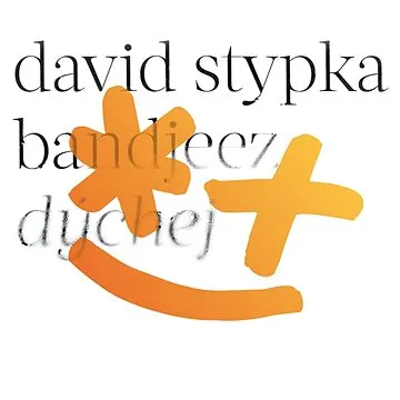
Stypka David: Dýchej - CD (3858425)
Hudební CD s posmrtným albem Davida Stypky z roku 2021. Album obsahuje 11 skladeb včetně písní Dýchej, Farmářům a O lítání. Jedná se o fyzické vydání na kompaktním disku.
- Posmrtné album z roku 2021 od Davida Stypky
- Obsahuje 11 skladeb včetně hitů Dýchej a Farmářům
- Fyzické CD pro sběratele a fanoušky
- Kvalitní zvukové provedení na CD nosiči
Objev podobné jako Stypka David: Dýchej - CD (3858425)
David Beckham Instinct parfémovaná voda pro muže 50 ml
David Beckham Instinct je parfémovaná voda pro muže uvedená na trh v roce 2005. Vůně kombinuje svěží citrusové tóny bergamotu s teplými kořeněnými akcenty kardamomu a zemitým podkladem pačuli. Produkt je dodáván v 50ml elegantním flakonu.
- Svěží fougère vůně s citrusovými tóny
- Elegantní flakon s ikonickým designem
- Dlouhotrvající pocit energie a sebevědomí
- Vhodná pro každodenní nošení
Objev podobné jako David Beckham Instinct parfémovaná voda pro muže 50 ml
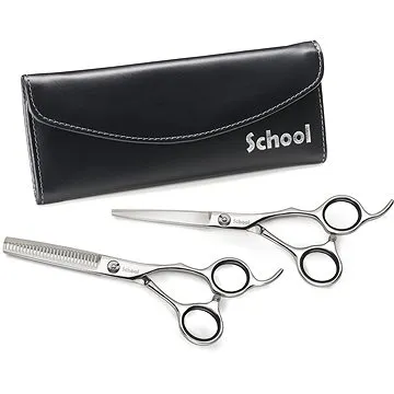
KIEPE Nůžky na vlasy Sada School 5.5“ + Efilační nůžky 5.5“ (8008981910617)
Sada KIEPE obsahuje profesionální kadeřnické nůžky o délce 14 cm a efilační nůžky se 32 zuby, vhodné pro začátečníky a výuku. Oba kusy jsou vyrobeny z tvrzené nerezové oceli a mají semi-offset typ držení. Součástí balení je černé koženkové pouzdro s logem.
- Kompletní sada pro začínající kadeřníky obsahující střihací i efilační nůžky
- Vyrobeno z kvalitní tvrzené nerezové oceli pro dlouhou životnost
- Pohodlné semi-offset držení snižující únavu při práci
- Elegantní koženkové pouzdro s patentkou pro bezpečné uložení a přenášení
Objev podobné jako KIEPE Nůžky na vlasy Sada School 5.5“ + Efilační nůžky 5.5“ (8008981910617)
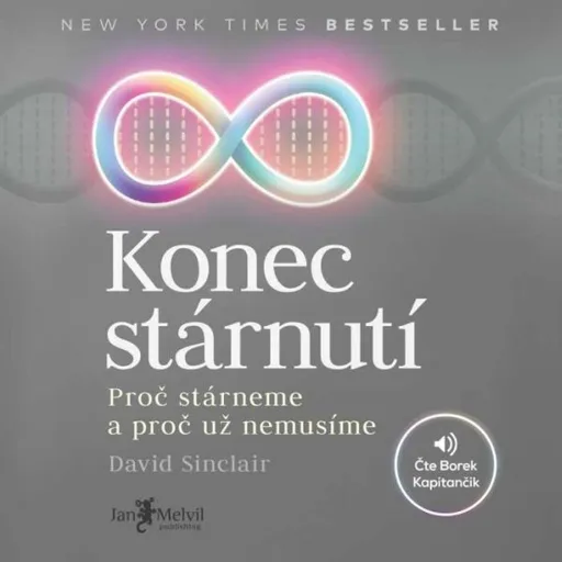
Konec stárnutí - David Sinclair - audiokniha
Audiokniha představuje revoluční pohled na stárnutí jako na léčitelnou nemoc. Shrnuje nejnovější vědecké poznatky a klinické studie o mechanismech stárnutí. Nabízí praktické strategie, jak proces stárnutí zpomalit a prodloužit si zdravá a vitální léta života.
- Autorita v oboru – autor je přední světový odborník na dlouhověkost.
- Aktuální vědecké poznatky – shrnuje nejnovější výzkumy a klinické studie.
- Praktický přínos – nabízí konkrétní strategie pro zpomalení stárnutí.
- Poutavé podání – komplexní téma podáno srozumitelně a strhujícím způsobem.
Objev podobné jako Konec stárnutí - David Sinclair - audiokniha
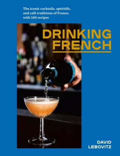
Drinking French - David Lebovitz
Kniha Drinking French od Davida Lebovitze představuje více než 160 receptů na francouzské nápoje včetně kávy, čaje, aperitivů a moderních koktejlů. Obsahuje také recepty na slané svačiny, které se tradičně podávají k pití. Autor doplňuje recepty osobními příběhy a tipy z francouzské pitné kultury.
- Více než 160 autentických receptů na francouzské nápoje
- Krásné fotografie z Paříže a Francie
- Praktické tipy a příběhy o francouzské kultuře pití
- Recepty na slané svačiny k nápojům
Objev podobné jako Drinking French - David Lebovitz
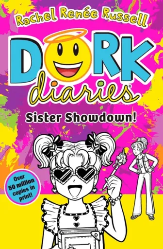
Dork Diaries: Sister Showdown - Rachel Renée Russellová
Kniha Dork Diaries: Sister Showdown je dalším dílem populární série deníkových příběhů Nikki Maxwell. Hlavní hrdinka se musí vypořádat s otravnou mladší sestrou a zároveň se připravit na novou školu. Příběh kombinuje humor, školní drama a téma přátelství.
- Nové dobrodružství v oblíbené sérii
- Vtipný a autentický příběh pro dívky
- Ideální čtení pro fanoušky deníkových příběhů
- Poutavé ilustrace a zábavný formát
Objev podobné jako Dork Diaries: Sister Showdown - Rachel Renée Russellová
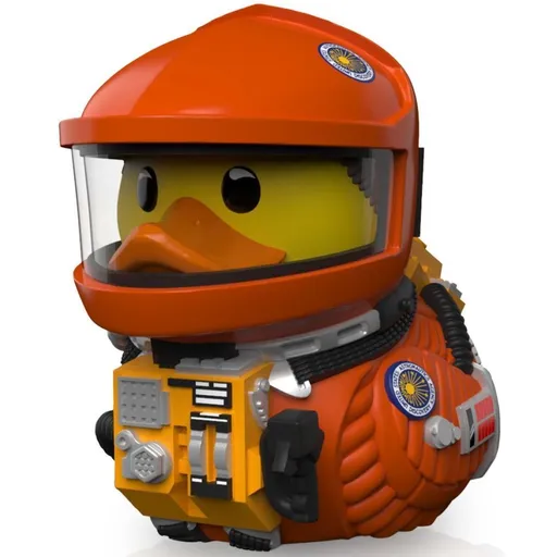
Tubbz kachnička Kubrick Space Odyssey - Dr David Bowman
Tubbz kachnička představuje Dr. Davida Bowmana z filmu Vesmírná odysea v podobě 9 cm vysoké figurky. Figurka je vyrobena z PVC s detailním provedením oranžového skafandru. Produkt je určen výhradně pro sběratelské účely a není určen k plavání.
- Věrná replika ikonického oranžového skafandru z filmu
- Vysoká kvalita zpracování z PVC materiálu
- Kompaktní velikost 9 cm vhodná do sbírky
- Originální dárek pro fanoušky sci-fi a Kubricka
Objev podobné jako Tubbz kachnička Kubrick Space Odyssey - Dr David Bowman

Bowie David: The Man Who Sold The World - LP (9029513293)
Reedice třetího studiového alba Davida Bowieho původně vydaného v roce 1970. Album představuje přechod od folkové polohy k tvrdšímu rockovému zvuku. Na picture discu je k dispozici remasterovaná verze z roku 2015 vydaná u příležitosti padesátého výročí britského vydání.
- Remasterovaná verze z roku 2015 na picture discu
- Limitovaná edice k 50. výročí britského vydání
- Kvalitní zpracování pro sběratele vinylů
- Historický přechod v Bowieho tvorbě
Objev podobné jako Bowie David: The Man Who Sold The World - LP (9029513293)
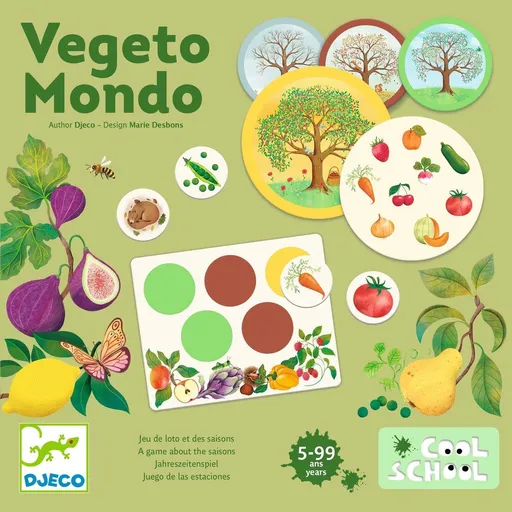
Loto hra Cool School Vegeto Mondo
Didaktická loto hra zaměřená na flóru planety učí děti přiřazovat ovoce a zeleninu k ročním obdobím. Sada obsahuje 6 bingo desek, 4 sezónní karty, 36 žetonů zvířat a látkovou tašku. Hra je vhodná pro děti od 5 let, trvá přibližně 15 minut a je vyrobena z certifikovaných materiálů.
- Rozvíjí znalosti o ročních obdobích a plodech země
- Citlivé ilustrace flóry podporují vztah k přírodě
- Kvalitní materiál s ekologickou certifikací FSC
- Vhodné pro samostatnou i skupinovou hru (1-6 hráčů)
Objev podobné jako Loto hra Cool School Vegeto Mondo
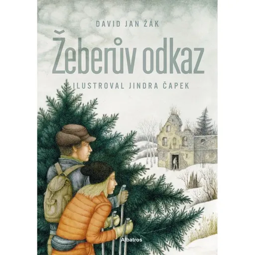
Žeberův odkaz David Jan Žák
Druhý díl dobrodružné série, ve kterém skupina dětí pátrá po zmizelém kamarádovi Edwinovi a zároveň po průchodech do tajemného světa Trombů. Příběh se točí kolem záhadného pokladu a rozpadlého přátelství. Kniha je určena pro čtenáře od 10 let, má 184 stran a je v češtině.
- Druhý díl oblíbené dobrodružné série.
- Vhodné pro čtenáře od 10 let, podporuje čtenářství.
- Kvalitní vázaná vazba s laminovaným potahem pro delší životnost.
- Ilustrace Jindry Čapka doplňují atmosféru příběhu.
Objev podobné jako Žeberův odkaz David Jan Žák
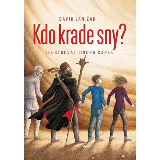
Kdo krade sny? David Jan Žák
Třetí díl série z tajemného světa Trombů, kde Edwin a jeho přátelé jsou přeneseni do paralelního světa plného nástrah. Musí překonat nebezpečí pomocí odvahy a důvtipu, aby porazili krále Klamma a zachránili Edwinovu maminku. Kniha má 192 stran a je určena dětem od 10 let.
- Třetí díl populární dobrodružné série
- Ilustrace od Jindry Čapka
- Vhodné pro čtenáře od 10 let
- Vázaná vazba s laminovaným přebalem
Objev podobné jako Kdo krade sny? David Jan Žák
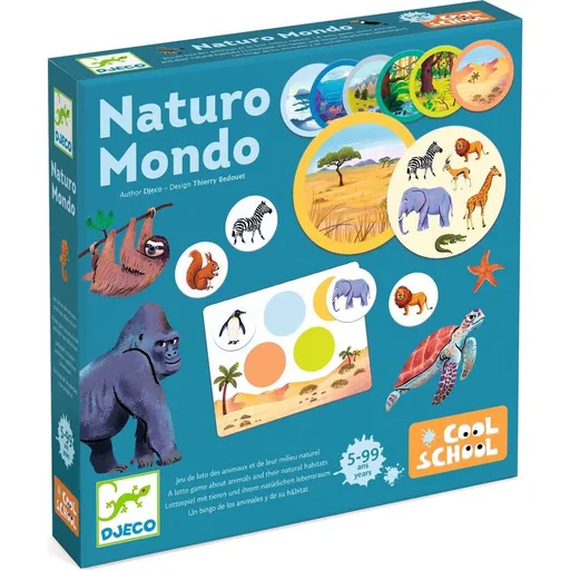
Loto hra Cool School Naturo Mondo
Loto hra Cool School Naturo Mondo je didaktická hra zaměřená na faunu planety. Děti se pomocí herních desek, karet prostředí a žetonů seznamují s přirozeným prostředím zvířat v různých ekosystémech. Hra je určena pro 1-6 hráčů od 5 let a je vyrobena z certifikovaného papíru a lepenky.
- Seznamuje děti s faunou a ekosystémy celé planety
- Výuková hra s citlivými ilustracemi zvířat
- Vyrobeno z certifikovaného materiálu FSC
- Vhodné pro 1-6 hráčů od 5 let, hra trvá cca 15 minut
Objev podobné jako Loto hra Cool School Naturo Mondo
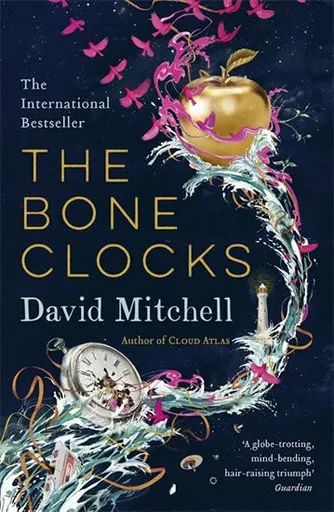
The Bone Clocks - David Mitchell
Román sleduje život Holly Sykes od dospívání, kdy její rozhodnutí spustí řetězec událostí v tajném nadpřirozeném konfliktu. Příběh se odehrává v průběhu šesti desetiletí a kombinuje prvky metafyzického thrilleru s úvahami o smrtelnosti. Kniha získala ocenění World Fantasy Award a byla nominována na Bookerovu cenu.
- Oceněný román World Fantasy Award
- Epický příběh s časovým rozsahem šesti dekád
- Kaleidoskopický a brilantně vynalézavý styl
- Metafyzický thriller s hlubokou úvahou o přežití
Objev podobné jako The Bone Clocks - David Mitchell
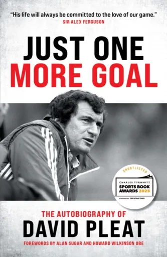
Just One More Goal - David Pleat
Autobiografie Davida Pleata mapuje jeho celoživotní vášeň pro fotbal a zároveň analyzuje proměnu tohoto sportu. Kniha zachycuje posun od spontánní hry k techničtější a chladnější podobě moderního fotbalu. Poskytuje odpověď na otázku, jak se fotbal vyvinul do své současné podoby.
- Autentický pohled dlouholetého fotbalového odborníka
- Analýza přerodu fotbalu z instinktivní hry na technickou disciplínu
- Poutavé vyprávění kombinující osobní příběh s vývojem sportu
- Ideální čtení pro fanoušky hledající hlubší porozumění fotbalu
Objev podobné jako Just One More Goal - David Pleat