2026 philip s easy to read road atlas of britain philip s maps
2026 Philip's Easy to Read Road Atlas of Britain - Philip's Maps
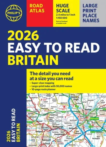
"The detail you need at a size you can read". The latest 2026 Philip''s Easy to Read Road Atlas of Britain from the best-selling Road Atlas range has over 350 pages packed with exceptionally clear mapping and everything you need for exploring Britain. Now available as a practical paperback, it will enhance any trip.· Clear maps packed with extra details for a better journey· Huge 1:150,000 scale (approx 2.4 miles to 1 inch)· Large print place names· Large print index· Super-clear 10-page route planner to create the best journeys· Thousands of attractions clearly mapped, including castles, theme parks, gardens, zoos and more.· London''s expanded ULEZ clearly shown on approach mapping· Over 100,000 copies of the Philip''s Easy Read Road Atlases of Britain sold since launch in 2020.At last, a road atlas that everyone can read easily, in or out of the car, no matter what the conditions. With up-to-date mapping technology, your travels have never been easier to plan. This edition contains a wealth of useful information, including tourist attractions, to ensure the best possible journey. Whether it''s dark, or if you just can''t find your glasses, the 2026 Philip''s Easy to Read Road Atlas of Britain is the ultimate ... Unknown localization key: "more"
Objev podobné jako 2026 Philip's Easy to Read Road Atlas of Britain - Philip's Maps
Philip's RGS Infant School Atlas - David Wright, Philip's Maps, Rachel Noonan
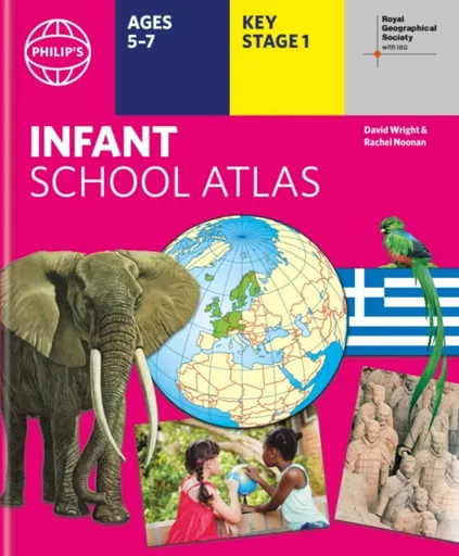
Written for 5 to 7 year-old this atlas is ideal for teaching Key Stage 1, helping to cover geography, history, science, citizenship and literacy requirements- Written by experts Professor David Wright and Rachel Noonan- Published in association with the Royal Geographical Society- 50 pages of clear, child-friendly maps showing our world today- Countries of the world brought to life with flags, illustrations and photos- Bold text, simple words and short sentences to encourage reading skills- Starts with the Earth as a Planet then zooms into each of the world''s regions with maps and illustrations- Numbered balloons on each map link to photos of a real placeFully revised and updated, the atlas is for children aged 5-7 in the early stages of reading, with simple text to explain what is happening on the maps and illustrations - all compatible with National Curriculum Key Stage 1.Clear, child-friendly maps are combined with vibrant photographs and facts about the world. Guidance is given at the beginning of the atlas on how to use the maps, encouraging the early development of map skills. Each colourful spread is illustrated with photographs and packed with fact boxes, curiosities, flags, stamps and simple quiz questions. Philip''s RGS Infant ... Unknown localization key: "more"
Objev podobné jako Philip's RGS Infant School Atlas - David Wright, Philip's Maps, Rachel Noonan
A History of Britain in 100 Maps - Jeremy Black
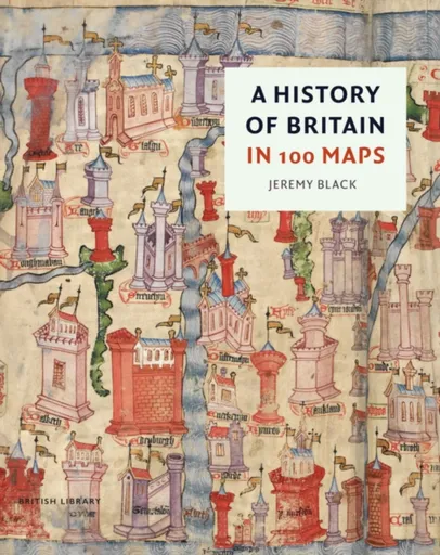
In A History of Britain in 100 Maps Jeremy Black takes readers deep into the unparalleled collections of the British Library Map Room to tell a new story of the British Isles through acknowledged treasures and previously undiscovered and unpublished items.
Objev podobné jako A History of Britain in 100 Maps - Jeremy Black
Podívejte se také
kalhoty na motorku pro styl Road
Sebring Road Performance 88 V
Hexbug Hexmods Pro Series žlutý off-road truck
Panini FIFA 365 2025-2026 Adrenalyn startovní sada
24 karet Panini Adrenalyn 2025-2026
Panini FIFA 365 2025-2026 Adrenalyn Premium Packet karty
sběratelské karty Panini FIFA 365 2025/2026
Panini Adrenalyn 2025-2026 CORE SPECIAL LIMITED karty
RC auto off road modré
off road auto s dosahem 40 metrů
PANINI FIFA 365 ADRENALYN FATPACK 2025 2026
Panini FIFA 365 2025-2026 Adrenalyn plechová krabička
Panini FIFA 365 karty 2025-2026
jungle off-road vozidlo pro děti
Panini FIFA 365 2025-2026 Adrenalyn zlatý balíček
Panini Adrenalyn 2025/2026 prémiový balíček
ERV Holy Bible Gospel of Matthew Paperback, Anglicized, (Easy to Read Version)
The fully anglicized text uses the accurate and accessible ERV (Easy-to-Read Version) translation. The contemporary language makes this gospel easy to get into, so that you can get a lot out of it!
Objev podobné jako ERV Holy Bible Gospel of Matthew Paperback, Anglicized, (Easy to Read Version)
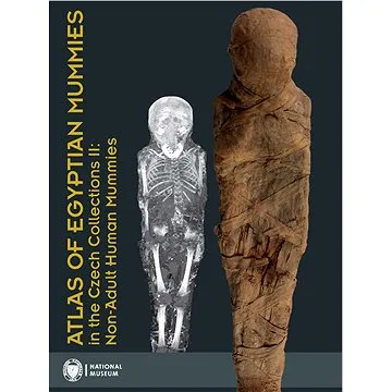
Atlas of Egyptian Mummies in the Czech Collections II: Non-Adult Human Mummies (978-80-7036-750-6)
Druhý díl série Atlas egyptských mumií v českých sbírkách se specializuje na mumie a pohřební vybavení dětí a dospívajících do 15 let. Obsahuje podrobný katalog dvou kompletních mumií, dvanácti izolovaných částí a šesti pohřebních schránek. Publikace přináší informace o zdravotním stavu, nemocech a pohřebních praktikách dětí ve starověkém Egyptě.
- Druhý díl odborné série o egyptských mumiích
- Zaměření na mumie dětí a dospívajících do 15 let
- Podrobný katalog s proveniencí a zdravotními analýzami
- Vědecky hodnotný materiál z Národního muzea v Praze
Objev podobné jako Atlas of Egyptian Mummies in the Czech Collections II: Non-Adult Human Mummies (978-80-7036-750-6)
ERV Holy Bible Hardback Floral, Anglicized, (Easy to Read Version)
The fully anglicized text uses the accurate and accessible ERV (Easy-to-Read Version) translation. The contemporary language makes the ERV Holy Bible easy to get into, so that you can get a lot out of it!
Objev podobné jako ERV Holy Bible Hardback Floral, Anglicized, (Easy to Read Version)
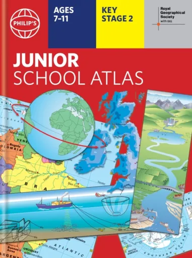
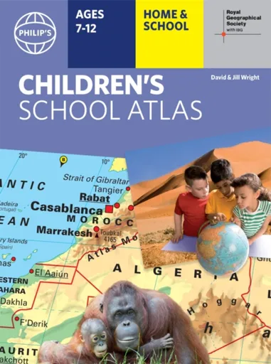
Philip's RGS Junior School Atlas - Philip's Maps
The 12th edition of the market-leading atlas for primary school pupils, Philip''s RGS Junior School Atlas has been fully revised and updated with all the latest facts and curriculum requirements.- The essential atlas for primary schools with clear and easy-to-follow maps and diagrams - updated for 2024/2025- Published in association with the Royal Geographical Society- Recommended for Key Stage 2 of the National Curriculum - and all 7-11 year olds - An excellent introduction to mapping concepts such as scale, direction, symbols, longitude and latitude- 22-page Britain and Ireland section with clear thematic charts, diagrams and large-scale regional maps- 22-page section on The World, with political maps - and thematic treatment of key themes, from volcanoes and earthquakes to transport and tourism- Continents section with physical and political maps- Easy-to-follow map references and 1,000-place indexThe introductory section describes the meaning of scale, how to measure distances using the maps, and explains the symbols on the maps.The following section is devoted to the United Kingdom and Ireland. Thematic maps cover topics such as mountains and rivers, climate and weather, population and cities, farming and fishing, industry and energy, transport, tourism and conservation. The rest of the atlas is made up of ... Unknown localization key: "more"
Objev podobné jako Philip's RGS Junior School Atlas - Philip's Maps
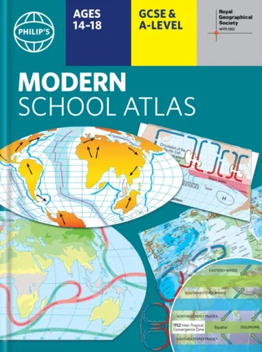
Philip's RGS Modern School Atlas - Philip's Maps
- Britain''s best-selling school atlas - now in its 101st edition- Recommended for Key Stage 4, GCSE and A-Level in England and Wales (Scottish National Qualifications/Highers) and international schools- Fully updated to reflect the latest changes in the curriculum- Published in association with the Royal Geographical Society- Combines superb digital maps of Britain and the world with up-to-date thematic maps - Country-by-country statistics on population, land use, trade, tourism, energy, wealth and much more - World Themes Section - from volcanoes and earthquakes to population trends, languages and religions, all the key aspects and statistics of geography are explored and explained- Plus a special section on how satellite imagery is used to interpret global, environmental and urban patterns of change Britain''s best-selling secondary school atlas, now in its 101st Edition. The contents are divided into colour-coded sections for rapid reference. The physical maps of the United Kingdom and Ireland are accompanied by thematic maps on numerous key social and economic themes. World topographical maps, with thematic maps on topics such as climate, population and economics, are followed by 30 pages of World thematic maps.Completing the atlas is a section of World social and economic statistics, and an index with letter-figure ... Unknown localization key: "more"
Objev podobné jako Philip's RGS Modern School Atlas - Philip's Maps

Philip's Caribbean Atlas for Secondary Schools - Philip's Maps
A new edition of the market-leading atlas for CXC Geography students, Philip''s Caribbean Atlas for Secondary Schools provides extensive coverage of the Caribbean area, together with a comprehensive selection of world and regional maps. The atlas is arranged in three sections for ease of use, with each page colour-coded for rapid reference. The first section is devoted to a detailed coverage of the Caribbean region in 48 pages, and includes maps of every island plus Belize and Guyana, as well as topographical, land use, tourism and mining maps.The second section is made up of 72 pages of World topographical maps, incorporating continental thematic maps on topics such as population, climate and biomes, followed by 32 pages of World thematic maps. This new 8th edition features updated mapping of all Caribbean islands, as well as the latest statistics. The World map section contains additional coverage of Brazil, the Americas and Asia, while the World thematic section includes maps on volcanoes, El Niño, tourism, energy, minerals, industry, trade and international organizations.Completing the atlas is a section of CXC study maps covering topics such as farming, soil conservation, economics, tourism and urban land use. Features regional studies of Mauritius, UK, Canada, USA and ... Unknown localization key: "more"
Objev podobné jako Philip's Caribbean Atlas for Secondary Schools - Philip's Maps
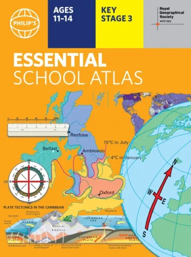
Philip's RGS Essential School Atlas - Philip's Maps
"An excellent world atlas. Very illuminating, good colours, clear texts...good glossary and, last but not least, up-to-date." - customer review- The ideal school atlas for Key Stage 3 pupils and Scotland''s National Qualifications, 11-14 years old- All updated for 2024 specifically to meet curriculum needs- Specially focused 16-page UK and Ireland section- Comprehensive 62-page world section includes thematic maps on the environment, climate change, people, quality of life, and energy- Published in association with the Royal Geographical SocietyPhilip''s RGS Essential School Atlas has been specially created for lower-secondary geography students (11-14 year olds). The maps have been carefully designed to be uncluttered and easy to read, containing specially selected place names and detail. A clear set of symbols and scale information accompanies every map, with a useful introductory section covering basic atlas skills, including aerial photographs and satellite images to further explain particular features on the maps. Latitude and longitude co-ordinates are included in the index, alongside figure-letter references. Fully up-to-date, the atlas includes detailed regional maps, charts and satellite images of Europe, Italy, the Middle East, China, Japan, Kenya, USA, Brazil, and the Arctic and Antarctica. It also focuses on areas of special interest for students of geography, such ... Unknown localization key: "more"
Objev podobné jako Philip's RGS Essential School Atlas - Philip's Maps
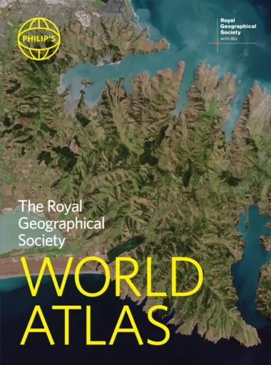
Philip's RGS World Atlas - Philip's Maps
"An excellent world atlas. Very illuminating, good colours, clear texts...good glossary and, last but not least, up-to-date". Amazon customer review· The perfect world atlas for work, study or leisure· Great value for money· 96 pages of authoritative world maps, physical and political· 70 city maps in the fascinating World Cities section, with full-page satellite images for 10 great cities· Over 35,000 place name indexAll this and a special 32-page introductory section - ''The World in Focus'' - covers key geographical themes such as the Earth''s position in the Solar System, the structure of the Earth, climate and weather, the environment, population, resources, economics and international organizations. Vital information on topics covered in geography, humanities and economics courses.The information-packed World Atlas from Philip''s, published in association with the Royal Geographical Society has been fully updated for this new, 2021 edition
Objev podobné jako Philip's RGS World Atlas - Philip's Maps
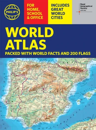
Philip's RGS World Atlas (A4) - Philip's Maps
Thousands of global facts at your fingertips with the best value quick-reference World Atlas on the market. Both physical and political geography is clearly illustrated alongside the great cities of our planet.The highest peak? The deepest ocean trench? The wettest, driest, longest, largest - we list the world''s fascinating extremes. Crammed with practical information like a Distance Chart for World Cities, World Time Zones, over 200 State Flags and the top 100 most populous countries, we include around 15,000 places indexed for easy checking. Whether for the pub quiz, travel planning or school reference, this great value handy world atlas is crammed with everything you need to know.Alongside the topography and physical attributes of the earth we also show political boundaries and the great global cities, including transport hubs and places of interest from mosques to temples, palaces to zoos and shopping centres to tourist information centres.Features include: * 200 Flags of the world''s major states and territories* 21 City centre maps: transport (road, rail, trams, light railways, bus and railway stations) and places of interest including religious buildings (churches, abbeys, cathedrals, synagogues, shrines, temples, mosques), museums, galleries, theatres, palaces, castles, parks, gardens, zoos, shopping centres, hospitals, Tourist Centres.* World ... Unknown localization key: "more"
Objev podobné jako Philip's RGS World Atlas (A4) - Philip's Maps
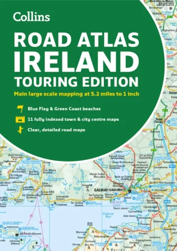
Road Atlas Ireland - Collins Maps
Explore Ireland with this accurate and fully updated road atlas.This road atlas is at A4 size, covering the whole of Ireland and features clear and detailed Collins colour mapping at a scale of 5.2 miles to 1 inch. Perfect for both residents and visitorstouring Ireland.This revised edition includes:Places of tourist interestContact information for Tourist Information Centres with grid references to the mappingFully indexed street maps of 11 cities and towns – Dublin, Belfast, Cork, Limerick, Waterford,Londonderry (Derry), Galway, Bangor, Dun Laoghaire, Drogheda and KillarneyBlue Flag & Green Coast beachesFerry and airport information; Distance chart; Distances marked on the roads in miles and kilometresRoute planning map of the whole of Ireland at 15.8 miles to 1 inchAdministrative map of Irish counties and districts.
Objev podobné jako Road Atlas Ireland - Collins Maps
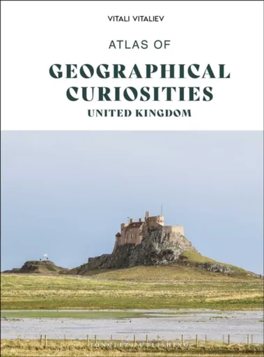
Atlas of Geographical Curiosities - Britain - Vitali Vitaliev
A glorious celebration of the Britain''s geographical eccentricities.Welcome to this compendium of interesting, unexpected and downright bizarre geographical anomalies that are guaranteed to delight and inspire.Britain is one of the quirkiest parts of the world, and many of its quirks are covered in this unique Atlas of Geographical Curiosities, the first of its kind.Put together by an acclaimed author and geographer, a Fellow of the Royal Geographical Society of Great Britain, the Atlas describes:Britain’s forgotten rainforeststhe world’s smallest island with a building a British hotel room which became Yugoslavian for one day onlyBritain’s only desertthe only bit of Britain’s territory still adhering to the Julian calendarthe lowest land point in Britainthe county that does not exist but still features in postal addressesBritain’s narrowest street and its smallest cityBritain’s ‘Great Barrier Reef’a bit of the Netherlands that briefly became part of ScotlandBritain is full of wonderful and strange geographical irregularities. Turn to the Atlas of Geographical Curiosities to uncover more little-known but important facts gathered together in this entertaining treasure trove.
Objev podobné jako Atlas of Geographical Curiosities - Britain - Vitali Vitaliev
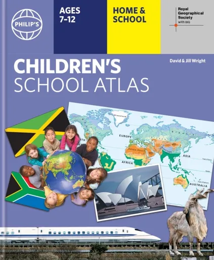
Philip's RGS Children's School Atlas - David Wright, Jill Wright
"This is such a great book for primary school age children and a little beyond for finding out about the world, its countries and people" Amazon customer review- Philip''s atlas, designed specially to use at home and at school with guidance for parents and teachers- Clear maps and fascinating facts bring geography to life for readers aged 7-12- Published by Philip''s the UK''s leading school atlas publisher, in association with the Royal Geographical Society- Quizzes, activity ideas and puzzles to make learning fun- Past winner of the Geographical Association''s award for making a significant contribution to geographyThe atlas is organized spread by spread in the classic sequence: first Europe, then its land neighbour Asia, followed by Africa, Australia and Oceania, North America and South America.Illustrated with captivating full-colour photographs and packed with fact boxes, curiosities, flags, stamps and quiz questions, Philip''s RGS Children''s Atlas is both fun to use and easy to understand.Now in its 16th edition, Philip''s RGS Children''s Atlas is a past winner of the Geographical Association''s award for making a significant contribution to geography. The atlas was judged "an excellent ''all round'' children''s atlas with simple yet well-designed maps, well-illustrated with colour photographs. It links places to ... Unknown localization key: "more"
Objev podobné jako Philip's RGS Children's School Atlas - David Wright, Jill Wright
Philip's RGS Children's School Atlas - David Wright, Jill Wright
"This is such a great book for primary school age children and a little beyond for finding out about the world, its countries and people" customer review- Philip''s atlas, designed specially to use at home and at school with guidance for parents and teachers- Clear maps and fascinating facts bring geography to life for readers aged 7-12- Published by Philip''s in association with the Royal Geographical Society- Quizzes, activity ideas and puzzles to make learning fun- Past winner of the Geographical Association''s award for making a significant contribution to geographyThe atlas is organized spread by spread in the classic sequence: first Europe, then its land neighbour Asia, followed by Africa, Australia and Oceania, North America and South America. Illustrated with captivating full-colour photographs and packed with fact boxes, curiosities, flags, stamps and quiz questions, Philip''s RGS Children''s Atlas is both fun to use and easy to understand.Now in its 17th edition, Philip''s RGS Children''s Atlas is a past winner of the Geographical Association''s award for making a significant contribution to geography. The atlas was judged "an excellent ''all round'' children''s atlas with simple yet well-designed maps, well-illustrated with colour photographs. It links places to issues, events and real people, giving ... Unknown localization key: "more"
Objev podobné jako Philip's RGS Children's School Atlas - David Wright, Jill Wright

Philip's RGS Children's School Atlas - David Wright, Jill Wright
"This is such a great book for primary school age children and a little beyond for finding out about the world, its countries and people" customer review- Philip''s atlas, designed to use at home and at school with guidance for parents and teachers- Clear maps and fascinating facts bring geography to life for readers aged 7-12- Published by Philip''s in association with the Royal Geographical Society- Quizzes, activity ideas and puzzles to make learning fun- Past winner of the Geographical Association''s award for making a significant contribution to geographyThe atlas is organized spread by spread in the classic sequence: first Europe, then its land neighbour Asia, followed by Africa, Australia and Oceania, North America and South America. Illustrated with captivating full-colour photographs and packed with fact boxes, curiosities, flags, stamps and quiz questions, Philip''s RGS Children''s Atlas is both fun to use and easy to understand.Now in its 17th edition, Philip''s RGS Children''s Atlas is a past winner of the Geographical Association''s award for making a significant contribution to geography. The atlas was judged "an excellent ''all round'' children''s atlas with simple yet well-designed maps, well-illustrated with colour photographs. It links places to issues, events and real people, giving a ... Unknown localization key: "more"
Objev podobné jako Philip's RGS Children's School Atlas - David Wright, Jill Wright
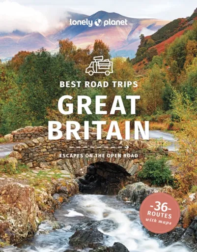
Lonely Planet Best Road Trips Great Britain - Damian Harper, Anthony Ham, Albiston Isabel, Berry Oliver, Lonely Planet, Davenport Fionn, Joe Bindloss,
Discover the freedom of the open road with Lonely Planet''s Great Britain''s Best Road Trips. This trusted travel companion features 36 amazing drives, from 3-day escapes to 3-week adventures. Explore the majestic Welsh mountains, gaze at the mysterious Stonehenge and cruise grand Scottish moors . Get to Great Britain, rent a car, and hit the road!Inside Lonely Planet''s Great Britain''s Best Road Trips:Itineraries for classic road trips plus other lesser-known drives with expert advice to pick the routes that suit your interests and needs Full-colour route maps - easy-to-read, detailed directionsDetours - delightful diversions to see Great Britain''s highlights along the wayLink Your Trip - cruise from one driving route to the nextInsider tips - get around like a local, avoid trouble spots and be safe on the road - local driving rules, parking, toll roadsStretch Your Legs - the best things to do outside the carEssential infoat your fingertips - hours of operation, phone numbers, websites, pricesHonest reviews for all budgets - eating, sleeping, sightseeing, hidden gems that most guidebooks missLavish colour photography provides inspiration throughoutCovers England, Scotland, Wales, the West Country, the Cotswolds, Bath, Edinburgh, Stonehenge, Welsh Mountains, Cambridge, Oxford, the Scottish Highlands, Stratford-upon-Avon, Blenheim Palace and moreThe ... Unknown localization key: "more"
Objev podobné jako Lonely Planet Best Road Trips Great Britain - Damian Harper, Anthony Ham, Albiston Isabel, Berry Oliver, Lonely Planet, Davenport Fionn, Joe Bindloss,
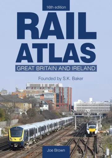
Rail Atlas: Great Britain & Ireland 16th Edition - Joe Brown
Following the sad death of Stuart Baker, the creator of Rail Atlas Great Britain and Ireland, in 2020, we were fortunate that another fine railway cartographer, Joe Brown, agreed to complete the work that Stuart had begun, to revise what became the 15th edition. However, the railway network of Great Britain and Ireland is always changing and never static and revised editions of this atlas are required on a regular basis; the rebuilding of the line from Oxford towards Cambridge and the reinstatement of the Foynes branch in Ireland being examples of some of the additions to this new edition. Fortunately, Joe Brown has agreed to take on this work and this 16th edition will be the first one to be fully edited and revised by him. As with all the previous editions, the Atlas has been fully revised and updated whilst retaining the convenient format of mapping where each page overlaps with that on adjoining pages to make it easier to follow a long-distance route. Where appropriate, additional detailed inset maps have been drawn to show the complex railway developments in metropolitan areas such as Nottingham and Manchester. While some minor changes to the layout have been made, Rail ... Unknown localization key: "more"
Objev podobné jako Rail Atlas: Great Britain & Ireland 16th Edition - Joe Brown
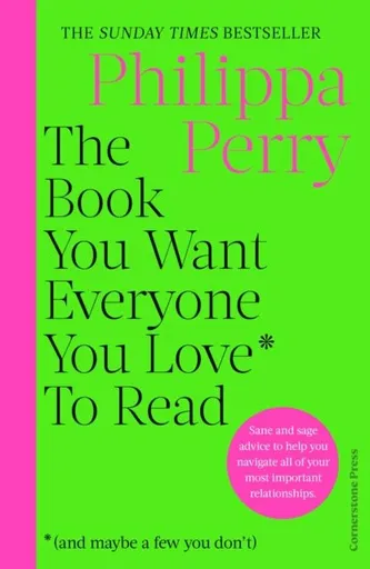
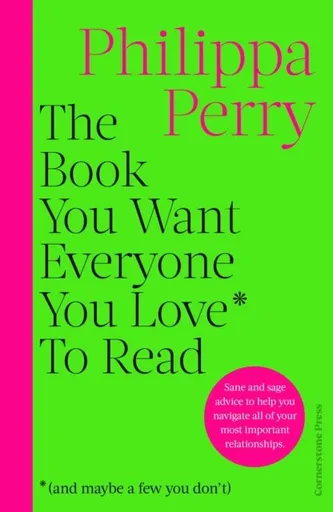
Book You Want Everyone You Love* To Read *(and maybe a few you don't) - Philippa Perry
** Get closer the people who matter the most with the help of the nation's favourite therapist, PHILIPPA PERRY **'Brilliant ... Very few self-help books are this wise' THE TIMES, Best Books of the Year'Life bible incoming: Philippa Perry's sage (and witty) advice will have you re-evaluating all the relationships in your life' STYLIST'I LOVE Philippa Perry and think she's wise and brilliant'BELLA MACKIE'Philippa Perry is one of the wisest, most sane and secure people I've ever met'Decca Aitkenhead, SUNDAY TIMES'Philippa Perry is a superwoman'CHRIS EVANS______________________________________________________________________________________Life is all about relationships and the quality of those connections, whether that's with family, partners, friends, colleagues or most importantly yourself. If you can get those relationships on a functional and even keel, then the other tricky stuff that life throws your way becomes easier to manage.In this warm, practical and witty book, No.1 Sunday Times bestselling psychotherapist Philippa Perry shows you how to approach life's big problems.How do you find and keep love? What can you do to manage conflict better? How can you get unstuck and cope with change and loss? What does it mean to you to be content? Are other people just annoying or are you the problem?With a healthy ... Unknown localization key: "more"
Objev podobné jako Book You Want Everyone You Love* To Read *(and maybe a few you don't) - Philippa Perry
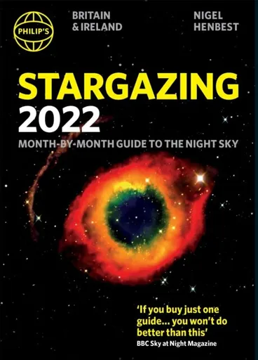
Philip's Stargazing 2022 Month-by-Month Guide to the Night Sky in Britain & Ireland - Nigel Henbest
Discover the latest in stargazing with the new and definitive guide to the night sky. Whether you're a seasoned astronomer or just starting out, Philip's Stargazing 2022 is the only book you'll need. Compiled by experts and specially designed for use in Britain and Ireland, Stargazing 2022 acts as a handily illustrated and comprehensive companion. 12 Brand-New Maps for year-round astronomical discovery Month-to-Month information Daily Moon Phase Calendar, highlighting special lunar events throughout the year Planet Watch for ideal viewing days in 2022 Avoid light pollution with our detailed Dark Sky Map Expert advice and insight throughout from internationally renowned Professor Nigel Henbest A 'Behind the Scenes' look at astrophotography from expert Robin Scagell Complete calendar of major astronomical events, including the Top 20 Sky Sights of 2022- Jargon Buster, explaining common or confusing terms - The planets' movements explained from solar and lunar eclipses to meteor showers and comets
Objev podobné jako Philip's Stargazing 2022 Month-by-Month Guide to the Night Sky in Britain & Ireland - Nigel Henbest
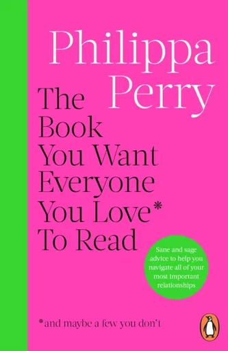
The Book You Want Everyone You Love* To Read *(and maybe a few you don’t) - Philippa Perry
As seen on ITV 'This Morning''Brilliant . . . Very few self-help books are this wise' The Times'Life bible incoming: Philippa Perry's sage (and witty) advice will have you re-evaluating all the relationships in your life' Stylist'I LOVE Philippa Perry and think she's wise and brilliant' Bella MackieLife is all about relationships and the quality of those connections, whether that's with family, partners, friends, colleagues or most importantly yourself. If you can get those relationships on a functional and even keel, then the other tricky stuff that life throws your way becomes easier to manage. In this warm, practical and witty book, No.1 Sunday Times bestselling psychotherapist Philippa Perry shows you how to approach life's big problems. How do you find and keep love? What can you do to manage conflict better? How can you get unstuck and cope with change and loss? What does it mean to you to be content? Are other people just annoying or are you the problem?With a healthy dose of sanity, Philippa Perry's compassionate advice could help you become a happier, wiser person. Includes some material adapted from the Ask Philippa columns in Observer Magazine.
Objev podobné jako The Book You Want Everyone You Love* To Read *(and maybe a few you don’t) - Philippa Perry
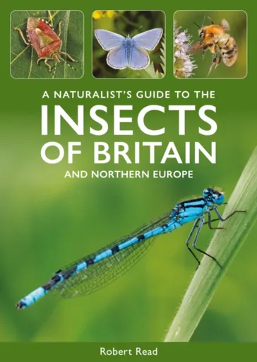
A Naturalist's Guide to the Insects of Britain and Northern Europe - Robert Read
A Naturalist's Guide to the Insects of Britain & Northern Europe is an easy-to-use identification guide to 280 insect species commonly seen in Britain and North-West Europe that is perfect for amateur naturalists.
Objev podobné jako A Naturalist's Guide to the Insects of Britain and Northern Europe - Robert Read
Atlas of Modern Clothing: From the Trench Coat to the Sweatshirt - Marina Madzhugina
This beautifully illustrated and inspiring atlas for fashion designers and fashionistas reveals the structure, characteristics and materials of contemporary garments for women and men. A handbook for clothing designers, stylists and fashionistas, this dashing publication uses beautiful illustrations and drawings to highlight the design and key details of various forms of contemporary clothing, such as coats, jackets, shirts, tops, blouses, dresses, trousers, shorts and skirts. Traditional and contemporary materials, colours and textures for different styles are also listed. This atlas will help designers in their work, no matter which creative method of costume design they choose: inversion, analogy, empathy, fantasy, creating new combinations and problem-solving. It is meant to be a source of inspiration and a useful tool for artists and designers working with clothing, and will be of interest to anyone who is passionate about fashion and style. AUTHOR: Marina Madzhugina graduated from the Institute of Design and Technology at Omsk State Technical University (Russia) with a degree in costume design. She has worked at her alma mater since 2013, teaching students who want to become stylists and image-makers. She is the winner of the Fashion Formula Competition (Omsk), the Local Style Competition for Young Fashion Designers (Voronezh) and ... Unknown localization key: "more"
Objev podobné jako Atlas of Modern Clothing: From the Trench Coat to the Sweatshirt - Marina Madzhugina
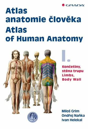
Atlas anatomie člověka I. - Končetiny, stěna trupu / Atlas of Human Anatomy I. - Limbs, Body Wall - Ondřej Naňka, Miloš Grim, Ivan Helekal
Poprvé od roku 1900 je zde originální domácí anatomický atlas. Dvojdílný komplet s téměř 1300 ilustracemi a fotografiemi. Kniha na celý život v latině, češtině a angličtině. Pracovníci Anatomického ústavu 1. LF UK v Praze tak navazují na bohatou tradici české anatomie.V prvním dílu atlasu je obsaženo 476 ilustrací anatomie horní a dolní končetiny a stěny trupu. Vždy je uveden nejprve skelet, pak jeho spoje a klouby, dále svaly a nakonec poloha a průběh nervů a cév v rámci topografické anatomie. Atlas tvoří anatomické obrazy a schémata (413) a snímky (63) pořízené některou ze zobrazovacích metod (RTG, CT, MRI). Anatomické útvary jsou popsány v mezinárodní Terminologia Anatomica (1998) a každou ilustraci doprovází vysvětlující text v latině, češtině a angličtině. Je připojen slovník nejčastějších latinských anatomických termínů a jejich překlad do češtiny a angličtiny. Didaktická a přehledná kniha je určena medikům a lékařům všech oborů, studentům přírodních věd i mnohým pracovníkům nelékařských zdravotnických oborů. Ocení ji jistě i výtvarníci, pracovníci v oblasti tělesné výchovy a sportu a v mnoha dalších odvětvích.Je využit bohatý obrazový materiál z archivu Ústavu, který jeho výtvarníci zhotovili na podkladě originálních preparátů připravených anatomy několika generací, počínaje rokem 1915. Řada těchto ilustrací nebyla dosud publikována moderními reprodukčními ... Unknown localization key: "more"
Objev podobné jako Atlas anatomie člověka I. - Končetiny, stěna trupu / Atlas of Human Anatomy I. - Limbs, Body Wall - Ondřej Naňka, Miloš Grim, Ivan Helekal
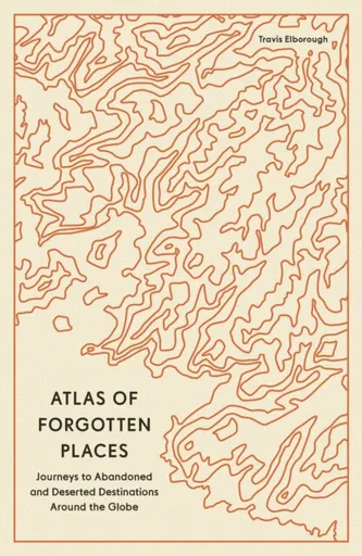
Atlas of Forgotten Places - Travis Elborough
Explore the places that time forgot. These abandoned, mysterious, sleeping monuments around the world have been relegated to the margins of history. From ancient ruins and crumbling castles to more recent relics – an art deco New York subway station, a Soviet ghost town in the Arctic Circle, a flooded Thai mall teeming with aquatic life – Travis Elborough takes you on a journey into these strange, overlooked, and disappearing worlds and immortalizes them in this book of original maps, accompanied by moving historic and geographic accounts of each site. The featured locations are a stark reminder of what was, and the accounts in this investigative book help to bring their stories back to life, telling us what happened, when and why, and to whom. The book features 40 sites, including: Santa Claus, Arizona, USA: A festive tourist resort-turned-ghost town deep in the desert where you could once meet Santa Claus any day of the year; Crystal Palace Subway, London, UK: One of the city’s best-kept secrets is an underground, cathedral-like relic that many Victorian commuters bustled through; Montserrat, West Indies: The small Caribbean island with a population of 5,000 that was evacuated when its volcano erupted in 1995. The ... Unknown localization key: "more"
Objev podobné jako Atlas of Forgotten Places - Travis Elborough
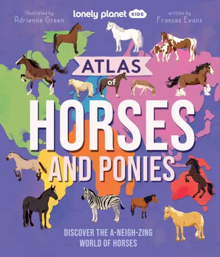
Lonely Planet Kids Atlas of Horses and Ponies - Frances Evans, Lonely Planet Kids
Take a wild ride into the world of horses and ponies with this awesome atlas of more than 100 incredible breeds from across the continents!Packed with gorgeous illustrations, marvellous maps and fascinating facts, discover a huge selection of horses and ponies from South America''s Peruvian Paso to Asia''s Orlov Trotter and Europe''s Swedish Warmblood. Learn about each horse’s country of origin, physical characteristics and personality traits, and saddle-up for the ultimate horse and pony adventure.Inside Atlas of Horses and Ponies:Over 100 awesome breeds from North and South America, Europe, Africa, Asia, Australia and New ZealandLarge maps of each continent show where each horse and pony originates fromAtlas of a horse provides readers with a basic geography of their body from their coat to their tailLearn about a horse''s amazing super senses plus discover how to talk horseFun-packed profiles give details on each horse''s personality traits, characteristics and unique skillsSpecial themed features on: Super Senses, Caring for Horses, Foals, Donkeys and Mules, Working Horses, Mythical Horses, Horse Sports, Wild Horses, War Horses, and Record-Breaking HorsesFrom the author of Lonely Planet Kids’ bestselling Atlas of Dogs and Atlas of Cats: Frances EvansFeaturing beautiful and lively illustrations throughout by Adrienne Green Hot on ... Unknown localization key: "more"
Objev podobné jako Lonely Planet Kids Atlas of Horses and Ponies - Frances Evans, Lonely Planet Kids
The Book You Want Everyone You Love* To Read *(and maybe a few you don’t) (poškozená) - Philippa Perryová
Life is all about relationships and the quality of those connections, whether that's with family, partners, friends, colleagues or most importantly yourself. If you can get those relationships on a functional and even keel, then the other tricky stuff that life throws your way becomes easier to manage.In this warm, practical and witty book, No.1 Sunday Times bestselling psychotherapist Philippa Perry shows you how to approach life's big problems.How do you find and keep love? What can you do to manage conflict better? How can you get unstuck and cope with change and loss? What does it mean to you to be content? Are other people just annoying or are you the problem?With a healthy dose of sanity, Philippa Perry's compassionate advice could help you become a happier, wiser person.Includes some material adapted from the Ask Philippa columns in Observer Magazine.
Objev podobné jako The Book You Want Everyone You Love* To Read *(and maybe a few you don’t) (poškozená) - Philippa Perryová
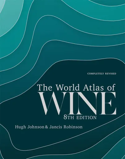
World Atlas of Wine 8th Edition - Hugh Johnson, Jancis Robinson
Winner of the André Simon Drinks Book of the Year 2019Shortlisted for the Louis Roederer Wine Book of the Year 2020"One book deserves a place on every wine drinker''s shelf, and that is The World Atlas of Wine" - Victoria Moore in the Telegraph"magisterial" - Fiona Beckett, Guardian "a key reference material for any sommelier, wine professional or any amateur serious about their passion" - Imbibe "The most useful single volume on wine ever published... If I owned only one wine book, it would be this one." - Andrew Jefford, Decanter*** Few wine books can be called classic, but the first edition of The World Atlas of Wine made publishing history when it appeared in 1971. It is recognized by critics as the essential and most authoritative wine reference work available. This eighth edition will bring readers, both old and new, up to date with the world of wine. To reflect all the changes in the global wine scene over the past six years, the Atlas has grown in size to 416 pages and 22 new maps have been added to the wealth of superb cartography in the book. The text has been given a complete overhaul to address the ... Unknown localization key: "more"
Objev podobné jako World Atlas of Wine 8th Edition - Hugh Johnson, Jancis Robinson
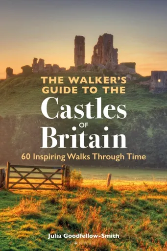
The Walker’s Guide to the Castles of Britain - Julia Goodfellow-Smith
Be transported through time with this wonderful guidebook to Britain''s 60 best castles, and 60 delightful walks from and around them.Castles often sit in spectacular landscapes that also offer exceptional walking opportunities, and some of the best views of castles are from a distance, where they can be seen in the context of the landscape. The Walker’s Guide to the Castles of Britain will inspire both keen walkers to visit castles and castle visitors to explore the surrounding area, by describing 60 of the best and most popular castles in Great Britain and an accompanying delightful short walk from each. Each chapter describes the castle itself, its history and architectural features, and how those relate to the landscape that surrounds it, followed by an easy-to-navigate description of the walk itself. This absorbing text is accompanied by brilliant photography of the castle and the sights you will see on your walk, and a useful map to guide you on your way.From the well-known and popular castles such as St Michael''s Mount, Tintagel Castle, Corfe Castle and Edinburgh Castle, to the lesser-known gems like Kidwelly Castle, Castle Stalker and Framlingham Castle, The Walker''s Guide to the Castles of Britain will show you ... Unknown localization key: "more"
Objev podobné jako The Walker’s Guide to the Castles of Britain - Julia Goodfellow-Smith
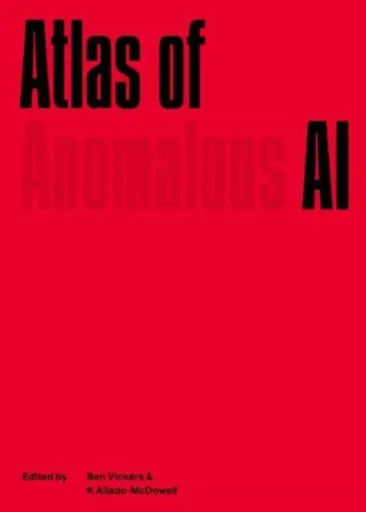
Atlas of Anomalous AI
**Edited by Ben Vickers & K Allado-McDowell Foreword by Bill Sherman **Like a snake eating its tail, artificial intelligence exists in a circular relationship with its human creators.The Atlas of Anomalous AI is a compelling and surprising map of our complex relationship to intelligence, from ancient to emerging systems of knowledge. A wildly associative constellation of ideas, stories, artworks and historical materials, the Atlas draws on art historian Aby Warburg’s Mnemosyne Atlas — an image map of the “afterlife of antiquity†— to approach the defining concepts of AI from an imaginative, artistic and revitalising perspective.The Atlas presents a hyperdimensional view of the world, through a broad range of perspectives that explore the question of what AI has been and what it is becoming. Key texts on modelling, prediction and automation are brought together with stories of science fiction, dreams and human knowledge, set among visionary and surreal imagesContributions from writers, philosophers and curators including: Blaise Agüera y Arcas, Ramon Amaro, Noelani Arista, Benjamin H. Bratton, Federico Campagna, Arthur C. Clarke, Rana Dasgupta, GPT-2, GPT-3, Yuk Hui, Nora N. Khan, Suzanne Kite, Jason Edward Lewis, Catherine Malabou, Hans Ulrich Obrist, Matteo Pasquinelli, Archer Pechawis, Noah Raford, Nisha Ramayya, Beth Singler ... Unknown localization key: "more"
Objev podobné jako Atlas of Anomalous AI
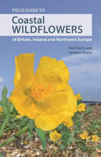
Field Guide to Coastal Wildflowers of Britain, Ireland and Northwest Europe - Paul Sterry, Andrew Cleave
A richly illustrated guide to the wildflowers and other flora of coastal Britain, Ireland and Northwest EuropeThe rugged and beautiful coastal regions of Britain and Ireland are among the crowning glories of these islands. Few visitors can fail to marvel at the stunning sight of Cornwall’s clifftops resplendent with flowering Thrift, or be struck by the resilience of plants that thrive on the inhospitable shingle beaches of Dungeness on the coast of Kent. This field guide covers more than 600 species of wildflowers and other coastal flora found in Britain and Ireland, and coastal mainland Northwest Europe. Detailed species accounts describe wildflowers, grasses, sedges and rushes that occur on the coast or in abundance within sight of the sea. Stunningly illustrated throughout, this comprehensive, user-friendly guide also covers trees and shrubs, a range of other groups from mosses and seaweeds, and more broadly, the natural history of coastal habitats.Covers more than 600 species of flowering plantsFeatures over 1,500 spectacular colour photosDescribes other groups such as ferns, mosses, liverworts, lichens, fungi and seaweedsProvides up-to-date colour distribution maps for Britain and Ireland
Objev podobné jako Field Guide to Coastal Wildflowers of Britain, Ireland and Northwest Europe - Paul Sterry, Andrew Cleave
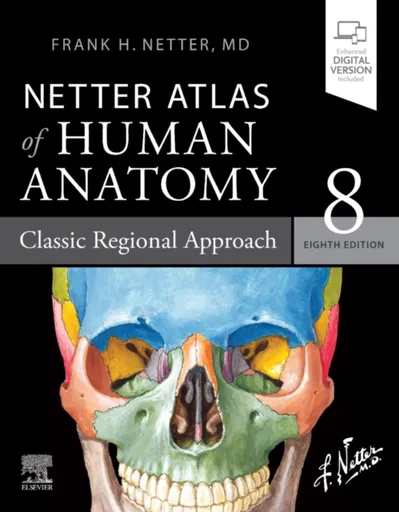
Netter Atlas of Human Anatomy: Classic Regional Approach - Frank H. Netter
For students and clinical professionals who are learning anatomy, participating in a dissection lab, sharing anatomy knowledge with patients, or refreshing their anatomy knowledge, the Netter Atlas of Human Anatomy illustrates the body, region by region, in clear, brilliant detail from a clinician’s perspective. Unique among anatomy atlases, it contains illustrations that emphasize anatomic relationships that are most important to the clinician in training and practice. Illustrated by clinicians, for clinicians, it contains more than 550 exquisite plates plus dozens of carefully selected radiologic images for common views. Presents world-renowned, superbly clear views of the human body from a clinical perspective, with paintings by Dr. Frank Netter as well as Dr. Carlos A. G. Machado, one of today’s foremost medical illustratorsContent guided by expert anatomists and educators: R. Shane Tubbs, Paul E. Neumann, Jennifer K. Brueckner-Collins, Martha Johnson Gdowski, Virginia T. Lyons, Peter J. Ward, Todd M. Hoagland, Brion Benninger, and an international Advisory BoardOffers region-by-region coverage, including muscle table appendices at the end of each section and quick reference notes on structures with high clinical significance in common clinical scenariosContains new illustrations by Dr. Machado including clinically important areas such as the pelvic cavity, temporal and infratemporal fossae, nasal ... Unknown localization key: "more"
Objev podobné jako Netter Atlas of Human Anatomy: Classic Regional Approach - Frank H. Netter
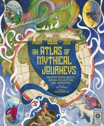
Atlas of Mythical Journeys
For thousands of years, humans have been telling stories of great and perilous journeys and the heroic adventurers who made them. Relive more than 30 of these legendary voyages with An Atlas of Mythical Journeys, and uncover the secret histories behind them.From the fateful homecoming of Odysseus to Mulan''s mission to free her homeland, these tales plot a course from myth to folklore to history. Marvel at epic scenes for every journey, featuring battles between gods and monsters, treacherous seas and long-lost lairs filled with treasure. Along the way, you''ll not only discover myths and legends you''ve never heard before, but also learn all about the peoples and cultures who told them, what they mean and where they come from.Arranged by continent, featured stories include:Jason and the Argonauts'' quest for the Golden FleeceLoki''s mischievous search for the apples of immortalitySan Zang''s famed journey to the WestThe exploits at sea of Sinbad the SailorThe Wabanaki legend of GlooscapAnansi the Spider and the Box of StoriesHow MÄui created the islands called New ZealandMany, many more...Fact meets fantasy in this stunning collection of beloved tales and unearthed legends for 9-12-year-olds, each of which reveals something more about the excitement of journeying into the ... Unknown localization key: "more"
Objev podobné jako Atlas of Mythical Journeys
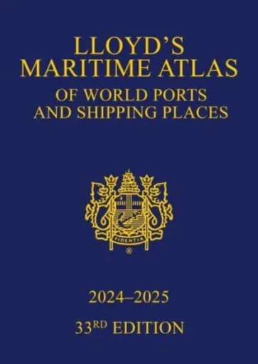
Lloyd's Maritime Atlas of World Ports and Shipping Places 2024-2025
Welcome to the 33rd edition of Lloyd’s Maritime Atlas.Published since 1951, Lloyd’s Maritime Atlas is the oldest and most respected atlas in the shipping industry. A comprehensive reference for locating the world’s busiest ports and shipping places, this new edition has been fully updated and enhanced with revised maps and new features to alleviate the demands on today’s busy shipping professional.In the 2024–2025 edition you will find:The maps and indexes have been updated with the latest port names and locations, and expanded with almost 200 new ports integratedThe addition of more than 400 new anchorages, 45 marine terminals, 22 offshore facilities, and 85 oil and gas fieldsThe latest data on piracy incidents applied to a global overview with summaries by region, vessel type and dwt, plus every map featuring three grades of incident symbols to highlight the severity of different hotspotsThe MARPOL map has been separated from PSSA and SECA for increased clarity, with new Mediterranean Sea areas for SECA and PSSA integratedAn updated world map of vaccinations required to protect against major global diseasesThe very latest Marine Distance Tables and fleet statisticsIn addition, Lloyd’s Maritime Atlas continues to provide:Precise latitude and longitude co-ordination of more than 9,000 ports and ... Unknown localization key: "more"
Objev podobné jako Lloyd's Maritime Atlas of World Ports and Shipping Places 2024-2025
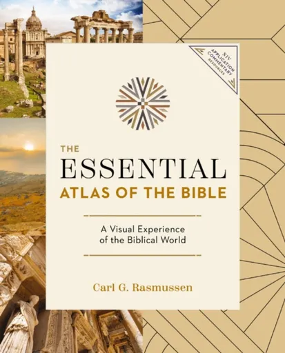
The Essential Atlas of the Bible - Carl G. Rasmussen
Embark on a fascinating journey through the lands where key biblical events unfolded. Visit the places where Jesus preached, Moses journeyed, and Paul spread the word of God - all from the comfort of your home with The Essential Atlas of the Bible.With nearly 200 visually captivating, multidimensional maps and full-color images, this comprehensive atlas will deepen your understanding of biblical lands, history, and spirituality. Leveraging highly accurate mapping technologies, it provides an up-to-date geographical perspective that makes Scripture study both engaging and impactful.Discover multifaceted insights through innovative chronological charts covering historical backgrounds, regions, weather, and roads of the Bible''s world. This full-color atlas is concise yet comprehensive - perfect for Bible scholars, future pilgrims to the Holy Land, or curious readers seeking greater insight into places frequently mentioned in the Old and New Testaments.The Essential Atlas of the Bible goes beyond just providing information; it takes you on a pilgrimage across time, enriching every step of your Bible study journey where you will discover a visual experience of the biblical world.Enhance your understanding and deepen your faith - don''t wait, grab your copy of The Essential Atlas of the Bible today.
Objev podobné jako The Essential Atlas of the Bible - Carl G. Rasmussen
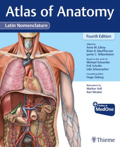
Atlas of Anatomy, Latin Nomenclature - Erik Schulte, Udo Schumacher, Michael Schuenke, Anne M Gilroy, Jamie Wikenheiser, Brian R MacPherson
Quintessential Atlas of Anatomy expands on widely acclaimed prior editions! Atlas of Anatomy, Latin Nomenclature, Fourth Edition builds on its longstanding reputation of being the highest-quality anatomy atlas published to date using Latin nomenclature. With more than 2,000 exquisitely detailed illustrations, including over 120 new to this edition, the Atlas helps students and seasoned clinicians master the details of human anatomy. Key Features: NEW! Expanded Radiology sections include over 40 new radiographs, CTs, and MRIsNEW! A more dissectional approach to the head and neck region places neck anatomy before that of the head – the way most students dissectNEW! Additional images and tables detail the challenging anatomy of the peritoneal cavity, inguinal region, and infratemporal and pterygopalatine fossaeNEW! Almost 30 new clinical boxes focus on function, pathology, diagnostic techniques, anatomic variation, and moreNEW! More comprehensive coverage clarifies the complexities of the ANS, including revised wiring schematicsAlso included in this new edition:Muscle Fact spreads provide origin, insertion, innervation, and actionAn innovative, user-friendly format: every topic covered in two side-by-side pagesOnline images with "labels-on and labels-off" capability are ideal for review and self-testingWhat users say about the Atlas of Anatomy: "I can't say enough how much I like the organization of this ... Unknown localization key: "more"
Objev podobné jako Atlas of Anatomy, Latin Nomenclature - Erik Schulte, Udo Schumacher, Michael Schuenke, Anne M Gilroy, Jamie Wikenheiser, Brian R MacPherson
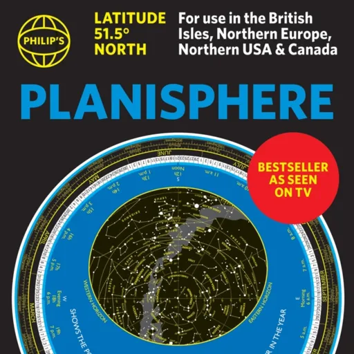
Philip's Planisphere (Latitude 51.5 North) - Philip's Maps
The first thing that every stargazer needs - an hour-by-hour and night-by-night moveable map of the stars ''A really useful bit of kit...a map of the night sky for any time of the year'' Mark Thompson, TV Astronomer on BBC Stargazing Live- Just turn the disc and ''dial up'' tonight''s night sky- Bestselling and accurate sky map for every hour of every night 24/7/365- Simple and fun to use for beginners - and an essential tool for experienced astronomers- All the stars and constellations down to magnitude 5 (visible with the naked eye)- Planet Tracker for the major visible planets - Full instructions and hints on exploring the skies by season - Suitable for UK, Ireland, Northern Europe, Canada and Northern USA (51.5N plus or minus 10 degrees)Philip''s have created a bestselling, practical, hour-by-hour tracker of the stars and constellations. Turn the oval panel to tonight''s date and time - and reveal the whole sky star by star visible from where you are. The map shows stars down to magnitude 5, plus several important deep-sky objects such as the Pleiades, the Andromeda Galaxy (M31) and the Orion Nebula (M42) The Planisphere is based at 51.5 degrees North. So it''s perfect ... Unknown localization key: "more"
Objev podobné jako Philip's Planisphere (Latitude 51.5 North) - Philip's Maps
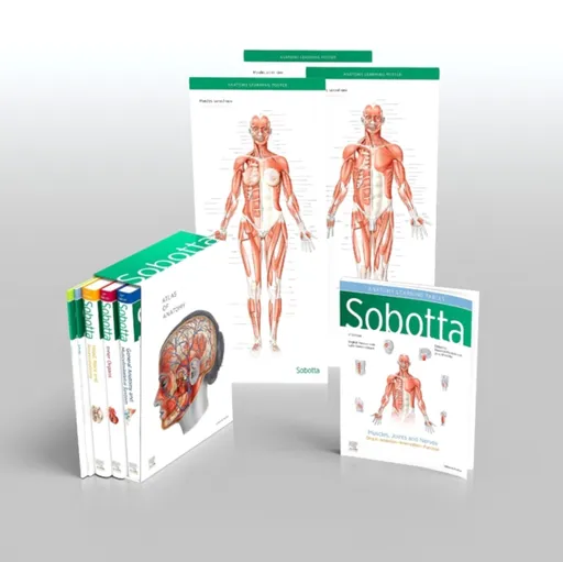
Sobotta Atlas of Anatomy, Package, 17th ed., English/Latin - Friedrich Paulsen, Jens Waschke
General Anatomy and Musculoskeletal System; Internal Organs; Head, Neck and Neuroanatomy; Muscles Tables; Poster Collection MORE THAN AN ATLAS Studying anatomy is fun! Recognising the structures on the dissection, understanding their relationships and gainingan overview of how they work together assures confident study and transition into clinical practice. The Sobotta Atlas shows authentic illustrations of the highest quality, drawn from genuine specimens, guaranteeingthe best preparation for the gross anatomy class and attestation. Sobotta focuses on the basics, making it totally comprehensive. Every tiny structure has been addressed according tocurrent scientific knowledge and can be found in this atlas. Themes relevant to exams and sample questions from oralanatomy exams help to focus the study process. The Sobotta Atlas is the optimal learning atlas for studying, from the first semester till the clinical semester. Case studiespresent examples and teach clinical understanding. Clinical themes and digressions into functional anatomy are motivatingand impart valuable information for prospective medical practice. With over 100 years of experience in 17 editions and thousands of unique anatomical illustrations, Sobotta achievesongoing success. The volume General Anatomy and Muscoloskeletal System contains the chapters: General AnatomyAnatomical planes and positions - Surface anatomy - Development - Musculoskeletal system - Neurovascular pathways - ... Unknown localization key: "more"
Objev podobné jako Sobotta Atlas of Anatomy, Package, 17th ed., English/Latin - Friedrich Paulsen, Jens Waschke
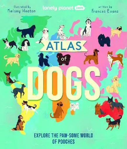
Lonely Planet Kids Atlas of Dogs - Frances Evans, Lonely Planet Kids
Explore the paw-some world of pooches in this definitive guide to dogs that’s packed with fun facts and illustrations. Large continent maps show the origin of 150 weird and wonderful breeds like the Greenland Dog with wicked sledging skills. Plus amazing Pooch Profiles provide size, coat and personality stats. Kids will love this who’s who of dogs!Discover bright and cheery dog diagrams to learn about their super senses and satisfy your canine curiosity with brilliant features about record-breaking hounds, fluffy film stars and more. Kids will meet some of the world’s most unique pups like Africa’s magnificent Basenji that doesn’t bark but yodels and the mighty Irish Wolfhound that towers above its four-pawed friends. Inside Atlas of Dogs:- 150 awesome breeds and crossbreeds from North America, South America, Europe, Africa, Asia, Australia and New Zealand- Large maps of each continent that show where each dog breed originates from- Atlas of a dog’s body and their super senses- Lively and colourful illustrations throughout with annotations that reveal unique and quirky dog facts and features- Pooch Profile detailing country of origin, size, coat and personality- Insightful Doggie Dictionary to help humans understand what their four-pawed pal is trying to say- Low-down of ... Unknown localization key: "more"
Objev podobné jako Lonely Planet Kids Atlas of Dogs - Frances Evans, Lonely Planet Kids
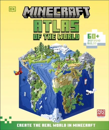
Minecraft Atlas of the World - Craig Jelley
Explore our incredible world in this fun atlas for Minecraft fansFilled with marvellous ideas, tips, and tricks for creating your own Minecraft builds, this educational Minecraft book for kids is inspired by real-world locations and natural wonders. Full of fun facts about locations, objects and animals from around the world, this is more than just an atlas – it’s a treasure trove of exciting Minecraft build ideas inspired by the real world!Join two Minecraft characters for a guided tour around the globe and learn about real-world natural wildlife and wonders, including Mount Fuji and Machu Picchu, man-made structures and buildings such as The Great Sphinx of Giza and the Roman Colosseum.Dig into the real world in this one-of-a-kind Minecraft book for kids:FACTUAL AND EDUCATIONAL: The Minecraft Atlas of the World is developed in collaboration with experts in their fields, with reference information reviewed by educational professionals.FILLED WITH REAL-WORLD BUILD IDEAS: Contains hundreds of build ideas designed to inspire young Minecraft fans to boost their creativity.TRAVEL AROUND THE GLOBE FROM THE COMFORT OF HOME: Kids will learn real-world facts about history and geography as they marvel at the incredible Minecraft creations on every page.THE PERFECT MINECRAFT GIFT: A wonderful Minecraft resource ... Unknown localization key: "more"
Objev podobné jako Minecraft Atlas of the World - Craig Jelley
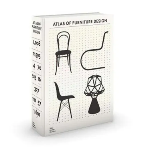
The Atlas of Furniture Design - Deyan Sudjic, Fulvio Ferrari, Mateo Kries, Wolf Tegethoff, Jochen Eisenbrand, Arthur Ruegg, Otakar Macel, Jane Pavitt,
In 2019, the Vitra Design Museum will publish the Atlas of Furniture Design, the definitive, encyclopedic overview of the history of modern furniture design. Featuring over 1700 objects by more than 500 designers and 121 manufacturers, it includes approximately 2800 images ranging from detailed object photographs to historical images documenting interiors, patents, brochures, and related works of art and architecture. The basis for the Atlas of Furniture Design is the collection held by the Vitra Design Museum, one of the largest of its kind with more than 7000 works. The book presents selected pieces by the most important designers of the last 230 years and documents key periods in design history, including early nineteenth-century industrial furniture in bentwood and metal, Art Nouveau and Secessionist pieces and works by protagonists of classical modernism and postwar design, as well as postmodern and contemporary pieces. The Atlas of Furniture Design employed a team of more than 70 experts and features over 550 detailed texts about key objects. In-depth essays provide sociocultural and design-historical context to four historical epochs of furniture design and the pieces highlighted here, enriched by a detailed annex containing designer biographies, glossaries, and elaborate information graphics. The Atlas of Furniture ... Unknown localization key: "more"
Objev podobné jako The Atlas of Furniture Design - Deyan Sudjic, Fulvio Ferrari, Mateo Kries, Wolf Tegethoff, Jochen Eisenbrand, Arthur Ruegg, Otakar Macel, Jane Pavitt,
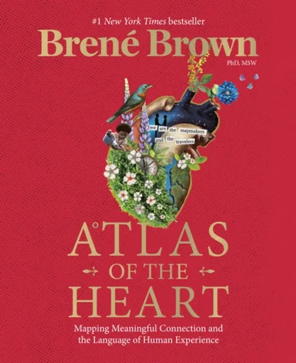
Atlas of the Heart - Brené Brown
#1 NEW YORK TIMES BESTSELLER • In her latest book, Brené Brown writes, “If we want to find the way back to ourselves and one another, we need language and the grounded confidence to both tell our stories and be stewards of the stories that we hear. This is the framework for meaningful connection.”Don’t miss the five-part HBO Max docuseries Brené Brown: Atlas of the Heart!In Atlas of the Heart, Brown takes us on a journey through eighty-seven of the emotions and experiences that define what it means to be human. As she maps the necessary skills and an actionable framework for meaningful connection, she gives us the language and tools to access a universe of new choices and second chances—a universe where we can share and steward the stories of our bravest and most heartbreaking moments with one another in a way that builds connection. Over the past two decades, Brown’s extensive research into the experiences that make us who we are has shaped the cultural conversation and helped define what it means to be courageous with our lives. Atlas of the Heart draws on this research, as well as on Brown’s singular skills as a storyteller, to show ... Unknown localization key: "more"
Objev podobné jako Atlas of the Heart - Brené Brown
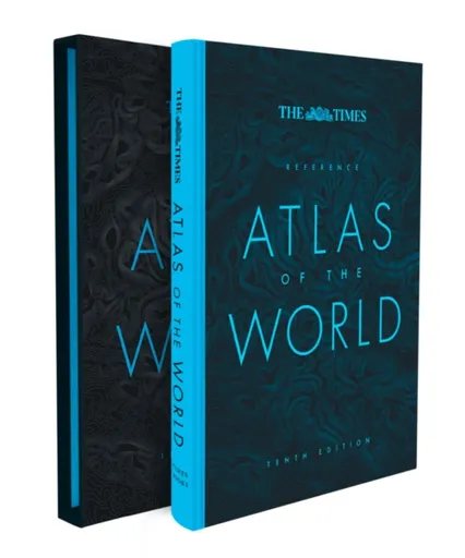
The Times Reference Atlas of the World - Times Atlases
Discover new places with authoritative atlases, beautifully designed and packaged.Tenth edition of this popular atlas from the prestigious and authoritative Times Atlas range. This world atlas contains the breadth, scale and detail to make it an ideal reference resource for school, home and business.The atlas has been brought fully up-to-date to provide a detailed and attractive picture of the world today. The beautifully illustrated introductory section gives a detailed profile of today’s world and covers major contemporary geographical and global issues – such as migration and population growth – through maps and graphics.The reference maps give exceptional detail and provide accurate, accessible and attractive coverage, helping you explore the world.A comprehensive guide to the world’s states and territories including flags, capitals and key statistics is included. Making this an ideal reference atlas for home, school or office.Main features include:• Authoritative mapping of the whole world• Plans of 46 of the world’s major cities• Geographical reference section with flags and statistics for the world’s states and territories• Maps and illustrations on major geographical themes, including earthquakes, population, cities, climate and migration• Historical mapping of the world from 1858 to the present day• More than 45,000 index entries
Objev podobné jako The Times Reference Atlas of the World - Times Atlases
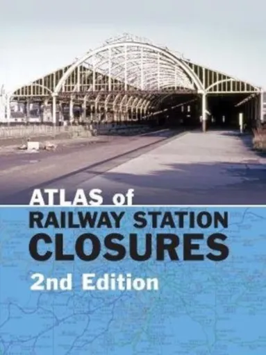
Atlas of Railway Station Closures - Peter Waller
This is a revised and expanded edition of one of our best-reviewed and best-selling titles of 2018, Atlas of Railway Station Closures. The Atlas shows all standard gauge railway lines built in Britain and the dates when each line and every station on those lines was closed. The first part of the book consists of an atlas of the entire railway network. On these maps line closures are colour-coded by decade. The company, BR Region or later organisation owning the station at the time of the closure is listed, as well as the last pre-grouping owner. The name of the station used is in every instance that applied at the time of its closure. The second part of the book provides a complete index and gazetteer listing all station closure dates if the station has closed, and highlighting those still in use.? Atlas of Railway Station Closures encompasses a wealth of invaluable information organised and presented in an accessible format, but we were aware that it was a hugely ambitious project and invited comments from readers some of which have been incorporated into this new edition. This second edition also contains additional inset maps to provide greater clarity and make ... Unknown localization key: "more"
Objev podobné jako Atlas of Railway Station Closures - Peter Waller
The Battle of Britain on the Big Screen - Dilip Sarkar
During the Second World War, the British movie industry produced a number of films concerning the war, all of which were, by necessity, heavily myth-laden and propagandised. Foremost among these productions was The First of the Few, which was the biggest grossing film of 1942.In the immediate post-war period, to start with there were no British aviation war films. The first to be released was Angels One Five in 1952. It was well-received, confirming that the Battle of Britain was a commercial commodity.Over the next few years, many famous war heroes published their memoirs, or had books written about them, including the legless Group Captain Douglas Bader, whose story, Reach for the Sky, told by Paul Brickhill, became a best-seller in 1956. It was followed a year later by the film of the same name, which, starring Kenneth More, dominated that yearÂ’s box office.The early Battle of Britain films had tended to focus upon the story of individuals, not the bigger picture. That changed with the release of the star-studded epic Battle of Britain in 1969. Using real aircraft, the film, produced in color and on a far larger scale than had been seen on film before, was notable for ... Unknown localization key: "more"
Objev podobné jako The Battle of Britain on the Big Screen - Dilip Sarkar
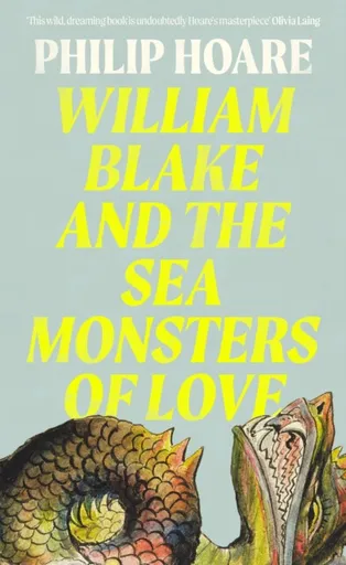
William Blake and The Sea Monsters of Love - Philip Hoare
How one visionary inspired 200 years of art, poetry, and protest…Weaving between the historical, cultural and personal, award-winning author Philip Hoare reveals a web of creative minds and artistic iconoclasts fired with the wild and revolutionary genius of William Blake.‘A life-changing book’ The Times, Book of the Week‘A poetic fever dream’Telegraph‘Queer in all senses of the word’ Neil Tennant‘Undoubtedly Hoare’s masterpiece’ Olivia LaingIn 1973, Derek Jarman set off from London to film the stones of Avebury. He was following in the footsteps of Paul Nash, who had photographed the ancient megaliths a generation before. Standing in that muddy field, by those stones, both artists had felt a direct connection to their hero – a man who had died a long, long time ago, yet who remained electrically alive to them.In this alluring and poetic odyssey, Philip Hoare traces the enduring legacy of William Blake and how he came to inspire so many creative lives. Reaching out of his past and into our future, Blake draws together the natural world and metaphysical realms, merging the human and the animal and the spiritual, firing up twentieth-century artists, filmmakers, poets, writers and musicians with his radical promise of absolute freedom. This stirring, deeply ... Unknown localization key: "more"
Objev podobné jako William Blake and The Sea Monsters of Love - Philip Hoare
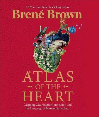
Atlas of the Heart - Brené Brown
In her latest book, five-time #1 New York Times bestselling author Dr Brené Brown, writes, "If we want to find the way back to ourselves and each other, we need language and the grounded confidence to both tell our stories, and to be stewards of the stories that we hear. This is the framework for meaningful connection."In Atlas of the Heart, Brown takes us on a journey through 87 of the emotions and experiences that define what it means to be human. As she maps the necessary skills and lays out an actionable framework for meaningful connection, she gives us the language and tools to access a universe of new choices and second chances - a universe where we can share and steward the stories of our bravest and most heart-breaking moments with one another in a way that builds connection.Over the past two decades, Brown''s extensive research into the experiences that make us who we are has shaped the cultural conversation and helped define what it means to be courageous with our lives. Atlas of the Heart draws on this research, as well as Brown''s singular skills as a researcher/storyteller, to lay out an invaluable, research-based framework that shows ... Unknown localization key: "more"
Objev podobné jako Atlas of the Heart - Brené Brown
Act Premium Prep 2026: Includes 5 Full Length Practice Tests, 100s of Practice Questions + 1 Year Access to Online Quizzes and Video Instruction - Kap
Kaplan is an Official Teaching Partner of the ACT. Redesigned to reflect changes to the ACT, Kaplan’s ACT Premium Prep 2026 has the detailed subject review, practice tests, and expert strategies you need to be prepared for test day. This ACT prep book includes hundreds of practice questions, 4 online practice tests, and video lessons from our experts to help you face test day with confidence. We’re so certain that ACT Premium Prep offers the guidance you need that we guarantee it: After studying with our online resources and book, you'll score higher on the ACT—or you'll get your money back.Essential Review 5 full-length Kaplan practice tests with detailed answer explanations (1 printed in the book and 4 tests online) One-year access to our online center with additional Qbank and videos to help guide your study Pre-quizzes to help you figure out what you already know and what you can skip Mixed practice quizzes after every chapter to assess how much you’ve learned A practice question at the beginning of each lesson to help you quickly identify its focus and dedicated practice questions after every lesson to test your comprehension Efficient Strategy “On Test Day” strategy notes in every math ... Unknown localization key: "more"
Objev podobné jako Act Premium Prep 2026: Includes 5 Full Length Practice Tests, 100s of Practice Questions + 1 Year Access to Online Quizzes and Video Instruction - Kap