torbay a z street atlas a z maps
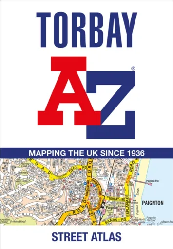
Torbay A-Z Street Atlas - A-Z Maps
Navigate your way around Torbay with this detailed and easy-to-use A-Z Street Atlas.Printed in full-colour, paperback format, this atlas contains 38 pages of continuous street mapping. More than 5,100 streets indexed. Large scale 4 inches to 1 mile map.Areas covered include: Brixham, Paignton, Torquay, Kingskerswell, Newton Abbot, Bovey Tracey, Teignmouth, Dawlish, Ashburton, Buckfastleigh, Totnes, Kingsbridge, Salcombe, Dartmouth.In addition, there are insets of: Bishopsteignton, Ipplepen, Stoke Gabriel and a large scale town centre map of Dartmouth.Postcode districts, one-way streets, Park and Ride sites, safety camera locations with their maximum speed and Dartmoor National Park boundary are featured on the mapping.The Places of Interest Guide is both informative and helpful with information about:Tourist Information CentresBoat tripsSelected places of interestThe English RivieraA comprehensive index lists streets, selected flats, walkways and places of interest, place, area and station names. Additional healthcare (hospitals, walk-in centres and hospices) and transport connections are indexed as well.
Objev podobné jako Torbay A-Z Street Atlas - A-Z Maps
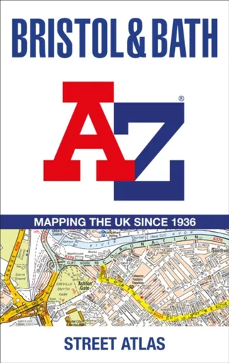
Bristol and Bath A-Z Street Atlas - A-Z Maps
Navigate your way around Bristol and Bath with this detailed and easy-to-use A-Z Street Atlas.Printed in full-colour, paperback format, this atlas contains 104 pages of continuous street mapping. More than 12,800 streets indexed. Large scale 6.25 inches to 1 mile map.Areas covered include: Avonmouth, Bradley Stoke, Filton, Keynsham, Kingswood, Mangotsfield, Portishead, Yate, Frampton Cotterell, Chipping Sodbury, Oldland, Swainswick, Batheaston, University of Bath, Combe Down, Bath Spa University, Saltford, Whitchurch, Bedminster, Long Ashton, Easton-in-Gordano, Cribbs Causeway.Also included are large scale city centre maps of both Bristol and Bath and a postcode map of the atlas area.Postcode districts, one-way streets and safety camera locations with their maximum speed are featured on the street mapping.A comprehensive index lists streets, selected flats, walkways and places of interest, place, area and station names. Additional healthcare (hospitals, walk-in centres and hospices) and transport connections are indexed as well.
Objev podobné jako Bristol and Bath A-Z Street Atlas - A-Z Maps
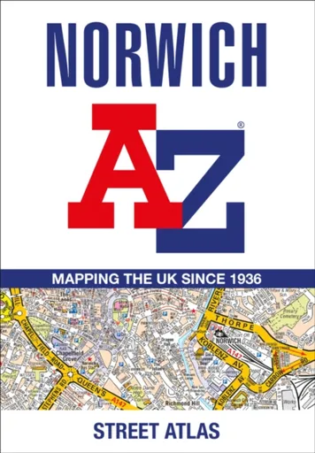
Norwich A-Z Street Atlas - A-Z Maps
Navigate your way around Norwich with this detailed and easy-to-use A-Z Street Atlas.Printed in full-colour, paperback format, this atlas contains 42 pages of continuous street mapping. More than 4,500 streets indexed. Large scale 4 inches to 1 mile map.Areas covered include :Blofield, Blofield Heath, Brundall, Cringleford, Hethersett, Norwich Airport,Poringland, Spixworth, Sprowston, Taverham, Wroxham, Wymondham.In addition, there is an inset map of Horsford and a large scale city centre map of Norwich.Postcode districts, one-way streets and safety camera locations with their maximum speed are featured on the street mapping.A comprehensive index lists streets, selected flats, walkways and places of interest, place, area and station names. Additional healthcare (hospitals, walk-in centres and hospices) and transport connections are indexed as well.
Objev podobné jako Norwich A-Z Street Atlas - A-Z Maps
Podívejte se také
DIESEL Only The Brave Street EdT 50 ml
DIESEL Only The Brave Street parfém
DIESEL Only The Brave Street EdT
koncert 7th Street Entry 1981
Puma COURT CLASSIC STREET boty
platformové boty Carina Street Lux
skateboard šířka 7.75 palců pro street
Converse Chuck Taylor All Star Malden Street
Street Life and Morals Lesley Chamberlainová
odrážedlo First Bike Street red
odrážedlo First Bike Street green
odrážedlo Street/Limited edition
odrážedlo First Bike Street s brzdou
odrážedlo Street light blue
věšák na boty Wenko Atlas
povlečení atlas grádl zelené
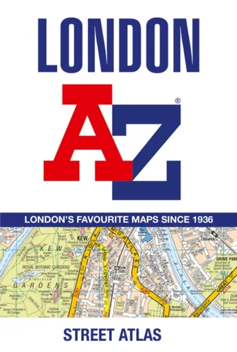
London A-Z Street Atlas - A-Z Maps
Navigate your way around London with this detailed, easy-to-use and up-to-date A-Z Street Atlas.First published in 1936, this iconic atlas is a trusted means of finding your way around the capital city.The main mapping extends beyond Central London from Heathrow Airport to Chingford at a scale of 2.88 inches to 1 mile (4.55 cm to 1 km), featuring postcode districts, one-way streets, the Congestion Charging Zone and Low Emission Zone.The large-scale street map of Central London – at a scale of 5.75 inches to 1 mile – cover Regent’s Park and Shoreditch, Chelsea and Vauxhall, Hyde Park and Bermondsey.A comprehensive index lists streets, selected flats, walkways and places of interest, place, area and junction names. Additional healthcare (hospitals, walk-in centres and hospices) and transport connections (National Rail, London Tramlink, Docklands Light Railway, London Underground and Overground stations, and River Bus pier) are indexed as well.Also included are:• Overview map of the Congestion Charging Zone, Ultra Low Emission and Low Emission Zones• West End Theatre map• London Connections rail services map
Objev podobné jako London A-Z Street Atlas - A-Z Maps
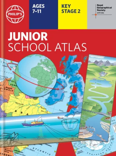
Philip's RGS Junior School Atlas - Philip's Maps
The 12th edition of the market-leading atlas for primary school pupils, Philip''s RGS Junior School Atlas has been fully revised and updated with all the latest facts and curriculum requirements.- The essential atlas for primary schools with clear and easy-to-follow maps and diagrams - updated for 2024/2025- Published in association with the Royal Geographical Society- Recommended for Key Stage 2 of the National Curriculum - and all 7-11 year olds - An excellent introduction to mapping concepts such as scale, direction, symbols, longitude and latitude- 22-page Britain and Ireland section with clear thematic charts, diagrams and large-scale regional maps- 22-page section on The World, with political maps - and thematic treatment of key themes, from volcanoes and earthquakes to transport and tourism- Continents section with physical and political maps- Easy-to-follow map references and 1,000-place indexThe introductory section describes the meaning of scale, how to measure distances using the maps, and explains the symbols on the maps.The following section is devoted to the United Kingdom and Ireland. Thematic maps cover topics such as mountains and rivers, climate and weather, population and cities, farming and fishing, industry and energy, transport, tourism and conservation. The rest of the atlas is made up of ... Unknown localization key: "more"
Objev podobné jako Philip's RGS Junior School Atlas - Philip's Maps
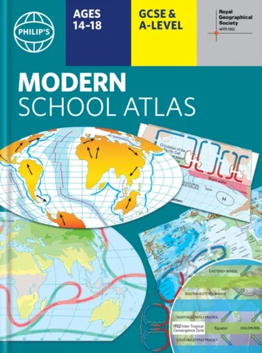
Philip's RGS Modern School Atlas - Philip's Maps
- Britain''s best-selling school atlas - now in its 101st edition- Recommended for Key Stage 4, GCSE and A-Level in England and Wales (Scottish National Qualifications/Highers) and international schools- Fully updated to reflect the latest changes in the curriculum- Published in association with the Royal Geographical Society- Combines superb digital maps of Britain and the world with up-to-date thematic maps - Country-by-country statistics on population, land use, trade, tourism, energy, wealth and much more - World Themes Section - from volcanoes and earthquakes to population trends, languages and religions, all the key aspects and statistics of geography are explored and explained- Plus a special section on how satellite imagery is used to interpret global, environmental and urban patterns of change Britain''s best-selling secondary school atlas, now in its 101st Edition. The contents are divided into colour-coded sections for rapid reference. The physical maps of the United Kingdom and Ireland are accompanied by thematic maps on numerous key social and economic themes. World topographical maps, with thematic maps on topics such as climate, population and economics, are followed by 30 pages of World thematic maps.Completing the atlas is a section of World social and economic statistics, and an index with letter-figure ... Unknown localization key: "more"
Objev podobné jako Philip's RGS Modern School Atlas - Philip's Maps
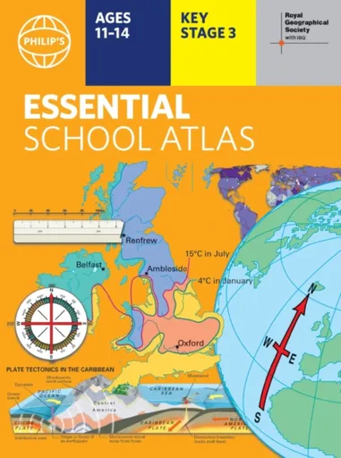
Philip's RGS Essential School Atlas - Philip's Maps
"An excellent world atlas. Very illuminating, good colours, clear texts...good glossary and, last but not least, up-to-date." - customer review- The ideal school atlas for Key Stage 3 pupils and Scotland''s National Qualifications, 11-14 years old- All updated for 2024 specifically to meet curriculum needs- Specially focused 16-page UK and Ireland section- Comprehensive 62-page world section includes thematic maps on the environment, climate change, people, quality of life, and energy- Published in association with the Royal Geographical SocietyPhilip''s RGS Essential School Atlas has been specially created for lower-secondary geography students (11-14 year olds). The maps have been carefully designed to be uncluttered and easy to read, containing specially selected place names and detail. A clear set of symbols and scale information accompanies every map, with a useful introductory section covering basic atlas skills, including aerial photographs and satellite images to further explain particular features on the maps. Latitude and longitude co-ordinates are included in the index, alongside figure-letter references. Fully up-to-date, the atlas includes detailed regional maps, charts and satellite images of Europe, Italy, the Middle East, China, Japan, Kenya, USA, Brazil, and the Arctic and Antarctica. It also focuses on areas of special interest for students of geography, such ... Unknown localization key: "more"
Objev podobné jako Philip's RGS Essential School Atlas - Philip's Maps
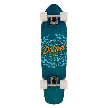
D-Street - Cruiser Atlas Blue 28" (5059415068513)
Longboard s cruiser tvarem desky, rozměry 71,2 × 18,4 cm, tvrdost koleček 78 A, průměr koleček 59 mm Pokud hledáte cruiser vhodný na jízdu po městě i delší projížďky, D-Street Atlas je skvělou volbou. Osloví vás nejen jeho výjimečný design, ale rovněž vysoce kvalitní komponenty. Cruiser je tvořený deskou ze 7 vrstev kanadského javoru, což zajistí jeho maximální pevnost. Pohodlnou jízdu umožní rychlá kolečka o průměru 60 mm a tvrdosti 78A, která jsou osazená ložisky ABEC-7. Trucky jsou přitom vyrobené z hliníku. S cruisem D-Street Atlas si užijete jízdu po městě i perfektní triky v parku. Klíčové vlastnosti longboardu D-Street Atlas Blue 28"Longboard vhodný na jízdu po městě i delší projížďkyTvořený deskou ze 7 vrstev kanadského javoruPohodlnou jízdu zajistí rychlá kolečka o průměru 60 mm a tvrdosti 78ATrucky vyrobené z hliníkuNechybí ložiska ABEC-7Cruiser D-Street Atlas umožní i provádění trikůBarevné provedení: žluto-černo-modré...
Objev podobné jako D-Street - Cruiser Atlas Blue 28" (5059415068513)
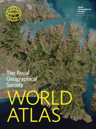
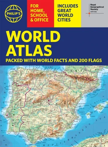
Philip's RGS World Atlas - Philip's Maps
"An excellent world atlas. Very illuminating, good colours, clear texts...good glossary and, last but not least, up-to-date". Amazon customer review· The perfect world atlas for work, study or leisure· Great value for money· 96 pages of authoritative world maps, physical and political· 70 city maps in the fascinating World Cities section, with full-page satellite images for 10 great cities· Over 35,000 place name indexAll this and a special 32-page introductory section - ''The World in Focus'' - covers key geographical themes such as the Earth''s position in the Solar System, the structure of the Earth, climate and weather, the environment, population, resources, economics and international organizations. Vital information on topics covered in geography, humanities and economics courses.The information-packed World Atlas from Philip''s, published in association with the Royal Geographical Society has been fully updated for this new, 2021 edition
Objev podobné jako Philip's RGS World Atlas - Philip's Maps
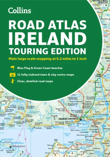
Road Atlas Ireland - Collins Maps
Explore Ireland with this accurate and fully updated road atlas.This road atlas is at A4 size, covering the whole of Ireland and features clear and detailed Collins colour mapping at a scale of 5.2 miles to 1 inch. Perfect for both residents and visitorstouring Ireland.This revised edition includes:Places of tourist interestContact information for Tourist Information Centres with grid references to the mappingFully indexed street maps of 11 cities and towns – Dublin, Belfast, Cork, Limerick, Waterford,Londonderry (Derry), Galway, Bangor, Dun Laoghaire, Drogheda and KillarneyBlue Flag & Green Coast beachesFerry and airport information; Distance chart; Distances marked on the roads in miles and kilometresRoute planning map of the whole of Ireland at 15.8 miles to 1 inchAdministrative map of Irish counties and districts.
Objev podobné jako Road Atlas Ireland - Collins Maps

Nicolson Street Atlas Ayrshire - Nicolson Digital Ltd, Val Fry
Based on OS data and fully revised for 2017 the Ayrshire Street Atlas is your essential guide to the towns and villages throughout Ayrshire. Exceptionally clear mapping and full index to street names. Don''t leave home without it!Exceptionally clear street mappingIndex to street namesTourist attractions highlightedShows schools, post offices, parking, petrol stations, hospitals religious buildings, recreation areas, cemeteries and more
Objev podobné jako Nicolson Street Atlas Ayrshire - Nicolson Digital Ltd, Val Fry
Nicolson Street Atlas Fife
Street atlas of all the towns and villages in Fife.Featuring the great clear Nicolson Digital Mapping
Objev podobné jako Nicolson Street Atlas Fife

Stanex Povlečení atlas grádl tmavě šedá, 140 x 200 cm, 70 x 90 cm
Povlečení z atlas grádlu je vyrobeno ze 100% bavlny a nabízí pohodlí a hebkost. Tmavě šedý odstín a struktura proužků dodávají elegantní vzhled. Souprava obsahuje povlak na polštář 70x90 cm a povlak na přikrývku 140x200 cm.
- Vyrobeno ze 100% kvalitní bavlny pro mimořádnou hebkost
- Elegantní tmavě šedý odstín a struktura 2,5 cm proužků
- Snadná údržba – perte naruby bez bělidel
Objev podobné jako Stanex Povlečení atlas grádl tmavě šedá, 140 x 200 cm, 70 x 90 cm

Stanex Povlečení atlas grádl béžová, 140 x 200 cm, 70 x 90 cm
Povlečení z atlas grádlu je vyrobeno z 100% bavlny a nabízí pohodlí a hebkost. Béžový odstín a struktura proužků dodávají elegantní vzhled. Souprava obsahuje povlak na přikrývku 140x200 cm a povlak na polštář 70x90 cm.
- Vyrobeno ze 100% kvalitní bavlny pro mimořádnou hebkost.
- Elegantní design s 2,5 cm proužky a noblesním béžovým odstínem.
- Snadná údržba – perte naruby bez bělidel a chemických čistidel.
- Kompletní souprava obsahuje povlak na přikrývku i polštář.
Objev podobné jako Stanex Povlečení atlas grádl béžová, 140 x 200 cm, 70 x 90 cm

Stanex Povlečení atlas grádl světle šedá, 140 x 200 cm, 70 x 90 cm
Povlečení z atlas grádlu je vyrobeno z 100% bavlny a nabízí pohodlí a hebkost. Světle šedý odstín a struktura proužků dodávají elegantní vzhled. Souprava obsahuje povlak na přikrývku 140x200 cm a povlak na polštář 70x90 cm.
- Vyrobeno ze 100% kvalitní bavlny pro mimořádnou hebkost.
- Elegantní design s 2,5 cm proužky a světle šedým odstínem.
- Snadná údržba – doporučeno prát naruby bez agresivní chemie.
- Kompletní souprava obsahuje povlak na přikrývku i polštář.
Objev podobné jako Stanex Povlečení atlas grádl světle šedá, 140 x 200 cm, 70 x 90 cm

Stanex Povlečení atlas grádl smetanová, 140 x 220 cm, 70 x 90 cm
Povlečení z materiálu atlas grádl nabízí hebkost a pohodlí. Sada obsahuje povlak na přikrývku 140x220 cm a povlak na polštář 70x90 cm v smetanovém odstínu. Je vyrobeno z kvalitní bavlny a vyznačuje se elegantním designem s proužky.
- Vyrobeno ze 100% kvalitní bavlny pro maximální pohodlí
- Elegantní design s 2,5 cm proužky a noblesním smetanovým odstínem
- Snadná údržba - doporučeno prát naruby bez agresivní chemie
Objev podobné jako Stanex Povlečení atlas grádl smetanová, 140 x 220 cm, 70 x 90 cm

Stanex Povlečení atlas grádl starorůžová, 140 x 220 cm, 70 x 90 cm
Povlečení z materiálu atlas grádl nabízí hebkost a pohodlí díky 100% bavlně. Design s 2,5 cm proužky a starorůžovým odstínem přináší do ložnice noblesní vzhled. Souprava obsahuje povlak na přikrývku 140x220 cm a povlak na polštář 70x90 cm.
- Vyrobeno ze 100% kvalitní bavlny pro maximální pohodlí
- Elegantní starorůžový odstín a struktura proužků
- Snadná údržba - doporučeno prát naruby bez agresivní chemie
- Kompletní souprava obsahuje povlak na přikrývku i polštář
Objev podobné jako Stanex Povlečení atlas grádl starorůžová, 140 x 220 cm, 70 x 90 cm
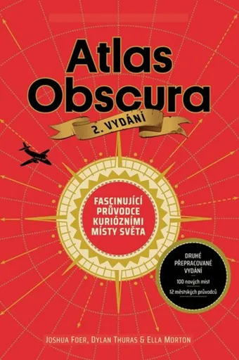
Atlas Obscura - Joshua Foer, kolektiv autorů
Atlas Obscura je průvodce představující přes 700 nejpodivuhodnějších a nejméně známých míst na planetě. Zahrnuje přírodní zázraky, bizarní lidské výtvory a tajemné lokality. Kniha slouží jako inspirace pro cestovatele hledající neobvyklé zážitky.
- Obsahuje více než 700 unikátních a kuriózních míst z celého světa.
- Inspiruje k objevování neznámých a nevyšlapaných cest.
- Bohatě ilustrovaný průvodce pro milovníky dobrodružství a záhad.
Objev podobné jako Atlas Obscura - Joshua Foer, kolektiv autorů
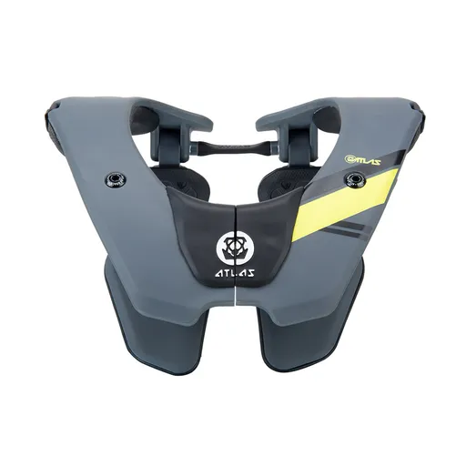
Dětský chránič krční páteře ATLAS Tyke Grey
Dětský chránič krční páteře ATLAS Tyke Grey je určen pro motokros, BMX, čtyřkolky a horská kola. Konstrukce Split-Flex Frame a systém ERS zajišťují pohyblivost a možnost rychlého odložení. Chránič zabraňuje hyperflexi, hyperextenzi a axiálnímu zatížení páteře.
- Patentovaná flexibilní konstrukce Split-Flex Frame pro maximální pohyblivost
- Systém ERS umožňující rychlé odložení chrániče při nehodě
- Široká kontaktní zóna a odpružení hrudní části pro vyšší bezpečnost
- Minimalistický design s nízkou hmotností (460 g) pro pohodlí dítěte
Objev podobné jako Dětský chránič krční páteře ATLAS Tyke Grey

Stanex Povlečení atlas grádl smetanová, 140 x 200 cm, 70 x 90 cm
Povlečení z atlas grádlu je vyrobeno ze 100% bavlny a nabízí pohodlí s hebkou strukturou. Smetanový odstín a proužkový design přináší do ložnice eleganci. Souprava obsahuje povlak na polštář 70x90 cm a povlak na přikrývku 140x200 cm.
- Vyrobeno z 100% kvalitní bavlny pro mimořádnou hebkost
- Elegantní struktura 2,5 cm proužků podtrhne design
- Smetanový odstín dodá ložnici noblesní vzhled
- Snadná údržba - doporučeno prát naruby bez bělidel
Objev podobné jako Stanex Povlečení atlas grádl smetanová, 140 x 200 cm, 70 x 90 cm

Stanex Povlečení atlas grádl světle šedá, 140 x 220 cm, 70 x 90 cm
Povlečení Stanex z atlas grádlu je vyrobeno z 100% bavlny a nabízí pohodlí s elegantním designem proužků. Světle šedý odstín dodá ložnici noblesní vzhled. Sada obsahuje povlak na přikrývku 140 x 220 cm a povlak na polštář 70 x 90 cm.
- Vyrobeno ze 100% kvalitní bavlny pro mimořádnou hebkost.
- Elegantní design s 2,5 cm proužky a světle šedým odstínem.
- Snadná údržba – perte naruby bez agresivní chemie.
- Kompletní sada obsahuje povlak na přikrývku i polštář.
Objev podobné jako Stanex Povlečení atlas grádl světle šedá, 140 x 220 cm, 70 x 90 cm
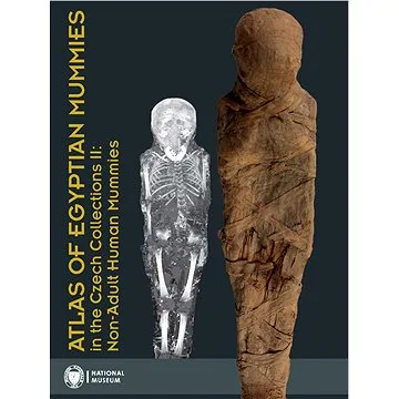
Atlas of Egyptian Mummies in the Czech Collections II: Non-Adult Human Mummies (978-80-7036-750-6)
Druhý díl série Atlas egyptských mumií v českých sbírkách se specializuje na mumie a pohřební vybavení dětí a dospívajících do 15 let. Obsahuje podrobný katalog dvou kompletních mumií, dvanácti izolovaných částí a šesti pohřebních schránek. Publikace přináší informace o zdravotním stavu, nemocech a pohřebních praktikách dětí ve starověkém Egyptě.
- Druhý díl odborné série o egyptských mumiích
- Zaměření na mumie dětí a dospívajících do 15 let
- Podrobný katalog s proveniencí a zdravotními analýzami
- Vědecky hodnotný materiál z Národního muzea v Praze
Objev podobné jako Atlas of Egyptian Mummies in the Czech Collections II: Non-Adult Human Mummies (978-80-7036-750-6)
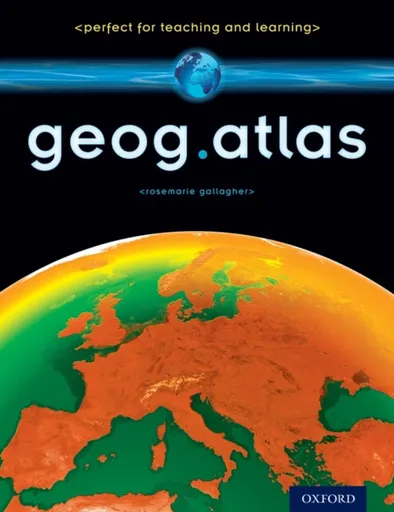
geog.atlas - Gallagher RoseMarie
geog.atlas is an engaging atlas of accessible maps and supporting information. It features unique coverage of places likely to appear in the news, such as the Middle East, Afghanistan, and the Falklands. Special maps look at themes like global warming, desertification, and how people spread around the world. Stunning satellite images are placed alongside physical geography maps to aid understanding. ''Did you know?'' and ''What if?'' circles provide interesting extra information and engaging facts.Full of clearly-labelled maps, straightforward explanations, and advice on how to ''read'' maps and understand what they show, it will help improve students'' basic locational knowledge, enhance their understanding, and build their confidence.geog.atlas supports teachers whether they''re using geog.123 or an alternative course at KS3.
Objev podobné jako geog.atlas - Gallagher RoseMarie

Stanex Povlečení atlas grádl starorůžová, 140 x 200 cm, 70 x 90 cm
Povlečení z atlas grádlu je vyrobeno ze 100% bavlny a nabízí pohodlí a hebkost. Souprava obsahuje povlak na přikrývku 140 x 200 cm a povlak na polštář 70 x 90 cm. Elegantní design s proužkovou strukturou a starorůžovým odstínem dodává ložnici noblesní vzhled.
- Vyrobeno ze 100% kvalitní bavlny pro mimořádnou hebkost.
- Elegantní design s 2,5 cm proužkovou strukturou.
- Starorůžový odstín dodává ložnici noblesní vzhled.
- Snadná údržba - doporučeno prát naruby bez bělidel.
Objev podobné jako Stanex Povlečení atlas grádl starorůžová, 140 x 200 cm, 70 x 90 cm
The Atlas Maneuver - Steve Berry
Román představuje nové dobrodružství Cottona Malonea, který se zaplete do pátrání po legendárním japonském válečném pokladu zvaném Yamashitovo zlato. Příběh propojuje historické události z konce druhé světové války se současnou hrozbou zneužití kryptoměn k narušení globálního finančního systému. Děj zavede čtenáře do Švýcarska, Lucemburska a marockých hor v honbě za odhalením konspirace známé jako Atlasovo manévr.
- Nejnovější díl oblíbené série Cotton Malone
- Napínavý příběh kombinující historická fakta a fikci
- Rychlý spád děje s mezinárodním přesahem
- Aktuální téma kryptoměn v thrillerovém kontextu
Objev podobné jako The Atlas Maneuver - Steve Berry
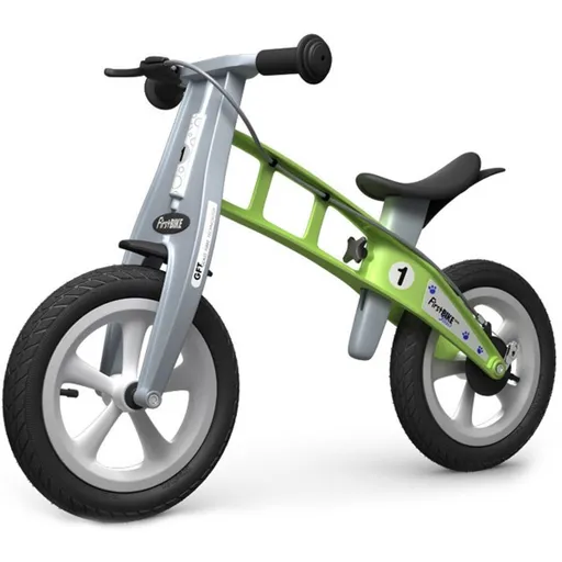
First Bike Odrážedlo Street green
First Bike Street je odrážedlo určené dětem od 2 do 5 let pro nácvik rovnováhy před přechodem na šlapací kolo. Disponuje nastavitelným sedlem, jemnými nafukovacími pneumatikami pro městské použití a bezpečnostními prvky jako omezený rozsah řídítek. Hmotnost 3,9 kg zajišťuje snadnou ovladatelnost pro malé děti.
- Lehká konstrukce (3,9 kg) pro snadné ovládání dětmi
- Plynule nastavitelné sedlo (34,5–44,5 cm) s možností snížení adaptérem
- Dvojité brzdění: citlivá ruční přední a bubnová zadní brzda
- Časově neomezená záruka na rám a vidlici, 5 let na ostatní díly
Objev podobné jako First Bike Odrážedlo Street green
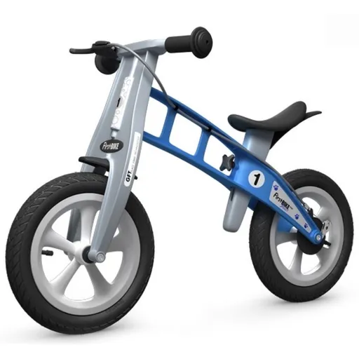
First BIKE Odrážedlo Street light blue s brzdou
Odrážedlo First Bike Street je lehké dětské odrážedlo určené pro věk 2–5 let, které pomáhá trénovat rovnováhu před přechodem na šlapací kolo. Disponuje nastavitelným sedlem, bezpečnostní brzdou a je optimalizováno pro použití ve městě. Výrobek nabízí rozšířené záruční podmínky.
- Lehká konstrukce (3,9 kg) pro snadné ovládání dětmi
- Plynule nastavitelné sedlo (34,5–44,5 cm) s možností snížení adaptérem
- Bezpečnostní prvky: citlivá ruční brzda, bubnová zadní brzda a omezený rozsah otáčení řídítek
- Dlouhá záruka: časově neomezená na rám a vidlici, 5 let na ostatní části
Objev podobné jako First BIKE Odrážedlo Street light blue s brzdou

DIESEL Only The Brave Street EdT 50 ml (3614272320819)
DIESEL Only The Brave Street EdT je pánská toaletní voda italské výroby s objemem 50 ml. Hlavní charakteristikou je dřevitá vůně kombinující silné a jemné tóny. Vůně je navržena tak, aby působila svěže a dynamicky.
- Dřevitá hlavní vůně s jedinečnou kombinací tónů
- Italská výroba zajišťující kvalitu
- Objem 50 ml pro dlouhodobé používání
- Silná, ale jemná vůně vhodná pro každodenní nošení
Objev podobné jako DIESEL Only The Brave Street EdT 50 ml (3614272320819)

First Bike Odrážedlo Street red
Odrážedlo First Bike Street je lehké sportovní odrážedlo určené dětem od 2 do 5 let pro trénink rovnováhy před přechodem na šlapací kolo. Vybaveno je nastavitelným sedlem, ruční a zadní brzdou a kvalitními nafukovacími pneumatikami vhodnými pro městské použití. Rám a vidlice mají časově neomezenou záruku.
- Lehounká konstrukce (3,9 kg) pro snadné ovládání dětmi
- Plynule nastavitelné sedlo (34,5–44,5 cm) a volitelný snižovací adaptér pro menší děti
- Dvojité brzdění: citlivá ruční brzda a zadní bubnová brzda
- Dlouhá záruka: časově neomezená na rám a vidlici, 5 let na ostatní části
Objev podobné jako First Bike Odrážedlo Street red
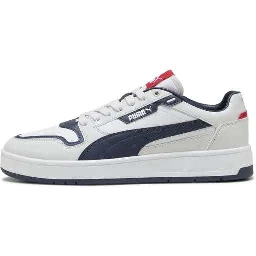
Puma COURT CLASSIC STREET Pánské boty na volný čas, bílá, velikost 42.5
Pánské tenisky Puma COURT CLASSIC STREET kombinují retro tenisový design s moderní všestranností pro denní nošení. Boty jsou vybaveny technologií SOFTFOAM+ pro optimální odpružení a pohodlí. Jedná se o ikonický základní kousek vhodný pro volnočasové aktivity.
- Stylový retro design inspirovaný tenisem
- Vložka SOFTFOAM+ pro vynikající odpružení a pohodlí
- Všestranný základní kousek vhodný pro každodenní nošení
- Kvalitní materiály a ikonická značka Puma
Objev podobné jako Puma COURT CLASSIC STREET Pánské boty na volný čas, bílá, velikost 42.5
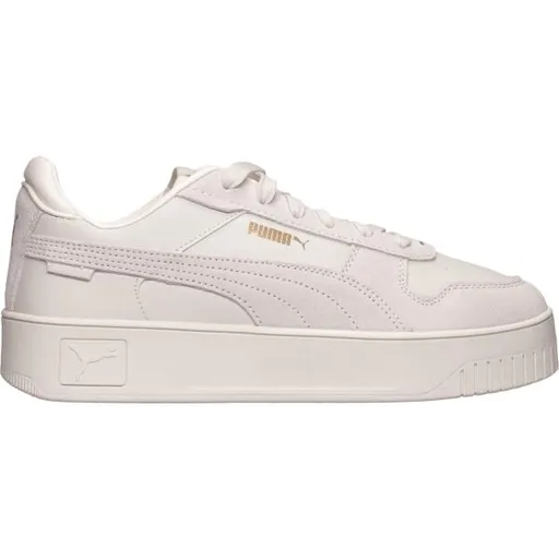
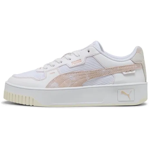
Puma CARINA STREET SD Dámské tenisky, béžová, velikost 41
Dámské tenisky Puma CARINA STREET SD s platformou jsou určeny pro každodenní nošení. Béžová barva umožňuje snadnou kombinaci s různými outfity. Model je dostupný ve velikosti 41.
- Zvýšená platforma pro pohodlí
- Vhodné pro každodenní nošení
- Stylový design od značky Puma
- Béžová barva snadno kombinovatelná
Objev podobné jako Puma CARINA STREET SD Dámské tenisky, béžová, velikost 41
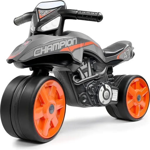
Falk Odrážedlo Street Chamipion šedo-oranžové
Odrážedlo Street Champion v šedo-oranžovém provedení je určeno pro děti od 2 let. Disponuje robustní konstrukcí s nosností do 30 kg a tichými kolečky. Výrobek je vyroben z části z recyklovaného plastu ve Francii a splňuje evropské bezpečnostní normy.
- Vhodné pro děti již od 2 let pro rozvoj rovnováhy a koordinace.
- Robustní konstrukce s nosností až 30 kg a tichými kolečky pro hladkou jízdu.
- Vyrobeno z kvalitního materiálu s 50% podílem recyklovaného plastu ve Francii.
- Kompaktní rozměry (75 × 40 × 51 cm) a testováno podle evropských bezpečnostních norem.
Objev podobné jako Falk Odrážedlo Street Chamipion šedo-oranžové
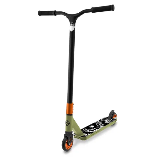
Freestyle koloběžka Street Surfing BANDIT Blast Olive Cr-Mo
Freestyle koloběžka Street Surfing BANDIT Blast je navržena pro triky s pevným hlavovým složením HIC a zpevněnými řídítky z oceli Cr-Mo. Disponuje širokým hliníkovým nášlapem, výkonnou brzdou a kolečky 100 mm. Je vhodná pro jezdce od 8 let s nosností 100 kg a hmotností 3,4 kg.
- Zpevněná ocelová řídítka Cr-Mo 4130 s otáčením 360° pro ovládání triků
- HIC kompresní systém v hlavovém složení pro stabilitu a snadné manévrování
- Široký protiskluzový nášlap ze slitiny hliníku 6061 o šířce 110 mm
- Výkonná zadní brzda a kvalitní komponenty (ABEC 9, PU kolečka) pro bezpečný výkon
Objev podobné jako Freestyle koloběžka Street Surfing BANDIT Blast Olive Cr-Mo
Puma CARINA STREET LUX CRAFTED FLOWERS Dámská vycházková obuv, bílá, velikost 38
Dámské tenisky Puma Carina Street Lux Crafted Flowers kombinují streetwearový design s platformovým profilem a basketbalovými detaily. Bílé boty s květinovým potiskem jsou vhodné pro volnočasové nošení. Model nabízí stylové doplnění každodenního outfitu.
- Stylový streetwear design s květinovým potiskem
- Platformový podpatek pro pohodlí a výšku
- Všestrannost pro každodenní nošení
- Kvalitní zpracování značky Puma
Objev podobné jako Puma CARINA STREET LUX CRAFTED FLOWERS Dámská vycházková obuv, bílá, velikost 38
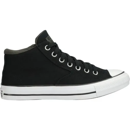
Converse CHUCK TAYLOR ALL STAR MALDEN STREET Pánské kotníkové tenisky, černá, velikost
Pánské kotníkové tenisky Converse CHUCK TAYLOR ALL STAR MALDEN STREET v černé barvě nabízejí pohodlné nošení díky polstrování okolo kotníku. Mají klasické šněrování, hřejivou podšívku a protiskluzovou podrážku. Logo značky je umístěno na vnitřní straně.
- Pohodlné silnější polstrování okolo kotníku
- Klasické šněrování s textilními tkaničkami
- Hřejivá podšívka a protiskluzová podrážka
- Univerzální design vhodný pro volnočasové outfity
Objev podobné jako Converse CHUCK TAYLOR ALL STAR MALDEN STREET Pánské kotníkové tenisky, černá, velikost
Philip's Caribbean Atlas for Secondary Schools - Philip's Maps
A new edition of the market-leading atlas for CXC Geography students, Philip''s Caribbean Atlas for Secondary Schools provides extensive coverage of the Caribbean area, together with a comprehensive selection of world and regional maps. The atlas is arranged in three sections for ease of use, with each page colour-coded for rapid reference. The first section is devoted to a detailed coverage of the Caribbean region in 48 pages, and includes maps of every island plus Belize and Guyana, as well as topographical, land use, tourism and mining maps.The second section is made up of 72 pages of World topographical maps, incorporating continental thematic maps on topics such as population, climate and biomes, followed by 32 pages of World thematic maps. This new 8th edition features updated mapping of all Caribbean islands, as well as the latest statistics. The World map section contains additional coverage of Brazil, the Americas and Asia, while the World thematic section includes maps on volcanoes, El Niño, tourism, energy, minerals, industry, trade and international organizations.Completing the atlas is a section of CXC study maps covering topics such as farming, soil conservation, economics, tourism and urban land use. Features regional studies of Mauritius, UK, Canada, USA and ... Unknown localization key: "more"
Objev podobné jako Philip's Caribbean Atlas for Secondary Schools - Philip's Maps
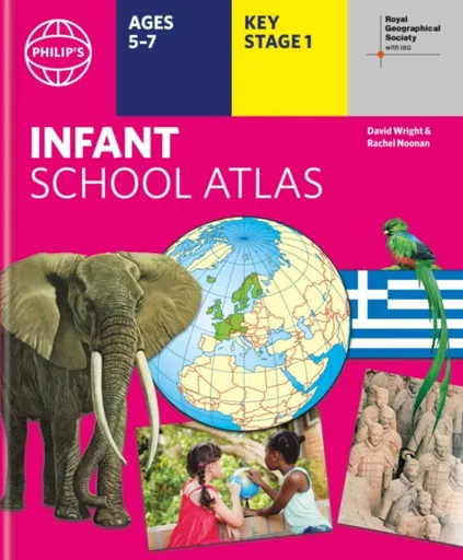
Philip's RGS Infant School Atlas - David Wright, Philip's Maps, Rachel Noonan
Written for 5 to 7 year-old this atlas is ideal for teaching Key Stage 1, helping to cover geography, history, science, citizenship and literacy requirements- Written by experts Professor David Wright and Rachel Noonan- Published in association with the Royal Geographical Society- 50 pages of clear, child-friendly maps showing our world today- Countries of the world brought to life with flags, illustrations and photos- Bold text, simple words and short sentences to encourage reading skills- Starts with the Earth as a Planet then zooms into each of the world''s regions with maps and illustrations- Numbered balloons on each map link to photos of a real placeFully revised and updated, the atlas is for children aged 5-7 in the early stages of reading, with simple text to explain what is happening on the maps and illustrations - all compatible with National Curriculum Key Stage 1.Clear, child-friendly maps are combined with vibrant photographs and facts about the world. Guidance is given at the beginning of the atlas on how to use the maps, encouraging the early development of map skills. Each colourful spread is illustrated with photographs and packed with fact boxes, curiosities, flags, stamps and simple quiz questions. Philip''s RGS Infant ... Unknown localization key: "more"
Objev podobné jako Philip's RGS Infant School Atlas - David Wright, Philip's Maps, Rachel Noonan
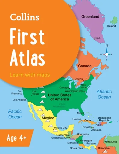
Collins First Atlas - Collins Maps
The must-have atlas for children aged 4-7Collins First Atlas is a fun, vibrant and clear starter atlas for children aged 4-7 years, providing the perfect foundation to basic geography skills.The atlas begins by introducing pupils to photographs and mapping of a local area, then gradually leads them through maps of regional, national, continental and global areas.Short, informative sentences introduce pupils to basic geographical and atlas vocabularyMaps are clearly labelled to highlight certain countries and featuresMapping concepts are presented in a way that supports learning development, as concepts become more complexIdeal for classroom use or home learningFully up-to-dateSuitable for EYFS and KS1This atlas is also available in a Kindle format. The next atlas in this series is the Collins Primary Atlas, suitable for ages 7+ and KS2.
Objev podobné jako Collins First Atlas - Collins Maps
Philip's RGS World Atlas (A4) - Philip's Maps
Thousands of global facts at your fingertips with the best value quick-reference World Atlas on the market. Both physical and political geography is clearly illustrated alongside the great cities of our planet.The highest peak? The deepest ocean trench? The wettest, driest, longest, largest - we list the world''s fascinating extremes. Crammed with practical information like a Distance Chart for World Cities, World Time Zones, over 200 State Flags and the top 100 most populous countries, we include around 15,000 places indexed for easy checking. Whether for the pub quiz, travel planning or school reference, this great value handy world atlas is crammed with everything you need to know.Alongside the topography and physical attributes of the earth we also show political boundaries and the great global cities, including transport hubs and places of interest from mosques to temples, palaces to zoos and shopping centres to tourist information centres.Features include: * 200 Flags of the world''s major states and territories* 21 City centre maps: transport (road, rail, trams, light railways, bus and railway stations) and places of interest including religious buildings (churches, abbeys, cathedrals, synagogues, shrines, temples, mosques), museums, galleries, theatres, palaces, castles, parks, gardens, zoos, shopping centres, hospitals, Tourist Centres.* World ... Unknown localization key: "more"
Objev podobné jako Philip's RGS World Atlas (A4) - Philip's Maps
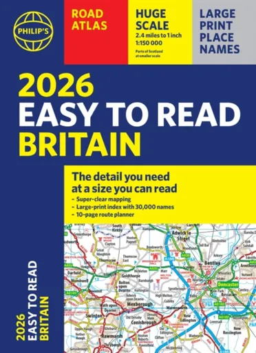
2026 Philip's Easy to Read Road Atlas of Britain - Philip's Maps
"The detail you need at a size you can read". The latest 2026 Philip''s Easy to Read Road Atlas of Britain from the best-selling Road Atlas range has over 350 pages packed with exceptionally clear mapping and everything you need for exploring Britain. Now available as a practical paperback, it will enhance any trip.· Clear maps packed with extra details for a better journey· Huge 1:150,000 scale (approx 2.4 miles to 1 inch)· Large print place names· Large print index· Super-clear 10-page route planner to create the best journeys· Thousands of attractions clearly mapped, including castles, theme parks, gardens, zoos and more.· London''s expanded ULEZ clearly shown on approach mapping· Over 100,000 copies of the Philip''s Easy Read Road Atlases of Britain sold since launch in 2020.At last, a road atlas that everyone can read easily, in or out of the car, no matter what the conditions. With up-to-date mapping technology, your travels have never been easier to plan. This edition contains a wealth of useful information, including tourist attractions, to ensure the best possible journey. Whether it''s dark, or if you just can''t find your glasses, the 2026 Philip''s Easy to Read Road Atlas of Britain is the ultimate ... Unknown localization key: "more"
Objev podobné jako 2026 Philip's Easy to Read Road Atlas of Britain - Philip's Maps
Collins World Atlas: Essential Edition - Collins Maps
A new fully updated reference atlas in the exciting Collins world atlas range. Great value and contains all the world maps you need in a budget atlas, for family, study and business use.
Objev podobné jako Collins World Atlas: Essential Edition - Collins Maps
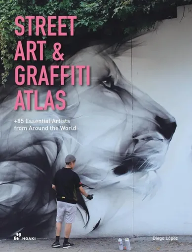
Street Art & Graffiti Atlas - Diego Lopez Gimenez
A visually rich book that offers a varied and diverse selection of 85 of the best graffiti artists, urban artists and muralists in the world today, showcasing a selection of their work and sharing their passions, dreams, challenges and the difficulties of being a street artist. Street Art & Graffiti Atlas offers a selection that hints at the wealth of street talent in the world today and is an excellent starting point for exploring the personal stories and creations of artists who decided to turn the city streets into their personal canvas. A varied and diverse selection of 86 of the best graffiti artists, urban artists and muralists from 26 countries around the world, including several texts from the famous Darryl "Cornbread" McCray, considered the world's first modern graffiti artist. Urban art, muralism and graffiti reflect the dynamic pulse of a city, breaking the monotony and grayness of the cement and altering our vision of an urban environment. Human beings have always felt the need to express themselves on the walls of their communities, from cave paintings to the inscriptions on the walls of ancient Roman and Greek cities, to the current walls of virtual networks. The artists featured in ... Unknown localization key: "more"
Objev podobné jako Street Art & Graffiti Atlas - Diego Lopez Gimenez
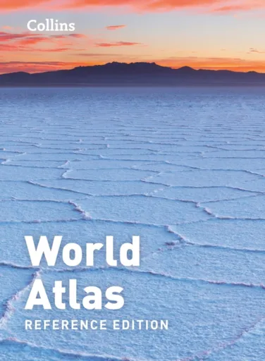
Collins World Atlas: Reference Edition - Collins Maps
A new, fully updated edition of this popular atlas in the Collins world atlas range. Designed in the distinctive Collins style, it is the ideal reference atlas for school, home and business use.
Objev podobné jako Collins World Atlas: Reference Edition - Collins Maps
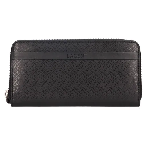
Dámská kožená peněženka Lagen Torbea - černá
Kvalitní kožená dámská peněženka značky Lagen! Vstupte do světa nekompromisní elegance a precizního designu s dámskou koženou peněženkou od prestižní značky Lagen. Peněženka Lagen Torbea představuje dokonalé spojení luxusního koženého provedení s praktickým uspořádáním. Peněženka je uzavíratelná zipem a nabízí dostatek úložného prostoru a organizace pro vaše potřeby. Uvnitř objevíte široký výběr přihrádek (osm) na platební nebo věrnostní karty, prostor pro bankovky, doklady a uzavíratelnou kapsu na zip, které zajistí bezpečné uložení vašich cenností. Každá peněženka je pečlivě zabalena v papírové dárkové krabičce, připravené k okamžitému darování nebo použití.
Objev podobné jako Dámská kožená peněženka Lagen Torbea - černá
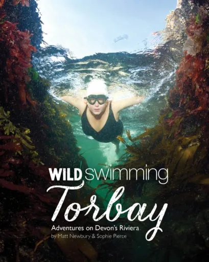
Wild Swimming Torbay - Sophie Pierce, Matt Newbury
15 swimming adventures along the secret coast. The coastline of Torquay, Paignton and Brixham in Devon is Britain's best kept swimming secret. With crystal clear sea, and intriguing caves, islands and rock formations, Torbay is a fascinating aquatic playground just waiting to be explored.
Objev podobné jako Wild Swimming Torbay - Sophie Pierce, Matt Newbury
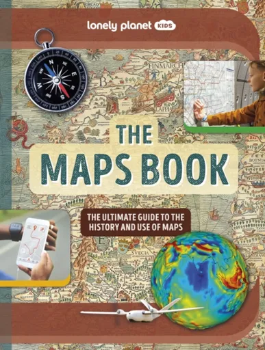
Lonely Planet Kids The Maps Book - Lonely Planet Kids, Joanne Bourne
Explore the amazing world of maps from the first sketches on cave walls to real time maps on phones. Discover their incredible history and marvel at ancient maps, war maps, weather maps and even interactive maps from computer games. Packed with awesome facts, kids will soon grasp how to read maps and symbols - plus learn how to make their own!Wow-factor maps, astounding historic photographs and lively text make this incredible map book the ultimate gift for kids - and grown ups too. Insightful case studies including Winston Churchill’s Map Room and John Snow’s groundbreaking 1854 cholera map will fascinate readers and aid learning; while unusual maps of the night sky, wildlife, populations, time-zones and even famous maps from literature and video games show the full breadth of the many mind-blowing maps in existence.Inside The Maps Book:- An exciting journey through the history of maps including ancient maps, the first ever world map, the mapping of the world wars and beyond- Vibrant artwork, unusual maps, historic photos and engaging text bring the world of maps to life- Fascinating case studies aid learning and comprehension- Revolutionary modern maps explained in detail covering GPS, online maps, streetview, 3D mapping, magnetic-field maps, map ... Unknown localization key: "more"
Objev podobné jako Lonely Planet Kids The Maps Book - Lonely Planet Kids, Joanne Bourne
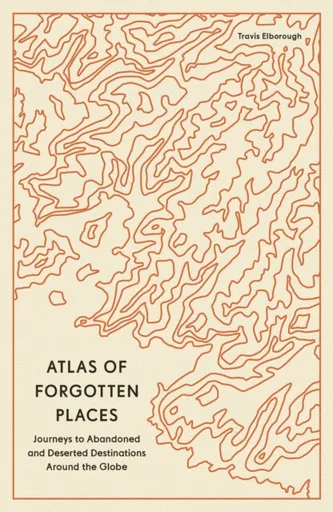
Atlas of Forgotten Places - Travis Elborough
Explore the places that time forgot. These abandoned, mysterious, sleeping monuments around the world have been relegated to the margins of history. From ancient ruins and crumbling castles to more recent relics – an art deco New York subway station, a Soviet ghost town in the Arctic Circle, a flooded Thai mall teeming with aquatic life – Travis Elborough takes you on a journey into these strange, overlooked, and disappearing worlds and immortalizes them in this book of original maps, accompanied by moving historic and geographic accounts of each site. The featured locations are a stark reminder of what was, and the accounts in this investigative book help to bring their stories back to life, telling us what happened, when and why, and to whom. The book features 40 sites, including: Santa Claus, Arizona, USA: A festive tourist resort-turned-ghost town deep in the desert where you could once meet Santa Claus any day of the year; Crystal Palace Subway, London, UK: One of the city’s best-kept secrets is an underground, cathedral-like relic that many Victorian commuters bustled through; Montserrat, West Indies: The small Caribbean island with a population of 5,000 that was evacuated when its volcano erupted in 1995. The ... Unknown localization key: "more"
Objev podobné jako Atlas of Forgotten Places - Travis Elborough
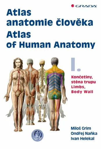
Atlas anatomie člověka I. - Končetiny, stěna trupu / Atlas of Human Anatomy I. - Limbs, Body Wall - Ondřej Naňka, Miloš Grim, Ivan Helekal
Poprvé od roku 1900 je zde originální domácí anatomický atlas. Dvojdílný komplet s téměř 1300 ilustracemi a fotografiemi. Kniha na celý život v latině, češtině a angličtině. Pracovníci Anatomického ústavu 1. LF UK v Praze tak navazují na bohatou tradici české anatomie.V prvním dílu atlasu je obsaženo 476 ilustrací anatomie horní a dolní končetiny a stěny trupu. Vždy je uveden nejprve skelet, pak jeho spoje a klouby, dále svaly a nakonec poloha a průběh nervů a cév v rámci topografické anatomie. Atlas tvoří anatomické obrazy a schémata (413) a snímky (63) pořízené některou ze zobrazovacích metod (RTG, CT, MRI). Anatomické útvary jsou popsány v mezinárodní Terminologia Anatomica (1998) a každou ilustraci doprovází vysvětlující text v latině, češtině a angličtině. Je připojen slovník nejčastějších latinských anatomických termínů a jejich překlad do češtiny a angličtiny. Didaktická a přehledná kniha je určena medikům a lékařům všech oborů, studentům přírodních věd i mnohým pracovníkům nelékařských zdravotnických oborů. Ocení ji jistě i výtvarníci, pracovníci v oblasti tělesné výchovy a sportu a v mnoha dalších odvětvích.Je využit bohatý obrazový materiál z archivu Ústavu, který jeho výtvarníci zhotovili na podkladě originálních preparátů připravených anatomy několika generací, počínaje rokem 1915. Řada těchto ilustrací nebyla dosud publikována moderními reprodukčními ... Unknown localization key: "more"
Objev podobné jako Atlas anatomie člověka I. - Končetiny, stěna trupu / Atlas of Human Anatomy I. - Limbs, Body Wall - Ondřej Naňka, Miloš Grim, Ivan Helekal
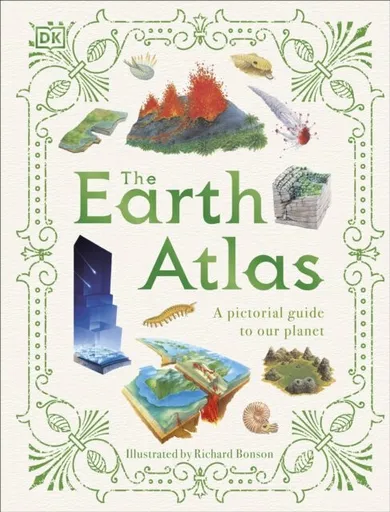
The Earth Atlas
Delve beneath the surface of Earth with this pictorial atlas and discover the secrets of our planet. How did planet Earth form? What's under the surface, and how can we see it? Why do volcanoes erupt? What do coasts and caves have in common? What's so important about rocks and soil? If you find yourself seeking the answers to these questions and more, then this may be the book for you!Introducing The Earth Atlas - a lavishly illustrated guide to our planet. From oceans to ice regions to deserts, this book takes you on an exciting trip to discover more about the Earth's features, explaining how they formed and what impact they have on us even today, supporting life and literally shaping the world with every tectonic movement! Ready for an adventure? Dive straight in to discover: A strikingly visual guide to the innermost depths of our Earth Exquisite hand-drawn illustrations and maps making the information engaging and accessible A diverse range of fascinating information using captions and detailed cross sections From ferocious volcanoes to testing tornadoes, The Earth Atlas is an engaging, fact-packed, and educational book for children aged 9-12, especially those interested in natural science, geology, geography, or ... Unknown localization key: "more"
Objev podobné jako The Earth Atlas