atlas zebra 8590331018192
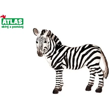
Atlas Zebra (8590331018192)
Figurka - zvířátka, na hraní, výška 10 cm, materiál plast, nepohyblivá, vhodná od 3 let Má vaše dítě rádo zvířátka a rádo je chodí pozorovat do přírody nebo do zoologické zahrady? Pak právě pro malé milovníky zvířat jsou připraveny figurky zvířat celého světa. Figurka Atlas zebra představuje zebru stepní žijící v Africe. Figurka je propracovaná do nejmenších detailů, realisticky vybarvena a je vyrobena z odolného plastu. Zebra je 10 cm vysoká a doplní sbírku zvířátek, které děti milují. Figurky Atlas učí děti nejen rozlišovat jednotlivé živočišné druhy, ale inspirují k získávání dalších informací o zvířatech a přírodě. Svou sbírku figurek si jistě dítě rádo vystaví ve svém pokojíčku. Figurka Atlas zebra je vhodná pro děti od 3 let. Klíčové vlastnosti figurky Atlas - zebraFigurka Atlas zebra představuje zebru stepníFigurka je propracovaná do nejmenších detailůHračka je vyrobena z odolného plastuZebra je 10 cm vysokáDoplní sbírku...
Objev podobné jako Atlas Zebra (8590331018192)
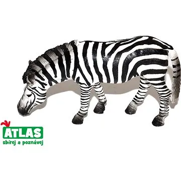
Atlas Zebra (8590331018789)
Figurka - zvířátka, na hraní, výška 6 cm, materiál plast, nepohyblivá, vhodná od 3 let Klíčové vlastnosti figurky Atlas Zebra S figurkou Wiky nebudete o dětech ani vědět Je vhodná pro ratolesti od 3 let Použitým materiálem je plast Atlas Zebra zaujme především milovníky zvířátek Díky figurce vymyslíte s dětmi mnoho nové zábavy V balení obdržíte jednu figurku Figurka Wiky měří 6 cm
Objev podobné jako Atlas Zebra (8590331018789)

Stanex Povlečení atlas grádl tmavě šedá, 140 x 200 cm, 70 x 90 cm
Povlečení z atlas grádlu je vyrobeno ze 100% bavlny a nabízí pohodlí a hebkost. Tmavě šedý odstín a struktura proužků dodávají elegantní vzhled. Souprava obsahuje povlak na polštář 70x90 cm a povlak na přikrývku 140x200 cm.
- Vyrobeno ze 100% kvalitní bavlny pro mimořádnou hebkost
- Elegantní tmavě šedý odstín a struktura 2,5 cm proužků
- Snadná údržba – perte naruby bez bělidel
Objev podobné jako Stanex Povlečení atlas grádl tmavě šedá, 140 x 200 cm, 70 x 90 cm
Podívejte se také
povlečení atlas grádl zelené 140x200 cm
luxusní bavlněné povlečení atlas grádl
povlak na přikrývku 140x200 z atlas grádlu
povlečení z 100% bavlny atlas grádl
povlečení atlas grádl starorůžová
povlečení atlas grádl světle šedá
povlečení atlas grádl pro dospělé
tmavě šedé atlas grádl povlečení
povlečení atlas grádl 140x200 cm
100% bavlna povlečení atlas grádl
péče o povlečení atlas grádl
povlečení atlas grádl smetanová
povlak na polštář 70x90 atlas
povlak na přikrývku atlas grádl
povlečení atlas grádl béžová 140x200 cm
povlak na polštář 70x90 atlas grádl

Stanex Povlečení atlas grádl béžová, 140 x 200 cm, 70 x 90 cm
Povlečení z atlas grádlu je vyrobeno z 100% bavlny a nabízí pohodlí a hebkost. Béžový odstín a struktura proužků dodávají elegantní vzhled. Souprava obsahuje povlak na přikrývku 140x200 cm a povlak na polštář 70x90 cm.
- Vyrobeno ze 100% kvalitní bavlny pro mimořádnou hebkost.
- Elegantní design s 2,5 cm proužky a noblesním béžovým odstínem.
- Snadná údržba – perte naruby bez bělidel a chemických čistidel.
- Kompletní souprava obsahuje povlak na přikrývku i polštář.
Objev podobné jako Stanex Povlečení atlas grádl béžová, 140 x 200 cm, 70 x 90 cm

Stanex Povlečení atlas grádl světle šedá, 140 x 200 cm, 70 x 90 cm
Povlečení z atlas grádlu je vyrobeno z 100% bavlny a nabízí pohodlí a hebkost. Světle šedý odstín a struktura proužků dodávají elegantní vzhled. Souprava obsahuje povlak na přikrývku 140x200 cm a povlak na polštář 70x90 cm.
- Vyrobeno ze 100% kvalitní bavlny pro mimořádnou hebkost.
- Elegantní design s 2,5 cm proužky a světle šedým odstínem.
- Snadná údržba – doporučeno prát naruby bez agresivní chemie.
- Kompletní souprava obsahuje povlak na přikrývku i polštář.
Objev podobné jako Stanex Povlečení atlas grádl světle šedá, 140 x 200 cm, 70 x 90 cm

Stanex Povlečení atlas grádl smetanová, 140 x 220 cm, 70 x 90 cm
Povlečení z materiálu atlas grádl nabízí hebkost a pohodlí. Sada obsahuje povlak na přikrývku 140x220 cm a povlak na polštář 70x90 cm v smetanovém odstínu. Je vyrobeno z kvalitní bavlny a vyznačuje se elegantním designem s proužky.
- Vyrobeno ze 100% kvalitní bavlny pro maximální pohodlí
- Elegantní design s 2,5 cm proužky a noblesním smetanovým odstínem
- Snadná údržba - doporučeno prát naruby bez agresivní chemie
Objev podobné jako Stanex Povlečení atlas grádl smetanová, 140 x 220 cm, 70 x 90 cm

Stanex Povlečení atlas grádl starorůžová, 140 x 220 cm, 70 x 90 cm
Povlečení z materiálu atlas grádl nabízí hebkost a pohodlí díky 100% bavlně. Design s 2,5 cm proužky a starorůžovým odstínem přináší do ložnice noblesní vzhled. Souprava obsahuje povlak na přikrývku 140x220 cm a povlak na polštář 70x90 cm.
- Vyrobeno ze 100% kvalitní bavlny pro maximální pohodlí
- Elegantní starorůžový odstín a struktura proužků
- Snadná údržba - doporučeno prát naruby bez agresivní chemie
- Kompletní souprava obsahuje povlak na přikrývku i polštář
Objev podobné jako Stanex Povlečení atlas grádl starorůžová, 140 x 220 cm, 70 x 90 cm
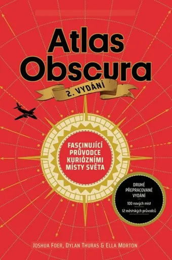
Atlas Obscura - Joshua Foer, kolektiv autorů
Atlas Obscura je průvodce představující přes 700 nejpodivuhodnějších a nejméně známých míst na planetě. Zahrnuje přírodní zázraky, bizarní lidské výtvory a tajemné lokality. Kniha slouží jako inspirace pro cestovatele hledající neobvyklé zážitky.
- Obsahuje více než 700 unikátních a kuriózních míst z celého světa.
- Inspiruje k objevování neznámých a nevyšlapaných cest.
- Bohatě ilustrovaný průvodce pro milovníky dobrodružství a záhad.
Objev podobné jako Atlas Obscura - Joshua Foer, kolektiv autorů
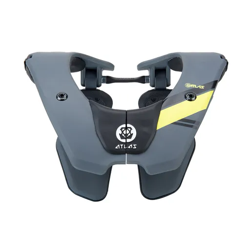
Dětský chránič krční páteře ATLAS Tyke Grey
Dětský chránič krční páteře ATLAS Tyke Grey je určen pro motokros, BMX, čtyřkolky a horská kola. Konstrukce Split-Flex Frame a systém ERS zajišťují pohyblivost a možnost rychlého odložení. Chránič zabraňuje hyperflexi, hyperextenzi a axiálnímu zatížení páteře.
- Patentovaná flexibilní konstrukce Split-Flex Frame pro maximální pohyblivost
- Systém ERS umožňující rychlé odložení chrániče při nehodě
- Široká kontaktní zóna a odpružení hrudní části pro vyšší bezpečnost
- Minimalistický design s nízkou hmotností (460 g) pro pohodlí dítěte
Objev podobné jako Dětský chránič krční páteře ATLAS Tyke Grey

Stanex Povlečení atlas grádl smetanová, 140 x 200 cm, 70 x 90 cm
Povlečení z atlas grádlu je vyrobeno ze 100% bavlny a nabízí pohodlí s hebkou strukturou. Smetanový odstín a proužkový design přináší do ložnice eleganci. Souprava obsahuje povlak na polštář 70x90 cm a povlak na přikrývku 140x200 cm.
- Vyrobeno z 100% kvalitní bavlny pro mimořádnou hebkost
- Elegantní struktura 2,5 cm proužků podtrhne design
- Smetanový odstín dodá ložnici noblesní vzhled
- Snadná údržba - doporučeno prát naruby bez bělidel
Objev podobné jako Stanex Povlečení atlas grádl smetanová, 140 x 200 cm, 70 x 90 cm

Stanex Povlečení atlas grádl světle šedá, 140 x 220 cm, 70 x 90 cm
Povlečení Stanex z atlas grádlu je vyrobeno z 100% bavlny a nabízí pohodlí s elegantním designem proužků. Světle šedý odstín dodá ložnici noblesní vzhled. Sada obsahuje povlak na přikrývku 140 x 220 cm a povlak na polštář 70 x 90 cm.
- Vyrobeno ze 100% kvalitní bavlny pro mimořádnou hebkost.
- Elegantní design s 2,5 cm proužky a světle šedým odstínem.
- Snadná údržba – perte naruby bez agresivní chemie.
- Kompletní sada obsahuje povlak na přikrývku i polštář.
Objev podobné jako Stanex Povlečení atlas grádl světle šedá, 140 x 220 cm, 70 x 90 cm
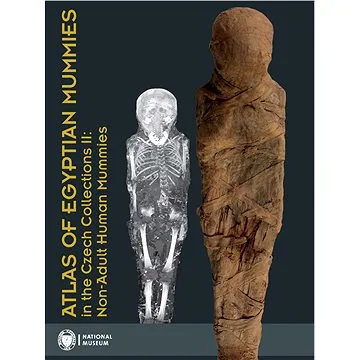
Atlas of Egyptian Mummies in the Czech Collections II: Non-Adult Human Mummies (978-80-7036-750-6)
Druhý díl série Atlas egyptských mumií v českých sbírkách se specializuje na mumie a pohřební vybavení dětí a dospívajících do 15 let. Obsahuje podrobný katalog dvou kompletních mumií, dvanácti izolovaných částí a šesti pohřebních schránek. Publikace přináší informace o zdravotním stavu, nemocech a pohřebních praktikách dětí ve starověkém Egyptě.
- Druhý díl odborné série o egyptských mumiích
- Zaměření na mumie dětí a dospívajících do 15 let
- Podrobný katalog s proveniencí a zdravotními analýzami
- Vědecky hodnotný materiál z Národního muzea v Praze
Objev podobné jako Atlas of Egyptian Mummies in the Czech Collections II: Non-Adult Human Mummies (978-80-7036-750-6)

Stanex Povlečení atlas grádl starorůžová, 140 x 200 cm, 70 x 90 cm
Povlečení z atlas grádlu je vyrobeno ze 100% bavlny a nabízí pohodlí a hebkost. Souprava obsahuje povlak na přikrývku 140 x 200 cm a povlak na polštář 70 x 90 cm. Elegantní design s proužkovou strukturou a starorůžovým odstínem dodává ložnici noblesní vzhled.
- Vyrobeno ze 100% kvalitní bavlny pro mimořádnou hebkost.
- Elegantní design s 2,5 cm proužkovou strukturou.
- Starorůžový odstín dodává ložnici noblesní vzhled.
- Snadná údržba - doporučeno prát naruby bez bělidel.
Objev podobné jako Stanex Povlečení atlas grádl starorůžová, 140 x 200 cm, 70 x 90 cm

The Atlas Maneuver - Steve Berry
Román představuje nové dobrodružství Cottona Malonea, který se zaplete do pátrání po legendárním japonském válečném pokladu zvaném Yamashitovo zlato. Příběh propojuje historické události z konce druhé světové války se současnou hrozbou zneužití kryptoměn k narušení globálního finančního systému. Děj zavede čtenáře do Švýcarska, Lucemburska a marockých hor v honbě za odhalením konspirace známé jako Atlasovo manévr.
- Nejnovější díl oblíbené série Cotton Malone
- Napínavý příběh kombinující historická fakta a fikci
- Rychlý spád děje s mezinárodním přesahem
- Aktuální téma kryptoměn v thrillerovém kontextu
Objev podobné jako The Atlas Maneuver - Steve Berry
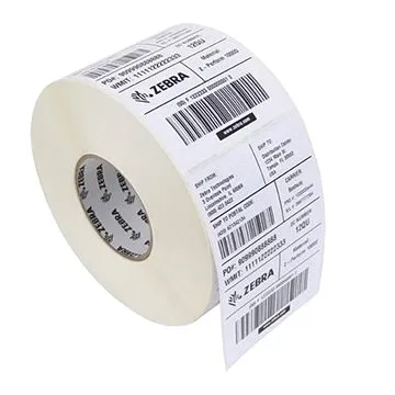
Zebra/Motorola nalepovací štítky 76mm x 51mm (800273-205)
Papírové samolepicí štítky o rozměru 76×51 mm určené pro termotransferový tisk. Role obsahuje 1370 kusů štítků s matným povrchem a perforací pro snadné oddělení. Štítky jsou kompatibilní s tiskárnami Zebra TLP28xx, TLP384x, G-série a dalšími modely.
- Vysoká přilnavost na různé materiály
- Matný povrch pro dobrou čitelnost
- Perforace pro snadné oddělení
- Kompatibilita s širokou řadou tiskáren Zebra/Motorola
Objev podobné jako Zebra/Motorola nalepovací štítky 76mm x 51mm (800273-205)

Zebra Z1AE-MC93XX-5C03 Service , 5 years
Zebra OneCare Essential je pětiletý servisní plán pro zařízení Zebra. Smlouva zahrnuje komplexní pokrytí, odborné uvedení do provozu a přístup do monitorovacího dashboardu. Servisní zásah je garantován do 3 pracovních dnů od nahlášení.
- Komplexní 5leté pokrytí pro maximální spolehlivost zařízení
- Rychlá reakce servisu s termínem opravy do 3 pracovních dnů (TAT)
- Zahrnuje odborné uvedení do provozu (komisionování) a přístup do monitorovacího dashboardu
- Možnost zakoupení do 30 dnů od pořízení zařízení
Objev podobné jako Zebra Z1AE-MC93XX-5C03 Service , 5 years
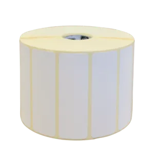
Zebra 880330-025 Z-Ultimate 3000T White, 31,75 x 25,4 mm, 5180 etiket, bílé
Role syntetických etiket Zebra Z-Ultimate 3000T v bílé barvě. Rozměry etikety jsou 31,75 mm na šířku a 25,4 mm na výšku, role obsahuje 5180 kusů. Etikety mají normální lepivost, mezeru mezi sebou a jsou určeny pro použití s doporučenou páskou.
- Vysoká odolnost syntetického materiálu
- Velkokapacitní role s 5180 etiketami pro dlouhodobé použití
- Standardní lepivost pro spolehlivé přichycení
- Bílá barva a struktura s mezerou pro snadné použití
Objev podobné jako Zebra 880330-025 Z-Ultimate 3000T White, 31,75 x 25,4 mm, 5180 etiket, bílé
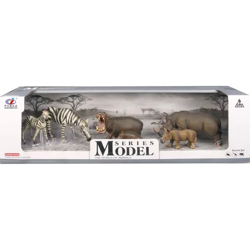
Series Model Svět zvířat zebry, hroši, nosorožci
Sada obsahuje tři plastové figurky afrických zvířat - zebru, hrocha a nosorožce, vždy s jejich mládětem. Figurky slouží k seznámení dětí s vzhledem a životem těchto zvířat. Jsou vhodné pro děti od 3 let.
- Detailní zpracování figurek
- Kvalitní a bezpečný plastový materiál
- Vhodné jako výuková pomůcka
- Rozvíjí dětskou představivost
Objev podobné jako Series Model Svět zvířat zebry, hroši, nosorožci

Zebra 3004634 Z-Perform 1000T Removable, 29 x 17 mm, 2670 etiket, bílé
Role odnímatelných papírových etiket Zebra Z-Perform 1000T o rozměrech 29x17 mm. Každá role obsahuje 8720 etiket s mezerami mezi jednotlivými štítky. Etikety mají odnímatelné lepidlo a jsou určeny pro dočasné označování.
- Odnímatelné lepidlo pro dočasné označování
- Vysoká kapacita 8720 etiket na jedné roli
- Standardní papírový materiál pro univerzální použití
- Přesné rozměry 29x17 mm pro konzistentní tisk
Objev podobné jako Zebra 3004634 Z-Perform 1000T Removable, 29 x 17 mm, 2670 etiket, bílé

Zebra 3008758 Z-Ultimate 3000T White, 28 x 8 mm, 16110 etiket, bílé
Jedná se o roli syntetických etiket Zebra Z-Ultimate 3000T bílé barvy o rozměrech 28 x 8 mm. Etikety mají normální lepivost, povrchovou úpravu a jsou odděleny mezerou. Role obsahuje 16110 etiket s vnějším průměrem 200 mm a vnitřním průměrem 76 mm.
- Vysoký počet 16110 etiket v jedné roli
- Syntetický materiál odolný proti otěru a vlhkosti
- Povrchová úprava pro kvalitní potisk
- Normální lepivost pro spolehlivé přichycení
Objev podobné jako Zebra 3008758 Z-Ultimate 3000T White, 28 x 8 mm, 16110 etiket, bílé
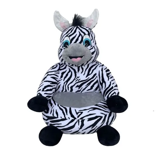
NEW BABY ZEBRA Dětské křesílko, bílá, velikost
Dětské křesílko NEW BABY ZEBRA v bílé barvě je vyrobeno z měkkého plyšového materiálu příjemného na dotyk. Jedná se o užitečný a zábavný doplněk do dětského pokoje. Křesílko poskytuje pohodlné sezení pro děti.
- Příjemný měkký plyšový materiál
- Zábavný design s motivem zebry
- Vhodné do dětského pokoje
- Pohodlné sezení pro děti
Objev podobné jako NEW BABY ZEBRA Dětské křesílko, bílá, velikost
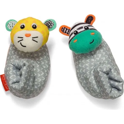
Infantino Chrastítka na nožičky Zebra & Tygr
Chrastítka Infantino ve tvaru zebry a tygra jsou určena k připevnění na dětské nožičky. Zvuk chrastících hlaviček upoutává pozornost miminek při pohybu. Výrobek je vhodný pro děti od narození a je vyroben z textilního materiálu.
- Rozvíjí smyslové vnímání u kojenců
- Balení obsahuje 2 kusy chrastítek
- Vhodné pro děti již od narození
- Textilní materiál šetrný k dětské pokožce
Objev podobné jako Infantino Chrastítka na nožičky Zebra & Tygr
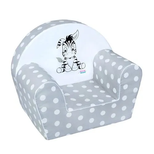
New Baby Zebra dětské křesílko šedá
Dětské křesílko s motivem zebry je vyrobeno z měkkého materiálu a má snímatelný bavlněný potah, který lze prát. Doporučuje se jako oblíbený doplněk do dětského pokoje. Technické parametry zahrnují výšku opěradla cca 29 cm a šířku sedadla cca 25 cm.
- Měkký a pohodlný materiál pro děti
- Snímatelný a pratelný bavlněný potah
- Atraktivní design s motivem zebry
- Vhodné do dětského pokoje jako doplněk
Objev podobné jako New Baby Zebra dětské křesílko šedá
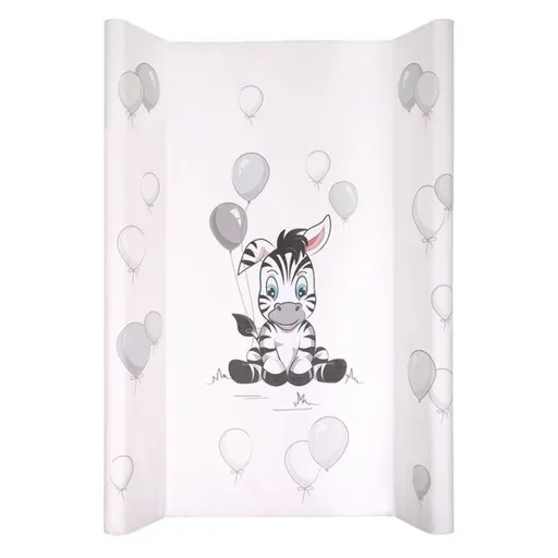
NEW BABY ZEBRA Přebalovací podložka, bílá, velikost
Přebalovací podložka NEW BABY ZEBRA s roztomilým motivem zebry je praktickým pomocníkem při péči o miminko. Díky vyvýšeným bočním stranám zajišťuje bezpečnost dítěte během přebalování. Nepromokavý a omyvatelný povrch usnadňuje údržbu a čištění.
- Praktický tvar s vyvýšenými bočními stranami pro bezpečnost miminka
- Nepromokavý a snadno omyvatelný povrch pro jednoduchou údržbu
- Roztomilý motiv zebry, který potěší rodiče i dítě
- Univerzální použití – lze položit na komodu nebo jiný nábytek
Objev podobné jako NEW BABY ZEBRA Přebalovací podložka, bílá, velikost
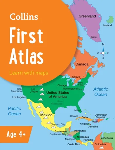
Collins First Atlas - Collins Maps
The must-have atlas for children aged 4-7Collins First Atlas is a fun, vibrant and clear starter atlas for children aged 4-7 years, providing the perfect foundation to basic geography skills.The atlas begins by introducing pupils to photographs and mapping of a local area, then gradually leads them through maps of regional, national, continental and global areas.Short, informative sentences introduce pupils to basic geographical and atlas vocabularyMaps are clearly labelled to highlight certain countries and featuresMapping concepts are presented in a way that supports learning development, as concepts become more complexIdeal for classroom use or home learningFully up-to-dateSuitable for EYFS and KS1This atlas is also available in a Kindle format. The next atlas in this series is the Collins Primary Atlas, suitable for ages 7+ and KS2.
Objev podobné jako Collins First Atlas - Collins Maps
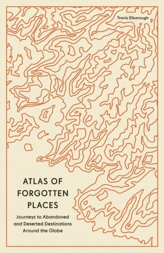
Atlas of Forgotten Places - Travis Elborough
Explore the places that time forgot. These abandoned, mysterious, sleeping monuments around the world have been relegated to the margins of history. From ancient ruins and crumbling castles to more recent relics – an art deco New York subway station, a Soviet ghost town in the Arctic Circle, a flooded Thai mall teeming with aquatic life – Travis Elborough takes you on a journey into these strange, overlooked, and disappearing worlds and immortalizes them in this book of original maps, accompanied by moving historic and geographic accounts of each site. The featured locations are a stark reminder of what was, and the accounts in this investigative book help to bring their stories back to life, telling us what happened, when and why, and to whom. The book features 40 sites, including: Santa Claus, Arizona, USA: A festive tourist resort-turned-ghost town deep in the desert where you could once meet Santa Claus any day of the year; Crystal Palace Subway, London, UK: One of the city’s best-kept secrets is an underground, cathedral-like relic that many Victorian commuters bustled through; Montserrat, West Indies: The small Caribbean island with a population of 5,000 that was evacuated when its volcano erupted in 1995. The ... Unknown localization key: "more"
Objev podobné jako Atlas of Forgotten Places - Travis Elborough
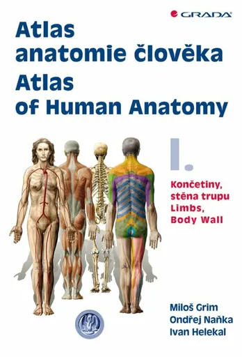
Atlas anatomie člověka I. - Končetiny, stěna trupu / Atlas of Human Anatomy I. - Limbs, Body Wall - Ondřej Naňka, Miloš Grim, Ivan Helekal
Poprvé od roku 1900 je zde originální domácí anatomický atlas. Dvojdílný komplet s téměř 1300 ilustracemi a fotografiemi. Kniha na celý život v latině, češtině a angličtině. Pracovníci Anatomického ústavu 1. LF UK v Praze tak navazují na bohatou tradici české anatomie.V prvním dílu atlasu je obsaženo 476 ilustrací anatomie horní a dolní končetiny a stěny trupu. Vždy je uveden nejprve skelet, pak jeho spoje a klouby, dále svaly a nakonec poloha a průběh nervů a cév v rámci topografické anatomie. Atlas tvoří anatomické obrazy a schémata (413) a snímky (63) pořízené některou ze zobrazovacích metod (RTG, CT, MRI). Anatomické útvary jsou popsány v mezinárodní Terminologia Anatomica (1998) a každou ilustraci doprovází vysvětlující text v latině, češtině a angličtině. Je připojen slovník nejčastějších latinských anatomických termínů a jejich překlad do češtiny a angličtiny. Didaktická a přehledná kniha je určena medikům a lékařům všech oborů, studentům přírodních věd i mnohým pracovníkům nelékařských zdravotnických oborů. Ocení ji jistě i výtvarníci, pracovníci v oblasti tělesné výchovy a sportu a v mnoha dalších odvětvích.Je využit bohatý obrazový materiál z archivu Ústavu, který jeho výtvarníci zhotovili na podkladě originálních preparátů připravených anatomy několika generací, počínaje rokem 1915. Řada těchto ilustrací nebyla dosud publikována moderními reprodukčními ... Unknown localization key: "more"
Objev podobné jako Atlas anatomie člověka I. - Končetiny, stěna trupu / Atlas of Human Anatomy I. - Limbs, Body Wall - Ondřej Naňka, Miloš Grim, Ivan Helekal
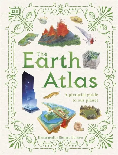
The Earth Atlas
Delve beneath the surface of Earth with this pictorial atlas and discover the secrets of our planet. How did planet Earth form? What's under the surface, and how can we see it? Why do volcanoes erupt? What do coasts and caves have in common? What's so important about rocks and soil? If you find yourself seeking the answers to these questions and more, then this may be the book for you!Introducing The Earth Atlas - a lavishly illustrated guide to our planet. From oceans to ice regions to deserts, this book takes you on an exciting trip to discover more about the Earth's features, explaining how they formed and what impact they have on us even today, supporting life and literally shaping the world with every tectonic movement! Ready for an adventure? Dive straight in to discover: A strikingly visual guide to the innermost depths of our Earth Exquisite hand-drawn illustrations and maps making the information engaging and accessible A diverse range of fascinating information using captions and detailed cross sections From ferocious volcanoes to testing tornadoes, The Earth Atlas is an engaging, fact-packed, and educational book for children aged 9-12, especially those interested in natural science, geology, geography, or ... Unknown localization key: "more"
Objev podobné jako The Earth Atlas
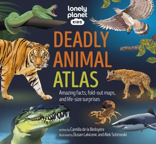
Lonely Planet Kids Deadly Animal Atlas - Lonely Planet, Lonely Planet Kids
Beware! The world''s deadliest creatures reside in the pages of this epic kid''s animal atlas… do you dare to meet them all?Discover the world''s scariest beasts in this ultimate compendium of our planet''s most fearsome predators. From snakes, sharks, and spiders to tigers, eagles, and jellyfish, curious kids will learn how these deadly animals spend their lives, defend their territories, and maintain the health of our ecosystem. Inside Deadly Animal Atlas:Thrilling photography, amazing illustrations, and original artwork make this a vibrant and engaging book for adventurous readersInsightful maps, diagrams, and fact-packed content guide children through the stealthiest predators on Earth, continent-by-continentFun interactive elements like lift-the-flaps, fold-out maps, and open-the-gatefolds keep children entertained and bring this awesome book to lifeCovers important topics including the problems animals are facing through habitat loss and climate change and highlights the measures being used to alleviate themCovers regions: North America, South America, Europe, Africa, Asia, Australasia and OceansWritten by Camilla de la Bedoyere, author of over 250 books including Lonely Planet Kids'' Bird AtlasIllustrated by Dusan Lakicevic and Alek Sotirovski Deadly Animal Atlas is the latest in Lonely Planet Kids'' awesome animal atlas series, which includes Dinosaur Atlas, Animal Atlas, Ocean Animal Atlas, and Bird ... Unknown localization key: "more"
Objev podobné jako Lonely Planet Kids Deadly Animal Atlas - Lonely Planet, Lonely Planet Kids
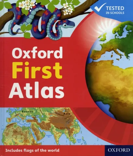
Oxford First Atlas
The Oxford First Atlas is an accessible and informative atlas for young learners in their first years at school.It is completely up-to-date, and features accurate and easy-to-read colourful mapping presented in an accessible visual layout based on research into how young children use maps. It encourages children to learn about their world and develop atlas and map skills. It includes:· A simple introduction to Planet Earth and places around the world· Clear and colourful maps of the world and all the continents· Clear and colourful thematic maps showing coasts, rivers, mountains, the weather, environments, cities, animals, and holidays · Colourful photographs· Fascinating facts about places and people· Questions that encourage children to think and engage with the maps.The Oxford First Atlas is accompanied by a Teacher''s Handbook for practical page-by-page guidance on using the atlas, an Activity Book for independent work to develop map skills, and an e-Atlas CD-ROM providing an interactive version of the atlas for whole-class display.
Objev podobné jako Oxford First Atlas
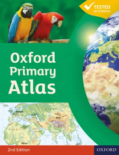
Oxford Primary Atlas
The Oxford Primary Atlas is a clear, bright and informative atlas for all 7-11 year olds. This new edition includes up-to-date country data and easy-to-read colourful mapping, presented in an accessible visual layout based on research into how young children use maps. It features key curriculum themes such as landscapes, water, settlements, connections, and environments. It includes easy-to-use features such as learning statements to summarize each theme, focus panels to prompt independent or group enquiry, innovative grid codes to help children find places listed in the index, colourful photographs to aid children''s understanding of map symbols, attractive artwork to provide a ''sense of place'', and stimulating graphics to make large numbers easy to understand. This new edition of the Oxford Primary Atlas, specially written to support the requirements of primary geography at Key Stage 2, and incorporating the most popular features of the bestselling Oxford Junior Atlas, uses simple, clear mapping and colourful illustration to create a stimulating and informative atlas for all 7-11 year olds.The Oxford Primary Atlas is also accompanied by the Activity Book for independent work to develop map literacy skills, and the e-Atlas CD-ROM for whole class display on interactive whiteboard.
Objev podobné jako Oxford Primary Atlas
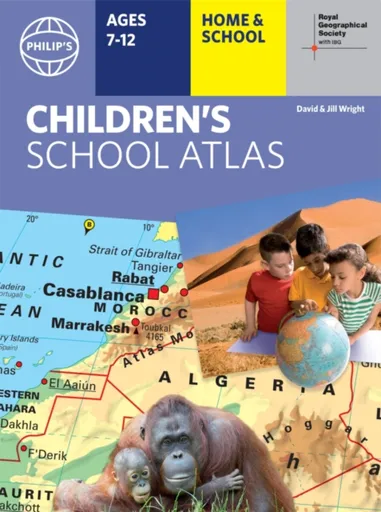
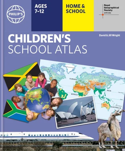
Philip's RGS Children's School Atlas - David Wright, Jill Wright
"This is such a great book for primary school age children and a little beyond for finding out about the world, its countries and people" Amazon customer review- Philip''s atlas, designed specially to use at home and at school with guidance for parents and teachers- Clear maps and fascinating facts bring geography to life for readers aged 7-12- Published by Philip''s the UK''s leading school atlas publisher, in association with the Royal Geographical Society- Quizzes, activity ideas and puzzles to make learning fun- Past winner of the Geographical Association''s award for making a significant contribution to geographyThe atlas is organized spread by spread in the classic sequence: first Europe, then its land neighbour Asia, followed by Africa, Australia and Oceania, North America and South America.Illustrated with captivating full-colour photographs and packed with fact boxes, curiosities, flags, stamps and quiz questions, Philip''s RGS Children''s Atlas is both fun to use and easy to understand.Now in its 16th edition, Philip''s RGS Children''s Atlas is a past winner of the Geographical Association''s award for making a significant contribution to geography. The atlas was judged "an excellent ''all round'' children''s atlas with simple yet well-designed maps, well-illustrated with colour photographs. It links places to ... Unknown localization key: "more"
Objev podobné jako Philip's RGS Children's School Atlas - David Wright, Jill Wright
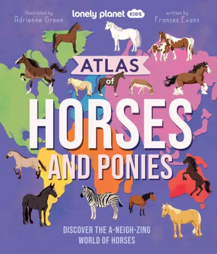
Lonely Planet Kids Atlas of Horses and Ponies - Frances Evans, Lonely Planet Kids
Take a wild ride into the world of horses and ponies with this awesome atlas of more than 100 incredible breeds from across the continents!Packed with gorgeous illustrations, marvellous maps and fascinating facts, discover a huge selection of horses and ponies from South America''s Peruvian Paso to Asia''s Orlov Trotter and Europe''s Swedish Warmblood. Learn about each horse’s country of origin, physical characteristics and personality traits, and saddle-up for the ultimate horse and pony adventure.Inside Atlas of Horses and Ponies:Over 100 awesome breeds from North and South America, Europe, Africa, Asia, Australia and New ZealandLarge maps of each continent show where each horse and pony originates fromAtlas of a horse provides readers with a basic geography of their body from their coat to their tailLearn about a horse''s amazing super senses plus discover how to talk horseFun-packed profiles give details on each horse''s personality traits, characteristics and unique skillsSpecial themed features on: Super Senses, Caring for Horses, Foals, Donkeys and Mules, Working Horses, Mythical Horses, Horse Sports, Wild Horses, War Horses, and Record-Breaking HorsesFrom the author of Lonely Planet Kids’ bestselling Atlas of Dogs and Atlas of Cats: Frances EvansFeaturing beautiful and lively illustrations throughout by Adrienne Green Hot on ... Unknown localization key: "more"
Objev podobné jako Lonely Planet Kids Atlas of Horses and Ponies - Frances Evans, Lonely Planet Kids
Atlas Delfín (8590331018505)
Figurka - zvířátka, na hraní, výška 3 cm, materiál plast, nepohyblivá, vhodná od 3 let Má vaše dítě rádo zvířátka a rádo je chodí pozorovat do zoologické zahrady? Pak právě pro malé milovníky zvířat jsou připraveny figurky zvířat celého světa. Figurka Atlas delfín je propracovaná do nejmenších detailů, realisticky vybarvena a je vyrobena z odolného plastu. Figurka delfína je 11 cm dlouhá a doplní sbírku zvířátek, které děti milují. Figurky Atlas učí děti nejen rozlišovat jednotlivé živočišné druhy, ale inspirují k získávání dalších informací o zvířatech a přírodě. Svou sbírku figurek si jistě dítě rádo vystaví ve svém pokojíčku. Figurka Atlas delfín je vhodná pro děti od 3 let. Klíčové vlastnosti figurky Atlas - delfínFigurka Atlas delfín je propracovaná do nejmenších detailůHračka je vyrobena z odolného plastuFigurka delfína je 11 cm dlouháDoplní sbírku oblíbených zvířátekFigurky Atlas rozvíjí dětské znalosti, lásku k přírodě, kreativitu a...
Objev podobné jako Atlas Delfín (8590331018505)
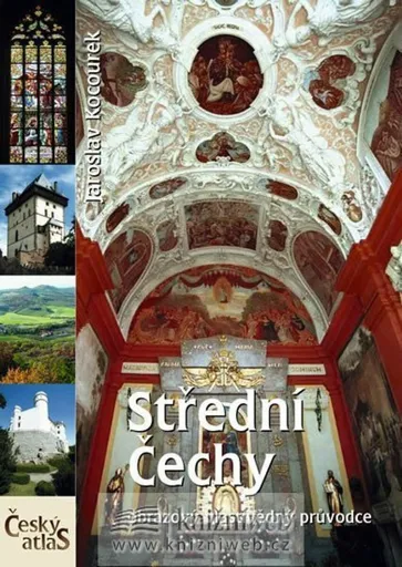
Český atlas - Střední Čechy - Jaroslav Kocourek
Český atlas Střední Čechy je založen na podrobném popisném textu a neobyčejně bohaté obrazové dokumentaci. Atlas představuje všechny známé i méně známé kulturní a historické pamětihodnosti, stejně jako přírodní pozoruhodnosti středočeské oblasti. Přehledně členěné kapitoly atlasu seznamují s jednotlivými regiony, městy a turisticky atraktivními cíli. Součástí atlasu jsou vedle mnoha fotografií a podrobného popisu zajímavých míst také četné mapy a plánky, kresby významných památek a znaky měst a šlechtických rodů. Vyhledávání v knize usnadňuje místní a jmenný rejstřík. V této ediční řadě dále vyšly publikace Český atlas Západní Čechy, Český atlas Severní Čechy, Český atlas Praha (v nabídce též varianta včetně DVD) a Český atlas Jižní Čechy (v nabídce též varianta včetně DVD).
Objev podobné jako Český atlas - Střední Čechy - Jaroslav Kocourek
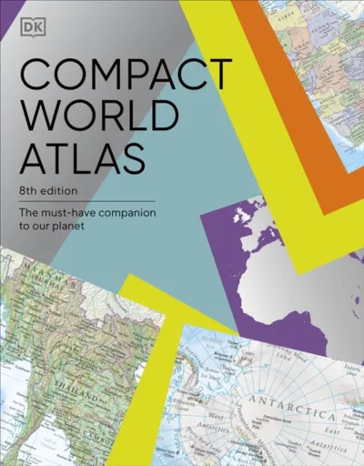
Compact World Atlas - DK
Colourful maps, flags and fascinating insights make this pocket sized atlas an ideal source of information about our ever changing world.Arranged in two main sections - a world atlas and country factfile - the Pocket A-Z World Atlas provides an invaluable source of accurate, informative and interesting geographical information, all in one compact and affordable volume. The atlas section, arranged by continent, presents over 70 colourful, clearly labelled, easy-to-read regional maps showing all the world''s nations, combining digital landscape modelling with the most important roads, railways, rivers, and settlements. Each map is annotated with fascinating ''insight'' facts that reveal a wealth of amazing information from around the world. The second section comprises a comprehensive series of country profiles, arranged alphabetically, covering all the essential facts and figures, including details of geography, climate, society, and economics. This section also contains reference factfile data for every nation, including the national flag, total area, population, languages, religions, and currency.Dive straight in to discover: - This new fully revised 8th Edition incorporating hundreds of updates to maps and statistics.- 71 regional maps, 196 country profile maps, flags, and statistics.- In-depth country profiles. - Fully cross-referenced index/gazetteer.Finding places is quick and convenient with a clearly-styled ... Unknown localization key: "more"
Objev podobné jako Compact World Atlas - DK
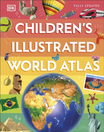
Children's Illustrated World Atlas - DK
Take young readers on the ultimate round-the-world trip with this impressive atlas - packed full of beautiful illustrations and photographs.Discover the world map-by-map with this exciting world atlas book for children, featuring more than 50 maps! Each page is filled with fascinating information, facts and colourful illustrations of our world. Children aged 9-12 will love to learn all about the many countries, cultures and people of the world through vibrant maps. Fascinating facts, local stories, vivid pictures, and clear, satellite-based maps together make this atlas a global yet personal experience for young readers.This illustrated atlas book for children offers: - Bite-sized information giving the profiles, facts, stats and flags of every country.- Pictures and stories explaining the society, culture and history of each region.- Maps created using satellite imagery providing a clear view of the world map-by-map.- A variety of topics covered, including population density, wealth, and internet access shown through graphics.From Bangkok''s floating markets to the carnival in Venice, the Children''s Illustrated World Atlas brings together views from windows all over the world. This illustrated atlas not only portrays regions, such as the Siberian wastes, with beautifully detailed maps but also describes the peoples who live there.
Objev podobné jako Children's Illustrated World Atlas - DK
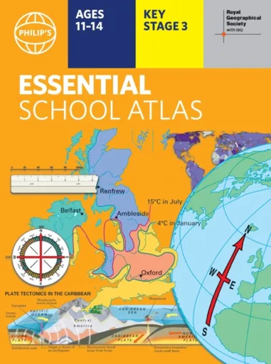
Philip's RGS Essential School Atlas - Philip's Maps
"An excellent world atlas. Very illuminating, good colours, clear texts...good glossary and, last but not least, up-to-date." - customer review- The ideal school atlas for Key Stage 3 pupils and Scotland''s National Qualifications, 11-14 years old- All updated for 2024 specifically to meet curriculum needs- Specially focused 16-page UK and Ireland section- Comprehensive 62-page world section includes thematic maps on the environment, climate change, people, quality of life, and energy- Published in association with the Royal Geographical SocietyPhilip''s RGS Essential School Atlas has been specially created for lower-secondary geography students (11-14 year olds). The maps have been carefully designed to be uncluttered and easy to read, containing specially selected place names and detail. A clear set of symbols and scale information accompanies every map, with a useful introductory section covering basic atlas skills, including aerial photographs and satellite images to further explain particular features on the maps. Latitude and longitude co-ordinates are included in the index, alongside figure-letter references. Fully up-to-date, the atlas includes detailed regional maps, charts and satellite images of Europe, Italy, the Middle East, China, Japan, Kenya, USA, Brazil, and the Arctic and Antarctica. It also focuses on areas of special interest for students of geography, such ... Unknown localization key: "more"
Objev podobné jako Philip's RGS Essential School Atlas - Philip's Maps
Philip's RGS Children's School Atlas - David Wright, Jill Wright
"This is such a great book for primary school age children and a little beyond for finding out about the world, its countries and people" customer review- Philip''s atlas, designed specially to use at home and at school with guidance for parents and teachers- Clear maps and fascinating facts bring geography to life for readers aged 7-12- Published by Philip''s in association with the Royal Geographical Society- Quizzes, activity ideas and puzzles to make learning fun- Past winner of the Geographical Association''s award for making a significant contribution to geographyThe atlas is organized spread by spread in the classic sequence: first Europe, then its land neighbour Asia, followed by Africa, Australia and Oceania, North America and South America. Illustrated with captivating full-colour photographs and packed with fact boxes, curiosities, flags, stamps and quiz questions, Philip''s RGS Children''s Atlas is both fun to use and easy to understand.Now in its 17th edition, Philip''s RGS Children''s Atlas is a past winner of the Geographical Association''s award for making a significant contribution to geography. The atlas was judged "an excellent ''all round'' children''s atlas with simple yet well-designed maps, well-illustrated with colour photographs. It links places to issues, events and real people, giving ... Unknown localization key: "more"
Objev podobné jako Philip's RGS Children's School Atlas - David Wright, Jill Wright
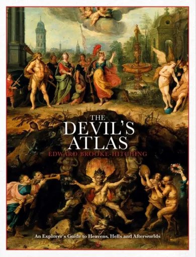
The Devil's Atlas - Edward Brooke-Hitching
'Very beautiful and illuminating' Mariella Frostrup Edward Brooke-Hitching, author of the international bestseller The Phantom Atlas delivers an atlas unlike any other. The Devil’s Atlas is an illustrated guide to the heavens, hells and lands of the dead as imagined throughout history by cultures and religions around the world. Packed with colourful maps, paintings and captivating stories, the reader is taken on a compelling tour of the geography, history and supernatural populations of the afterworlds of cultures around the globe. Whether it’s the thirteen heavens of the Aztecs, the Chinese Taoist netherworld of ‘hungry ghosts’, or the ‘Hell of the Flaming Rooster’ of Japanese Buddhist mythology (in which sinners are tormented by an enormous fire-breathing cockerel), The Devil’s Atlas gathers together a wonderful variety of beliefs and representations of life after death. These afterworlds are illustrated with an unprecedented collection of images, ranging from the marvellous ‘infernal cartography’ of the European Renaissance artists attempting to map the structured Hell described by Dante and the decorative Islamic depictions of Paradise to the various efforts to map the Garden of Eden and the spiritual vision paintings of nineteenth-century mediums.The Devil’s Atlas accompanies beautiful images with a highly readable trove of surprising facts ... Unknown localization key: "more"
Objev podobné jako The Devil's Atlas - Edward Brooke-Hitching

Philip's RGS Children's School Atlas - David Wright, Jill Wright
"This is such a great book for primary school age children and a little beyond for finding out about the world, its countries and people" customer review- Philip''s atlas, designed to use at home and at school with guidance for parents and teachers- Clear maps and fascinating facts bring geography to life for readers aged 7-12- Published by Philip''s in association with the Royal Geographical Society- Quizzes, activity ideas and puzzles to make learning fun- Past winner of the Geographical Association''s award for making a significant contribution to geographyThe atlas is organized spread by spread in the classic sequence: first Europe, then its land neighbour Asia, followed by Africa, Australia and Oceania, North America and South America. Illustrated with captivating full-colour photographs and packed with fact boxes, curiosities, flags, stamps and quiz questions, Philip''s RGS Children''s Atlas is both fun to use and easy to understand.Now in its 17th edition, Philip''s RGS Children''s Atlas is a past winner of the Geographical Association''s award for making a significant contribution to geography. The atlas was judged "an excellent ''all round'' children''s atlas with simple yet well-designed maps, well-illustrated with colour photographs. It links places to issues, events and real people, giving a ... Unknown localization key: "more"
Objev podobné jako Philip's RGS Children's School Atlas - David Wright, Jill Wright
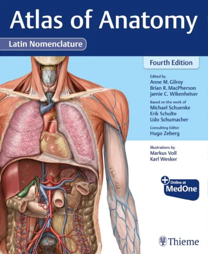
Atlas of Anatomy, Latin Nomenclature - Erik Schulte, Udo Schumacher, Michael Schuenke, Anne M Gilroy, Jamie Wikenheiser, Brian R MacPherson
Quintessential Atlas of Anatomy expands on widely acclaimed prior editions! Atlas of Anatomy, Latin Nomenclature, Fourth Edition builds on its longstanding reputation of being the highest-quality anatomy atlas published to date using Latin nomenclature. With more than 2,000 exquisitely detailed illustrations, including over 120 new to this edition, the Atlas helps students and seasoned clinicians master the details of human anatomy. Key Features: NEW! Expanded Radiology sections include over 40 new radiographs, CTs, and MRIsNEW! A more dissectional approach to the head and neck region places neck anatomy before that of the head – the way most students dissectNEW! Additional images and tables detail the challenging anatomy of the peritoneal cavity, inguinal region, and infratemporal and pterygopalatine fossaeNEW! Almost 30 new clinical boxes focus on function, pathology, diagnostic techniques, anatomic variation, and moreNEW! More comprehensive coverage clarifies the complexities of the ANS, including revised wiring schematicsAlso included in this new edition:Muscle Fact spreads provide origin, insertion, innervation, and actionAn innovative, user-friendly format: every topic covered in two side-by-side pagesOnline images with "labels-on and labels-off" capability are ideal for review and self-testingWhat users say about the Atlas of Anatomy: "I can't say enough how much I like the organization of this ... Unknown localization key: "more"
Objev podobné jako Atlas of Anatomy, Latin Nomenclature - Erik Schulte, Udo Schumacher, Michael Schuenke, Anne M Gilroy, Jamie Wikenheiser, Brian R MacPherson
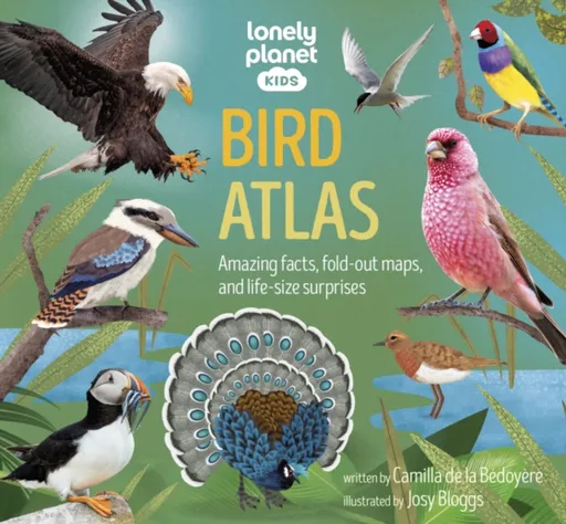
Lonely Planet Kids Bird Atlas - Camilla de la Bédoyére, Lonely Planet Kids
Take to the skies and meet the world’s most amazing birds. Navigate your way across the continents using detailed maps and discover birds of prey, birds of paradise, aquatic birds and more. Fun lift-the-flaps offer kids an immersive experience, revealing surprises, wow-factor facts and a fascinating glimpse into the lives of our feathered friends.Stretch your wings for an epic journey around the globe and discover the many incredible birds that share our planet. Use the handy maps and diagrams to understand more about each bird’s natural habitat and track impressive migration routes for those that travel extraordinary distances. Learn about their spectacular courtship displays, mind-blowing nest-building techniques and the environmental changes that threaten their way of life. This is the ultimate book for children - and grown ups - who are wild about wildlife.Inside Bird Atlas:- Packed with original artwork, beautiful illustrations and stunning photography that make this vibrant and engaging book a must-read for kids aged 8+- Detailed and insightful maps and diagrams that guide readers from continent to continent, showing them where the birds live and how they spend their lives- Fun interactive elements and lift-the-flaps to entertain curious minds- Features popular and lesser-known birds including eagles, falcons, ... Unknown localization key: "more"
Objev podobné jako Lonely Planet Kids Bird Atlas - Camilla de la Bédoyére, Lonely Planet Kids
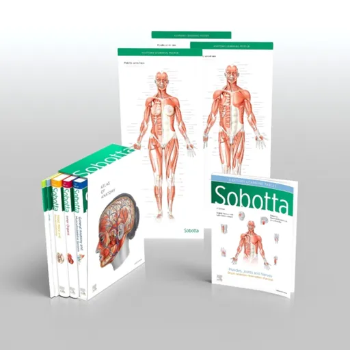
Sobotta Atlas of Anatomy, Package, 17th ed., English/Latin - Friedrich Paulsen, Jens Waschke
General Anatomy and Musculoskeletal System; Internal Organs; Head, Neck and Neuroanatomy; Muscles Tables; Poster Collection MORE THAN AN ATLAS Studying anatomy is fun! Recognising the structures on the dissection, understanding their relationships and gainingan overview of how they work together assures confident study and transition into clinical practice. The Sobotta Atlas shows authentic illustrations of the highest quality, drawn from genuine specimens, guaranteeingthe best preparation for the gross anatomy class and attestation. Sobotta focuses on the basics, making it totally comprehensive. Every tiny structure has been addressed according tocurrent scientific knowledge and can be found in this atlas. Themes relevant to exams and sample questions from oralanatomy exams help to focus the study process. The Sobotta Atlas is the optimal learning atlas for studying, from the first semester till the clinical semester. Case studiespresent examples and teach clinical understanding. Clinical themes and digressions into functional anatomy are motivatingand impart valuable information for prospective medical practice. With over 100 years of experience in 17 editions and thousands of unique anatomical illustrations, Sobotta achievesongoing success. The volume General Anatomy and Muscoloskeletal System contains the chapters: General AnatomyAnatomical planes and positions - Surface anatomy - Development - Musculoskeletal system - Neurovascular pathways - ... Unknown localization key: "more"
Objev podobné jako Sobotta Atlas of Anatomy, Package, 17th ed., English/Latin - Friedrich Paulsen, Jens Waschke
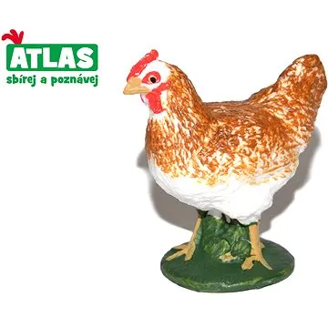
Atlas Slepice (8590331018666)
Figurka - zvířátka, na hraní, výška 5 cm, materiál plast, nepohyblivá, vhodná od 3 let Má vaše dítě rádo zvířátka a rádo by si doma vytvořilo statek? Pak právě pro malé milovníky zvířat jsou připraveny figurky domácích zvířat. Figurka Atlas slepice představuje zmenšenou napodobeninu skutečného zvířete, přesně takového, jakého děti znají z obrázkových knížek. Figurka je propracovaná do nejmenších detailů a je vyrobena z odolného plastu. Figurka slepice je vysoká 5 cm a doplní sbírku zvířátek, které děti milují. Figurky Atlas učí děti nejen rozlišovat jednotlivé živočišné druhy, ale inspirují k získávání dalších informací o zvířatech a přírodě. Figurka může sloužit jako hračka nebo si ji dítě může jen vystavit ve svém pokojíčku. Figurka Atlas slepice je vhodná pro děti od 3 let. Klíčové vlastnosti figurky Atlas - slepiceFigurka slepice je propracovaná do nejmenších detailůHračka je vyrobena z odolného plastuFigurka Atlas je vysoká 5 cmDoplní...
Objev podobné jako Atlas Slepice (8590331018666)
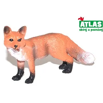
Atlas Liška (8590331018413)
Figurka - zvířátka, na hraní, výška 4 cm, materiál plast, nepohyblivá, vhodná od 3 let Má vaše dítě rádo zvířátka a rádo je chodí pozorovat do přírody nebo do zoologické zahrady? Pak právě pro malé milovníky zvířat jsou připraveny figurky zvířat celého světa. Figurka Atlas liška představuje lišku obecnou, přesně takovou, která se vyskytuje v našich lesích a jakou ji děti znají z pohádek. Figurka je propracovaná do nejmenších detailů a je vyrobena z odolného plastu. Liška je 7 cm dlouhá a doplní sbírku zvířátek, které děti milují. Figurky Atlas učí děti nejen rozlišovat jednotlivé živočišné druhy, ale inspirují k získávání dalších informací o zvířatech a přírodě. Svou sbírku figurek si jistě dítě rádo vystaví ve svém pokojíčku. Figurka Atlas liška je vhodná pro děti od 3 let. Klíčové vlastnosti figurky Atlas - liškyFigurka Atlas liška představuje lišku obecnouFigurka je propracovaná do nejmenších detailůHračka je vyrobena z odolného...
Objev podobné jako Atlas Liška (8590331018413)
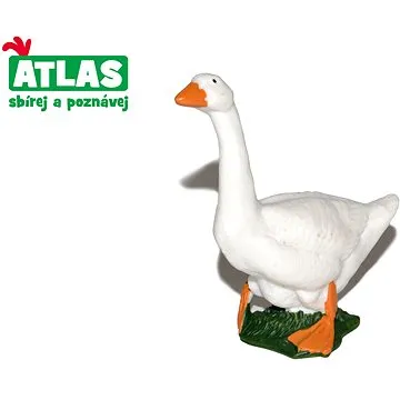
Atlas Husa (8590331018659)
Figurka - zvířátka, na hraní, výška 7 cm, materiál plast, nepohyblivá, vhodná od 3 let Má vaše dítě rádo zvířátka a rádo by si doma vytvořilo statek? Pak právě pro malé milovníky zvířat jsou připraveny figurky domácích zvířat. Figurka Atlas husa představuje zmenšenou napodobeninu skutečného zvířete, přesně takového, jakého děti znají nejen z obrázkových knížek. Figurka je propracovaná do nejmenších detailů a je vyrobena z odolného plastu. Figurka husy je vysoká 7 cm a doplní sbírku domácích zvířátek, které děti milují. Figurky Atlas učí děti nejen rozlišovat jednotlivé živočišné druhy, ale inspirují k získávání dalších informací o zvířatech a přírodě. Figurka může sloužit jako hračka nebo si ji dítě může jen vystavit ve svém pokojíčku. Figurka Atlas husa je vhodná pro děti od 3 let. Klíčové vlastnosti figurky Atlas - husaFigurka husy je propracovaná do nejmenších detailůHračka je vyrobena z odolného plastuFigurka Atlas je vysoká 7 cmDoplní...
Objev podobné jako Atlas Husa (8590331018659)
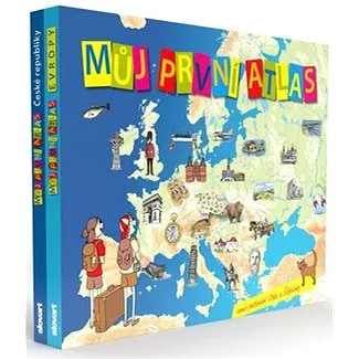
Můj první atlas: Můj první atlas České republiky a Můj první atlas Evropy (2100004115590)
Kniha - autor Vít Štěpánek, 128 stran, česky, pevná bez přebalu lesklá Překvapit ve škole skvělými vědomostmi ze zeměpisu, být rodinným poradcem při plánování výletů, to vše se dětem povede s atlasem plným barevných ilustrací, jednoduchých map i srozumitelných a poutavých textů. Knihami Můj první atlas České republiky a Můj první atlas Evropy provází čtenáře dvojice mladých cestovatelů Vítek a Štěpánka. Při seznamování se s hlavními charakteristikami naší vlasti i dalších evropských zemí, jejích krásami, památkami a zajímavostmi hlavní hrdinové stále něco řeší, ne vždy je hned jasné, kdo z nich má pravdu. Správné odpovědi na všechny otázky najdou čtenáři na konci knihy. Hravým způsobem se tak dozví třeba to, která zřícenina je v Česku největší, jestli v místech skalních soutěsek v severních Čechách bylo kdysi moře, kde se nachází zoo s obrovskými výběhy, kterými lze projíždět autem či autobusem a pozorovat zvířata, která evropská země je nejmenší, ve kterém...
Objev podobné jako Můj první atlas: Můj první atlas České republiky a Můj první atlas Evropy (2100004115590)
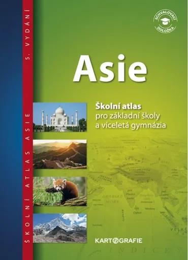
Asie – školní atlas
Atlas je součástí ucelené řady zeměpisných atlasů světa, kontinentů a Česka. Představuje Asii z nejrůznějších pohledů – přírody a její ochrany, obyvatelstva, hospodářství i historie. Edice sešitových školních atlasů je určena pro výuku zeměpisu na základních školách a víceletých gymnáziích. Atlas Asie doplňuje Školní atlas světa, rozšiřuje jeho tématiku a vybrané jevy a charakteristiky světadílu prezentuje na podrobnějších mapách. Asie je na mapách představena po všech důležitých stránkách (příroda, obyvatelstvo, historie, hospodářství). V atlase jsou zařazeny cvičné strany k hravému a oddychovému procvičování učiva vytvořením vlastní mapy. Podle vhodně volených otázek může žák samostatně do mapy popisovat důležité názvy a pojmy, další otázky pak mohou vymýšlet sami učitelé. Fotografická příloha „Foto-toulky“ dokumentuje prostředí, přírodu a život světadílu. Atlas je schválen jako učebnice MŠMT. Doložka prodloužena do roku 2029. V pátém vydání byly především aktualizovány veškeré tematické a statistické údaje, revidováno bylo také politické a administrativní uspořádání světadílu. Z obsahu: přehledná fyzická a politická mapa podrobné obecně zeměpisné mapy tematické mapy přírodní sféry, obyvatelstva a hospodářství procvičování formou tvorby vlastní mapy přehled států a zeměpisné rekordy světadílu foto-toulky rejstřík Další materiály ke školnímu atlasu Asie ke stažení zdarma najdete zde.
Objev podobné jako Asie – školní atlas